


Standing on the boardwalk at the Jobos Bay National Estuarine Research Reserve, I realized quickly that “nature around Guayama” is not just one thing. Within a short drive I moved from salt-crusted mangrove islands and seagrass flats to dry coastal scrub, then up into cooler mountain forest. Each ecosystem looked, sounded, and even smelled different, and exploring them required very different expectations, shoes, and levels of preparation.
Get the latest updates straight to your inbox!
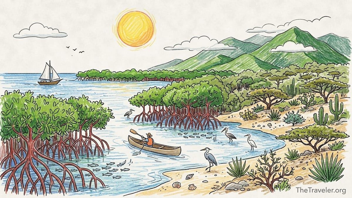
Understanding Jobos Bay: Puerto Rico’s Southern Estuary
Jobos Bay stretches between the municipalities of Guayama and Salinas, forming Puerto Rico’s second-largest estuarine area and one of the island’s key protected coastal systems. The bay is protected as the Jobos Bay National Estuarine Research Reserve, co-managed by Puerto Rico’s Department of Natural and Environmental Resources (DRNA) and the National Oceanic and Atmospheric Administration (NOAA). The reserve covers roughly 2,883 acres of habitats that are all connected by tides and currents but feel very different once you step into them: mangrove islands, seagrass beds, coastal dry forest, lagoons, and reef-associated shallows.
Arriving by car, the transition is abrupt. You leave the inland urban area of Guayama, follow PR-3 and local roads toward Aguirre, and suddenly the landscape opens into flat salt-tolerant vegetation with glimpses of shimmering water through mangrove trunks. The main reserve visitor facilities sit on the Salinas side in the Aguirre area, but the waters and cays spread across municipal lines. From the parking area you can smell the mix of salt, decaying leaves, and mud that defines an estuary in the tropics.
What makes Jobos Bay stand out is how compressed these ecosystems are. On a single outing I walked from a dry, thorny coastal patch into shade-cast mangrove forest, then looked out over carpet-like seagrass just offshore. That mosaic is exactly what the reserve was created to protect: a functioning estuary where freshwater from the land meets the Caribbean Sea and supports everything from tiny crabs and juvenile fish to wading birds and, in certain areas, manatees that are present but far from guaranteed to be seen.
Walking the Cayo Caribe Trail: Inside the Mangrove Islands
The clearest way to understand Jobos Bay’s mangrove ecosystem is to take the Cayo Caribe Trail, a roughly 1.1 kilometer route described in the reserve’s management plan that loops across part of the Cayos Caribe mangrove cays. Access involves a short drive through Aguirre to signed reserve facilities, then a walk along a sandy and sometimes muddy approach, so sturdy walking shoes that can get dirty are important. The trail itself alternates between compacted soil and simple boardwalk sections, with scattered shade from red, black, and white mangroves.
Underfoot, the ground is uneven and cut with shallow tidal pools. I watched tiny fiddler crabs scatter into burrows, leaving pockmarks across the mud, and saw periwinkle-like snails clinging to mangrove roots. Overhead, the canopy stayed low, but enough to soften the strong southern sun. Mosquitoes were present in patches, especially where the wind died and the trail narrowed, and bug repellent made the difference between a slow, careful wildlife stop and a rushed march. On my visit the weather was typical south-coast dry season: high-80s Fahrenheit, bright sun, and a brisk breeze that helped, but shaded, windless pockets felt immediately humid.
Wildlife along the Cayo Caribe Trail is subtle rather than spectacular. I did not see manatees, sea turtles, or rare birds up close, even though the reserve’s materials mention that these animals use the estuary. Instead I noted herons hunting small fish on the edge of the channels, a few brown pelicans gliding low over the water, and constant movement in the shallows where juvenile fish flashed between submerged roots. In the stillest pools, the surface film moved with tiny air bubbles as crabs and worms worked through the mud. The reward here is immersion in the small details of a mangrove system, not a guaranteed show-stopping sighting.
Seagrass Beds and Shallow Channels: Jobos Bay from the Water
Jobos Bay feels very different once you leave the trail and get onto the water. Local operators in the broader Salinas and Guayama area offer kayak and small-boat excursions that stay within the maze of mangrove channels and cays, avoiding the open Caribbean swells. The reserve notes a marked kayak route that loops through protected waters near Cayos Caribe, and from the surface you can clearly see why seagrass beds are so important here. In calm, clear sections the bottom appeared as a textured lawn of turtle grass and manatee grass swaying with the tide, with schools of silvery baitfish weaving between the blades.
Conditions matter greatly. On a calm morning with light wind, the channels felt like paddling through an outdoor hallway of mangroves. Water depth in many parts was only a few feet, enough to float a kayak comfortably but shallow enough that the paddle occasionally brushed seagrass. I wore simple water shoes, which proved useful when stepping off in knee-deep water near a sandier patch; bare feet would have been risky given scattered shells and the occasional sharp limestone fragment. Life jackets were required by the operator and worn the whole time, both due to regulations and common sense in a tidal, boat-trafficked zone.
From the kayak I saw more active fish life than from the shore: needlefish hovering near the surface, small barracuda resting motionless in shade, and flashes of color that were likely juvenile grunts and snappers using the roots as a nursery. Egrets and herons perched on exposed branches, watching the shallows. Again, I did not see manatees or rays on this particular outing, even though both are documented in the bay, which underlined how unpredictable large-animal encounters can be in a working estuary. The experience was still rich, centered on the way the seagrass, mangroves, and tides interact.
Dry Forest and Coastal Scrub: The Landward Side of Jobos Bay
Just landward of the mangroves, particularly on the Guayama side near Aguirre and toward Las Mareas, the vegetation shifts quickly into dry coastal forest and scrub. From the road and on short side paths off the main access routes, I moved into a landscape of low acacias, cactus-like succulents, and hardy shrubs adapted to salt-laden winds and infrequent rain. The soil here felt sandy and gravelly, with patches of exposed limestone. Footing was mostly firm, but loose stones made me grateful for closed-toe shoes rather than sandals.
Wildlife in this zone included small lizards darting across the path and more terrestrial bird species using the shrub layer. I heard the calls of doves and saw Puerto Rican woodpeckers on utility poles at the forest edge, alongside the more water-linked herons flying overhead toward the bay. In the heat of midafternoon this area can feel punishing, with little shade and temperatures that easily reach the high-80s or low-90s Fahrenheit, so carrying more water than you think you need and wearing a wide-brimmed hat is not optional. I finished a one-liter bottle in under an hour of slow walking.
Access to this dry forest strip is more informal than the official reserve trails. There are small pullouts and dirt tracks, but not all are sanctioned entrances, and some may cross private or industrial lands linked to the historic Aguirre company town. Before venturing off the main roads I verified I was not using a signed service or restricted road and stayed out of any areas marked as closed or private. This is the part of the Guayama coast where doing homework on current access rules is important rather than assuming that every dirt track to the water is a legal entry point.
Cayos Caribe and the Challenge of Access
The DRNA describes a group of about 15 mangrove-covered cays in the Cayos Caribe sector of Jobos Bay. On nautical charts and in sailing guides, these appear as a tight line of low islands that protect the inner bay from Caribbean swells. From the water, they look like a continuous wall of green, but up close each cayo has its own small channels and pockets. The reserve’s management documents mention limited sanitary facilities on one of the cayos and a network of designated access points, but much of the shoreline is intentionally left wild and unbuilt.
From a visitor’s perspective, this means you should not expect to simply drive to “Cayos Caribe beach” and set up for the day. Reaching these islands typically involves arriving at the main reserve access on the Aguirre side, using permitted kayak put-ins or arranging a small-boat excursion that respects both conservation rules and shallow-water navigation. Depths around the cays often range around 6 to 15 feet in some pockets and much shallower over seagrass and near reefs, and routes are shaped by tidal channels and marked paths rather than straight lines on a map.
On my outing, a guide familiar with local regulations explained which mangrove channels were part of the reserve’s official routes and which shallow flats near the reef line were off-limits to prevent propeller scars in seagrass and damage to coral. That conversation underscored how important it is to check reserve regulations directly with the visitor center or the DRNA before planning your own route. Conditions such as sea state and ongoing management actions sometimes lead to temporary changes in how the kayak trail is routed, and the staff have the most up-to-date information. Without that guidance it would be easy to stray into sensitive habitat or areas reserved for research work.
Aguirre State Forest: Mangroves Beyond the Main Reserve
West of the core Jobos Bay reserve, the Aguirre State Forest protects additional mangrove areas between Guayama and neighboring municipalities. Access is via local roads off PR-3 toward the coast, with trailheads and parking described around Road 7710 near kilometer markers in DRNA and local visitor information. Driving in, I passed salt flats and aging industrial buildings linked to the historic Aguirre sugar operations before reaching patches of darker green that signaled dense mangrove forest.
On the ground, Aguirre State Forest felt quieter and more enclosed than the open mosaics of Jobos Bay. Narrow trails followed old dikes and levees between mangrove stands, the air thick with the smell of decomposing leaves. The difference in management approach was palpable: fewer built facilities, no major visitor center complex, and a more self-guided feel. I walked along a flat, partially overgrown path where the mud was firm enough in the dry season but clearly becomes soft and potentially flooded during heavy rains or higher tides.
Wildlife here showed up in sound first. I heard the rhythmic popping of snapping shrimp in nearby channels and the calls of wading birds I could not always see through the dense roots. Mosquitoes were more intense in windless corners, so long sleeves and repellent were crucial. There were no marked kiosks selling water or snacks, and cell service fluctuated, so I treated Aguirre State Forest as a proper backcountry mangrove walk: starting early in the day, bringing my own supplies, and letting someone know my planned exit time before setting out.
Carite State Forest: From Coastal Plain to Mountain Cloud
Carite State Forest lies inland from Guayama, climbing into the Sierra de Cayey across several municipalities. It is a very different world from the mangroves and coastal dry forest below. The forest protects thousands of acres of subtropical moist forest, with elevations that rise above 3,000 feet around Cerro La Santa. Access generally involves following mountain sections of the scenic route known as the Ruta Panorámica and connecting local roads from Guayama into higher terrain. The drive alone provides a visual lesson in how rainfall and elevation shape vegetation.
As the road climbed, I watched the landscape change from dry scrub and grassland to taller, denser forest. Humidity increased, temperature dropped noticeably, and clouds often brushed the ridgelines even when the coastal plain remained sunny. On foot, the trails in Carite offered leaf-littered paths with tree ferns, broadleaf trees, and mossy trunks rather than mangrove roots and salty mud. I encountered songbirds in the canopy and heard frogs calling from damp ditches and stream edges. The forest here is recognized in conservation circles as important habitat for a number of native and endemic species, especially birds, although seeing rarities requires both time and luck.
Access in Carite requires attention to current conditions. News reports in recent years have highlighted landslides and closures on roads such as PR-179 near the Carite community in Guayama, especially after heavy rains. That made me cautious about assuming that every map-marked mountain road would be fully open. Before driving, I checked recent local updates and, once in the area, asked residents and business owners about any ongoing closures. Weather in the mountains can shift quickly; on one afternoon a clear start turned into heavy fog and light rain within an hour, turning curves slick and limiting visibility. Sturdy walking shoes with good traction and a light rain shell were more important here than on the coast.
What Was Difficult, What Worked, and What to Check Before You Go
Across Guayama’s coast and forests, access challenges were as memorable as the scenery. Around Jobos Bay and Aguirre, the biggest difficulties involved understanding exactly where public access begins and ends, and where conservation rules limit landing, anchoring, or off-trail wandering. Industrial history, private landholdings, and sensitive habitats mean that not every shoreline visible on satellite imagery or maps is fair game. The most effective solution was to start at official points: the Jobos Bay reserve visitor center in Aguirre for estuary access, clearly signed trailheads for Aguirre State Forest, and recognized mountain pullouts for Carite.
Mosquitoes and heat demanded practical adjustments. On the mangrove trails I wore lightweight long sleeves and pants, used a strong repellent, and avoided standing still for long in windless pockets. Along the dry coastal scrub I carried at least one liter of water per hour of unshaded walking and wore closed-toe shoes that could handle loose rock, cactus spines, and occasional mud. On the water I combined a sun shirt, hat, polarized sunglasses, and water shoes that could safely step onto both mud and sharp limestone if necessary.
There are three things I would research immediately before any repeat visit. First, current regulations and conditions at Jobos Bay: opening hours for visitor facilities, any changes to kayak trail routing, and any special closures for research or restoration work. Second, road conditions into Carite and other mountain access routes around Guayama, especially after periods of heavy rain or storms. Third, the status of trails and parking at Aguirre State Forest, which can be affected by flooding, overgrowth, or maintenance schedules. A quick call to the DRNA offices or a stop at an official information point can save hours of backtracking.
The Takeaway
Exploring nature in and around Guayama is about learning to read multiple ecosystems rather than chasing a single postcard view. In Jobos Bay, mangroves and seagrass work together as a living estuary that feels most alive in the details: tiny crabs in the mud, juvenile fish around roots, and the filtered light of the Cayo Caribe Trail. Along the nearby coast, dry forest and scrub remind you how close the desert-like south of Puerto Rico is, while inland, Carite’s mountain forest offers cool, damp relief and a completely different set of sounds and smells.
On my trip, I did not see manatees, sea turtles, or rare birds up close, even though they are documented in these habitats, and that felt like an honest lesson. Guayama’s wild spaces are not theme parks designed around guaranteed sightings. Instead they require patience, respect for regulations, and careful attention to access. In return, they offer a set of contrasting landscapes that, taken together, make this corner of Puerto Rico one of the most instructive places to experience how coast, estuary, and mountain fit into a single region.
FAQ
Q1. How do I get to the Jobos Bay National Estuarine Research Reserve from Guayama?
From central Guayama, drive toward the south coast on PR-3 and follow signs toward Aguirre and the Jobos Bay reserve. The main visitor facilities and access points are in the Aguirre area, close to the municipal boundary with Salinas. Parking is available at the visitor center and at designated trail and kayak access locations.
Q2. Do I need a guide to explore Jobos Bay, or can I go on my own?
For walking the signed trails near the visitor center, you can usually go on your own during open hours, following posted rules. For kayaking among the mangrove cays and shallow channels, many visitors find it safer and more informative to join a local outfitter or guide, both to respect regulations and to navigate shallow, reef-fringed areas without damaging seagrass or coral.
Q3. What footwear is best for Jobos Bay’s trails and kayak areas?
On land, closed-toe hiking shoes or sturdy walking shoes that you do not mind getting muddy work best on the Cayo Caribe Trail and other reserve paths. For kayak outings, quick-drying water shoes with solid soles are ideal, since you may step into shallow water with mud, shells, and sharp limestone fragments.
Q4. Are mosquitoes a serious problem in the mangroves?
Mosquitoes can be intense in shaded, wind-sheltered pockets of the mangrove forest, especially at dawn, dusk, or after rain. During my visit they were noticeable but manageable with long sleeves, long pants, and a strong repellent. If you are very sensitive to bites, consider also wearing a lightweight head net for slower trail sections where you may stop to observe wildlife.
Q5. Can I count on seeing manatees, sea turtles, or rare birds in Jobos Bay?
No. While manatees, sea turtles, and a variety of bird species are known to use the estuary and nearby reefs, sightings are not guaranteed on any given visit. On my own outings I saw wading birds, pelicans, and fish in the shallows, but I did not see manatees or turtles up close. Treat any encounter with larger or rarer species as a bonus rather than an expectation.
Q6. How is Carite State Forest different from the coastal areas near Guayama?
Carite State Forest lies in the Sierra de Cayey mountains and is noticeably cooler, wetter, and more densely forested than the coastal plain. Instead of mangroves and dry scrub, you will find subtropical moist forest with tree ferns, mossy trunks, and mountain streams. Weather shifts quickly, and trails are more like traditional mountain hikes, so bring good traction shoes and a light rain layer.
Q7. Are there current road issues getting into Carite from Guayama?
Mountain roads in the Carite area, such as PR-179 and nearby routes, have experienced landslides and partial closures in recent years after heavy rains. Before driving up from Guayama, check recent local updates or ask residents about any ongoing closures or detours. Conditions can change between seasons, and not all map-marked roads are reliably passable.
Q8. Is swimming recommended in Jobos Bay’s mangrove channels and near the cays?
Swimming is possible in some sandy, more open pockets near the cays, but you should always confirm locally which areas are allowed and safe before entering the water. Many parts of the bay are shallow with seagrass, boat traffic, and sensitive habitat, so operators often designate specific spots for short swims during kayak or small-boat excursions rather than encouraging swimming everywhere.
Q9. What should I bring for a day exploring Jobos Bay and Aguirre State Forest?
Plan on bringing plenty of drinking water, sun protection such as a hat and sunscreen, insect repellent, closed-toe shoes for trails, and water shoes if you will be kayaking. Snacks, a small first-aid kit, and a dry bag for valuables are also useful, since there are limited services once you leave the main roads. Do not rely on finding shops or kiosks at trailheads or along mangrove paths.
Q10. How do I find the most up-to-date rules and access information before visiting?
The most reliable sources are the Jobos Bay reserve visitor center staff and official DRNA communications, which can update visitors on trail status, kayak route adjustments, and any temporary closures. Because road and trail conditions in both coastal and mountain areas can change after storms or heavy rain, it is wise to check in shortly before your visit rather than relying on older printed materials or secondhand recommendations.