
More news on this day
Montpellier is quietly redrawing its city map, with an expanding tram network, new pedestrian corridors and green spaces combining to change how visitors read and move through the historic Mediterranean hub.
Get the latest news straight to your inbox!
A Compact Historic Core That Feels Larger Than It Looks
On paper, Montpellier’s center is small, but recent tourist maps underline how dense the experience has become for visitors. The medieval Écusson district, the crescent around Place de la Comédie and the Esplanade Charles de Gaulle are presented as a single, nearly continuous pedestrian zone, even though the streets still follow their centuries-old maze-like pattern.
Publicly available city plans highlight an emphasis on distance by time rather than distance by scale. Short walks between key sites such as the Arc de Triomphe, the Jardin des Plantes and the Antigone district are now clearly indicated, reflecting a planning approach that assumes visitors will combine walking with tram or shuttle hops rather than rely on private cars.
The latest tourist city schemes also give more prominence to outlying cultural sites than in earlier years. Contemporary attractions in Port Marianne, the Odysseum leisure complex and riverside green spaces now appear on the same core map as the historic center, suggesting that the practical city map of Montpellier in 2026 spreads well beyond the old walls, even if the emotional heart remains in the Écusson.
For travelers using printed or downloadable city plans, this means that the apparent “center” of Montpellier is no longer just the old town. Instead, the map encourages a wider loop that connects the railway stations, major tram interchanges and newer neighborhoods that have grown into everyday parts of the visitor experience.
Tram Lines Redefining the Mental Map
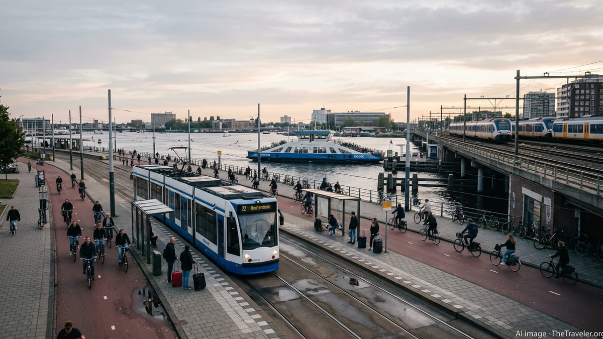
Montpellier’s tram network now shapes how most visitors navigate the urban area, and the city maps are evolving to match that reality. Current diagrams show five tram lines structuring the metropolis, four radiating from central districts and a newer line linking northern and southwestern suburbs without passing directly through the main rail hub.
Network plans emphasize the color-coded identity of each route, with line 1 often depicted in blue as the spine connecting the historic center to key hubs including both of the city’s railway stations. Line 4 appears as a circular loop encircling central neighborhoods, effectively doubling as a simplified city map for first-time visitors who want to understand how the districts fit together.
Recent press material and municipal documents highlight the strategic role of new infrastructure, particularly the extension that now directly links the historic Saint-Roch station with the high-speed Sud de France station. On most current city and transport maps, this connection collapses what once felt like two separate poles of arrival into a single, legible axis for travelers.
With each modification of the tram diagram, surrounding cartography is quietly adjusted. Areas once shown as peripheral, such as emerging residential zones and university campuses, now sit astride the bright lines of the tram network, encouraging visitors to see them as easy additions to an urban itinerary rather than remote suburbs.
From Car Traffic to Pedestrian and Green Axes
Montpellier’s official mapping increasingly reflects a long-term effort to favor walking, cycling and public transport in its core districts. Where older city plans would have highlighted radial avenues and car circulation, new diagrams emphasize tree-lined promenades, linear parks and pedestrianized streets that knit together different parts of the center.
Municipal information indicates that large-scale planting programs and the creation of green corridors are altering the way the city is drawn. Multi-year targets for tens of thousands of new trees, along with redesigned squares such as the Esplanade Charles de Gaulle, appear in planning graphics as shaded green bands that guide movement just as much as roads or rail tracks.
Concept maps accompanying these projects show how walking routes now have a structure similar to that of the tram network, linking squares, historic gates and modern parks along prioritized axes. The result is a layered city map in which pedestrian itineraries, tram lines and cycling lanes all run in parallel, giving travelers several options for tracing similar journeys at different speeds.
As these walking paths mature and streets are progressively calmed, cartographers are beginning to simplify the representation of individual car lanes in the central area. For visitors, the message of the map is clear: the most efficient way to read and experience Montpellier’s center is on foot, by tram or by bike, not through the lens of a road atlas.
Digital Navigation and The New “Official” Map
Beyond printed tourist plans, the most up-to-date maps of Montpellier now live on digital platforms. Mapping services and transit-focused applications have integrated the extended tram network, new stops and park-and-ride facilities, often updating line by line as infrastructure opens. These tools are increasingly becoming the de facto reference for how the city is structured.
Publicly available transit layers typically display the tram network first, with bus routes, cycle lanes and pedestrian streets added as optional overlays. This inversion, where rail and walking infrastructure occupy the prime visual space and car routes recede, signals a broader shift in how Montpellier presents itself and how visitors come to understand its geography.
Digital city maps also allow for more granular neighborhood detail than a standard paper plan. Districts such as Beaux-Arts, Aiguelongue, Celleneuve or the areas around university campuses appear with densities of small streets, local squares and green spaces that were rarely highlighted together in older tourist cartography.
For travelers arriving in 2026, the combination of official tourist plans, municipal diagrams and real-time digital navigation now delivers a composite map of Montpellier that is both more extensive and more legible than before. Reading that map carefully can turn a short city break into a broader exploration of a metropolis that is still very much reshaping its own outline.