


More news on this day
Thick autumn fog settled over London on Sunday, with a Met Office yellow warning in force and early reports pointing to slower journeys and the risk of delays for road, rail and air travellers across the capital and much of southern England.
Get the latest news straight to your inbox!
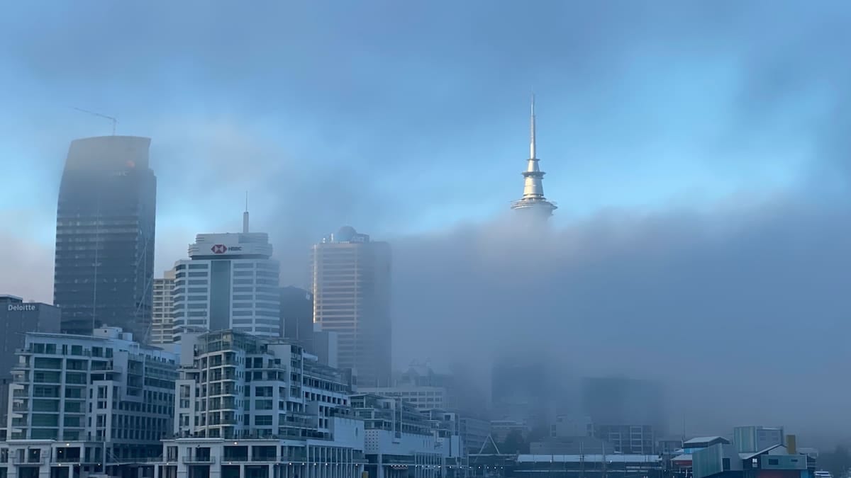
Warning covers London and key transport corridors
The current yellow fog warning, valid until 10:00 on Sunday 1 November, extends across London and the South East as well as large parts of central and northern England and sections of Wales. Publicly available information from the Met Office describes fog “dense in places” and notes that visibility in some patches could drop below 100 metres, creating difficult conditions on busy commuter and intercity routes.
Met Office data shows that the alert was issued late on Saturday evening after fog formed widely overnight, coinciding with relatively light winds and high pressure over southern Britain. A separate notice specific to London City and London Gatwick airports highlights the same visibility concerns, indicating that these coastal and estuary locations are among the most exposed to low cloud and persistent fog early in the day.
Although the warning is scheduled to expire by mid-morning, the forecaster notes that in some locations fog may be slow to lift, lingering into the late morning or early afternoon. That pattern raises the prospect of knock-on disruption for early flights, morning rail services and road traffic heading into and out of the capital.
Background guidance from the UK’s National Severe Weather Warning Service explains that yellow alerts are used when weather is expected to bring some level of impact, including localised travel disruption, even if many people are still able to continue with their normal plans.
Early flights face low visibility challenges
Airports serving the London area are among the most sensitive to dense fog, and the current alert specifically references a chance of delays and cancellations to flights. Visibility below 100 metres can affect the rate at which aircraft are permitted to land and take off, prompting air traffic control to space movements further apart and leading to backlogs at terminals.
London City Airport, with its short runway in the Royal Docks and frequent business services into Europe, is particularly exposed when visibility drops sharply over the Thames corridor. Met Office warning pages for the airport state that dense patches could bring difficult travel conditions in the surrounding area during the first half of the day. London Gatwick in West Sussex, the UK’s second-busiest airport, is under the same regional warning, with forecasters again underlining the risk of very low visibility during the morning peak.
Coverage from UK broadcasters and online travel trackers on Sunday morning has already highlighted fog-induced delays at several airports within the warning area, including London. While many flights continue to operate, some early departures have been rescheduled and a small number of services have been cancelled where crew, aircraft positioning or visibility thresholds are affected.
Public information from airlines and airports continues to urge passengers travelling this morning to check the latest status of their flights and to allow extra time for journeys to the airport in case road or rail links are slowed by the fog.
Slower road and rail journeys across the capital
The yellow alert also covers major road and rail corridors radiating from London. Met Office warning text notes that slower journey times are likely, with delays to bus and train services possible where low visibility forces drivers and signalers to reduce speeds.
Transport reports on Sunday morning indicate that dense patches of fog have formed along sections of the M25 orbital motorway, as well as on the M1, M3 and M4 approaching the capital. Reduced visibility, combined with residual surface moisture from recent unsettled weather, is contributing to queues on some approaches to London’s main road crossings and junctions.
On the rails, commuter routes into London termini such as Waterloo, Paddington, Euston and King’s Cross are broadly operating, but some services are running a few minutes slower where visibility is poor on exposed stretches of track. Public journey planners for intercity operators and suburban networks continue to flag the Met Office warning and advise passengers to check for short-notice alterations.
Local bus operators and city transport dashboards similarly warn that speeds may be reduced along key corridors, particularly during the early morning rush when traffic volumes are higher and fog is at its thickest.
High pressure brings calmer but foggier pattern
The current fog event follows a spell of stormier weather in late October that brought strong winds and heavy rain to parts of the UK. A recent Met Office outlook highlighted a transition to a calmer pattern under high pressure over southern Britain heading into early November, accompanied by an increase in mist and fog, especially overnight and during the mornings.
With lighter winds and clearer skies at night, radiative cooling near the surface encourages moisture in the air to condense into fog, particularly in river valleys and low-lying urban areas such as the Thames basin. Once established, this fog can persist for several hours if there is not enough wind or sunshine to disperse it quickly.
Community resilience guidance published by the Met Office and London authorities notes that while fog is a familiar feature of the UK climate, persistent dense fog over a large urban area like London can nevertheless disrupt daily routines. The documents cite impacts ranging from slower commute times and delayed deliveries to temporary changes in local air quality when standing traffic builds up around congested junctions.
Flood and weather monitoring platforms that archive UK alerts show that Sunday’s yellow fog warning is part of a cluster of recent advisories covering large parts of England and Wales, underlining how quickly high-pressure autumn conditions can trigger visibility problems after a period of unsettled weather.
What travellers should do as the warning evolves
For travellers with plans in and around London, publicly available advice from the Met Office focuses on allowing extra time for journeys, checking road conditions before setting off and ensuring vehicle lights, including fog lights where fitted, are working correctly. Motorists are also urged in official guidance to maintain greater spacing from the vehicle ahead when visibility deteriorates.
Passengers using trains, coaches or long-distance buses are being encouraged via operator updates and news coverage to verify departure and arrival times on the morning of travel, as dense fog can lead to slower running speeds or minor timetable changes. Those connecting to early flights from London City, Gatwick, Heathrow, Luton or Stansted are advised to monitor both airline and airport feeds, given that even short delays can cause missed connections later in the day.
Travel insurers typically treat fog-related disruption according to specific policy wording, and open-source consumer guidance stresses the importance of checking cover levels in advance rather than at the departure gate. Some policies include benefits for long delays caused by adverse weather, while others limit compensation to cancellations.
Looking ahead, Met Office forecasts suggest that the broader weather pattern over southern Britain will remain relatively calm in the coming days, with the potential for further overnight mist and fog episodes where skies stay clear. Travellers planning early-morning departures from London this week are therefore likely to benefit from monitoring the warning pages regularly, particularly when journeys depend on tight connections or time-sensitive appointments.