
More news on this day
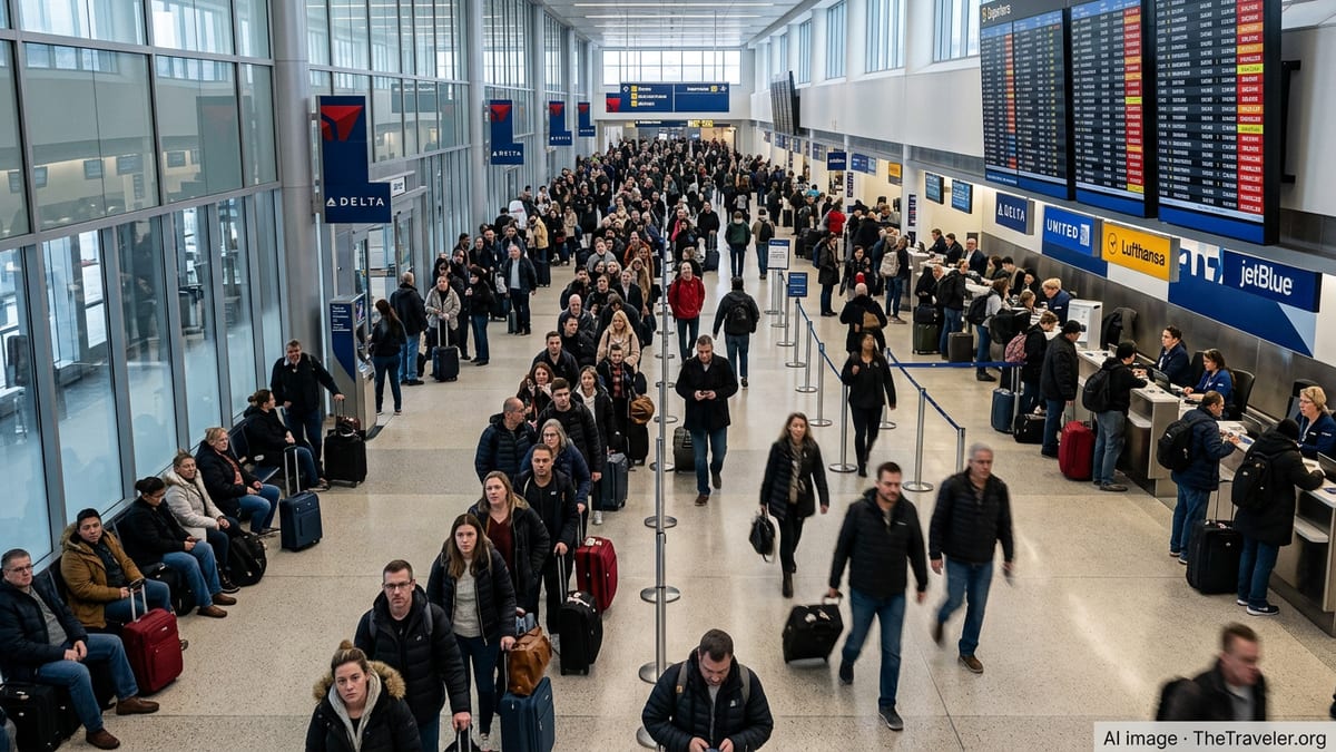
More than 5,000 flights across the United States were delayed on Thursday as a fresh round of severe thunderstorms in the Midwest combined with tropical moisture over the South, snarling air travel at major hubs from Chicago to Dallas and Atlanta.
Get the latest news straight to your inbox!
Thunderstorms, Tropical Rains Combine to Snarl Air Travel
Tracking data from major flight-monitoring services on June 18 indicated that U.S. carriers faced thousands of delays as a sprawling severe weather pattern swept across the central United States. Storm systems affecting the Midwest coincided with deep tropical moisture tied to the remnants of Tropical Storm Arthur over the Gulf Coast and Southeast, creating widespread operational challenges for airlines.
Published coverage from national outlets and regional broadcasters describes a volatile mix of hazards, including strong thunderstorms, damaging winds and torrential rain stretching from the Great Lakes region through the Mississippi Valley and into Texas and the lower Southeast. Flood watches and severe thunderstorm alerts have been in effect for millions of people, limiting the ability of aircraft to depart and arrive on schedule at some of the country’s busiest airports.
Publicly available aviation data shows that delays have concentrated around midcontinent and southern hubs where storms have repeatedly fired since midweek. The pattern has led to rolling congestion and long waits at gates and on taxiways as airlines reduce takeoff and landing rates to accommodate lightning, low visibility and wind shear concerns.
Air traffic control programs designed to meter traffic into storm-affected airspace have further reduced capacity, extending the disruption well beyond the immediate path of the most intense cells.
Midwest Hubs Hit by Repeated Severe Storm Rounds
The latest disruption follows days of turbulent weather across the Midwest. Forecast discussions and storm outlooks from meteorologists on Wednesday and Thursday highlighted a risk of fast-moving squall lines and rotating supercell thunderstorms across parts of Iowa, Illinois, Indiana and neighboring states, with the potential for destructive winds and large hail.
According to published coverage from Chicago-based outlets, thunderstorms earlier in the week prompted a ground stop for incoming flights at O’Hare International Airport, one of the nation’s largest hubs, with average delays extending more than an hour at the height of the storms. Similar storms have affected Midway International Airport and airports across Indiana and Ohio, forcing airlines to slow operations, reroute flights and, in some cases, divert aircraft to alternate airports until conditions improved.
Storm surveys reported by regional newspapers indicate that the same system produced multiple tornadoes and extensive wind damage across parts of Illinois and Indiana in recent days. That history of severe weather has prompted a cautious posture among airlines and flight planners as new thunderstorm complexes redevelop over many of the same areas, occasionally shutting down arrival and departure corridors that are central to cross-country routings.
The persistence of storms over the central U.S. has had cumulative effects, leaving aircraft and crews out of position and amplifying the impact of each new round of severe weather on daily schedules.
South Grapples With Flooding Rains and Tropical Moisture
While the Midwest contends with violent thunderstorms, the South is facing prolonged heavy rain linked to the remnants of Tropical Storm Arthur, which formed near the Gulf Coast this week. Weather analyses and media reports show that the system, though no longer a named tropical storm, continues to pump deep tropical moisture into Texas, Louisiana and neighboring states, triggering dangerous flash flooding in some communities.
Coverage from public radio and national newspapers notes that more than 20 million people from the western Gulf Coast to the Southeast were under flood watches or related alerts on Wednesday and Thursday. Some locations along the Gulf Coast and Deep South have already seen repeated rounds of downpours, with forecasters warning that additional rainfall could easily overwhelm saturated ground and drainage systems.
Major southern airports, including hubs in Texas and the broader Gulf region, have reported waves of delays as low clouds, torrential rain and lightning interfere with safe operations on the ground and in nearby airspace. Even when storms are not directly overhead, convective activity along key arrival and departure paths can force air traffic managers to slow or briefly halt flights, contributing to the nationwide tally of delayed departures.
The tropical influence has also interacted with frontal boundaries draped across the lower Mississippi Valley and Southeast, helping to ignite new clusters of thunderstorms that migrate toward busy corridors connecting the South with the Midwest and East Coast.
Ripple Effects Spread Across the National Air Network
Industry analysis of previous severe weather episodes shows that disruptions centered on a few major hubs can rapidly cascade across the entire U.S. network. When storms force airlines to hold, reroute or cancel flights at key connecting airports, aircraft and crews often end up in the wrong place for subsequent legs, triggering secondary delays hours or even days later on routes far from the original trouble spots.
Operational updates shared by travelers and airlines on public platforms in recent days describe long ground holds at airports ranging from Dallas and Chicago to Washington and New York as storm-related flow-control measures impact departure queues. Some passengers have reported sitting on aircraft for extended periods while crews wait for new takeoff slots, while others have faced multiple rolling delays as forecasts evolve.
Airlines typically respond to these events by issuing weather waivers that allow travelers to change flights without additional fees, reassigning crews to protect as many flights as possible, and prioritizing early-morning departures that are less exposed to afternoon and evening thunderstorms. However, when intense systems repeatedly regenerate over the same regions, options for recovery can be limited until the broader weather pattern shifts.
Travel industry researchers point out that the concentration of airline operations at a relatively small number of mega-hubs makes the system especially sensitive to events like the current Midwest and Gulf Coast outbreak, where several critical nodes are affected at once.
What Travelers Can Expect in the Coming Days
Forecast guidance from meteorologists suggests that the threat of severe weather will continue across portions of the Midwest and Ohio Valley into Thursday night and possibly Friday, while heavy rain and flood threats linger along parts of the Gulf Coast and Southeast. As a result, airlines and passengers may continue to face elevated risks of delays and scattered cancellations, particularly during peak afternoon and evening travel periods when thunderstorms are most active.
Publicly available planning advisories emphasize that travelers heading through central and southern hubs should anticipate longer-than-usual connection times and be prepared for sudden schedule changes as storms flare along key routes. Same-day rebooking options may be more limited on heavily traveled corridors where aircraft are already tightly scheduled.
Air travel analysts generally advise that during widespread weather events, passengers check their flight status frequently through official airline channels, consider carrying essential items in hand luggage in case of extended waits, and allow extra time for connections through vulnerable hubs. Given the current pattern, those precautions may be especially relevant for itineraries passing through Chicago, Dallas, Houston, Atlanta and other major connecting points across the affected regions.
With the summer travel season already underway and severe weather season in full swing, aviation observers note that episodes like this week’s delays highlight how quickly storms over the Midwest and South can ripple through the national system, turning localized thunderstorms and tropical downpours into a nationwide travel challenge.