


More news on this day
Storm Austen is sweeping across the south east of England with gusts above 60 mph, bringing widespread disruption to rail services, challenging driving conditions and delays for air travellers on Friday.
Get the latest news straight to your inbox!
Yellow wind warnings and strongest impacts in coastal areas
The Met Office has issued yellow wind warnings covering London and South East England as Storm Austen tracks east across the United Kingdom. Forecasts indicate gusts widely in the 50 to 60 mph range along the south coast, with the potential for higher values on exposed headlands and sea fronts from Hampshire to Kent. The strongest winds are expected to ease from the west later on Friday, but unsettled conditions are likely to linger into the weekend.
Publicly available information from the Met Office highlights the combination of strong winds, heavy showers and many trees still in leaf as key factors increasing the risk of falling branches, debris on transport routes and short‑lived power interruptions. Travel disruption, particularly for high‑sided vehicles on coastal routes and elevated sections of motorway, is considered likely during the peak of the storm.
Reports from weather observers indicate that the most severe conditions so far have been recorded across parts of the Isles of Scilly, southwest England and sections of the south coast, where gusts have exceeded 70 mph. As the low pressure system moves east, its rain and wind field is now focusing on southern and eastern counties, affecting major commuter corridors into London.
Rail networks in the South East see widespread delays
National Rail’s disruption summaries for Friday report multiple incidents attributed to Storm Austen across south east England. Services operated by Southern, Thameslink and Gatwick Express are affected by speed restrictions, short‑notice cancellations and altered stopping patterns, particularly on routes along the south coast and between Brighton, Gatwick Airport and London. Replacement road transport is being used on some corridors where trees or debris have blocked the line.
Separate disruption alerts show that Southeastern services are also experiencing storm‑related problems, including delays on suburban and main line routes into London from Kent and East Sussex. Passengers on lines serving Hastings, Ashford and coastal towns are being advised to allow additional time and to check departure boards frequently, as services may change at short notice while checks are carried out on infrastructure and overhead equipment.
South Western Railway has issued similar warnings covering routes between Southampton Central, Portsmouth Harbour and London Waterloo. According to the latest service updates, ticket acceptance has been arranged on certain neighbouring operators where capacity allows, and some passengers whose trains are cancelled may use alternative services within a defined time window around their original departure. Travellers heading for the capital from the south coast are seeing significantly extended journey times, with some trains diverted or terminating short of their usual destinations.
Real‑time rail tracking platforms show knock‑on delays spreading well beyond the immediate coastal impact zone, as reduced line speeds and blocked sections affect train diagrams and crew availability through the afternoon and evening peak. Industry messaging continues to highlight the importance of checking journey planners before leaving home and staying alert to station announcements throughout the day.
Road journeys and cross‑Channel links under pressure
For road users, the combination of strong crosswinds and surface water is creating difficult driving conditions on exposed stretches of the M25, M3, A27 and other key arteries across the South East. National guidance associated with the Met Office warnings urges motorists to plan extra time, reduce speed in heavy rain and be prepared for sudden gusts, particularly when overtaking high‑sided vehicles or crossing elevated structures.
Local reports from coastal communities describe fallen branches, temporary lane closures and congestion around incidents where debris has reached the carriageway. Urban areas in Kent, Sussex and Hampshire are also seeing slower traffic, as signals and junctions become overloaded during periods when public transport alternatives are operating a reduced timetable.
Across the English Channel, publicly available information on the wider European impacts of Storm Austen indicates that ferry and regional rail services in northern France have faced suspensions and delays due to heavy swell and fallen trees. As conditions feed into the Dover Strait and eastern Channel later in the day, travellers using cross‑Channel ferries and the main road approaches are being advised to keep a close watch on operator updates for any rolling timetable changes or queuing systems at ports.
Air travel into London airports faces weather‑related delays
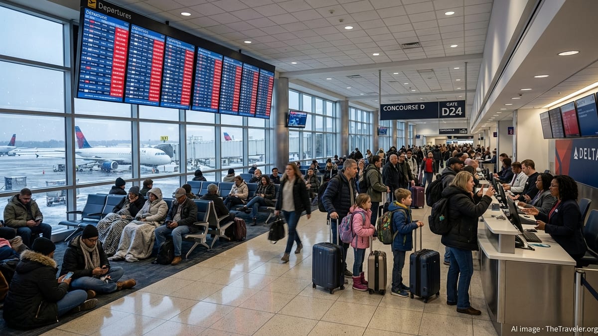
While London’s main airports remain open, high winds and low cloud associated with Storm Austen are contributing to air traffic control restrictions and increased spacing between arrivals and departures. This has led to delays on some short‑haul European and domestic flights into and out of the South East, with knock‑on effects for later rotations through the day.
Public flight‑tracking and aviation data show that operations at Gatwick are particularly sensitive to the storm, given its role as a key hub for services from along the south coast rail corridor already affected by disruption. Passengers heading to Gatwick by train are encountering extended journey times or replacement transport, adding further uncertainty to connection plans and check‑in schedules.
Heathrow, Stansted and London City are also experiencing weather‑related impacts, although to varying degrees depending on wind direction and runway configuration. Travellers are being encouraged by airlines and airport operators, via public websites and social media channels, to monitor flight status closely on Friday and to arrive earlier than usual, especially if also navigating reduced public transport or congested road links.
What travellers in the South East should do now
With yellow wind warnings in force and rail disruption expected to last into the evening, those who have flexibility are being advised through public travel and weather guidance to postpone non‑essential journeys where possible. For essential travel, the consistent message from transport operators and meteorological services is to plan ahead, build in extra time and prepare for changes on the day.
Rail passengers across the South East are being urged to use official journey planners before setting out and again immediately before boarding, as timetables are being updated throughout the day to reflect track inspections, speed restrictions and localised blockages. Where ticket acceptance has been introduced between operators, travellers may have more than one route option to reach their destination, but should expect services to be busy and slower than normal.
Those travelling by car are encouraged to check local traffic bulletins for reports of fallen trees, collisions or flooded sections, and to carry basic supplies in case of extended delays. For air and ferry passengers, publicly available advice stresses the importance of confirming departure times directly through operator channels and allowing for longer transfer times to ports and airports.
Forecasts indicate that Storm Austen will continue to move east through Friday, with winds gradually easing across many western areas by nightfall. However, unsettled weather and residual transport disruption are likely to persist into the weekend, so travellers across the South East should remain prepared for slower journeys and short‑notice changes to planned services.