


More news on this day
Scotland is braced for significant flooding and transport disruption as Storm Austen and Storm Boelo move across the country within 48 hours, prompting multiple Met Office weather warnings and pre-emptive changes to rail and road operations.
Get the latest news straight to your inbox!
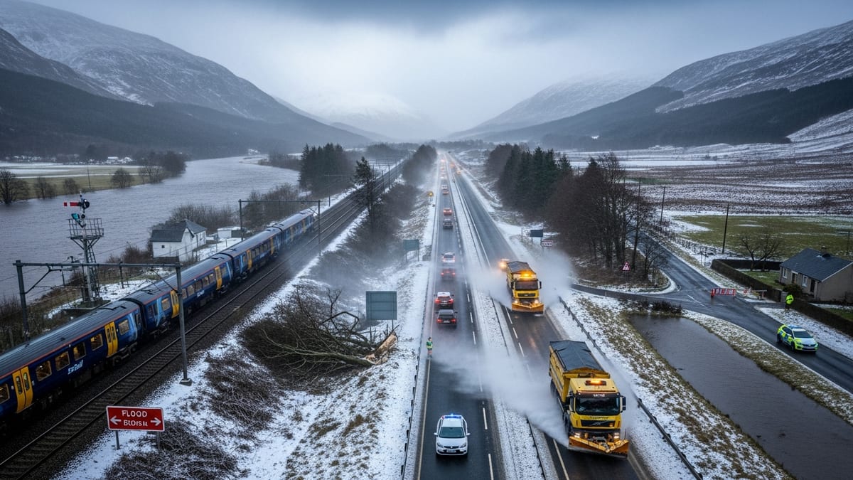
Two named storms in 48 hours for Scotland
The Met Office has issued a series of yellow and amber alerts as Storm Austen brings heavy rain to central, southern and northeast Scotland on Friday 23 October, followed rapidly by strong winds from Storm Boelo through Saturday night and Sunday. Forecasts indicate that the first storm will focus on intense rainfall, increasing the risk of surface water and river flooding, while the second will deliver widespread gales, especially across western, northern and upland areas.
According to publicly available Met Office information, a yellow rain warning covers much of Scotland from early Friday morning into the small hours of Saturday, coinciding with the passage of Storm Austen. Rainfall totals of 10 to 25 millimetres are expected quite widely, with higher totals possible over southern and eastern parts of the country where bands of heavier rain are likely to linger.
Storm Boelo, officially named on Thursday 22 October, is then forecast to track across the northern half of the UK over the weekend. Updated guidance on Friday brings an amber wind warning into force across large parts of western and central Scotland from Saturday evening into Sunday, highlighting the potential for gusts of 55 to 60 miles per hour quite widely and up to around 80 miles per hour in exposed coastal and high ground locations.
Publicly available coverage from Scottish and UK media notes that these are the first back-to-back named storms of the 2026–27 windstorm season, following an already unsettled October that has seen several bouts of heavy rain and strong winds across northern Britain.
Flood risk and local preparedness
The combination of saturated ground from recent unsettled weather and further heavy rain from Storm Austen is raising concerns over flooding in parts of Scotland. Met Office briefings on Friday highlight the potential for standing water on roads, rapidly responding watercourses and localised river flooding, particularly in central belt corridors and northeast catchments where rainfall totals may be highest.
Scotland’s national and local resilience frameworks emphasise a colour-coded warning approach, with yellow and amber severe-weather advisories used to flag both the likelihood and potential impact of flooding and wind damage. Publicly available guidance explains that amber alerts indicate an increased risk to life and property, as well as the potential for widespread disruption to essential services and travel.
Local authority updates in areas such as Aberdeenshire and the Scottish Borders on Friday reference the amber wind warning associated with Storm Boelo, encouraging residents to secure loose items, check for localised surface water issues and stay informed on any river flood alerts. Information issued through official channels stresses that flood-prone communities, including those near smaller, faster-responding rivers, may see impacts develop quickly as bands of heavy rain move through.
Travellers heading into rural and coastal regions are being advised in public information notices to monitor Scottish flood and weather pages closely, particularly from Friday evening onward, and to be prepared for short-notice changes if water levels rise on minor roads and low-lying routes.
Rail passengers warned of route closures and delays
Scotland’s rail network is preparing for substantial disruption as the two storms pass in close succession. National Rail’s service disruption pages on Friday outline that Storm Austen is already affecting ScotRail operations, with further changes expected as Storm Boelo’s stronger winds arrive on Saturday and Sunday. Passengers are being urged via published alerts to check journey planners on the day of travel and to expect extended journey times.
Network Rail’s media updates on Friday morning indicate that some lines in Scotland will be closed pre-emptively during the peak of Storm Boelo’s winds, particularly on routes where past storms have brought fallen trees, landslips or overhead line damage. Extra staff and equipment are being positioned at known trouble spots to deal with debris, blocked drainage and any damage to infrastructure once winds ease sufficiently to allow inspections.
National Rail information covering the wider UK notes that storms Austen and Boelo are expected to affect travel until at least Monday 26 October, with disruption possible beyond the formal warning periods while lines are inspected and repairs completed. For Scotland, this means that even early-week services may be subject to short-notice alterations where damage is identified over the weekend.
Travellers heading to or from major Scottish cities such as Glasgow, Edinburgh, Aberdeen and Inverness are being advised through publicly available notices to allow extra time for connections, avoid final trains where possible, and check for replacement road transport in areas where rail closures have been planned as a precaution.
Road, ferry and air travel impacts
Road users across Scotland are being cautioned to prepare for hazardous driving conditions, especially from Friday afternoon onward as heavy rain reduces visibility and increases spray. With gusty winds already developing in the wake of Storm Austen and much stronger winds anticipated from Storm Boelo, bridges and exposed sections of trunk roads may face speed restrictions or temporary closures, according to travel advisories from national transport agencies.
Public transport information suggests that bus and coach operators may be forced to divert or suspend services on some cross-country routes if localised flooding or fallen trees occur. Motorists are being encouraged via official guidance to avoid driving through flood water, to plan routes that minimise exposure to coastal roads and high passes, and to check live travel bulletins before setting out.
Ferry services to and from Scotland’s islands are also at risk of disruption, with strong winds and large waves likely across the Hebrides, Orkney and Shetland sea areas as Storm Boelo peaks. Operators typically adjust timetables or cancel sailings when wind and swell exceed safe operating thresholds, and publicly available timetables for the weekend are already flagged with weather-related warnings. Travellers are being encouraged to treat all sailings on Saturday night and Sunday as subject to late change.
Airports in the central belt and Highlands may also experience knock-on effects as crosswinds increase and cloud bases lower during squally showers. While no blanket closures are indicated in current public information, airlines commonly adjust schedules, consolidate flights or introduce delays when strong winds and turbulence coincide with busy periods. Passengers connecting through Scottish hubs are therefore advised to keep contact details updated with carriers and to monitor flight status pages closely.
Advice for visitors and late-season travelers
The back-to-back storms arrive during a busy late-October period for tourism in Scotland, when visitors travel for autumn foliage, city breaks and Highland walking trips. Travel forums and public advice channels over recent days highlight questions from visitors about whether to cancel plans, particularly for long-distance driving or island trips.
Safety-focused guidance from official weather and resilience agencies emphasises that decisions should be based on up-to-date warnings for specific locations and times, rather than on broad national headlines. A yellow warning may still allow travel with extra caution, while an amber alert significantly raises the risk of dangerous conditions, particularly for high-sided vehicles, hikers on exposed hills and travellers on coastal or mountain roads.
For those already in Scotland or due to arrive over the weekend, publicly available information recommends a flexible approach. Travellers are encouraged to build in time for delays, consider basing themselves in larger towns or cities while the worst of the weather passes, and avoid committing to tight onward connections immediately after the storm period.
Accommodation providers and tour operators often adjust cancellation or rescheduling policies during severe weather, but terms vary. Since conditions and warnings can change quickly as Storm Austen clears and Storm Boelo intensifies, visitors are being advised to check the latest Met Office warnings, transport updates and local authority announcements regularly, and to prioritise personal safety over fixed itineraries as Scotland navigates this period of intense autumn weather.