


More news on this day
Scotland faces a weekend of hazardous travel and potential infrastructure disruption as the Met Office’s amber wind warning for Storm Boelo comes into force from Saturday evening into Sunday, covering most of the mainland and several island areas.
Get the latest news straight to your inbox!
What the Amber Wind Warning Actually Means
Publicly available guidance from the Met Office describes an amber wind warning as indicating an increased likelihood of significant impacts, including a danger to life from flying debris, falling trees and large waves, alongside widespread travel disruption and power interruptions. The amber area for Storm Boelo currently covers the bulk of mainland Scotland, along with parts of Northern Ireland and northern England, with gusts widely expected to reach 55 to 65 miles per hour and potentially 70 to 80 miles per hour in exposed and coastal locations.
Weather warning maps published on 23 October show the amber alert in force from 21:00 on Saturday 24 October until 21:00 on Sunday 25 October. A broader yellow warning for wind extends beyond this core zone, indicating that while very strong gusts are most likely in the amber area, disruptive conditions may also be experienced elsewhere. A number of councils, including Aberdeenshire, Moray, the Highlands and the Scottish Borders, have issued their own updates highlighting the risk of falling branches, structural damage and interruptions to utilities over the same period.
Previous amber wind events in Scotland have brought widespread transport disruption, particularly where strong gusts coincide with saturated ground and high river levels. Met Office post event summaries for earlier storms record observed gusts above 70 miles per hour across northern and western Scotland, leading to closed bridges, suspended ferry sailings and widespread power cuts. Against that backdrop, agencies are treating Boelo as a serious test of the early 2026 to 2027 storm season.
Road and Bridge Conditions Across the Network
Traffic Scotland’s dedicated Storm Boelo pages state that the amber period from Saturday night through Sunday is expected to bring a high risk of disruption on key trunk roads, especially on elevated and coastal stretches. Strong crosswinds are likely on exposed routes such as the A9, A82 and A835, while debris and fallen branches may affect smaller roads and rural connections. Motorists are being urged through public notices to check live travel information, consider whether journeys are essential and allow additional time if travel cannot be avoided.
Published advice from Police Scotland’s road policing division notes that driving conditions may become hazardous, with a particular concern for high sided vehicles, caravans and trailers on open sections and bridges. In past amber wind events, restrictions or closures have been imposed on structures such as the Forth Road Bridge and the Tay Road Bridge when gusts approach 60 to 70 miles per hour, and there is potential for similar measures during Boelo if forecast wind speeds materialise.
Local authority statements in areas such as Aberdeenshire and the Highlands also highlight the risk of surface water and blocked drains where Storm Boelo’s winds arrive on top of recent rainfall linked to Storm Austen. While the current Met Office focus is on wind rather than rain, councils are advising drivers to be prepared for standing water, temporary traffic signals for fallen trees and the possibility of diversion routes adding significant mileage to planned journeys.
Rail, Ferry and Air Travel Disruption Risks
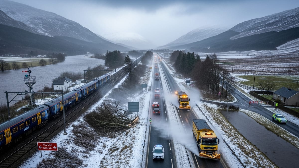
Rail and ferry operations in Scotland routinely adjust services when amber wind warnings coincide with very strong gusts and large waves, and public travel advice for Storm Boelo indicates that some pre emptive suspensions and speed restrictions are likely. Traffic Scotland’s disruption overview for the weekend notes that road, rail, air and ferry services are expected to be affected, with longer journey times and potential cancellations.
In previous autumn storms of similar strength, rail operators have reduced speeds on exposed sections and closed some lines where falling trees and blown debris pose a risk to overhead lines and signalling. Public information around Boelo suggests that particular attention is being paid to coastal and rural routes where access for repair teams can be difficult if conditions deteriorate overnight. Travellers are being advised to check the latest service information with operators before setting out, rather than assuming that weekend timetables will run as published.
Ferry services linking the mainland with island communities on the west and north coasts are especially sensitive to Boelo’s projected gusts and swell. Local council statements for the Western Isles, the Highlands and the Northern Isles point to the likelihood of short notice cancellations or amended timetables if conditions at sea or in harbour become unsafe. Airports across Scotland are also preparing for crosswinds and turbulence, and although runways remain usable in many windy conditions, passengers are being warned that delays and diversions are possible, particularly on shorter regional routes and at smaller island airfields.
Regional Impacts from Borders to the Highlands
Although the amber wind warning is national in scope, the expected impacts vary by region. Scottish Borders Council reports that its area will be under the amber alert from Saturday evening into Sunday evening, following heavy rain from Storm Austen that could increase the risk of surface water and minor flooding. Public messaging in the Borders highlights vulnerable routes in river valleys and upland passes where gusts can funnel through gaps and affect high sided vehicles.
Aberdeenshire Council’s update notes that very strong winds are forecast across most of the north east over the same weekend window, with particular concern for coastal communities along the North Sea where large waves and overtopping may affect promenades, harbours and exposed sections of road. Residents are being urged through council channels to secure loose garden items, move vehicles away from trees where possible and follow any local advice if flooding or structural damage occurs.
In Moray and the Highlands, council communications stress that Storm Boelo could initially hit western coastal areas on Saturday night before the strongest winds transfer eastwards on Sunday. Remote and rural communities that rely on a small number of road links and power lines are being reminded that access may be limited if trees fall or lines come down, and that temporary loss of mobile coverage or broadband is possible during the peak of the storm.
Practical Safety Guidance for Residents and Visitors
Publicly available information from the Met Office and Scottish resilience partners sets out a number of practical steps for staying safe during an amber wind event such as Boelo. People are encouraged to secure or move indoors any loose items around homes, holiday lets or campsites, including outdoor furniture, bins and equipment that could be lifted by strong gusts. Those in coastal areas are advised to stay back from sea walls, harbour fronts and cliff edges during peak winds, as large waves and spray can be unpredictable and hazardous.
Travelers planning to move around Scotland this weekend are being urged by multiple agencies to reconsider non essential journeys during the height of the warning, especially across the central belt, Highlands, north east and Borders where impacts are expected to be most pronounced. Where travel is unavoidable, the advice stresses checking for route closures and live disruption, carrying warm clothing, food and water in vehicles, and ensuring mobile phones are charged in case of delays.
Guidance from councils and emergency planners also highlights the benefits of basic household preparation ahead of possible power cuts, such as having torches, batteries and power banks to hand and knowing how to contact energy suppliers in the event of an outage. Visitors staying in rural accommodation are encouraged to familiarise themselves with local contact numbers supplied by hosts and to keep a close eye on updated forecasts across Saturday and Sunday, as the precise track and strength of Storm Boelo may still change slightly as it approaches.