


More news on this day
Storm Austen has been named by the Met Office as a rapidly deepening Atlantic system moves towards the British Isles, triggering widespread yellow wind warnings and raising the prospect of travel disruption, power interruptions and hazardous coastal conditions from late Thursday into Friday.
Get the latest news straight to your inbox!
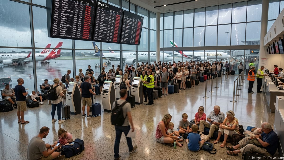
First named storm of the season targets southern UK
Publicly available information shows that Storm Austen is the first named storm of the 2026–27 UK and Ireland season, developing as an area of low pressure over the Atlantic before intensifying on its approach to the southwest of the UK late on Thursday 22 October. Forecast guidance indicates that the system will be energised by a strong jet stream, a setup associated with rapid deepening of autumn and winter storms.
The Met Office announcement on 20 October stated that Storm Austen is expected to bring a spell of very windy weather and outbreaks of heavy rain as it sweeps east and north during the early hours of Friday 23 October. Forecast charts highlight southern England and south Wales as the most likely to see disruptive gusts, with the strongest winds anticipated around exposed coasts and high ground.
Travelers planning journeys into or out of the southwest of England, south Wales, the south coast and the London area during this period are being advised in public guidance to allow extra time, check for short‑notice changes to road, rail, air and ferry services, and be prepared for delays where conditions deteriorate quickly. The combination of darkness, heavy rain and crosswinds during the overnight and early morning hours is expected to make conditions particularly challenging.
Yellow wind warnings and potential for stronger local impacts
The Met Office has issued a broad yellow warning for wind covering southern parts of England and south Wales from midnight to midday on Friday. According to the official warning text, gusts of 50 to 60 miles per hour are considered likely across many inland locations within the warning area, with the potential for gusts above 70 miles per hour along the most exposed stretches of southwest and southern coastline.
For coastal communities in Cornwall, Devon, Dorset and along the English Channel, these wind speeds raise the risk of large waves, minor coastal flooding and hazardous conditions around piers and promenades. Public safety advice associated with the warning notes an increased chance of debris on roads, temporary power interruptions and difficult driving conditions, particularly for high‑sided vehicles and on exposed routes such as bridges and elevated sections of motorway.
Reports from Irish forecaster Met Éireann indicate that Austen will also be accompanied by bands of heavy rain, with a nationwide status yellow rain warning in force in Ireland from Thursday evening to Friday morning as the frontal system crosses the country. While wind criteria on the Irish side are currently expected to remain below orange threshold for most areas, forecasters there highlight the risk of localised surface water flooding and poor visibility on the roads overnight.
Why a named storm can carry only a yellow warning
The decision to name a storm like Austen is based on expected impacts rather than the warning colour alone. Met Office guidance on storm naming explains that systems are considered for naming when they show the potential to cause medium or high impacts across the UK and Ireland, which may be associated with yellow, amber or red warnings depending on confidence and severity.
Published background material from the Met Office and partner agencies notes that yellow warnings can cover a wide range of possible outcomes. In some instances, a yellow warning may involve relatively modest effects that are limited in both time and space. In other cases, as with Storm Austen, forecasters judge that while there is still uncertainty around the precise track and intensity, there is already enough likelihood of more significant disruption to justify assigning a name to aid public communication.
Storm naming is a joint initiative between the Met Office, Met Éireann and the Dutch meteorological service KNMI, designed to provide a single, easily recognisable label for impactful weather systems. By using a consistent name across forecasts, broadcast bulletins and digital channels, agencies aim to help the public follow updates more easily as warnings are refined, upgraded or, in some cases, downgraded closer to the event.
Expected disruption for transport and coastal travel
For those travelling around the UK and Ireland, the main window of concern associated with Storm Austen runs from Thursday evening 22 October into the first half of Friday 23 October. According to current forecast timelines, the first impacts are likely to be felt in southwest Ireland and the far southwest of England on Thursday night, before the core of strongest winds transfers across south Wales, southern England and the Irish Sea during Friday morning.
Public transport operators typically respond to yellow wind warnings by monitoring real‑time conditions and adjusting services where necessary. Experience from previous named storms with similar warning levels suggests a risk of speed restrictions on exposed rail lines, temporary closures of some coastal routes and occasional cancellations of ferry crossings on the Irish Sea and English Channel if sea state deteriorates. Air travel is generally more resilient, but gusty crosswinds can still lead to delays or changes in runway use at busy hubs such as London airports, Birmingham, Bristol and Cardiff.
Road users are being advised in official guidance associated with the warnings to drive more slowly in strong winds, take particular care when passing high‑sided vehicles, cyclists and motorcyclists, and avoid parking under trees where falling branches are more likely. For coastal walkers and visitors, forecasters and coastal safety agencies routinely recommend staying well back from breaking waves, harbour walls and seafront structures during periods of strong onshore winds.
What travellers should watch for as forecasts evolve
Although confidence has increased enough for Austen to be named, forecast tracks for mid‑latitude storms can still shift by tens of miles in the final 24 to 36 hours before landfall. Publicly available forecast discussions from the Met Office emphasise that the exact positioning of the strongest winds and heaviest rain bands could yet change, which may lead to adjustments in the extent or timing of yellow warning areas.
Travellers with flexible plans are being encouraged through public information campaigns to keep checking updated forecasts and warning maps through Thursday and into Friday, particularly if they are crossing the Irish Sea, using exposed coastal routes, or transiting the southwest of Britain early on Friday morning. A relatively small change in the storm’s track could mean that some locations see only blustery conditions with showers, while others experience a shorter period of much more severe gusts and heavy rainfall.
For visitors already in the affected regions, local authorities and tourism bodies typically advise securing loose outdoor items, making contingency plans for outdoor events and excursions, and allowing for the possibility that some attractions may open later than usual or with restricted access while staff assess any overnight damage. Once Austen moves away to the east later on Friday, forecast model guidance indicates that the broader weather pattern is likely to remain unsettled into the weekend, with further showers, periods of rain and brisk winds in many areas even after the named storm itself has passed.