


More news on this day
Overnight gusts reaching 85 mph have battered parts of Scotland as Storm Boelo swept across the country, bringing widespread travel disruption, coastal flooding and power outages during an already stormy autumn weekend.
Get the latest news straight to your inbox!
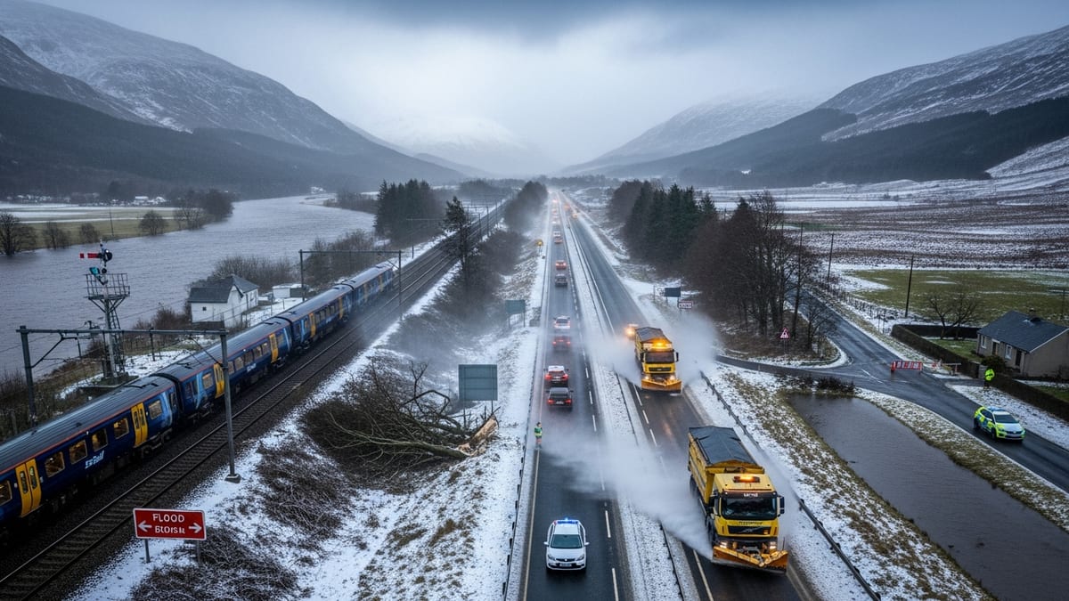
Storm Boelo’s path across Scotland
Storm Boelo is the second powerful Atlantic system to affect the United Kingdom this weekend, following closely on the heels of Storm Austen. The Met Office named Boelo on 22 October as forecast models showed a deep area of low pressure tracking across the North Atlantic and into northern Britain, with the strongest impacts expected in Scotland.
Through Saturday night into Sunday, 24 to 25 October, Boelo’s core moved across the north and west of Scotland. Publicly available data from the Met Office shows an amber warning for strong winds in place across much of mainland Scotland, the Western Isles and parts of Northern Ireland, highlighting a risk of flying debris, damage to buildings and dangerous conditions on exposed routes.
Wind speeds intensified quickly after nightfall. Network updates from Scottish and UK energy operators reported gusts over 80 mph across Argyll, with a peak of 85 mph recorded at Machrihanish on the Kintyre peninsula. Other widely reported readings across western Scotland and the Inner Hebrides reached the low 80s, leaving communities facing storm‑force conditions well into Sunday morning.
Alongside the winds, Boelo pulled in bands of heavy showers and squally downpours, adding a further hazard on already saturated ground after earlier rainfall from Storm Austen. Environmental agencies warned of a heightened risk of surface water flooding and wave overtopping on west‑facing coasts as large Atlantic swells coincided with high tides.
Severe disruption to rail, road and ferry travel
Travel across Scotland has been heavily affected, with rail, road and ferry operators implementing extensive restrictions as the storm peaked overnight. ScotRail network updates on Sunday morning indicated multiple line closures or partial suspensions linked to fallen trees, debris and flooding on the tracks, particularly on routes radiating from Glasgow and across the central belt.
In Glasgow, local coverage shows one city station temporarily flooded, with images of water pooling across platforms and concourses as drains struggled to cope with intense rainfall. West‑coast lines toward Gourock and Wemyss Bay, as well as key intercity corridors to Carlisle and other destinations in northern England, have seen speed restrictions, delays and cancellations as engineers inspected infrastructure for wind damage.
On the roads, Traffic Scotland’s live disruption pages list a series of incidents associated with Boelo, including restrictions and temporary closures on exposed bridges and higher‑level routes. Sections of the A85 in Argyll have been reported as blocked or partially obstructed by fallen trees and debris, while other trunk roads are experiencing difficult driving conditions due to standing water and high crosswinds.
Ferry links to islands off Scotland’s west and north coasts have also been significantly curtailed. Operators have suspended or amended sailings where winds and swell exceed safe operating thresholds, with particular disruption reported on services serving the Inner Hebrides and Western Isles. Travellers heading for island destinations have been advised via public updates to check for last‑minute cancellations and rolling revisions to timetables.
Air travel delays and wider UK and European impacts
The effects of Storm Boelo have extended well beyond Scotland. UK‑wide aviation updates on Sunday report dozens of flight cancellations and delays linked to the storm, with services to and from Scottish airports among the most affected. Strong crosswinds have prompted temporary suspensions of operations on some runways while conditions were reassessed.
As Boelo moved eastwards out of Scotland and across the North Sea, major aviation hubs on the continent began warning of knock‑on disruption. Amsterdam’s Schiphol Airport, a key transit point for travellers connecting between North America, the UK and mainland Europe, has notified passengers of delays and possible cancellations caused by continuing high winds over the Netherlands.
Elsewhere in the British Isles, publicly reported data from airports and transport operators in Ireland and northern England shows similar patterns of disruption, with strong gusts affecting approach paths and departure slots. Combined with the lingering impacts of Storm Austen, the weekend has become one of the most unsettled for travellers in the region so far this year.
The wider rail network in northern England has also been affected by precautionary speed limits and route checks, particularly on exposed coastal stretches and cross‑border services. For many passengers, extended journey times and last‑minute changes have become unavoidable as operators prioritise safety while the strongest winds abate.
Power cuts, coastal flooding and conditions on the ground
Energy network operators across northern Scotland report that tens of thousands of homes have experienced power interruptions as Boelo’s highest gusts brought down lines and damaged local infrastructure. In Argyll and the islands, where the 85 mph peak at Machrihanish was recorded, field teams have been mobilised to begin repairs as soon as conditions permit.
Along the west coast, environmental agencies including the Scottish Environment Protection Agency (SEPA) have issued flooding outlooks warning of wave overtopping, coastal inundation and localised flooding of low‑lying roads. Communities facing onto inlets and sea lochs have been advised through public channels to be vigilant around high tide, avoid sea fronts and stay clear of harbour walls, where large waves and spray have been reported.
Inland, rainfall on already saturated catchments has led to reports of surface water on roads and minor river flooding, particularly where drainage systems have struggled to cope with the volume of water arriving in a short period. Local authorities have highlighted the potential for rapidly changing conditions, with some smaller roads becoming impassable for short periods overnight.
Despite the severity of the conditions in some western and northern districts, other parts of central and eastern Scotland have experienced more intermittent squally showers and gusty periods as Boelo’s core tracks away. However, travel and power networks remain on alert for further issues until the system fully clears and winds ease later on Sunday.
What travellers need to know in the coming days
With amber and yellow wind and rain warnings still in force over parts of Scotland on Sunday, travellers are being urged through official public advisories to plan cautiously. Rail passengers are encouraged to consult live journey planners before setting off, pay close attention to any “do not travel” notices on particular routes and be prepared for replacement transport where lines remain blocked by debris or floodwater.
Those intending to drive across exposed bridges, coastal routes or higher‑level roads are being directed to check real‑time information services such as Traffic Scotland’s online maps and radio updates. Guidance on these platforms emphasises slower speeds, greater following distances and avoiding journeys in high‑sided vehicles where crosswinds remain strong.
For air travellers, airlines and airports are continuing to update departure boards and customer notifications as weather‑related knock‑on effects ripple through schedules. Passengers heading to or from Scottish airports, or connecting via hubs in northern England, Ireland or the Netherlands, are likely to see residual delays even as the core of Storm Boelo moves away.
Looking ahead, forecast guidance suggests that conditions should gradually improve across most of Scotland once Boelo clears into the North Sea. However, with the ground already saturated and the storm season well underway, transport and tourism businesses across the region are expected to remain attentive to further Atlantic systems that could develop in the days and weeks to come.