
More news on this day
Violent rainstorms sweeping across the Texas Gulf Coast on June 16 have disrupted air travel at Houston’s major airports and rippled across the state’s aviation network, with reports of extensive delays, diversions, and scattered cancellations as airlines struggle to keep schedules moving through the severe weather.
Get the latest news straight to your inbox!
Storm System Slams Gulf Coast on Busy Summer Travel Day
Publicly available weather data show a broad disturbance over southern Texas feeding repeated bands of heavy rain and thunderstorms into the Houston region and other Gulf Coast cities. Forecast discussions describe a slow-moving system capable of tropical development, bringing intense downpours, frequent lightning, and pockets of strong wind along the coast.
Meteorological outlooks issued on June 16 highlight Houston among several urban centers under heavy rain and flooding concerns as showers train over the same areas. The pattern is typical of early summer in the western Gulf, but the combination of saturated ground, low cloud ceilings, and convective storms has created especially difficult conditions for air traffic managers.
The timing of the weather has compounded its impact. The strongest cells moved through during morning and midday bank periods when departures and arrivals are heaviest, forcing traffic flow programs, airborne holding, and reroutes just as terminals were filling with business and summer leisure travelers.
Houston Hubs Bear the Brunt of Flight Disruptions
George Bush Intercontinental Airport and William P. Hobby Airport have been at the center of the disruption, with online trackers showing waves of delayed departures and arrivals as the storms evolved over the metro area. FAA traffic management advisories in recent days already outlined reduced capacity and arrival metering for Houston, and the new round of weather has extended and intensified those constraints.
Industry-facing delay dashboards indicate that delays at Bush Intercontinental have periodically climbed into the range of half an hour or more on average, with individual flights experiencing significantly longer waits as ground stops and reroutes are put in place. The airport’s role as a major connecting hub means disruptions extend well beyond Texas, affecting passengers who never planned to set foot in Houston.
At Hobby, where a mix of domestic and short-haul services operate, convection directly over the field has temporarily halted ramp activity at times. Aviation guidance notes that lightning within a certain radius can trigger ramp closures as ground crews are pulled back for safety, a standard procedure that nonetheless cascades into missed departure slots and tight turnarounds for aircraft.
Ripple Effects Reach Dallas and Other Texas Gateways
While the most intense rainfall has focused on the Gulf Coast, the same unstable air mass and moisture plume have influenced operations across a wider swath of Texas. Dallas Fort Worth International, Dallas Love Field, San Antonio, and smaller regional airports have all contended with lower ceilings, passing storms, or rerouted traffic as controllers work to thread flights around the worst cells.
Flight-tracking services and airline operations alerts show that Dallas Fort Worth, already prone to bottlenecks during convective events, has faced periodic flow restrictions when thunderstorms build along key arrival and departure corridors. Even when storms do not sit directly over the airport, weather along the arrival paths from Houston and the Gulf has prompted airborne holding and slowed sequences into North Texas.
The result is a layered disruption pattern typical of large, weather-sensitive air networks. Aircraft and crews delayed on the coast arrive late into inland hubs, compressing connection windows and forcing rolling rebookings. Travelers starting their journeys in relatively clear conditions have still found flights held at the gate while dispatchers wait for release times through constrained Texas airspace.
Heavy Rains Expose Existing Capacity Strains
The latest storm-related gridlock comes against a backdrop of ongoing capacity challenges at major Texas airports. Federal aviation planning documents released earlier this year flagged Bush Intercontinental for periods of reduced capacity and higher delay risk during peak operations, reflecting both infrastructure constraints and the sheer scale of connecting traffic handled by the hub.
Industry analyses have also noted that Houston’s location near the Gulf makes it particularly vulnerable to summer thunderstorm complexes and potential tropical systems from June through November. These events often force repeated ground stops and crew reassignments, stretching airline schedules that are already running near pre-pandemic volumes.
Experts in airport performance point out that severe weather increasingly intersects with tight scheduling, limited spare aircraft, and heavy global events traffic, leaving little slack when storms strike. With Texas cities hosting high-profile sports and business events this summer, even a single multi-day rainmaker can quickly translate into hundreds of disrupted flights and prolonged recovery periods.
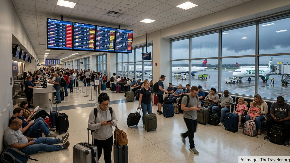
Travelers Face Long Lines, Rebookings, and Uncertain Timelines
Images and accounts shared on social platforms throughout June 16 describe long queues at customer service desks, packed gate areas, and departure boards dominated by yellow and red status markers. Some passengers report multiple sequential delays as airlines adjusted departure times in step with evolving traffic management initiatives into Houston and other affected airports.
Publicly posted airline bulletins show that at least one major carrier has issued a weather-related change-fee waiver for Houston-area flights, allowing affected travelers to move their trips to later dates within a defined window. Such waivers are a standard tool during significant weather disruptions and signal that airlines expect ongoing operational challenges rather than a brief, passing shower.
Travel guidance shared by aviation experts online encourages passengers to monitor airline apps closely, enroll in text alerts, and proactively seek alternative routings when feasible, especially for tight connections through Texas hubs. Morning and late-evening departures are often cited as more resilient during thunderstorm seasons, when the most intense convection frequently peaks in the afternoon hours.
With the Gulf system still evolving and the potential for additional heavy rain across southern and eastern Texas into Wednesday, forecasters suggest that recovery for the state’s aviation network could take time. For travelers passing through Houston and other major Texas airports, the latest storms are a reminder that in peak thunderstorm season, even routine itineraries can quickly be swept up in a broader travel shockwave.