


More news on this day
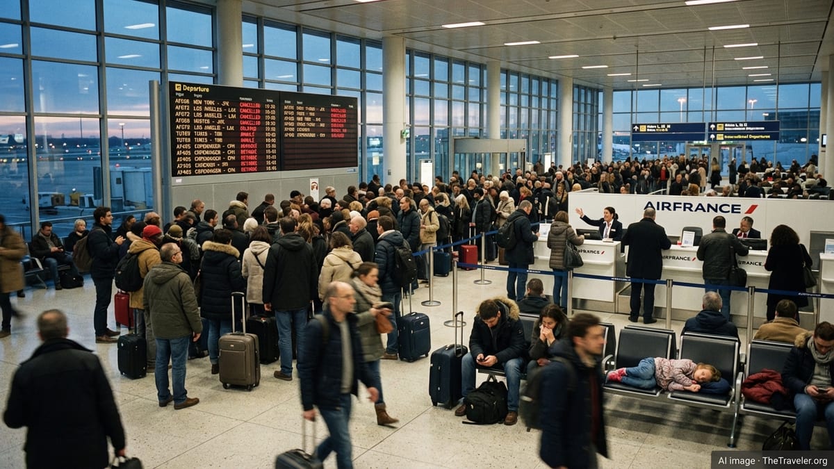
Severe storm forecasts over France in mid July 2026 have triggered significant disruption across the country’s main air hubs, with 68 flight cancellations and 1,178 delays reported across Paris, Nice and Marseille as airlines trimmed schedules and air traffic managers slowed arrivals and departures in anticipation of volatile weather.
Get the latest news straight to your inbox!
Storm Risk Follows Weeks of Extreme Heat
The disruption comes on the heels of an intense heat episode that gripped much of France in early July, followed by a rapid transition to unstable, storm prone air over the north and along the Mediterranean basin. Publicly available meteorological updates describe a sharp breakdown of the heat, with cooler Atlantic air colliding with lingering hot, humid masses over the interior and coastal regions.
Synoptic charts and regional outlooks indicate that this clash has produced a band of strong thunderstorms from the Paris region through central France and into Provence Alpes Côte d’Azur, where Nice and Marseille serve as critical gateways for peak summer tourism. The resulting convective systems have included heavy rain, lightning and localized strong winds, conditions that quickly reduce airport capacity and force air traffic controllers to widen separation between aircraft.
Forecast discussions for the second half of the week highlight an elevated risk of severe storms on Thursday and Friday, particularly in areas already subject to heat related vigilance earlier in the month. Aviation planners treated the pattern as sufficiently volatile to warrant proactive schedule reductions and extended spacing on arrivals and departures at the busiest platforms.
Operational data from flight tracking platforms show that the majority of July’s storm related disruptions at French hubs have clustered around these transition days, when rapid changes in cloud cover, wind shear and storm cell movement complicate runway use and approach patterns.
Paris Orly and Charles de Gaulle Lead the Disruption
The largest share of the 68 cancellations and more than one thousand delays has been concentrated in the Paris system, split between Paris Orly and Paris Charles de Gaulle. According to published coverage, France’s civil aviation administration asked airlines operating at Orly to cut parts of their Thursday evening schedules in response to the heightened storm risk, a step that immediately removed dozens of planned rotations from the board.
Flight monitoring dashboards show that the cutbacks, combined with holding patterns and reduced arrival rates at Charles de Gaulle, translated into several hundred delayed flights as carriers attempted to work around temporary capacity constraints. Even services that ultimately departed experienced extended ground times while crews waited for gaps between storm cells or for winds to return within crosswind limits for the active runways.
The Paris platforms sit close to the core of the unstable air mass and were repeatedly affected by quickly forming thunderstorms passing over the wider Île de France region. Each passing cell required air traffic controllers to adjust flight paths, impose short lived ground stops or divert aircraft to alternate routings around active weather, measures that inevitably cascaded into network wide delays.
Although the absolute number of cancellations remained limited relative to the size of the Paris network, the imbalance between reduced capacity and peak season demand left many flights heavily delayed and aircraft and crews out of position for subsequent rotations later in the evening and into the following day.
Mediterranean Gateways in Nice and Marseille Also Affected
On the Mediterranean coast, Nice Côte d’Azur and Marseille Provence registered a smaller but still notable share of the overall tally, with a combination of outright cancellations and repeated pushbacks of departure times. Publicly accessible weather bulletins for southern France describe a volatile pattern marked by lingering heat, dry surface layers and moist air aloft, a recipe that can generate strong, sometimes isolated, thunderstorms over land and near coastal ranges.
At Nice, a high proportion of operations involve short haul European links that are sensitive to even modest schedule slippage, as aircraft are scheduled for multiple daily rotations. Tracking data indicate that when storm cells developed near the airport during the late afternoon, several arrivals were held or rerouted, and operators cancelled select turn around flights to regain schedule stability.
Marseille, already under heightened vigilance for fire and heat conditions earlier in July, faced separate challenges as changing wind directions and localized downpours temporarily constrained runway use. While the number of cancellations remained in the single digits, dozens of flights encountered extended taxi and departure queues as controllers sequenced movements around passing showers and variable visibility.
For both Mediterranean hubs, the timing of storms during the busiest hours of the day amplified the impact, as late afternoon delays quickly spilled into the evening wave of departures serving domestic, North African and intra European markets.
Peak Summer Travel Meets Weather Sensitive Infrastructure
The July disruptions underscore how sensitive high density European hubs remain to convective summer weather, particularly when air traffic is already near or above 2019 levels. Historical analyses of European aviation performance have highlighted that even minor capacity reductions at busy airports can produce disproportionate knock on effects later in the day as aircraft, crews and gates fall out of their planned sequence.
In France, the combination of strong seasonal demand, ongoing resource pressures and a more frequent pattern of heat and storm events has narrowed the margin for absorbing shocks. When storms force temporary reductions in arrival or departure rates, airlines are left to choose between concentrating delays on certain rotations or proactively cancelling selected services to stabilize the remainder of the schedule.
The figures emerging from Paris, Nice and Marseille for this mid July episode 68 cancellations against more than a thousand delays suggest that carriers and traffic managers opted largely to maintain the bulk of the program, accepting widespread lateness while targeting a limited number of flights for pre emptive removal. For travelers, the practical result is often missed connections and arrival times pushed deep into the night, even when their flights ultimately operate.
Air passenger rights frameworks in the European Union treat severe weather and air traffic control restrictions as extraordinary circumstances, which typically limit eligibility for financial compensation. However, travelers affected by long delays can still access care measures such as meals and accommodation when disruptions extend overnight, subject to each carrier’s policies and available capacity in the affected city.
Implications for Travelers Planning French Summer Trips
The latest round of storm driven disruption serves as a reminder that July and August itineraries involving France’s busiest hubs carry an elevated risk of weather related irregularities, even under clear skies at the time of booking. Forecasts for the broader season indicate that alternating phases of heat and instability are likely to persist, especially over northern and southeastern France.
For travelers transiting through Paris, Nice or Marseille, operational data and recent experience suggest that early morning departures tend to be less exposed to cascading delays than late afternoon and evening services, which remain more vulnerable to the cumulative effects of storms, air traffic flow measures and crew duty time limits. Building longer connection windows and avoiding last departures of the day on critical legs can help reduce the risk of missed onward flights.
Those with flexibility may also wish to monitor short range weather outlooks for their travel dates and remain alert to schedule adjustments announced in the 24 to 48 hours leading up to departure. Airlines operating in France have increasingly used proactive schedule trimming on high risk days to mitigate the worst effects of storm episodes, which can result in cancellations being communicated well before passengers arrive at the airport.
As extreme heat and intense storms become more intertwined features of the French summer, the pattern seen in July 2026 at Paris, Nice and Marseille provides an early indication of the operational challenges that airports and airlines will likely confront repeatedly in the peak travel seasons ahead.