


More news on this day
Summer thunderstorms sweeping across western Canada and the U.S. Mid-South in 2026 are disrupting air travel and knocking out electricity in multiple communities, creating fresh challenges for travelers and residents from British Columbia to Tennessee.
Get the latest news straight to your inbox!
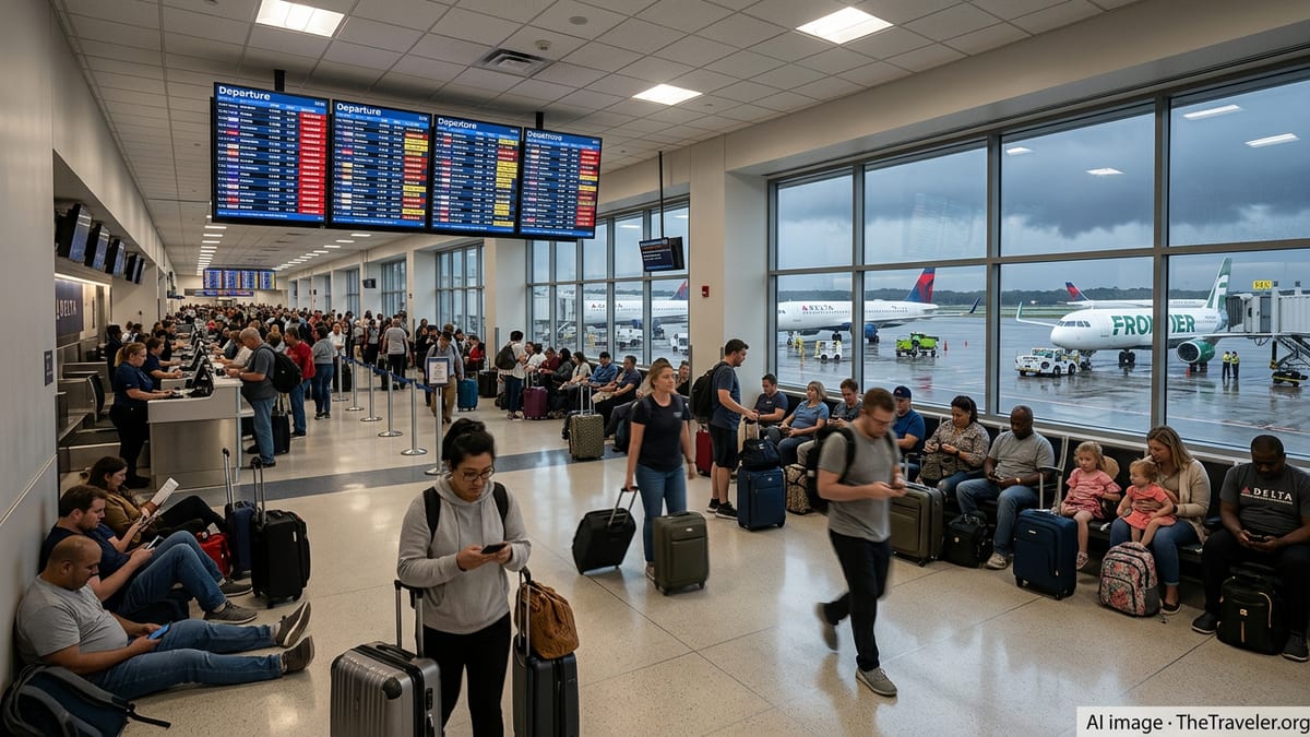
Thunderstorms Converge on Key Travel Corridors
A series of moisture-rich storm systems has focused on some of North America’s busiest summer travel corridors, with strong thunderstorms repeatedly forming along frontal boundaries from the Pacific coast to the Mississippi Valley. Publicly available aviation outlooks show that convective weather has become a near-daily feature in parts of the Mid-South, including Memphis and surrounding hubs, where slow-moving storms can rapidly trigger delays when they pass over major airports.
Recent air traffic planning summaries indicate that thunderstorms have been slowing traffic at airports such as Memphis and Atlanta during peak periods, with rain, low cloud, and lightning frequently cited as contributing factors. When storm cells line up along approach and departure routes, controllers may reduce arrival rates or implement ground delay programs, which then ripple across airline networks as aircraft and crews fall out of position.
These patterns follow a broader seasonal trend in which short-lived but intense convective outbreaks can be as disruptive to summer travel as winter snow events. Even when storms are relatively localized, their timing over a single hub at the wrong hour of the day can generate missed connections, diversions, and last-minute cancellations for travelers across the continent.
Flight Cancellations Mount in the Mid-South
Operational summaries and advisory notices from federal aviation systems show that thunderstorms have periodically forced flow restrictions and arrival delays into key Mid-South airports in 2026, particularly around Nashville and Memphis. On days when convective clusters form directly over arrival corridors, planned arrival rates have been cut and delays of up to half an hour or more have been recorded for inbound flights, with additional knock-on effects across airline schedules.
In some instances, thunderstorm-driven slowdowns have combined with existing summer capacity constraints to magnify disruption. When storms prompt reroutes or holding patterns over already busy hubs, carriers are more likely to cancel later flights in order to reset their operations, protecting early-morning departures on the following day at the expense of same-day connections.
For travelers transiting the Mid-South, these conditions mean that even routine summer itineraries can quickly become complicated. Passenger reports across airline and aviation forums describe evenings of rolling delay notifications, aircraft waiting on the tarmac for weather windows to reopen, and diversions to outlying airports when lightning or heavy downpours temporarily close ramp operations.
Power Outages Spread Across British Columbia
Farther northwest, stormy weather and related hazards have contributed to a patchwork of power interruptions across British Columbia during the 2026 warm season. Utility outage dashboards and regional coverage show that thousands of customers have experienced short-term blackouts in recent weeks, particularly in smaller communities and semi-rural corridors where transmission and distribution lines run through forested terrain.
In early July, local reporting from northeastern British Columbia noted that more than 2,000 customers around Fort St. John lost power after a mid-morning outage, with the utility identifying the disruption on its outage list as crews moved to restore service. Other dispatches from the same region referenced multiple smaller outages in nearby areas on subsequent days, underscoring how quickly localized weather and line issues can leave pockets of customers without electricity.
Southwest of the Interior, coverage from the Fraser Valley documented a larger event in mid-July in which over 9,000 customers around Hope, Agassiz, Seabird Island, and the Fraser Canyon were briefly without power around midday. Utility dashboards cited a transmission line problem linked to that cluster of outages, illustrating how a single line going out of service during unsettled weather can affect a wide geographic area before redundancy and repairs bring customers back online.
These incidents have unfolded against a backdrop of heightened weather volatility in British Columbia, where provincial and utility planning documents highlight storms, drought-stressed trees, and wildfire activity as growing risks to the power grid. Severe thunderstorm watches issued by federal forecasters in August for parts of the province have emphasized the potential for damaging hail, strong winds, and heavy rain, all of which can damage infrastructure or bring branches and trees down onto lines.
Travel and Tourism Feel the Strain
The combination of flight disruptions in the Mid-South and power instability in British Columbia is being felt across the travel sector. When thunderstorms slow operations at connecting hubs such as Memphis or Nashville, itineraries linking Canada and the southern United States can be thrown off schedule, with travelers missing onward flights or facing overnight stays far from their intended destinations.
In British Columbia, power outages during peak summer holidays affect both local residents and visiting tourists. Short-term blackouts can interrupt hotel operations, restaurant service, and campground facilities, while longer outages may complicate refrigeration, communications, and payment systems in smaller communities that rely heavily on seasonal visitors. Tourism operators in regions like the Fraser Valley and the Peace Country must increasingly build contingency plans for outages into their daily operations during storm season.
These challenges come on top of other climate and infrastructure pressures affecting travel, including heat-driven constraints on aircraft performance and wildfire smoke that can reduce visibility or prompt additional advisories. Industry analyses have noted that as summers trend hotter and more convectively active, airlines and utilities alike are facing a narrower margin for error in keeping people and goods moving reliably.
Preparing for a More Volatile Storm Season
Publicly available guidance from forecasters and utilities stresses that travelers and residents should treat severe thunderstorm season as a planning priority rather than an occasional inconvenience. Environment Canada’s thunderstorm watch bulletins for British Columbia highlight the potential for intense rainfall, damaging wind, and hail, while also encouraging the public to monitor alerts and be ready for rapidly changing conditions.
Utility preparedness materials in the province recommend that households maintain basic emergency supplies, including battery-powered lighting, charged devices, and non-perishable food, in case of multi-hour outages during stormy periods. Travelers venturing into more remote regions are urged to check outage maps and local advisories before driving long distances, especially where cellular coverage is intermittent and detours may be lengthy.
For air passengers, aviation planners advise close monitoring of flight status on days when thunderstorms are in the forecast for key hubs. Early departures, flexible tickets, and longer layovers can reduce the risk of missed connections when convective weather triggers ground delays, reroutes, or cancellations. As stormy skies continue to define much of the 2026 summer travel season, awareness and flexibility remain essential tools for navigating an increasingly weather-sensitive transportation network.
Energetic City coverage of Fort St. John outage