


More news on this day
Thick patches of fog have prompted a yellow weather warning across much of Northern Ireland this morning, with visibility dropping below 100 metres in places and the potential for widespread travel delays on roads and public transport.
Get the latest news straight to your inbox!
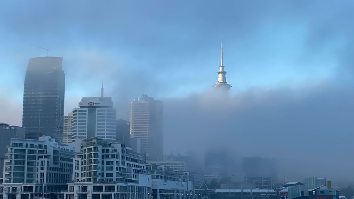
Yellow fog warning in force this morning
The Met Office issued the yellow warning for fog at 03:48 UTC on Tuesday 3 November 2026, covering all six counties of Northern Ireland. Publicly available information shows the alert is in place until 10:00 UTC, with the focus on western parts of the region but impacts possible more widely as patches drift and reform.
Forecast guidance indicates areas of dense fog forming during the early hours, particularly in low-lying and inland locations, before gradually thinning as the morning progresses. The warning notes that visibility could fall to less than 100 metres at times, creating hazardous conditions for drivers setting out during the morning peak.
The Met Office classifies the alert as yellow, meaning a high likelihood of low to moderate impacts. That combination signals an increased risk of localised disruption without the expectation of widespread severe impacts, but it does ask travellers to be prepared for slower journeys and changes to normal routines.
Companion guidance from Met Éireann highlights the same fog hazard for border counties in the Republic of Ireland, underlining that the low-visibility conditions are affecting a broad swathe of the island rather than isolated pockets.
Road, rail and air passengers advised to expect delays
Travel information services in Northern Ireland are drawing attention to the early morning warning window. TrafficWatch Northern Ireland notes that thick fog is likely to produce slower journey times on main routes, with commuters encouraged to allow extra time and be ready for sudden changes in visibility along their route.
Publicly available advice highlights that bus and train services may experience knock-on delays where speeds are reduced for safety or where road congestion builds near major junctions. Even modest reductions in speed on key approaches into Belfast, Derry and other regional centres can add several minutes to point-to-point journeys during the busiest hour.
The Met Office warning also flags a chance of delays or cancellations to flights. Early morning operations at airports such as Belfast City and Belfast International are most exposed, as dense fog can affect both arriving and departing services when visibility drops below set thresholds on the runway. Passengers with morning departures are being urged through public transport and airport channels to check the latest status of their flight before travelling.
While ferries across the Irish Sea are generally less sensitive to fog than to high winds, visibility constraints can still slow approaches to ports or require adjustments to schedules. Operators are therefore advising passengers to monitor updates where possible as the fog persists.
Where the fog is thickest across Northern Ireland
Weather maps from the Met Office show the warning area spanning all of County Antrim, County Armagh, County Down, County Fermanagh, County Londonderry and County Tyrone. Within that broad zone, forecasters highlight western parts of Northern Ireland as particularly prone to locally dense fog during the early morning period.
Locations around Lough Neagh and the western river valleys, along with inland stretches of major routes such as the A4 and A5 corridors, are especially susceptible when light winds and overnight cooling combine to trap moisture near the surface. Observational data from previous events in the region indicate that such conditions can produce multiple hours of restricted visibility before the sun is high enough to break up the fog.
Coastal settlements, including stretches of the Causeway Coast and Belfast Lough, may experience slightly more variable conditions as light breezes off the sea help to erode the thickest banks. Nevertheless, travellers are being advised that even short journeys from coast to inland areas can involve abrupt transitions from clear air to dense fog.
The Met Office notes that the fog is expected to thin and clear through the morning, with improving visibility toward late morning and midday. No further fog warnings were in force for Northern Ireland later in the week at the time of publication, suggesting that this is a relatively short-lived episode rather than the start of a prolonged spell of low-visibility conditions.
What the yellow warning means for travellers
The current alert forms part of the UK’s National Severe Weather Warning Service, which uses a colour-coded system from yellow through amber to red. Yellow warnings such as today’s are designed to give the public and transport operators early notice of weather that could disrupt everyday activities, even if the impacts are expected to be limited in scale.
Community guidance from the Met Office and partner agencies notes that even patchy fog can significantly affect all transport networks. For drivers, the main concerns are sharply reduced sightlines, difficulty judging distances and an increased risk of sudden encounters with slower or stationary vehicles ahead.
Transport agencies are therefore encouraging travellers to review standard safety advice for foggy conditions. This includes reducing speed, allowing greater distance from the vehicle in front, switching on dipped headlights and using front and rear fog lights where visibility drops below 100 metres. Motorists are also being urged to avoid sudden braking and to be especially cautious on rural roads, where sharp bends and unlit junctions can be hidden until the last moment.
Rail and bus passengers are being reminded that timetables may be adjusted, particularly in the early part of the morning. Where connecting services are involved, such as onward rail journeys from Belfast or Derry after a bus approach, travellers are advised to build in extra time to reduce the risk of missed connections.
Planning trips and stays in Northern Ireland today
For visitors currently in Northern Ireland, the foggy start to the day mainly affects early excursions, airport transfers and self-drive touring. City-based stays in Belfast, Derry and other urban centres may see reduced views from higher ground and tall buildings during the morning, but conditions are expected to improve as the fog lifts.
Those planning scenic drives along inland sections of the Causeway Coastal Route, through the Sperrin Mountains or around Fermanagh’s lake district are likely to encounter low-visibility stretches before late morning. Travel advisories recommend delaying departures where itineraries allow, or adjusting plans so that the most view-dependent segments of the day fall later, once skies have brightened.
Accommodation providers and tour operators are using routine communication channels to remind guests and clients about the warning, particularly where early starts, airport shuttles or coach departures are scheduled. Many are advising guests to allow additional time to reach pick-up points or terminals while the warning remains in effect.
With no further fog alerts currently signalled for the coming days, most itineraries for the week can proceed largely as planned. However, the episode serves as a reminder that during the late autumn period, travellers across Northern Ireland can face occasional bouts of dense fog, and building flexibility into early morning travel plans can help to absorb any short-notice changes.