
More news on this day
Severe thunderstorms over southeast England on Saturday have caused major disruption at London’s Heathrow and Gatwick airports, with hundreds of flights delayed or cancelled and knock-on impacts spreading across European air routes.
Get the latest news straight to your inbox!
Hundreds of flights delayed as storm cells cross London
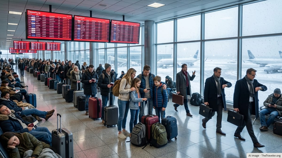
Publicly available flight-tracking data and media coverage on 27 June indicate that Heathrow and Gatwick, the United Kingdom’s two busiest airports, have faced extensive disruption after intense storm cells moved across the capital and surrounding counties. Airlines reduced movements during the worst of the lightning and heavy rain, leading to long queues of aircraft on the ground and extended holding patterns in the air.
Reports from multiple outlets suggest that well over 600 flights were delayed across the two hubs over the course of the day, with some services pushed back by six hours or more. At Heathrow, delays and cancellations affected both long-haul and short-haul operations, while Gatwick saw particular pressure on popular holiday services to Mediterranean destinations.
By Saturday afternoon, travel-news reports described passengers waiting for hours in terminal departure areas and on board aircraft that had already pushed back from the gate but were unable to depart. Social media posts from travellers described disrupted connections and missed events as the thunderstorm band lingered over southeast England and nearby European airspace.
Operational data referenced in local coverage show that the disruptions came at a time when Heathrow and Gatwick are already operating close to capacity, leaving limited room to recover when weather reduces the rate at which aircraft can safely land and take off.
Thunderstorms compound heatwave and wider weather risks
The storms followed a prolonged spell of unusually hot weather across parts of England, creating unstable atmospheric conditions over the region. Meteorological briefings cited in UK media describe a transition from record or near-record June temperatures to a cooler, turbulent air mass, triggering intense thunderstorms, frequent lightning and bursts of torrential rain.
The Met Office had issued thunderstorm warnings for portions of southeast England, signalling the potential for sudden downpours and hazardous conditions for aviation. As the storm cells developed overnight and into Saturday morning, air traffic managers introduced spacing measures to keep aircraft away from the most active weather, cutting the number of movements possible per hour.
Industry analyses published in recent years highlight that summer thunderstorms are an increasing operational risk for major European hubs, particularly those like Heathrow and Gatwick that run close to full capacity in peak travel periods. When storm-related restrictions coincide with high passenger volumes, relatively short weather events can translate into day-long backlogs and aircraft out of position across the wider network.
Background documents from both airports on climate and resilience planning note that more frequent episodes of extreme heat and convective storms are among the weather patterns they monitor closely. The current disruption, arriving in the middle of a busy summer season, offers another illustration of how quickly conditions can change from heat-related concerns to storm-driven delays.
Airlines trim schedules as knock-on delays spread beyond London
According to publicly available information from airlines and flight trackers, carriers including British Airways and easyJet have adjusted schedules throughout the day in response to air traffic control restrictions. Some services were cancelled in advance to ease congestion, while others operated with significant delays as aircraft and crews became out of position.
Travel reports indicate that passengers affected by cancellations have been offered options such as rebooking on later services or requesting refunds, in line with standard airline disruption policies. For those facing long waits, airlines have arranged hotel accommodation and meal vouchers in certain cases, particularly when overnight stays became unavoidable.
The thunderstorm band has not only affected departures from London but also arrivals from across Europe. Aircraft bound for Heathrow and Gatwick have in some cases diverted to other airports or held in extended patterns while controllers managed safe separation from active storm cells. This has created secondary delays for travellers returning to London, as inbound aircraft arrive late for their next rotation.
Across the wider European network, air traffic management updates describe congestion in airspace linking southeast England with northern France, the Low Countries and parts of Germany. Some services connecting beyond London, including transatlantic flights using Heathrow as a transfer point, have also reported departure or arrival delays as knock-on effects propagate through the system.
Rail access and onward journeys also under strain
The disruption has not been limited to the skies. Separate travel alerts show that rail access to Heathrow has experienced problems, adding another layer of complexity for passengers attempting to reach or leave the airport. A points failure affecting services at Heathrow Terminal 5 on Saturday prompted delays and cancellations on both the Heathrow Express and sections of the Elizabeth line that serve the airport.
With parts of the London Underground network subject to planned engineering works on the same day, some travellers have had to rely on alternative routes, road transport or coach services to make it to the airport or return home. This has contributed to heavier-than-usual demand on road links around Heathrow and Gatwick.
Travel advisories from rail operators and local media have urged passengers to check the latest service information before setting out, particularly those with tight connections to flights that are themselves running behind schedule. For some, the combination of rail disruption and airport delays has resulted in missed departures even when flights eventually left the runway.
For travellers already in the terminals, onward journeys beyond London have also become more complicated. Missed train connections to other regions, along with sold-out replacement services, have left some passengers needing to make last-minute accommodation arrangements or replan itineraries at short notice.
What passengers can expect over the coming hours
European air traffic management updates cited in specialist aviation coverage suggest that weather-related restrictions around southeast England may continue intermittently as further storm cells develop and move across the region. While the most intense thunderstorms are expected to be relatively localized, any renewed activity over key approach paths can quickly slow arrivals and departures.
For travellers booked to fly into or out of Heathrow, Gatwick or nearby airports over the remainder of the weekend, publicly available guidance from airlines and airports stresses the importance of checking flight status repeatedly rather than relying on earlier schedules. Even flights that appear on time may experience changes as aircraft and crews cycle through delayed rotations.
Industry observers note that once the worst of the weather passes, it can still take many hours for operations to return to normal, particularly at slot-constrained hubs where there is limited spare capacity to run additional recovery flights. Late-running aircraft into the night period can also be restricted by local noise rules, potentially pushing some services into the following day.
For now, the combination of volatile summer weather, high passenger demand and tight operational margins has left London’s main gateways grappling with one of the most challenging travel days of the season so far, with ripple effects likely to be felt across European routes well beyond the storm clouds over Heathrow and Gatwick.