
More news on this day
A rapidly intensifying storm system has prompted a tornado watch across large sections of New York, Vermont and Massachusetts today, leading to mounting flight delays and weather-related disruptions at several key airports in the Northeast.
Get the latest news straight to your inbox!
Severe Weather Triggers Tornado Watch Across Three States
Publicly available information from the National Weather Service indicates that a tornado watch is in effect this afternoon for portions of central and eastern New York, most of Vermont and much of Massachusetts, including the Capital Region, the Champlain Valley and parts of western New England. The alert window extends into the mid-afternoon hours, coinciding with one of the busiest periods for regional and national air traffic.
Forecast discussions and television meteorologist briefings describe an unusually strong low level jet intersecting with warm, humid air over the Northeast, creating conditions favorable for rotating thunderstorms capable of producing tornadoes, damaging straight line winds and intense rainfall. Hour by hour outlooks for upstate New York and Vermont highlight the potential for storms to organize into fast moving lines, with wind gusts that could easily exceed thresholds that trigger ground stops at major airports.
Across northern New England and upstate New York, local broadcast outlets and community alert systems have been pushing warnings throughout the morning, advising residents to monitor rapidly changing conditions. Social media posts from Vermont, Albany and Syracuse residents describe phones and televisions sounding repeated tornado watch alerts as the main line of storms advances eastward.
While tornadoes remain relatively uncommon in the far Northeast, previous severe weather events show that even brief, weak tornadoes and downbursts can topple trees, bring down power lines and affect airport operations by cutting power or blocking access roads. The combination of heavy rain, strong crosswinds and lightning is already enough to slow air traffic, even if no confirmed tornadoes occur.
New York Airports Face Growing Backups
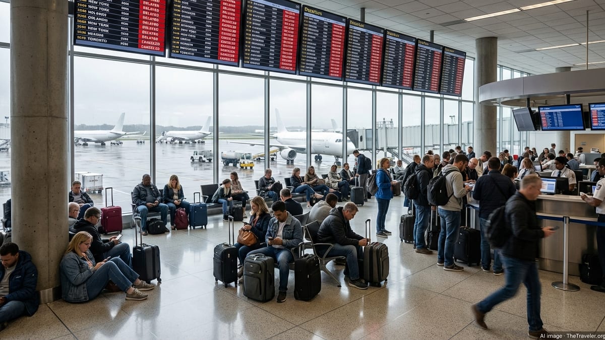
The storm track places several New York airports in or near the tornado watch area at various points today, including Albany International and a number of regional fields that feed traffic into New York City’s major hubs. Aviation tracking dashboards are beginning to show longer taxi times and airborne holding patterns as thunderstorms ripple across central New York and the Hudson Valley.
At the same time, airlines serving John F. Kennedy, LaGuardia and Newark are closely watching thunderstorm development just to the north and west of the metropolitan area. Even when the core of a tornado watch remains upstate, strong storms along key arrival and departure routes can force air traffic controllers to reroute jets, reduce arrival rates and temporarily pause takeoffs in certain directions.
Historical performance data compiled by aviation analytics platforms suggest that New York City airports are among the most sensitive in the United States to convective weather, due to crowded airspace and limited runway configurations. When thunderstorms or severe weather watches impact the broader region, delays can quickly propagate as aircraft and crews fall out of position, sometimes lingering long after the last storm cell has passed over a specific airport.
Travelers using New York airports today are already reporting longer lines and gate changes as carriers consolidate flights and try to keep their schedules flexible. With the tornado watch still active into the afternoon, additional rolling ground delays are possible if storms intensify closer to the coastal terminals.
Vermont and Massachusetts See Regional Flight Disruptions
Further north, the tornado watch covers much of Vermont, including the Burlington area, where regional carriers connect the state to hubs in New York, Boston and beyond. Local media coverage from Burlington and other Vermont communities notes that thunderstorms with wind gusts strong enough to bring down tree limbs could sweep across the Champlain Valley and central Vermont during the peak travel window.
Smaller regional airports, such as those in Burlington and Rutland, typically operate with fewer runways and more limited ramp space than major hubs. In severe weather, this can amplify the impact of a relatively short suspension of operations, as aircraft await safe conditions for landing and departure. Even modest delays in Vermont can cascade to connecting flights in New York and the Midwest, particularly on routes operated only a few times per day.
In Massachusetts, reports from residents and local discussion forums indicate that most of the state is under or near the tornado watch area, with particular attention on western and central counties that are more directly in the path of the strongest thunderstorms. While Boston’s primary airport sits east of the main risk corridor, it depends heavily on overland arrival routes from New York and the interior Northeast, where storms are expected to be more intense.
As convection builds over the Berkshires and Connecticut River Valley, flights linking smaller Massachusetts airports to national hubs may experience delays, diversions or cancellations. That, in turn, can affect passenger flows into Boston and New York, especially for travelers who rely on short regional hops rather than driving to larger airports.
National Flight Network Braces for Knock-on Delays
The tornado watch over New York, Vermont and Massachusetts comes as the broader eastern United States is already grappling with rounds of severe weather from the Midwest into the Mid Atlantic. Public forecasts highlight a multi state corridor of strong storms, raising the risk that delays in the Northeast will coincide with disruptions at other key hubs in Chicago, Detroit and the Ohio Valley.
Aviation industry analyses frequently note that New York area airports and the busy Northeast corridor act as a critical choke point for the national air system. When severe weather slows traffic into and out of these airports, it can quickly trigger ripples across the country, particularly on transcontinental routes and tightly timed business schedules.
Travel data from previous severe weather episodes show that missed connections and crew time limit issues are common secondary effects once initial thunderstorms cause holding patterns and ground stops. Aircraft may be forced to divert to alternate airports to refuel or wait for conditions to improve, while flight crews can approach or exceed duty limits, requiring last minute substitutions that are not always available.
Given the timing of today’s tornado watch, late afternoon and evening flights are considered particularly vulnerable to cascading delays, as earlier disruptions compress the schedule and reduce the buffer time that airlines usually depend on to recover from weather related slowdowns.
What Travelers Can Expect and How to Prepare
For passengers flying into, out of or through New York, Vermont and Massachusetts today, publicly available guidance from airlines and aviation agencies emphasizes flexibility and real time monitoring. Many carriers are offering limited fee waivers or flexible rebooking options on affected routes when severe weather watches are in place, although specific policies vary by airline and ticket type.
Travelers are being encouraged by airlines and airport operators to check their flight status frequently through official apps and departure boards, rather than relying on early morning schedules that may no longer be accurate. Extra time at the airport is advisable, particularly for those connecting through New York area hubs or linking from smaller regional airports in Vermont and western Massachusetts, where local storms can temporarily close ramps and runways.
Passengers who must travel today are also advised by publicly available preparedness materials to pack essential medications, chargers and a change of clothes in carry on luggage, in case of unexpected overnights caused by missed connections or diversions. For those whose trips are flexible, postponing nonessential travel until the tornado watch period has ended and the line of storms has cleared the region may reduce the risk of extended delays.
As the tornado watch window progresses, forecasters will continue to refine the expected track and intensity of thunderstorms over New York, Vermont and Massachusetts. Additional short term alerts for severe thunderstorms or tornado warnings may be issued for specific counties, and aviation impacts are likely to evolve hour by hour as the volatile weather system moves through the Northeast corridor.