


More news on this day
A freight train derailment on a line north of Eureka has led to an extended road closure in a rural area, disrupting local travel while rail and highway crews work to clear damaged cars, repair track and inspect nearby infrastructure.
Get the latest news straight to your inbox!
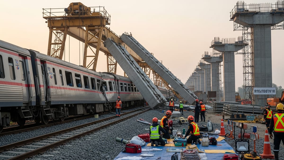
Derailment disrupts traffic on key approach route
Early reports indicate that the derailment occurred on a freight corridor serving the Eureka area, with several cars leaving the tracks near a highway connection that functions as a primary approach route into the region. Publicly available information shows that the incident happened close enough to an intersecting road that debris and response vehicles made normal traffic flow unsafe.
As a result, the affected road has been fully closed to through traffic while crews stabilize derailed railcars, inspect the rail bed and verify that nearby bridges, culverts and roadside slopes remain secure. Local drivers are being directed onto alternate rural routes, adding travel time for commuters, commercial trucks and visitors bound for the North Coast.
Traffic cameras and mapping data reviewed after the derailment show congestion building on secondary roads as drivers divert around the closure. For travelers unfamiliar with the area, the sudden lack of access on a familiar signed route into Eureka creates additional complexity, particularly during peak tourism periods when visitor numbers are higher.
Published coverage notes that the closure has immediate implications for regional logistics, as freight movements into and out of the greater Eureka area rely heavily on a limited number of rail and road links that weave through steep terrain, rivers and coastal wetlands.
Rail clearance and track repair expected to take days
Based on comparable derailments documented in federal safety databases and recent incidents in other North American regions, the process now underway north of Eureka typically unfolds in several stages. Initial work focuses on securing the scene, ensuring no additional rolling stock can shift, and confirming that nearby utilities, drainage structures and slopes are stable.
Once the area is deemed safe for extended work, heavy equipment is brought in to rerail or dismantle damaged cars, remove spilled cargo and clear any rail segments that have buckled or been displaced. Track sections that have been bent, undercut by soil movement or otherwise compromised are removed so that new ties, ballast and rail can be installed.
Public project timelines for similar derailments suggest that even when there are no injuries and limited structural damage, full restoration of service can take several days, especially where access is constrained by narrow river valleys or marshland. In remote portions of the Eureka rail network, crews may need to stage machinery and materials using the very highway that is now closed, prolonging the disruption for motorists.
Observers following the response through regional transportation updates note that rail operators and contractors often work continuously in shifts to shorten the closure period, but must balance that urgency with safety requirements and inspections mandated by state and federal regulations.
Environmental checks along Humboldt Bay corridor
The rail corridor north of Eureka runs through a landscape that includes Humboldt Bay, tidal marshes, streams and forested slopes, an environment that has long required careful monitoring whenever heavy infrastructure work takes place. Although early information indicates that the derailed train was primarily carrying general freight, environmental checks are a routine part of the response whenever railcars leave the tracks.
Publicly available planning documents for the Humboldt Bay region emphasize the sensitivity of local wetlands and waterways, noting that even relatively small spills of fuel, lubricants or cargo can affect shorelines, bird habitat and aquatic species. In similar derailments elsewhere, response teams have placed absorbent booms, deployed vacuum trucks and taken soil and water samples as a precaution, even when no major release is immediately evident.
Reports from recent derailments across North America show that environmental reviews can extend beyond the initial reopening of a highway or rail line, with follow-up sampling continuing for weeks or months. In the Eureka area, any sustained closure of a road adjacent to the rails may signal ongoing monitoring work, slope stabilization or culvert repairs designed to prevent future washouts.
For travelers and residents, the visible signs of this work may include temporary staging areas along the closed road, stockpiles of rock and ballast, and intermittent periods when construction noise or lighting remains active into the evening as crews secure the site.
Impacts on tourism and local businesses
The road closure north of Eureka comes during a high-traffic period for California’s North Coast, when visitors are traveling to the redwood parks, coastal towns and outdoor recreation areas that anchor the local tourism economy. With one of the key approaches into the region partially cut off, travel itineraries that rely on tight driving schedules may need to be adjusted.
Travel information platforms that track incidents on U.S. highways show that even modest detours in this part of Northern California can add significant time, as alternate routes often involve slower rural roads with limited passing opportunities. Lodging providers, tour operators and small businesses along the usual corridor into Eureka may experience cancellations or late arrivals as visitors adapt their plans.
According to published coverage of similar closures, some communities have responded by updating wayfinding materials, emphasizing alternate scenic routes and encouraging travelers to plan additional stops along detour corridors. For visitors willing to be flexible, the disruption can create opportunities to explore lesser-known coastal viewpoints, historic towns and trailheads that lie just off the main highway.
However, businesses that depend on predictable delivery schedules may face short-term challenges as freight trucks take longer paths around the closure. Perishable goods, construction materials and fuel shipments bound for the Eureka area can all be affected when both rail and adjacent road capacity are constrained by the same incident.
What travelers should know before heading toward Eureka
Prospective travelers driving toward Eureka in the coming days are being advised, through public transport updates and mapping services, to check for the latest closure details and recommended detours before departure. Because rural intersections are spaced far apart, missing a posted detour sign can result in lengthy backtracking.
Travel planning tools commonly used for the North Coast suggest allowing extra time when driving near active rail repair sites, as flaggers, pilot cars and temporary speed limits may remain in place even after the main road has partially reopened. Drivers of large recreational vehicles or vehicles towing trailers may encounter tight turning radii on interim detours, particularly on older county roads.
For rail passengers, publicly available information indicates that passenger services that share or cross the affected freight line can experience delays or schedule adjustments until track inspections are complete. Even if passenger trains are not directly involved in the derailment, dispatchers often impose speed restrictions through the area.
Travelers are also encouraged to factor in the possibility of changing coastal weather. Fog, rain and shifting light conditions along the Humboldt Bay corridor can reduce visibility around work zones, making it especially important to watch for temporary signage and sudden slowdowns near the closure area.