


More news on this day
Rain moving across Kern County on Wednesday has placed Bakersfield under a National Weather Service flood watch, with transportation agencies urging drivers to prepare for slick roads, localized flooding and slower trips through the southern San Joaquin Valley.
Get the latest news straight to your inbox!
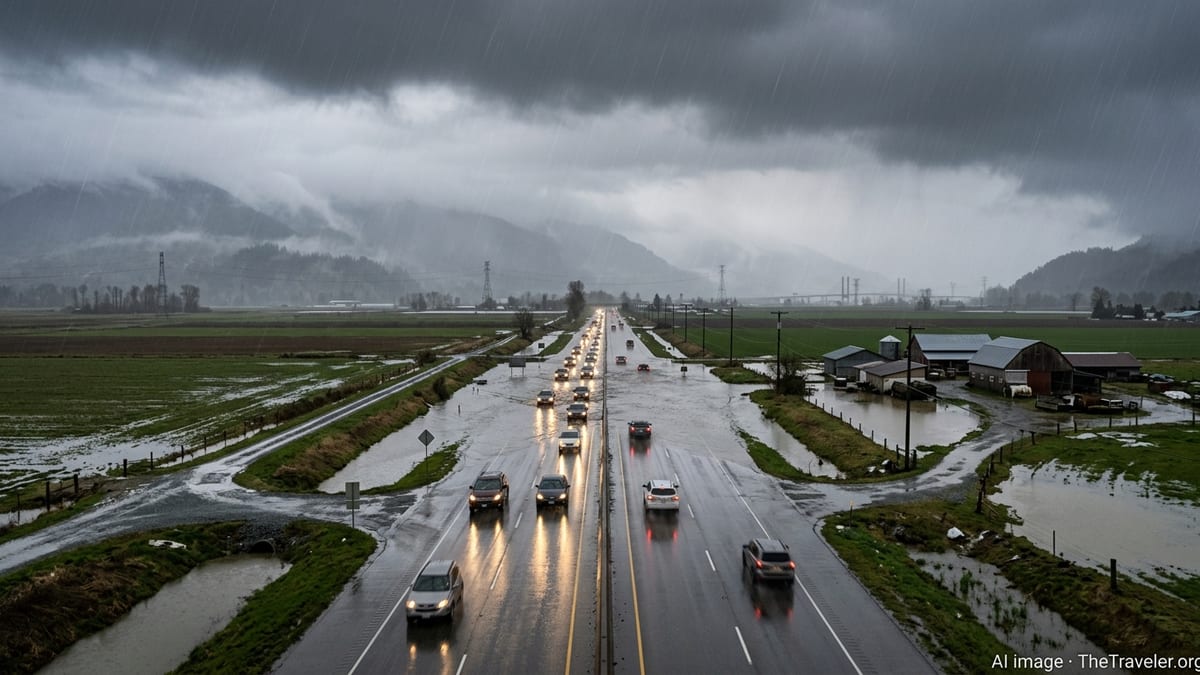
Flood watch covers Bakersfield through Thursday evening
Publicly available forecasts from the National Weather Service indicate that a flood watch is in effect for Bakersfield and much of Kern County from Wednesday morning, October 21, through Thursday evening, October 22. The alert covers the Bakersfield urban area, nearby communities around Buena Vista Lake and portions of the south end of the San Joaquin Valley, reflecting concern about periods of heavy rain over already saturated ground.
The Hanford weather office projects highs near 70 degrees in Bakersfield on Wednesday, with a series of rain showers and a slight chance of thunderstorms bringing a 70 to 80 percent probability of precipitation through the night. Rainfall totals are expected to reach between a few tenths of an inch and localized higher amounts where thunderstorms develop, increasing the risk of ponding on roadways and rapid rises in small streams and low-lying urban spots.
Regional dashboards that compile National Weather Service alerts show Kern County grouped with neighboring zones under a broader flood watch, classified as a severe-level alert and currently expected to remain active into late Thursday. Map products from the San Joaquin Valley forecast office highlight Kern County and the southern coastal ranges as areas with a moderate risk of localized flooding while the current Pacific storm system remains nearly stationary just offshore.
River forecast data available from federal hydrology centers do not show major river flooding in the Bakersfield area as of Wednesday morning, but forecasters continue to monitor smaller drainage channels and arroyos that can respond quickly to intense downpours. The flood watch emphasizes that flash flooding could develop with heavier bursts of rain, particularly near burn scars, steep terrain and areas with poor drainage.
California Highway Patrol highlights wet-weather travel risks
The California Highway Patrol typically issues broad wet-weather travel reminders when storms move through the Central Valley, and Wednesday’s flood watch has renewed attention on those safety messages among drivers planning trips through Bakersfield. Public-facing CHP guidance for similar events stresses slower speeds, greater following distance and headlights-on driving whenever wipers are in continuous use, in line with state traffic regulations.
Statewide traffic summaries available on CHP incident dashboards around midday Wednesday showed no major long-term closures on Bakersfield freeways related to flooding. Even so, officers frequently caution that crash numbers tend to rise with the first significant rain after a dry spell, when oil residue on pavement mixes with water and reduces tire grip, especially at higher speeds or where standing water collects in ruts and along shoulders.
For motorists heading into or out of Bakersfield on regional corridors such as State Route 99 and State Route 58, CHP reminders emphasize watching for quickly changing conditions. Short-lived but intense showers, like those mentioned in National Weather Service outlooks for Kern County, can temporarily overwhelm storm drains, leading to unexpected pooling at on- and off-ramps, underpasses and low freeway sections. Hydroplaning risk increases sharply once water depth reaches only a small fraction of an inch at freeway speeds.
Travelers planning to tow trailers, drive recreational vehicles or haul high-profile loads through the valley and Tehachapi passes are also being urged by state agencies to stay alert for shifting wind and visibility as showers and isolated thunderstorms pass. Coordination between CHP, Caltrans and local public works departments typically focuses on quickly identifying any flooded lanes or debris flows that might require temporary lane reductions or detours.
Caltrans reports active alerts on key Kern County corridors
Caltrans road condition reports for Wednesday morning show that State Route 99 in the Central California area is under a high wind advisory farther north between county lines, with travel not recommended for campers, trailers or permit loads along that stretch. While that advisory lies outside Bakersfield’s immediate limits, it underscores the unsettled weather pattern affecting much of the valley and the importance of checking updated highway information before longer trips.
Within Kern County, Caltrans maintenance crews generally prepare for early-season storms by clearing drains, inspecting culverts and staging equipment for potential mud or rock flows above the city in the Kern River Canyon and Tehachapi grades. Publicly available information from the San Joaquin Valley weather office notes that rainfall is also impacting higher elevations in the southern Sierra Nevada, where winter weather advisories and early snow can add further complexity to regional travel, particularly for drivers using State Route 178 or crossing the Grapevine on Interstate 5.
State transportation bulletins direct motorists to the 24-hour highway conditions phone line and digital road-condition map for the latest information on closures, chain controls in higher terrain and any new advisories that might be posted if flooding worsens. As of the latest Wednesday updates, no widespread closures tied specifically to flooding in Bakersfield had been posted, but conditions remain subject to rapid change as additional bands of rain move inland.
Rain-related slowdowns can create secondary impacts well beyond the immediate storm zone, especially along freight corridors linking the southern Central Valley to the Los Angeles Basin and Bay Area. Logistical planners and commercial drivers often track Caltrans and weather updates closely during multiday events like the current coastal trough, adjusting schedules and routes to avoid the heaviest rain and any temporary restrictions on mountain passes.
Local impacts: urban flooding, air quality and transit disruptions
Local roundups from Bakersfield-focused news outlets on Wednesday morning highlighted the flood watch alongside a broader snapshot of conditions across the city. Air quality readings in the moderate range around daybreak, combined with cooler temperatures and incoming rain, suggest temporary relief from dust and particulate pollution that often builds under stagnant autumn high-pressure systems in the valley.
At the same time, the flood watch raises the possibility of localized street flooding in parts of Bakersfield where storm drains clog with debris or where past storms have produced deep puddles and impassable lanes. Transportation summaries from overnight show multiple traffic collisions in the region even before the main rain bands moved through, underscoring the sensitivity of local travel patterns to changing weather.
Publicly available information from Kern County transit and emergency summaries indicates that wet and slick pavement has already played a role in at least one bus incident in southeast Bakersfield this week, where a transit vehicle left the roadway and several passengers were reported injured. While investigators continue to review the circumstances of that crash, it has added urgency to renewed calls for slower driving and heightened attention near bus stops, school zones and pedestrian crossings in rainy conditions.
City and county agencies typically coordinate storm response by clearing known trouble spots, distributing sandbags at designated yards when heavier rainfall is forecast and monitoring underpasses, canals and river channels for rising water. Travelers moving through Bakersfield by car, intercity bus or rideshare may encounter short-notice detours or delays if localized flooding develops near freeway interchanges or major surface streets such as Rosedale Highway, Panama Lane or Edison Highway.
Guidance for travelers and next forecast milestones
Weather products issued early Wednesday outline several key time frames for travelers to watch in the Bakersfield area. The first comes from late Wednesday morning through the afternoon, when showers and a slight chance of thunderstorms coincide with daytime travel peaks and school dismissals. A second focus period extends into Wednesday night and Thursday morning, when additional rounds of rain may arrive over already wet ground, keeping the flood watch in place through at least 8 p.m. on October 22.
Forecast discussions from the National Weather Service stress that some thunderstorms may produce heavy rainfall, with torrential downpours possible within isolated cells. Under those conditions, forecasters caution that flash flooding can develop quickly, particularly in poor-drainage urban locations, dry washes and small creeks. Travelers are advised by public safety campaigns to avoid driving through water that obscures lane markings or the curb line, since depth and underlying damage can be difficult to judge from behind the wheel.
Hydrologic outlooks indicate that larger rivers in the broader San Joaquin basin remain below flood stage as of Wednesday’s morning issuance, but the combination of valley rain and mountain snowfall is being closely tracked by federal and state water managers. Any significant shift in storm intensity or track could prompt updated watches or, if flooding becomes more imminent, targeted warnings for specific communities.
For now, the mix of moderate temperatures, on-and-off rain and an active flood watch means that anyone traveling into, out of or through Bakersfield over the next day should plan for slower trips, check updated weather and highway reports before departure and remain prepared for rapidly changing conditions. Transportation agencies and weather services are expected to provide additional updates through Thursday as the coastal storm gradually weakens and shifts, setting the stage for drier and sunnier weather heading into the weekend.