


Southern Utah’s Bears Ears region is one of the most evocative landscapes in the American Southwest. Two names come up again and again when hikers start planning a trip here: Comb Ridge and Cedar Mesa. Both sit in the southern part of Bears Ears National Monument and both are rich with canyons, cultural sites and big-sky desert views. Yet they offer very different kinds of adventures. If you only have a few days, which should you choose?
Get the latest updates straight to your inbox!
Setting the Scene: Where Comb Ridge and Cedar Mesa Actually Are
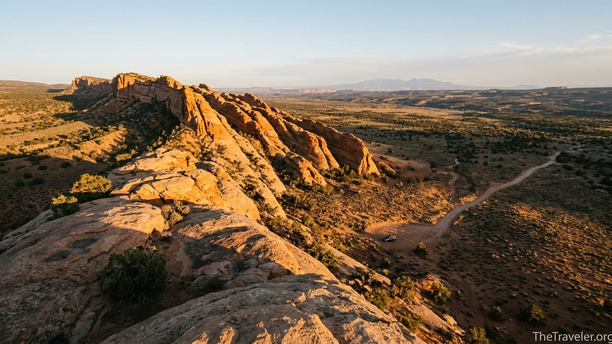
Comb Ridge and Cedar Mesa occupy neighboring corners of the southern Bears Ears region in San Juan County, Utah. Comb Ridge is a dramatic, 80-mile-long sandstone monocline that runs roughly north–south between Blanding and Mexican Hat, visible from highways 95 and 163 as a jagged fin lifting abruptly from the desert floor. Drivers crest its spine on Utah 95 at Comb Ridge Summit, then descend toward the San Juan River, with pullouts offering wide views of the ridge and the surrounding canyon country.
Cedar Mesa lies immediately west of Comb Ridge, a high, pinyon juniper–covered tableland deeply incised by canyons like Grand Gulch, Mule Canyon, Owl and Fish. From above, the mesa looks flat and unassuming, but once you drop into its canyons you enter a world of sculpted sandstone alcoves, cottonwood-shaded streams and an extraordinary density of Ancestral Puebloan sites. The mesa is easily reached by Highway 95 from Blanding or by the steep Moki Dugway, a graded dirt road that switchbacks up the cliffs from the Valley of the Gods.
Both landscapes are part of Bears Ears National Monument and are managed primarily by the Bureau of Land Management. That means you will not find entrance stations or national-park-style infrastructure. Instead, you will find signed trailheads, scattered information boards, the Kane Gulch Ranger Station on the east side of Cedar Mesa, and a system of permits and passes that applies to both Comb Ridge and Cedar Mesa canyons.
Permits, Passes and Practicalities: What It Takes to Visit
One of the most important differences between Comb Ridge and Cedar Mesa is how structured your planning needs to be. For day hiking in both areas, you are required to purchase a day hiking pass for the Cedar Mesa and Comb Ridge zones of Bears Ears National Monument. The Bureau of Land Management sells these passes online through recreation platforms and at on-site self-pay fee tubes at most trailheads, including along North and South Butler Wash and across Cedar Mesa. Current guidance from the BLM notes that passes are required for the canyons of Cedar Mesa and Comb Ridge, but that day hiking passes themselves are not numerically limited, which makes spontaneous day trips realistic as long as you can pay on site.
Backpacking is a different story, and this is where Cedar Mesa stands apart. Overnight trips into canyons such as Grand Gulch, Bullet Canyon, Owl and Fish, Slickhorn, Road Canyon and Mule Canyon require advance permits, with daily person limits at each trailhead and a per-person fee for each trip. Recent BLM information lists overnight backpacking permits for these canyons at around fifteen dollars per person per trip, with quotas that can fill up for peak spring and fall dates. Some routes, such as the Grand Gulch through-hike or the popular Fish and Owl Canyon loop, are often reserved weeks or months ahead for prime weekends in April and October.
Comb Ridge, by contrast, is primarily a day-hiking and short-scramble destination. While you need a day hiking pass to explore its canyons and alcoves, there is currently no comparable, canyon-wide overnight backpacking permit system focused specifically on Comb Ridge itself. Most visitors base in nearby towns like Bluff or Blanding, or at developed campgrounds along Highway 95 or dispersed sites on surrounding BLM land, and then make day trips into side canyons off Butler Wash Road or Comb Wash Road.
In practice, this means that if you have not secured advance permits and are traveling in a busy season, Comb Ridge offers more low-friction options for hikers who are content with day adventures and roadside camping. If your dream is a multi-day backpack deep in quiet canyons, Cedar Mesa’s permit system is a gate you need to pass through, and you should expect to spend time planning around quotas, pickup locations and conditions posted by the Kane Gulch Ranger Station.
Landscape and Scenery: Sharp Ridge or Hidden Canyons?
Visually, Comb Ridge and Cedar Mesa feel like two different worlds, even though they are separated by only a few miles of desert. Comb Ridge is all about the line of the land. From the west, along Comb Wash Road, the monocline appears as a series of steep, stepped sandstone ribs rising sharply from cottonwood-lined washes. Short hikes lead to viewpoints where you stand on slickrock benches and look across the valley to the Abajo Mountains, with the ridge itself slicing toward the horizon. Photographers often time visits for late afternoon when the western flank glows bronze and the long spine of the ridge casts angular shadows across the desert floor.
Cedar Mesa, on the other hand, does not reveal its drama from the highway. The top of the mesa is gently rolling, cloaked in pinyon and juniper, with modest views across to Bears Ears Buttes and west toward Glen Canyon. The magic happens only when you drop into the canyons. In Grand Gulch, you might walk for hours along a sandy streambed beneath sheer sandstone walls streaked with desert varnish, passing seeps and hanging gardens. In Mule Canyon, you move from one alcove to another, each with different light and acoustics. The larger canyons are often several hundred feet deep, with shaded microclimates where box elders, willows and cottonwoods create a lush contrast with the sun-baked mesa above.
For travelers whose mental picture of Southern Utah is big open horizons and singular geologic forms, Comb Ridge often matches expectations. If you are drawn more to intimate canyon environments, filtered light and the sense of being enclosed in stone, Cedar Mesa is more likely to feel like the quintessential Bears Ears experience. Many repeat visitors recommend combining both in a single driving day: cresting Comb Ridge on Highway 95, stopping for a short ridge hike, then heading west to peer into the head of one of Cedar Mesa’s canyons before sunset.
Cultural Sites and Respectful Travel
Both Comb Ridge and Cedar Mesa hold an exceptional concentration of Ancestral Puebloan cultural sites, from cliff dwellings tucked into alcoves to rock art panels and ancient agricultural terraces. The BLM and tribal partners emphasize that these places are still deeply significant to descendant communities and must be visited with care. Before setting out, many travelers stop at the Kane Gulch Ranger Station on Highway 261 or the Bears Ears Education Center in Bluff to pick up maps, watch short orientation videos and talk with staff about appropriate behavior at sites.
Cedar Mesa is particularly renowned for its density of cultural resources. A single multi-day trip through Grand Gulch can pass dozens of sites, some signed and many not. Well-known locations include cliff dwellings high under overhangs, kivas, granaries and panels of rock art. The agency’s trip planners and on-the-ground signs encourage visitors to view structures from a distance, avoid entering rooms, refrain from touching walls or rock art, and leave any pottery sherds, corncobs or other artifacts exactly where they are. In recent years, rangers have reported damage from social media exposure of sensitive sites, which has led to tighter permit rules for certain canyons and day-hike destinations such as Moon House on McLoyd Canyon.
Comb Ridge also contains numerous cultural sites, though they are typically visited on shorter day hikes from Butler Wash or Comb Wash trailheads. Here, you may follow a sandy wash a mile or two to a side canyon, then scramble onto slickrock to reach an alcove with masonry structures or rock art. Because many Comb Ridge trailheads are easily accessible from paved highways, they see a broad mix of visitors, from serious hikers to families stopping for a short walk while road-tripping between Monument Valley and Moab. That accessibility makes it all the more important to model respectful behavior: keeping pets off fragile structures, staying on durable surfaces and packing out all trash.
If your top priority is spending days immersed in a canyon system with many cultural sites, Cedar Mesa’s backpacking routes offer more depth and variety. If you are more interested in sampling a few emblematic sites on moderate day hikes, particularly if you are based in Bluff or Blanding, Comb Ridge may be the more convenient choice.
Hiking Styles: Day Walks, Scrambles and Multi-day Routes
From a hiking perspective, the question of Comb Ridge versus Cedar Mesa is really a question of day hiking versus backpacking and how comfortable you are with route-finding. Comb Ridge is best known for its network of short to moderate day hikes that leave from the Butler Wash and Comb Wash sides of the ridge. Typical routes are one to five miles round-trip, with modest elevation gain but frequent slickrock scrambles and some route-finding in and out of side canyons. For instance, a traveler staying in Bluff might drive 15 to 30 minutes to a Butler Wash trailhead, follow cairns up slickrock slabs, and spend half a day exploring a single canyon with a few cultural sites and viewpoints along the ridge.
Cedar Mesa’s signature experiences are longer canyon hikes and backpacking trips. Grand Gulch is the classic example: many parties book a three- or four-day trip, entering at one trailhead such as Kane Gulch or Bullet Canyon and exiting at another, arranging a car shuttle along the mesa-top roads. Fish and Owl Canyons form a strenuous loop that strong hikers complete in two or three days, dropping steeply off the mesa into narrow canyons with pour-offs, pools and several challenging route-finding sections. Even day hikes like the popular excursions into Mule Canyon can involve six to eight miles of round-trip walking, with creek crossings and some scrambling.
Water availability is a key trip-planning factor on Cedar Mesa. Ranger updates and recent trip reports often describe which potholes and seeps are currently holding water. In a dry autumn, backpackers might carry extra water for the first day, then rely on known sources deep in Grand Gulch or slickrock catchments on north-facing walls. This level of planning is less critical on Comb Ridge, where many day hikers carry all of the water they need for a few hours of walking and return to their vehicle or campground by late afternoon.
In general, choose Comb Ridge if you prefer half-day outings with the flexibility to adjust plans on the fly and return to town amenities each night. Choose Cedar Mesa if you are ready to commit to longer canyon days, heavier packs and the logistics of multi-day desert travel.
Access, Roads and Where to Base Yourself
Access considerations often tip the balance between Comb Ridge and Cedar Mesa, especially for travelers in rental vehicles. Comb Ridge hugs well-traveled highways and graded dirt roads that, in dry conditions, are commonly driven by standard passenger cars with moderate clearance. Highway 95 crosses the ridge west of Blanding, and the Butler Wash Road parallels the eastern base of the monocline, with signed turnoffs for various trailheads. On the west side, the Comb Wash Road offers a scenic, mostly two-wheel-drive corridor beneath the cliffs when dry. After heavy rain or spring snowmelt, these clay-based roads can turn slick and impassable, so it is wise to check conditions with local ranger stations or visitor centers before committing.
Cedar Mesa’s access roads are more varied. The mesa top is reached from the east via Highway 95 or from the south via Utah 261, which includes the well-known Moki Dugway: three miles of graded gravel switchbacks that gain roughly 1,200 vertical feet from the Valley of the Gods to the mesa rim. Most rental cars regularly drive this road in good weather, but it is not recommended for large RVs or for drivers uncomfortable with unpaved, cliff-edge switchbacks. Once on top, trailheads for canyons like Kane Gulch, Bullet, Slickhorn and Owl and Fish are reached by a mix of paved highways and shorter dirt spurs that can become rutted or muddy. Some itineraries, such as complex Grand Gulch shuttles, are far easier with a high-clearance vehicle or by hiring a local shuttle service.
Where you choose to base yourself influences which area feels more natural to visit. Bluff, about 25 minutes from Comb Ridge trailheads, works well for people who want easy access to short hikes plus amenities like small hotels, cafés and a visitor center. Blanding, to the north, offers more grocery options and is closer to Highway 95 crossings of both Comb Ridge and Cedar Mesa. Travelers who prioritize Cedar Mesa backpacking often camp at trailhead-adjacent sites on the mesa top, stay at simple motels in Blanding, or split time between Cedar Mesa and neighboring destinations like Natural Bridges National Monument and Valley of the Gods.
Seasons, Weather and Crowd Patterns
Both Comb Ridge and Cedar Mesa share the classic high-desert seasonal pattern: hot, dry summers, cold winter nights and shoulder seasons that many hikers consider ideal. In practice, though, the way weather shapes your experience can differ between the two. Comb Ridge’s day hikes are often fully exposed, especially on the slickrock approaches to the ridge crest. In June and July, mid-day temperatures can climb well above 90 degrees Fahrenheit, turning even short hikes into strenuous undertakings. Many visitors in summer either hike very early in the morning, retreating to shaded accommodations by mid-day, or skip longer ridge hikes entirely.
Cedar Mesa’s canyons, by contrast, can feel significantly cooler on hot days thanks to shade, narrow walls and flowing or pooled water. Spring and fall backpacking trips here are coveted for their comfortable daytime temperatures and relatively mild nights, though cold snaps and heat waves are both possible. In winter, the mesa top can hold snow and ice, making access roads and trailhead parking slick, while canyon bottoms may remain largely snow-free but cold, with icy crossings and limited daylight.
In terms of crowds, both areas remain much quieter than Utah’s marquee national parks but have seen sharply increased visitation since Bears Ears became a national monument. Day-use sites along Comb Ridge that are close to highways can feel relatively busy on holiday weekends, especially where social media has popularized specific rock art panels or cliff dwellings. Cedar Mesa’s main access points, such as Kane Gulch Ranger Station and Mule Canyon trailheads, also see busy mornings during peak seasons, yet even on popular weekends many backpackers report long stretches of solitude once deep in the canyons.
If you are looking for the most solitude with the least planning, a shoulder-season visit that avoids spring break and fall holiday weekends, combined with choosing less-publicized canyon trailheads, can be effective in both areas. Travelers highly sensitive to heat often lean toward Cedar Mesa’s canyon environments in spring and fall, using Comb Ridge primarily for short sunrise or sunset walks.
Which One Is Right for You? Trip Scenarios
Because Comb Ridge and Cedar Mesa sit so close together, many itineraries can include both. Yet if you must choose, thinking through some real-world trip scenarios can help clarify your decision. Imagine a long weekend in late April, driving from Salt Lake City with a standard rental car and two friends who are comfortable on six- to eight-mile day hikes but not interested in carrying overnight packs. In that case, Comb Ridge paired with short Cedar Mesa day hikes might be ideal. You could base in Blanding or Bluff, spend one day exploring Butler Wash side canyons on Comb Ridge, another day visiting Mule Canyon or a short section of Grand Gulch as a permitted day hike, and perhaps a third day driving the loop that includes the Moki Dugway and Natural Bridges National Monument.
Now imagine a different traveler: an experienced backpacker flying into Albuquerque, renting a high-clearance vehicle and meeting a partner for a four-day backpack in late October. Their priority is immersion, quiet and cultural landscapes. For this team, Cedar Mesa is the clear choice. They might secure a Grand Gulch permit months ahead, pick up their paperwork at Kane Gulch Ranger Station, then spend three nights in the canyon, carefully following Leave No Trace practices around archaeological sites and water sources.
Families with school-age children often find Comb Ridge more forgiving. With a base in Bluff, they can choose short hikes each day depending on energy levels and weather, keep heavy overnight gear to a minimum, and still experience cliff dwellings, rock art and expansive views. Cedar Mesa, while rewarding for adventurous families, generally requires more commitment, longer days, and careful attention to safety issues like flash flooding, loose rock and reliable navigation in complex canyon systems.
Ultimately, both landscapes offer genuine wilderness character and a sense of connection to deep time. The better choice for your next Southern Utah adventure hinges on your appetite for logistics, your comfort with backpacking, and whether your imagination is more fired by standing on a high sandstone spine watching shadow lines crawl across the desert, or by walking in cool canyon shade beneath overhanging walls that have sheltered human communities for thousands of years.
FAQ
Q1. Do I need a permit to hike in Comb Ridge or Cedar Mesa?
Day hiking in both the Cedar Mesa and Comb Ridge parts of Bears Ears requires a day hiking pass, which you can purchase in advance online or at trailhead fee tubes. Overnight backpacking in major Cedar Mesa canyons such as Grand Gulch, Owl and Fish, and Bullet Canyon requires a separate advance permit with limited daily quotas.
Q2. Can I visit either area with a regular rental car?
Yes in dry conditions, but with caveats. Highway 95 and the main access roads to Butler Wash and the top of Cedar Mesa are usually passable for standard rental cars. However, clay-based dirt roads like Comb Wash or some Cedar Mesa spur roads can become muddy and hazardous after storms, and the gravel Moki Dugway road, while widely driven, is not recommended for large RVs or for drivers uncomfortable with steep drop-offs.
Q3. Which area is better for first-time visitors to Bears Ears?
For first-timers who want flexibility and easier logistics, Comb Ridge often works better. You can base in Bluff or Blanding, choose from multiple short to moderate day hikes, and still see distinctive geology and cultural sites without securing backpacking permits or arranging complex shuttles.
Q4. When is the best time of year to hike Comb Ridge and Cedar Mesa?
Spring and fall are generally considered the best seasons. From roughly March to May and late September into early November, daytime temperatures are more comfortable, water sources in Cedar Mesa canyons are more reliable than in midsummer, and road conditions are typically better than in winter, though storms can occur in any season.
Q5. Are there campgrounds near Comb Ridge and Cedar Mesa?
Yes. There are simple BLM campgrounds and dispersed camping areas along roads like Comb Wash and on top of Cedar Mesa, as well as campgrounds at nearby destinations like Natural Bridges National Monument. Many travelers also stay in small motels or cabins in Bluff and Blanding, then make day trips into both areas.
Q6. How strenuous are the hikes in each area?
Comb Ridge hikes are usually moderate, with distances of one to five miles and some slickrock scrambling but no need to carry overnight packs. Cedar Mesa hikes range from moderate day trips of six to eight miles to multi-day backpacks that involve steep descents into canyons, route-finding, creek crossings and carrying several days’ worth of food and water.
Q7. Is one area better than the other for photography?
They offer different strengths. Comb Ridge excels at sunrise and sunset ridge-top views, long shadows and minimalist desert compositions. Cedar Mesa shines in canyon light, with reflected glow on overhanging walls, pools and ripples in sand, and the interplay of cultural sites and natural forms. Serious photographers often plan time in both.
Q8. How should I prepare for visiting cultural sites respectfully?
Plan to view all structures and rock art from a distance, without entering rooms or touching walls. Stay on durable surfaces, leave all artifacts where you find them, keep pets away from sites and avoid sharing exact locations of sensitive places online. Stopping at the Kane Gulch Ranger Station or Bears Ears Education Center for orientation before you hike is an excellent way to learn current guidance.
Q9. What if I cannot get a Cedar Mesa backpacking permit?
If overnight permits are booked for your dates, you can often still enjoy Cedar Mesa on day hikes using a day hiking pass, or shift focus to Comb Ridge, where day hiking is the norm. Some travelers adjust their timing to shoulder-season weekdays, when more Cedar Mesa permits may be available, or choose less popular canyon trailheads that have lighter demand.
Q10. If I only have one full day, should I choose Comb Ridge or Cedar Mesa?
With only a single day, most travelers find Comb Ridge more straightforward. You can drive from Bluff or Blanding, visit one or two trailheads off Butler Wash or Comb Wash, and still have time for scenic stops along Highway 95. Cedar Mesa day hikes tend to be longer and logistically more involved, so they are often more satisfying when you can devote at least a full long day or, ideally, several days.