


More news on this day
A widespread yellow fog warning is in force across parts of South West England this morning, with dense patches expected to reduce visibility on key road and rail corridors through late morning and affect some early flights.
Get the latest news straight to your inbox!
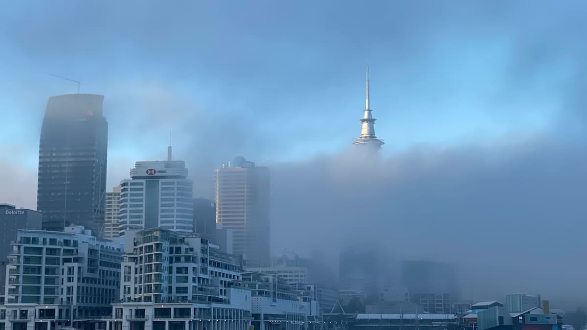
Yellow warning in force across key South West counties
Publicly available information from the Met Office shows a yellow warning for fog covering much of South West England from 18:00 on Sunday 8 November until 11:00 on Monday 9 November 2026. The warning, issued on Sunday morning, highlights the risk of slow and hazardous journeys where fog becomes dense, particularly around dawn.
Regional feeds that track Met Office alerts list Bath and North East Somerset, Bournemouth, Christchurch and Poole, Bristol, Dorset, Gloucestershire, North Somerset, Somerset, South Gloucestershire, Swindon and Wiltshire among the local authority areas included in the South West warning area. Travellers moving between these counties, especially along low-lying river valleys and higher inland routes, are being urged in published guidance to prepare for rapidly changing visibility.
According to summaries of the warning, the advisory is classed as yellow for fog, with a medium likelihood and low overall impact at regional scale. That still allows for very poor local conditions, with pockets of dense fog likely to form and re-form through the morning commute before gradually lifting into low cloud by late morning or midday.
Travel disruption likely on roads, rails and at airports
Met Office based summaries collated by several UK travel and safety services state that slower journey times are expected, with possible delays to bus and train services where fog lingers along key transport corridors. Routes linking Bristol with Bath, Swindon, Gloucester, Exeter and coastal Dorset are all within the broader warning area.
The same summaries indicate that there is a chance of delays or cancellations to flights during the warning period. Regional airports serving the South West, including Bristol and Bournemouth, are susceptible to low-visibility procedures when fog settles over runways and approach paths. Passengers with early morning departures or arrivals are being advised in public travel notices to monitor live flight information and allow extra time at the airport.
For drivers, the most immediate impact is on visibility. Dense fog patches can reduce sightlines to a few hundred metres or less on stretches of the M4 near Swindon, the M5 through Gloucestershire and Somerset, and smaller A-roads connecting market towns across Wiltshire, Dorset and the Mendip hills. Travel services that relay Met Office warnings recommend keeping speeds down, avoiding sudden braking and using fog lights where visibility falls below the statutory threshold.
Why conditions have turned so foggy
Regional forecasts for South West England issued overnight describe a set-up of light winds, clear breaks in cloud and damp ground following recent rain, creating ideal conditions for radiation fog to form. Under this pattern, heat escapes from the surface overnight, the air close to the ground cools rapidly and moisture condenses into a low, thick blanket of fog that can become stubborn where winds remain light.
Forecast discussion summaries note that the densest fog is most likely in inland valleys and around sheltered river basins, while some coastal areas may see more of a low cloud deck rather than thick, ground-hugging fog. As frontal systems approach from the Atlantic later today, the combination of increasing breeze and incoming cloud should help lift and disperse the fog, although low grey skies and patchy drizzle may replace the worst of the murk.
Outlook guidance for the coming days indicates a generally unsettled pattern for the South West through midweek, with a mix of rain bands and clearer intervals. That changeable regime means any further widespread fog episodes are more likely to be brief, forming in shorter overnight clear slots rather than persisting as they have this morning.
Practical advice for travellers and holidaymakers
For travellers currently visiting the South West, practical steps can help reduce the impact of the fog. Road safety campaigns that reference Met Office warnings highlight the importance of checking vehicle lights before setting off, clearing all windows completely of condensation and frost, and maintaining greater distances from the vehicle in front. Navigation apps and satnav systems can assist with lane discipline at complex junctions where road markings may be hard to see in very low visibility.
Rail passengers heading to or from leisure destinations such as Bath, Bristol, the Dorset coast or the Cotswolds fringe may encounter minor delays where reduced visibility affects line speeds or signalling checks. Operators typically post live updates early in the day, so checking for service alterations before leaving accommodation can help avoid missed connections.
Visitors planning scenic drives across the Somerset Levels, the Wiltshire Downs or towards the Jurassic Coast may wish to postpone early departures until late morning, when the yellow warning period is due to expire and most forecasts anticipate gradually improving visibility. For those on tight schedules, choosing main roads over smaller rural lanes can offer better markings, more lighting and additional signage in foggy conditions.
Watching how the warning evolves through the day
Services that relay National Severe Weather Warning Service information emphasise that warning details can be updated as conditions evolve. Valid times, affected areas and impact assessments may change if fog clears more quickly than expected or if denser patches form over a wider area than first indicated.
Because of this, travellers are encouraged in public guidance to keep checking the latest regional forecasts, rather than relying on a single early-morning update. In particular, anyone with long-distance journeys that cross several English regions affected by the same fog warning, such as routes from the South West towards London, the Midlands or northern England, should monitor how the alert is being applied along the full length of their trip.
For now, the focus for the South West on Monday morning remains firmly on reduced visibility and slower travel, rather than on high winds or heavy rain. As the day progresses and Atlantic systems move in, attention is expected to shift back to more typical late-autumn hazards such as wet roads and gusty conditions, ending this brief but impactful spell of dense fog for one of the United Kingdom’s most visited regions.