


Svartifoss is one of South Iceland’s most distinctive waterfalls, framed by dark basalt columns in the Skaftafell area of Vatnajökull National Park. If you are planning a Ring Road road trip, it is important to understand that you do not drive directly to the waterfall itself. Access is via the Skaftafell turn off from Iceland’s main Ring Road, Route 1, then on foot from the visitor area. The information below focuses on how to reach Skaftafell, where to park and what facilities to expect when setting out on the popular hike to Svartifoss.
Get the latest updates straight to your inbox!
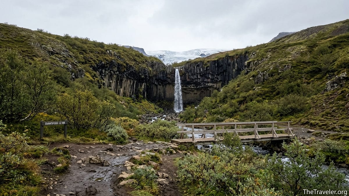
Understanding Where Svartifoss Is Located
Svartifoss sits in the southern sector of Vatnajökull National Park, within the Skaftafell area. Rather than being a roadside stop, it is reached by a signposted hiking trail that begins near the Skaftafell visitor centre. This makes Skaftafell your true navigation target, whether you are driving yourself around the Ring Road or joining an organised tour.
The national park lies directly off Iceland’s main Ring Road, also called Route 1, which circles the country. As you drive the South Coast between Vík and Höfn, Skaftafell appears as a clearly marked junction on Route 1 that leads to the visitor area and campground. There are no interior mountain tracks involved in reaching the trailhead, which is one reason Svartifoss is such a popular stop on South Coast itineraries.
Within Skaftafell, the waterfall is set in a small valley above the main service area. You cannot see Svartifoss from the parking lot, so allow time for the walk and make use of the visitor centre information boards and maps to visualise the trail before setting out.
Driving to Skaftafell on the Ring Road
The most common way to reach Skaftafell and Svartifoss is by rental car along Route 1. From Reykjavík to Skaftafell the distance is roughly 325 to 335 kilometres. In typical summer conditions this is often a four and a half to five hour drive without long stops, although you should expect the journey to take longer in winter when snow, ice or strong winds can slow traffic and require extra caution.
Many travellers break the drive with overnight stays or sightseeing pauses along the South Coast. As a rough guide, the drive from Vík to Skaftafell is around 140 kilometres and often takes close to two hours in clear conditions, while from Kirkjubæjarklaustur to Skaftafell is roughly one hour. These times are approximate and can lengthen significantly in poor weather, so they should be treated as broad planning windows rather than fixed schedules.
Route 1 on this stretch is a standard paved highway used by cars, campervans and buses. There are no tolls and, importantly, no F roads or mandatory 4x4 sections between Reykjavík and Skaftafell. Although a high clearance vehicle can feel more stable in winter, a regular two wheel drive car is usually sufficient in settled conditions provided the driver is comfortable with Iceland’s changing weather and follows local advice.
Access Road to Skaftafell: No F Roads or 4x4 Required
Once you reach the Skaftafell junction on Route 1, a short paved spur road leads directly to the visitor area. This access road is sometimes identified as road 998 or a similar local number on maps and rental GPS units. Unlike the interior highland tracks that Iceland designates as F roads, this spur is a conventional road maintained for regular traffic, including buses and motorhomes.
Because the spur is paved and relatively short, there is no requirement for a 4x4 vehicle to reach either the visitor centre or the main car parks in normal conditions. The road climbs gently toward the glacier views but remains suitable for standard rental cars. In heavy snow or high winds, the usual national advice applies: check real time road information before you set out and be prepared to adjust your plans if conditions deteriorate.
Signage from Route 1 to Skaftafell is straightforward, typically indicating both Skaftafell and Vatnajökull National Park. Once you turn off, you simply follow the spur to the end of the road where the parking areas, visitor centre and campground are all clustered together.
Parking at Skaftafell for the Svartifoss Hike
Visitors planning to hike to Svartifoss generally park in the main Skaftafell car park near the visitor centre and the adjacent campground. From here it is only a short walk to the signed trail start. The car park is laid out to accommodate both day visitors and overnight guests, with separate bays or zones for cars, campervans and larger vehicles where space allows.
A regional parking fee is charged at Skaftafell as part of Vatnajökull National Park’s management of visitor facilities. Payment is typically collected via ticket machines in the parking area and digital methods such as online or app based payment. Prices, categories and durations can change, and there may be differences between short stay, day, and multi day options, as well as between smaller vehicles and larger campers.
Before publication, the writer should confirm the current Skaftafell parking tariffs, how payment is made in practice and any restrictions that apply. These include the length of stay covered by a standard ticket, rules for overnight parking, and whether the same ticket is valid at nearby sites within the park. The most reliable source will be the responsible managing body for Vatnajökull National Park and any official regional fee notices posted for Skaftafell.
Walking Distances from the Car Park to Svartifoss
The hike to Svartifoss begins close to the Skaftafell visitor centre and information signs. From the main parking and campground area, it is usually only a few minutes’ walk to reach the point where waymarked trails branch uphill toward the waterfall. Paths are generally well indicated, with coloured route markers and maps at the trailhead showing loop options that include viewpoints and neighbouring cascades.
Most descriptions of the Svartifoss hike describe an out and back or small loop of roughly a couple of kilometres each way between the visitor area and the waterfall. Exact figures vary between sources depending on the chosen route and where the distance is measured from, but it is sensible to plan for a walk of a few kilometres in total rather than a quick roadside photo stop. The trail gains some elevation as it climbs the hillside, so even though it is not technically difficult, it can feel like a steady uphill walk.
Because walking speeds differ widely between individuals and conditions, it is wise to avoid promising precise timings. Many visitors complete the return hike, with photo stops, in around one and a half to two hours, but others prefer a slower pace. The writer should cross check the latest official trail descriptions from the national park, including any updated maps or waymarking schemes, before stating specific distance ranges or suggested outing times.
Visitor Facilities at Skaftafell
The Skaftafell visitor centre is the main hub for information about Svartifoss and the wider Vatnajökull National Park in this region. Inside, travellers can usually expect staffed information desks where rangers or wardens answer questions about trail conditions, safety and current closures. There are often interpretive displays on the geology, glaciers, flora and fauna of Skaftafell and Vatnajökull, which provide useful context before you set out to the waterfall.
Basic facilities near the visitor centre typically include restrooms, with additional toilet blocks on or near the adjoining campground. A small shop often sells maps, books, postcards and souvenirs, and there may be simple food options such as a café, snack counter or seasonal food trucks in the main travel months. Availability and choice can vary significantly outside the peak summer period, when opening hours are shorter and some services pause for the low season.
Skaftafell also has a campground that serves as a convenient base for exploring Svartifoss and neighbouring trails without long daily drives. Campground facilities commonly include designated pitches, service buildings with showers and toilets, and washing up areas. The writer should verify which services operate year round and which are limited to the main summer season, as well as any current booking requirements, before describing them in detail.
Arriving Without a Car: Buses and Tours
While most visitors reach Skaftafell and Svartifoss by rental car, it is sometimes possible to visit without driving. During the main season, long distance buses along the South Coast may stop at or near Skaftafell, allowing determined travellers to combine public transport with local walking. Timetables and routes are subject to change and often run on reduced frequencies outside summer, so they must be checked carefully for the specific travel dates.
Several tour companies include Skaftafell in wider South Coast itineraries, occasionally combining a guided glacier walk with time for the Svartifoss hike. These tours generally handle all driving on Route 1, using the same paved access road into Skaftafell as self drive visitors. Some itineraries start in Reykjavík and others in South Coast bases such as Vík or Höfn, where travellers can join as part of a longer Ring Road journey.
The writer should research current bus lines and tour offerings for the intended season of publication to judge how realistic it is to reach Svartifoss without a car at that time. If feasible, the article can then outline a representative pattern, such as a regional bus to Skaftafell followed by a self guided hike, or a multi day tour that schedules a half day at Skaftafell. Specific operator names and departure times should be treated as examples rather than endorsements and checked directly before inclusion.
Seasonal Considerations and Safety on the Trail
Conditions at Skaftafell and on the path to Svartifoss vary sharply with the seasons. In summer, long daylight hours and relatively dry ground usually make the hike straightforward for well prepared walkers. In spring, autumn and winter, snow, ice and high winds can affect both the drive on Route 1 and the surface of the trail itself, particularly on steeper sections and near exposed viewpoints.
Before setting out, visitors should check Iceland’s national road and weather advisory services for up to date information on Route 1 and the Skaftafell access road. Warnings about strong winds, icy patches or reduced visibility are common in the darker months and should be taken seriously, especially for those with limited winter driving experience. Footwear with good grip, warm layers and waterproof outer clothing are all advisable, as conditions can shift quickly during a single outing.
On arrival at Skaftafell, the visitor centre is the best place to confirm whether the trail to Svartifoss is open, whether any bridges or viewpoints are closed for safety reasons, and if alternative routes are recommended. Rangers can also advise on daylight windows for the day and realistic turnaround times for the hike, which is particularly important in mid winter when usable daylight can be short.
Practical Checklist for Visiting Svartifoss
Before committing to the long drive to Skaftafell, it is wise to fuel up your vehicle at one of the larger South Coast towns, as services become more widely spaced east of Vík. Fuel stations, shops and cafés are less frequent between settlements in this region, so treating Skaftafell as a remote stop within a sparsely serviced stretch of the Ring Road will help you plan conservatively for fuel, snacks and emergency supplies.
Check both weather forecasts and official road condition updates on the morning of your drive, paying attention to wind speeds, precipitation and any travel advisories for the selected route. Adjust your schedule so that you arrive with enough daylight not only to drive safely but also to complete the hike to Svartifoss and return to the car park without rushing. Building in extra time for photo stops and rest breaks will keep the experience relaxed and avoid hiking in twilight.
Once at Skaftafell, use the visitor centre to pick up trail maps, review the latest information on path conditions and any temporary closures and clarify the most suitable route for your fitness and the day’s weather. With realistic driving expectations, a clear parking plan and a good understanding of the facilities on site, Svartifoss can be a rewarding highlight of a South Coast or full Ring Road itinerary.