


Utuado sits in the rugged heart of Puerto Rico, surrounded by deep river canyons, hydroelectric lakes, coffee hillsides and Taíno ceremonial sites. That mountain beauty is exactly why logistics are one of the most important decisions you will make for this trip. Distances on the map look short, but winding roads, changing elevations and scattered attractions mean that getting in and out of Utuado requires more thought than a typical beach run from San Juan.
Get the latest updates straight to your inbox!
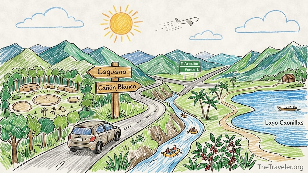
Understanding Utuado’s Geography and Drive Times
Tourism boards often describe Utuado as roughly 1.5 hours from San Juan and about 1 hour from Ponce in normal traffic. In practice, those figures describe the drive to the urban center of the municipality or the junction with main roads like PR 10, not necessarily the last stretch to places like the Caguana Indigenous Ceremonial Center, the Tanamá River canyon, Cañón Blanco or a remote cabin on the far side of Lago Caonillas. Once you leave the main corridor, narrow, curving local roads can easily add 20 to 40 minutes for what looks like a short hop on a map.
The main north–south backbone through the region is PR 10, which connects Ponce on the south coast with Arecibo on the north via Adjuntas and Utuado, crossing the Cordillera Central with sweeping mountain views and long grades. Much of PR 10 is modern and relatively wide, but the segments where it overlaps with older roads still have tighter curves and reduced speed limits. Older routes such as PR 123, which historically linked Ponce, Adjuntas and Utuado, remain in use but are significantly slower than the newer highway sections and pass through small town centers where traffic, pedestrians and speed bumps slow progress.
Within Utuado municipality itself, attractions are scattered along several distinct valleys. Caguana sits along PR 111 in Barrio Caguana to the west, while many Tanamá River adventure operators and trailheads are reached by local roads off PR 10 and PR 123. Cañón Blanco and some rural riverside spots are reached on yet another set of back roads. It is not uncommon for visitors to underestimate how far apart these sub-regions are. A route that looks like 15 miles may require 40 to 50 minutes of careful driving because of sharp switchbacks, blind curves and reduced visibility.
The result is that Utuado works best when you think in terms of corridors rather than straight-line distance. One day might reasonably cover sites along PR 111, another focuses on the Tanamá corridor off PR 10, while a third explores lakes like Dos Bocas and Caonillas. Trying to connect far-flung corners of the municipality in a single day can leave you spending more time behind the wheel than on trails or at archaeological sites.
Why a Rental Car is Usually Essential
For most independent travelers, renting a car is the only practical way to explore Utuado in depth. Public transportation into the central mountains exists in the form of shared vans and local buses, but schedules are limited, transfers are slow, and vehicles rarely stop directly at trailheads or rural accommodations. Once in Utuado, local public options thin out even further, particularly on weekends or evenings when visitors are returning from river trips or hikes.
Rideshare services like Uber and Lyft operate in the San Juan metropolitan area and to a lesser extent in larger cities such as Ponce, but coverage in Utuado and nearby mountain towns remains inconsistent. Travelers occasionally find an available car to take them into the mountains from the coast, but drivers are much less likely to accept or be available for return runs from rural barrios, especially after dark or in bad weather. Planning to call a ride back from a river canyon or a remote eco-lodge is risky; there may simply be no driver within range when you need one.
Traditional taxis based in San Juan or Ponce can be arranged for transfers into the interior, but the cost for a private round trip that involves waiting time while you visit an attraction can easily surpass the price of a multiday car rental. Travelers who have priced custom transfers for routes like San Juan to Utuado often find that door-to-door quotes approach or exceed what a compact rental car costs for three or four days, not counting the flexibility a rental provides for side trips to places like Adjuntas or Arecibo.
By contrast, renting a standard compact or midsize vehicle from a major agency at San Juan or Ponce airports gives you the ability to adapt plans to weather and energy levels. Many visitors pair an affordable sedan with cautious, unhurried driving and do not find four-wheel drive necessary for the main routes and commonly visited attractions. However, if your plan involves staying at a very remote cabin, farm stay or riverside camp down an unpaved or poorly maintained lane, checking with the host about ground clearance requirements is critical before you choose a vehicle category.
Driving Mountain Roads vs Puerto Rico’s Highways
Driving across coastal Puerto Rico on highways like PR 52 between San Juan and Ponce feels familiar to many North American and European drivers. PR 52 is a divided toll road with multiple lanes, regular signage, and speed limits that allow for efficient cruising. From the capital to Ponce, experienced local drivers describe the run as taking about two hours in ordinary traffic, longer at rush hour. Once you leave that highway network and head into the mountains around Utuado, the character of the driving changes quickly.
Mountain roads such as PR 111, PR 140, PR 123 and some older stretches of PR 10 are narrow and full of tight curves. Lanes may be shoulderless, with guardrails on one side and steep drop-offs or hillside on the other. Speed limits are low and locals, familiar with every bend, may drive faster than visitors are comfortable with. It is common to encounter slow trucks climbing hills, school buses stopping frequently in small barrios and random obstacles like fallen branches after a storm. Navigating this environment calls for slower speeds, a readiness to pull over to let faster traffic pass, and extra attention in rain when pavement becomes slick.
Drive times in this terrain are often disproportionate to the mileage. For example, a spur from central Utuado to a Tanamá River adventure base camp might be less than 10 miles but require 25 to 30 minutes because much of it is on a one-and-a-half-lane road with blind curves where drivers honk gently before entering. A traveler might plan to go from San Juan to Caguana, then down to Cañón Blanco and finally back to San Juan in one day because the total distance appears manageable. In reality, the cumulative time spent on secondary roads and backtracking can turn that plan into an exhausting, dusk-to-dark marathon.
Another factor is driver fatigue. Visitors who are accustomed to long, straight interstates sometimes underestimate how mentally tiring constant cornering and elevation change can be. A day that begins with two hours of highway driving followed by several hours of rural exploration and then another mountain run back to the coast will wear down even confident drivers. Building in rest stops, sharing driving duties when possible and booking lodgings closer to key attractions rather than commuting from the coast all help mitigate that fatigue.
Safety, Weather, Fuel and Navigation Considerations
Weather in the central mountains can be very different from conditions on the coast. Afternoon thunderstorms are common for much of the year, and low clouds can produce pockets of fog along higher ridgelines. On roads without shoulders or streetlights, even a light mist can significantly reduce visibility and make painted lane markings harder to see. For this reason, many local hosts recommend that visitors plan to arrive at rural accommodations before dark, particularly on their first night, so that they learn the route in daylight.
Rain also affects traction on older asphalt and concrete surfaces, especially where leaves or mud have washed across the road. In some canyons, water can pool briefly in low spots after downpours, and there may be sections with lingering storm damage or temporary repairs. Because Puerto Rico has been investing in major reconstruction of roads and bridges in the mountain municipalities, conditions continue to improve, but localized closures and detours still occur. Before setting out, it is wise to check your navigation app for road closure alerts and cross-check with recent traveler reports or your accommodation host for up-to-date advice.
Fuel planning is another critical aspect of driving in and around Utuado. Gasoline is widely available in Puerto Rico, but stations are clustered along main corridors and in town centers rather than deep in the countryside. Driving from San Juan, most travelers top up at a station near the metro area and again near Arecibo or Ponce, then arrive in Utuado with a comfortable buffer. If you begin a full day of exploring from Utuado town or along PR 10, it is sensible to start with at least half a tank, since running low while exploring side roads up to lakes or river access points can be stressful.
Navigation apps generally perform well along main routes such as PR 22, PR 52 and PR 10, but can become less reliable on very minor roads where GPS estimates do not fully account for slow speeds or roadwork. It is common for map apps to underestimate travel time between interior towns by 20 to 30 percent. Ask your host or tour operator which road numbers to follow and how long the drive truly takes in current conditions, then add a safety margin. When possible, download offline maps of the island before you leave the airport so you are not dependent on continuous mobile data signal in the interior.
Planning Your Route Within Utuado: Avoiding Backtracking
Because Utuado’s attractions spread across several different valleys, planning your days around logical clusters will save you hours on the road. The PR 111 corridor takes you west from town toward the Caguana Indigenous Ceremonial Center and onward in the direction of Jayuya. The PR 10 and PR 123 corridors focus on views over the Caonillas valley, access to river adventures in the Tanamá canyon, and connections toward Adjuntas or Arecibo. Other lesser-known spurs head toward Cañón Blanco and rural river spots. The key is not to treat these as interchangeable stops that can easily be strung together in any order.
For example, a visitor staying near central Utuado might devote one day to the PR 111 side: exploring the Caguana ceremonial park in the morning, then continuing to a café or lookout in the direction of Jayuya, and finally returning the same way. Another day could be built around the Tanamá corridor, combining a guided river trek with a lakeside meal at Lago Dos Bocas. Trying to visit Caguana early, then race across to a Tanamá canyon adventure and finish with sunset at a distant mirador on the same day often leads to rushed visits or long nighttime drives on roads you have not seen in daylight.
Remote cabins around Lago Caonillas and other reservoirs provide atmospheric stays, but they sometimes require an extra 15 to 30 minutes of driving from town. If you book one of these retreats, consider arranging your itinerary so that activities are mostly on the same side of Utuado as your lodging. This might mean choosing a Tanamá river experience if you are staying along that corridor, or focusing on Caguana and Jayuya if you are based closer to PR 111. Aligning your base with your main activities reduces both driving time and the temptation to push on at dusk to “get just one more thing done.”
It is also important to factor in how long specific experiences really take. A half-day river trek on the Tanamá can easily consume five or six hours once you include safety briefings, gear-up time, transport between meeting point and canyon access, and the return shuttle. Visiting Caguana is shorter but still typically requires one to two hours on site plus driving. When you add lunch, coffee breaks and photo stops, there is rarely room for more than two substantial activities in one day without resorting to quick drive-bys.
San Juan to Utuado: A Realistic Day Trip Scenario
Travelers based in San Juan sometimes consider Utuado as a single long day trip into the interior. The most straightforward route leaves the metro area on PR 22 westbound toward Arecibo, then turns south on PR 10 into the mountains toward Utuado. In light traffic, navigation apps often estimate about 1.5 hours from San Juan to Utuado’s center, but experienced drivers typically budget closer to two hours each way, especially if they plan a coffee or fuel stop near Arecibo.
A realistic San Juan day trip might look like this. Depart the city around 7:00 a.m., clear the western edge of the metro by 7:45 a.m., and reach the PR 10 junction near Arecibo by about 8:15 a.m. After a brief break, you climb into the mountains, arriving in Utuado late morning. From there, you could continue along PR 111 to Caguana for a late-morning visit to the ceremonial park and its small museum, then return toward town for a leisurely lunch. In the afternoon, you might take a short scenic drive along PR 10 toward one of the lakes or viewpoints before turning back north to reach the coast again and drive PR 22 east at daylight.
Trying to add a full Tanamá river trek or a long hike into this same day from San Juan is much more demanding. Tanamá canyon experiences often start in the morning, and operators ask guests to arrive at their base early. That can mean leaving San Juan pre-dawn to be on time. After several hours in the water, plus the drive back to PR 10 and then down to San Juan, you are likely to be navigating at night or in heavy afternoon traffic on the approach to the capital. Travelers who have attempted this in one push often report arriving back exhausted, with little appetite for evening plans.
For this reason, many visitors who are interested in both San Juan’s culture and Utuado’s mountains choose to stay at least one night in the interior. Splitting the drive over two days not only reduces fatigue but also provides margin for weather delays. If heavy rain is forecast for the afternoon, you can shift your canyon or hiking activity to the following morning, instead of feeling locked into a rigid one-day schedule.
Ponce to Utuado: Linking the South Coast and the Interior
Ponce is closer to Utuado than San Juan is, both in distance and driving time. Typical estimates place the drive from Ponce to Utuado at around 50 minutes to 1 hour in normal traffic, primarily via PR 10 heading north from the city into the mountains. This route quickly leaves the coastal plain and climbs through scenic uplands, passing near Adjuntas before continuing toward Utuado and eventually Arecibo. For many travelers, this corridor offers a memorable combination of engineering tunnels, high bridges and lush, steep valleys.
A practical Ponce-to-Utuado day or overnight trip might begin with a mid-morning departure from Ponce after breakfast in the historic center. Joining PR 10 north, you gradually ascend into cooler air, with opportunities to stop at roadside lookouts for views over the interior. Arriving in Utuado late morning, you could check into a central guesthouse, have lunch and then spend the afternoon on a shorter outing, such as a visit to a lakeside restaurant or a brief walk to a local mirador, avoiding any long hikes that would bring you back after dark.
If you plan to continue from Ponce through Utuado toward the north coast, it is tempting to treat PR 10 as a quick transit route. While the improved sections make for easier driving than older twisting roads, you should still plan for reduced speeds through construction zones, areas where PR 10 merges with local roads and spots prone to fog in the late afternoon. It is sensible to allow at least two and a half to three hours to go from Ponce to Utuado, then on to Arecibo with scenic stops, rather than relying strictly on the estimated one-hour segment times.
Staying a night or two in Utuado also gives Ponce-based travelers a comfortable base to experience Caguana or the Tanamá canyon without having to reverse the mountain drive immediately afterward. Rather than blasting in and out in one day, you can drive up from Ponce on day one, spend day two on a river or archaeological excursion, then either return to Ponce or continue north toward the coast on day three.
Designing a 2–3‑Night Central Mountains Road Trip
For travelers who want to experience Puerto Rico’s interior more deeply, a two or three night road trip that links San Juan, Utuado and either Ponce or the northwest coast works especially well. Arriving at San Juan’s airport, you could rent a compact car, spend your first night in Old San Juan or Condado, then depart the city early for Utuado on day two using the PR 22 and PR 10 combination. This gives you time to stop at a roadside fruit stand near Arecibo, stretch your legs at a viewpoint, and still reach your mountain lodging around midday.
Once based in Utuado, day three might be entirely devoted to a guided nature or river experience. With two nights in the interior, you have the flexibility to choose the best weather window for a canyon trek, kayak outing or coffee farm visit and still have a second day for Caguana or a scenic drive toward Jayuya. The key is to avoid over-scheduling; one structured activity plus one unstructured drive or village stroll per day is usually plenty given the slower pace of mountain roads.
On day four, you can choose your onward direction. One appealing loop leads south on PR 10 to Ponce for a night in the city before returning to San Juan via PR 52. Another continues north on PR 10 to Arecibo and then along the north coast toward towns like Arecibo or even westward to Isabela or Aguadilla for a beach finale. Either option lets you experience a very different side of Puerto Rico than the resort corridors while keeping each day’s driving window reasonable, usually within two to three hours of wheel time.
Throughout such a road trip, the same principles apply: keep the fuel tank comfortably above a quarter, check road conditions with your hosts before setting out each day, and give yourself extra minutes beyond what the navigation app predicts, particularly when switching between coastal highways and interior secondary roads. Planning arrival at each new lodging by late afternoon allows you to handle any unexpected detours or weather while still getting to new mountain roads in daylight.
FAQ
Q1. Is it realistic to visit Utuado as a day trip from San Juan?
It is possible but demanding. The drive can take around two hours each way in light traffic, and mountain roads add fatigue. Many travelers prefer to stay at least one night in the interior to enjoy sites like Caguana or the Tanamá canyon without rushing or driving back to San Juan in the dark.
Q2. Do I need a 4x4 vehicle to drive in Utuado?
Most main routes, including PR 10, PR 111 and PR 123, are paved and navigable in a standard compact or midsize rental car driven carefully. A higher clearance vehicle can be helpful for very remote cabins or unpaved side roads, so confirm access conditions with your host or tour operator before choosing your car category.
Q3. How different are mountain roads from Puerto Rico’s major highways?
Highways such as PR 52 and parts of PR 22 are wide, divided roads with higher speed limits and good signage. Mountain roads like PR 111, PR 140 and older segments of PR 123 are narrower, steeper and full of tight curves, with limited shoulders and frequent blind corners. Expect lower speeds and more concentration.
Q4. Are there gas stations in and around Utuado?
Yes, there are service stations in Utuado town and along main approaches, but options thin out on minor roads. It is wise to arrive in the region with at least half a tank and to top up when you pass through town rather than waiting until the gauge is low while exploring side valleys or lakes.
Q5. Can I rely on Uber or taxis for return trips from rural attractions?
Rideshare coverage in Utuado and nearby mountain areas is inconsistent, and drivers may not accept late or remote pickups. Taxis from coastal cities can be arranged but are expensive for round trips with waiting time. For flexible and reliable transport, a rental car remains the most practical option for most visitors.
Q6. Is it safe to drive to or from Utuado in the dark?
Many locals drive these roads at all hours, but visitors face challenges at night, including lack of street lighting, fog patches, animals on the road and difficulty judging curves. It is safer to plan arrivals at new accommodations for daylight and reserve night driving for short, familiar segments when possible.
Q7. How should I plan my days to avoid excessive driving?
Group activities by corridor. Dedicate one day to PR 111 and Caguana, another to the Tanamá and lake areas off PR 10 and PR 123, rather than crossing from one side of the municipality to the other repeatedly. Accept that two major stops in a day is usually plenty in the interior.
Q8. What should I know about driving in rain or fog in the central mountains?
Afternoon showers and low clouds are common. Rain can make pavement slick and reduce visibility, while fog on ridgelines obscures curves. Slow down, use headlights, avoid sudden braking, and allow extra time. If conditions become very poor, pause at a safe turnout until visibility improves.
Q9. Are navigation apps reliable in Utuado?
Apps usually show the correct road layout, but estimated times are often optimistic on mountain routes and may not reflect roadworks or minor closures. Download offline maps before leaving the city and confirm key segments and drive times with your lodging or tour provider each day.
Q10. What is a good length of stay in Utuado for first-time visitors?
Two or three nights is a comfortable window for first-timers. That allows one full day for a canyon, river or nature tour, another day for Caguana and scenic drives or lakes, and adequate rest between mountain drives from and back to the coast.