


There are places that migrate from practical infrastructure to social media legend, and Puente La Hamaca over Lago Garzas in Adjuntas is firmly in that category. Once a workhorse suspension bridge serving the construction and operation of the Garzas hydroelectric system, it has become one of the most photographed landmarks in Puerto Rico’s central mountains. Yet in late 2026, questions about who maintains it, whether the crossing is officially allowed, and how to reach it legally and safely make a typical, upbeat sightseeing guide feel misleading at best. This article approaches Puente La Hamaca as a critical field report rather than an invitation to walk onto an unmanaged structure just because older photos show people doing so.
Get the latest updates straight to your inbox!
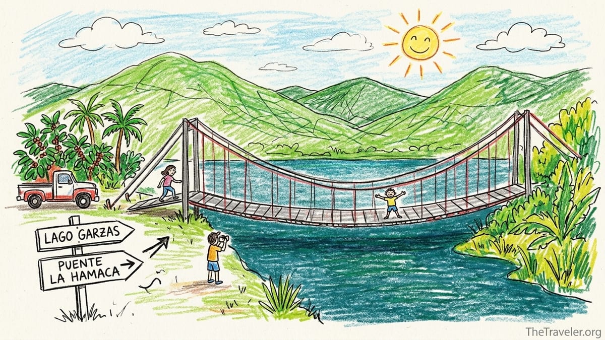
Why Puente La Hamaca Became a Bucket List Stop
Long before the bridge appeared in Instagram reels, Lago Garzas already had a firm place in Puerto Rico’s infrastructure story. The reservoir was completed in the early 1940s as part of the Garzas hydroelectric system, an earthfill dam and power project in the Garzas barrio of Adjuntas designed for electricity generation and municipal water supply. Engineering and government documents describe a dam roughly 60 meters high that impounds the Río Vacas, with water used for both hydropower and drinking along the southern coast. The lake sits in steep, forested terrain where coffee and small farms still shape local life.
Puente La Hamaca itself was built during this era as a functional work bridge. Contemporary reporting and historical summaries explain that workers needed a way to move materials and personnel across what would become Lago Garzas while the dam and associated structures were under construction. Steel cables were strung between concrete anchor points and a suspended deck was installed, creating a narrow utility crossing that outlived its original purpose. For decades after the dam was finished, the bridge lingered above the reservoir as a quiet piece of infrastructure rather than a signed tourist lookout.
What changed was the internet. Local blogs, adventure tour operators and lifestyle media started highlighting the “hidden” suspension bridge in the Garzas hills, emphasizing its wobble, its rust and the rush of walking above deep green water. Images shared by outfitters and visitors show the bridge framed by dense forest, with Lago Garzas stretching away under the cables. Official regional tourism descriptions of the lake even mention “finding the Puente Hamaca” as a favorite activity, describing it as a great photo opportunity reached by a lakeside walk. The story that reached would‑be visitors, especially those planning a day trip from San Juan or Ponce, was straightforward: there is a dramatic bridge, and people cross it.
What those viral posts rarely clarify is that Puente La Hamaca is not a maintained attraction in the way many visitors assume. It was not built as a recreational footbridge with regular inspections for family tourism. Its ownership lies within a complex web of agencies responsible for the dam, reservoir and surrounding public lands, and policies about access, maintenance and liability have changed over time. That gap between online imagery and the real status on the ground is the core issue any responsible traveler now faces when trying to decide if the bridge is worth the effort.
Verifying Ownership, Access and Safety Before You Go
Before attempting to visit Puente La Hamaca, the single most important step is verification. Because the structure is deeply tied to the Garzas dam and reservoir, its underlying ownership historically traces back to the public entities that developed and now manage that system. Technical reports prepared for Puerto Rico’s power and water authorities describe the Garzas dam and reservoir as part of a hydroelectric network that was constructed under federal New Deal programs and is now operated by island agencies responsible for energy and drinking water. Recent government planning documents continue to list Lago Garzas among Puerto Rico’s principal reservoirs, with oversight shared between the electric power authority for hydroelectric operations and the aqueduct and sewer authority for water supply.
In practical terms, that means travelers should not treat the bridge as “abandoned” or outside regulation. The surrounding forested slopes intersect with state land managed in coordination with the Department of Natural and Environmental Resources, which issues camping permits for the Guilarte area and regulates recreational use on and around many reservoirs. The safest assumption is that any bridge anchored into the hydroelectric corridor remains within a controlled zone, and that only the relevant agencies can confirm whether the structure is currently inspected and legally open for public crossing.
As of late 2026, there is no widely publicized government notice explicitly marketing Puente La Hamaca as an official, maintained tourist attraction in the way a state forest overlook or ranger‑managed trail would be promoted. Regional guides continue to reference hikes to the bridge and describe it as part of the Lago Garzas experience, but these are often produced by private platforms or tour operators rather than by the authorities responsible for structural safety. Some list specific opening hours for the broader lake area and note that the bridge experience involves an unmarked or lightly marked trail and a certain amount of bushwhacking.
Because conditions on a structure like this can change rapidly with corrosion, storms or seismic activity, it is essential to contact the relevant public agencies before visiting. Travelers should seek direct confirmation from the reservoir’s managing authority and, if applicable, from the regional office of natural resources, asking very specific questions: whether Puente La Hamaca is currently inspected for pedestrian use, whether crossing is officially permitted, and whether there are posted restrictions or closures. Without that confirmation, it is not responsible to assume that a crossing is allowed simply because earlier photos show visitors standing mid‑span.
The Drive Through Garzas: Directions, Roads and Parking Reality
Arriving at Puente La Hamaca starts as a classic central‑mountain drive rather than a visit to a signed park entrance. Lago Garzas lies off the narrow, twisting secondary roads that branch from the main routes serving Adjuntas. The reservoir’s dam crest doubles as part of a local road alignment, and official tourism materials for the lake reference State Road PR‑518 as a primary access point. Drivers approaching from Adjuntas town typically follow a combination of PR‑10 and then smaller routes that climb into the coffee country, before descending toward the reservoir along lanes that cling to steep hillsides.
In practice, the Garzas area drive is beautiful and demanding. Expect tight curves, limited shoulder and frequent blind corners. This is an active rural corridor, so pickup trucks, school buses and local residents share the road, and there is little forgiveness for distracted navigation. Cell signal can be intermittent, which means travelers relying on phone navigation should download maps in advance or carry a backup plan. The GPS coordinates shared across blogs and unofficial guides tend to place visitors near the lake, often at small restaurants or pullover areas that serve as informal trailheads, but these drop‑pins are not the same as a signed, government‑maintained parking lot.
On the ground, the question of legal parking is surprisingly complex. The immediate surroundings of Lago Garzas include narrow roadside verges, private driveways, gated hydroelectric facilities and scattered businesses such as small roadside eateries. Some online trip reports have used restaurants along the reservoir edge as reference points, describing walks that begin from a parking spot in front of a dining room or from a gravel pullout by the road. Those descriptions do not necessarily distinguish between public right‑of‑way and private or semi‑private land. Travelers arriving now should be prepared to ask permission directly if considering parking near a small business and to look for any posted “no parking” or “no trespassing” signage near dam infrastructure and access gates.
The key test for a responsible visit is whether an authorized access point is clearly signed and unambiguous. A properly sanctioned trailhead would normally feature at least a basic information board, official markings or a maintained turnoff with room for several vehicles. As of this writing, reports and imagery from the area continue to show that access to the Puente La Hamaca path is only loosely marked at best, often identified through word of mouth or social media instructions that refer to kilometer posts, utility poles or unpainted gates. Anyone expecting a big brown recreational sign pointing the way to “Puente La Hamaca Suspension Bridge” is likely to be disappointed.
Walking Toward the Bridge: Mud, Vegetation and Steep Banks
Once you leave the relative certainty of the road, the experience shifts from rural driving to informal trail navigation. Accounts collected over the past several years, along with recent photo essays in regional media, describe a route that begins along a rough service track or former access road before narrowing into a footpath used by hikers and local residents. The trail is not groomed in the sense of a state forest loop. It passes through dense tropical vegetation, with coffee plants, ferns and secondary forest crowding the edges, and sections where branches lean into the corridor.
The ground underfoot reflects the climate of Puerto Rico’s central cordillera. Rainfall in the Lago Garzas basin is high, and soils on steep slopes quickly become slick. Visitors describe stretches of ankle‑deep mud after wet weather, washed‑out ruts where water has carved channels down the path, and roots that form natural steps. Insects are part of the experience: mosquitoes and biting flies become more active in shaded, humid sections, and spiders often anchor webs across less‑used stretches of trail. Hikers who arrive in sandals or city sneakers frequently report feeling underprepared once the first muddy descent appears.
Trail distance estimates vary because the starting point can differ, but a commonly reported walking time from roadside reference points to the bridge area is in the range of 20 to 30 minutes at a moderate pace. That time can lengthen significantly in rain, with families or with frequent photo stops. Importantly, the approach to the actual bridgehead often involves steeper ground close to the water’s edge, where informal side paths peel away from the main route. These side cuts sometimes descend over loose soil or eroding banks to the concrete abutment where the suspension cables are anchored.
Throughout this approach there are no staffed facilities. There is no ranger station, no concessions kiosk, no emergency call box and no maintained restroom. The last reliable services are typically at the restaurants and small shops near the road. In rainy weather, or after multi‑day storms, the combination of saturated soils, slippery clay and steep, unrailed banks increases the risk of slips and falls on the way down to the bridge, quite apart from any concern about the bridge structure itself.
What You Can See Without Stepping Onto the Deck
Crucially, the visual reward of Puente La Hamaca does not require stepping onto the suspended deck. From the approach trail and the immediate area around the abutments, visitors can observe a surprising amount about both the bridge construction and its current condition. The structure consists of steel cables running between substantial concrete anchor blocks, from which a narrow deck is hung. The deck itself is composed of metal plates supported by transverse steel elements, with side cables that form the basic handrails. In older photographs, the handrails are basic and the walking surface appears open between plates, leaving gaps where the reservoir can be seen far below.
Recent images and narrative accounts emphasize aging and lack of formal maintenance. Surface rust is visible on many components, some of the deck plates show deformation or misalignment, and the handrail cables are low compared with modern pedestrian bridge standards. In places, advanced corrosion appears along fittings and sections where drainage is poor. From safe ground at the start of the span, these conditions are clearly visible, which is one reason local media have framed a walk onto the bridge as a test of courage rather than an everyday stroll.
Looking outward rather than down, the surroundings remain striking. The bridge floats above deep water that reflects steep, forested slopes on both sides of Lago Garzas. On a clear day the combination of green ridges, distant dam works and still water creates a cinematic frame for photography, even from the shore. In low cloud or light rain, mist can hang in the trees, giving the scene a moody, enclosed feel. Sound travels easily over the water, so the occasional distant hum of vehicles on the dam road contrasts with birdsong and insect noise near the trail.
From a safety‑first perspective, the most reasonable experience for many visitors is to stop at the abutment and treat the bridge as an historic object to be observed rather than a piece of playground equipment. There is ample opportunity at that point to photograph the structure, capture the sweep of cables and the lake beyond, and consider the history of the reservoir without committing weight to a deck whose current structural capacity is not clearly documented for public use.
From Workhorse to Folk Landmark: The Bridge and the Reservoir’s History
Lago Garzas did not appear out of nowhere as a tourist lake. Planning documents and technical studies trace its origin to a coordinated hydroelectric and water supply initiative launched in the 1930s. Construction on the dam and associated infrastructure began under the Puerto Rico Reconstruction Administration, part of a broader rural electrification effort that brought hydropower to interior municipalities. The lake was formed when the dam across the Río Vacas was completed around 1943, impounding water to feed the Garzas hydroelectric plants downstream and to contribute to drinking water systems along the south coast.
The reservoir’s role is still primarily functional. Hydrologic studies produced over past decades for Puerto Rico’s water planning agencies describe Lago Garzas in terms of storage capacity, sedimentation rates and spillway elevations, rather than as a park reservoir designed for heavy recreation. The dam is one of several on the island classified as high risk, not because it is failing, but because of the consequences that a hypothetical failure would pose to people and property downstream. Inspections have historically focused on embankment integrity, spillway capacity and operational safety of the hydroelectric system.
Within that context, Puente La Hamaca appears in official and semi‑official texts not as a stand‑alone historical monument but as a logistical solution. Contemporary media coverage and local historians note that the bridge allowed workers to move equipment and materials across the developing reservoir footprint during and after construction, bridging points that later became separated by deep water. Over time, as the engineering phase gave way to operation, the bridge remained hanging above the lake, its functional necessity reduced but not entirely erased. Maintenance, however, shifted away from the routine, visitor‑oriented standards one might see at a designated heritage attraction.
In recent years, lifestyle and travel outlets have wrapped the bridge in storytelling language that leans toward legend: a hidden, slightly forbidden structure tucked into the forest, known by locals and gradually discovered by outsiders. While that narrative has boosted awareness and driven visits, it can obscure the more prosaic reality that Puente La Hamaca is part of a working water and power system whose managers understandably prioritize operational safety over recreational polish. Understanding that history helps explain why the access path is rough, signage minimal and official statements about the bridge as a tourist experience relatively scarce.
If It Is Open and Inspected: What a Permitted Visit Should Look Like
Suppose, after contacting the responsible authorities, you receive clear confirmation that Puente La Hamaca is currently inspected and officially open for pedestrian crossing. In that case, the on‑site experience should still be approached with a cautious mindset rather than an adventure‑for‑adventure’s‑sake attitude. An authorized opening would reasonably be accompanied by at least minimal safety measures such as posted capacity limits, instructions at the bridgehead and possibly reinforcement or replacement of the most degraded deck elements.
On arrival, a permitted visit would begin with reading and respecting whatever signage has been installed. If a board specifies a maximum number of people on the bridge at one time, that limit should be treated as non‑negotiable. Children should be closely supervised, and running, jumping or intentional swaying of the structure should be off the table. Given the bridge’s narrowness and the likely presence of other visitors drawn by social media attention, a single‑file crossing with deliberate spacing is a practical way to balance safety with courtesy.
Under those ideal conditions, the crossing itself offers a distinctive vantage point over Lago Garzas. At mid‑span, visitors can look back toward the dam and forward toward the narrowing reaches of the lake, with the steep, forested walls of the valley rising on both sides. The deck’s movement underfoot is part of the experience, a reminder that this is a suspension structure rather than a fixed concrete viaduct. However, anyone who feels nervous at the first few meters should feel no pressure to continue. Turning back early is a valid choice, particularly for those who are sensitive to heights or traveling with children.
Even in a formally open scenario, wet conditions remain a serious factor. Afternoon showers and passing mountain squalls can arrive with little warning, leaving steel surfaces slick. The approach trail can quickly deteriorate into a muddy obstacle course, and the last steps down to the bridgehead may become treacherous. Sensible footwear with good grip, a small first‑aid kit and a firm personal rule to abandon the attempt if thunder is heard or if the deck appears newly damaged are all part of treating the bridge as a privilege rather than an entitlement.
If It Is Not Open: Viewing Only and Safer Alternatives
The more conservative, and in many ways more likely, outcome of a call to the responsible agencies is that Puente La Hamaca is not officially sanctioned for public crossing. That may mean it is under evaluation, considered part of restricted dam infrastructure, or simply not maintained to a standard that the owners are willing to endorse for general pedestrian use. In that scenario, the recommendation is straightforward: treat the bridge as a viewpoint subject, not as a walkway.
Even if the deck is technically capable of bearing weight, using a structure against the explicit or implicit guidance of its owners transfers all risk to the visitor. Fall potential, sudden failure of corroded elements and the absence of rescue staff combine to create a worst‑case scenario that no photograph can justify. Fortunately, as described earlier, substantial visual value can be gained from the immediate approach. Standing just shy of the deck, visitors can frame the sweep of cables and the waters of Lago Garzas in their shots without stepping onto the uncertain span.
At that point, the question becomes whether the outing as a whole feels worthwhile. One honest way to judge is to compare the time and uncertainty invested in finding the bridge with what could have been experienced on more predictable trails nearby. Guilarte State Forest, which lies in the same highland region, offers signed trailheads, official maps, designated viewpoints and, in some seasons, staffed facilities or contact points. Hikes toward Monte Guilarte or shorter forest loops give visitors a mix of cloud‑forest scenery, cool temperatures and established infrastructure like numbered campsites, and they can be reached from Adjuntas on similarly winding but clearly marked roads.
Likewise, other maintained viewpoints around Lago Garzas provide lake vistas without the ambiguity of trespassing near hydroelectric installations. Official tourism descriptions highlight the reservoir’s roadside lookouts and picnic areas, where basic amenities such as marked parking and restrooms may be available. Compared with the half‑hour search for an unmarked side path to Puente La Hamaca, a traveler might reasonably conclude that those sanctioned sites deliver better value, especially during a short stay in the region or when traveling with less mobile companions.
Photos vs Reality: Expectations, Scenery and Whether I Would Return
Personally, what drew me to Puente La Hamaca in the first place was the collision of infrastructure and landscape. The photos that circulate online show a delicate line of steel brushing the treetops, people silhouetted mid‑span with arms outstretched over deep green water. It looked like the kind of place where the island’s industrial history and its mountain beauty physically intersect, a rare opportunity to feel close to a working reservoir without being confined to a roadside pullout.
The reality of reaching the area was more complex. The drive through Garzas was as beautiful as promised, with cloud‑wrapped ridges and glimpses of farms clinging to steep slopes. It was also tiring, demanding constant attention and patience around corners where a truck or school bus might appear at any moment. Parking required negotiation and care to avoid blocking local access or edging too close to gated dam facilities. The trail, while atmospheric and rich with bird calls, was muddy, uneven and at times vaguely defined, with no official markers to reassure us we were on sanctioned ground rather than cutting across a maintenance corridor.
When I finally reached the bridgehead, the structure that waited in front of me was both exactly as pictured and subtly more troubling. The long curve of cables and narrow deck matched the dramatic photos, but the rust, deck misalignments and low handrails felt more immediate and less romantic in person. There were no official signs granting permission to cross, no visible evidence of recent refurbishment, no indication that any public body was inviting people onto the span. In that absence, stepping onto the deck would have felt like a private gamble rather than part of a managed visitor experience.
What felt unsafe was not a single obvious defect but the compound picture: slippery mud on the final approach, unprotected drops toward the water, a visibly aging deck and the knowledge that if anything went wrong, rescue would depend on cell reception and the goodwill of whoever happened to be nearby. Standing on solid concrete at the abutment, cameras in hand, it became clear that the more responsible choice was to treat the bridge as a photographic subject and nothing more. The lake and forest scenery did partly justify the effort; seeing Lago Garzas from that low angle, framed by cables and rainforest, offered a perspective that roadside viewpoints cannot quite replicate. Yet as I hiked back out, comparing the hour spent hunting an unmarked trail with previous days on clear paths in Guilarte, I knew I would steer most readers toward the managed experiences instead.
Would I return to Puente La Hamaca specifically? Only if the authorities responsible for the reservoir and surrounding lands publicly clarified the bridge’s status, invested in inspection and basic visitor infrastructure, and made it clear that the crossing formed part of a sanctioned trail network. Absent that, my future time in Adjuntas will be weighted toward places where environmental stewardship, safety and access are all being actively managed: the signed loops in Guilarte State Forest, official Lago Garzas overlooks and cultural sites in town that interpret the area’s coffee and hydropower heritage without asking visitors to walk a structural tightrope between folklore and liability.
The Takeaway
Puente La Hamaca is one of those rare places where an island’s working infrastructure and its romantic image collide. The bridge earned its legend because it offers a dramatic, almost cinematic view over Lago Garzas, and because generations of workers and visitors have left it hanging over an emerald reservoir in the Garzas hills. At the same time, the very qualities that make it compelling also make it risky to present as a casual attraction. It was built as a work bridge within a hydroelectric system, not as a modern recreational footpath, and its current condition reflects that origin.
As of late 2026, responsible travel to the area means starting with verification. Travelers should contact the agencies that oversee the reservoir and surrounding public lands to confirm whether Puente La Hamaca is inspected and legally open for pedestrian use. If the answer is anything less than an unambiguous yes, the appropriate response is to treat the bridge as a viewpoint only, photographing it from stable ground and enjoying the lake and forest scenery without stepping onto the aging deck. Relying on old social media posts that show people crossing, without regard for ownership or maintenance, is not a substitute for current information from those charged with managing the structure.
Even with those precautions, there is genuine value in the journey. The drive through Garzas, the muddy walk under the canopy and the sight of a slender suspension bridge hovering above deep green water all speak to Adjuntas’s identity as both an industrial and a natural landscape. Yet when measured against the predictable rewards of a day in Guilarte State Forest or at an official Lago Garzas overlook, the unsignposted search for Puente La Hamaca will feel excessive to many visitors, especially families and those who prefer managed attractions.
For photographers who enjoy hunting out half‑hidden infrastructure, a carefully planned visit that stops at the abutment may still be worthwhile, particularly in soft morning or late‑afternoon light when the lake turns reflective and the surrounding ridges glow. Families with young children, travelers without sturdy footwear, or anyone uncomfortable with height and exposure are better served by the signed trails and maintained viewpoints nearby. In the end, the bridge’s greatest value may lie in what it teaches about expectation versus reality: that some of the island’s most shared images are anchored not in curated parks, but in working landscapes where caution, respect and up‑to‑date information matter far more than capturing the same pose as the last viral post.
FAQ
Q1. Is Puente La Hamaca officially open for visitors to cross?
As of late 2026, there is no widely publicized official statement clearly inviting the public to cross Puente La Hamaca, and policies can change. Travelers should contact the agencies managing Lago Garzas and nearby public lands before visiting and treat the bridge as a viewpoint only unless those authorities explicitly confirm that it is inspected and open for pedestrian use.
Q2. Who is responsible for Puente La Hamaca and Lago Garzas?
Lago Garzas is part of a hydroelectric and water supply system developed under public ownership, with operational responsibilities shared between Puerto Rico’s electric power and aqueduct authorities and coordination with environmental and natural resources agencies. Because Puente La Hamaca is physically tied into this system, only those agencies can definitively state who maintains the bridge and whether public access is allowed.
Q3. How do I drive to the general area of Puente La Hamaca?
Most visitors reach the area by driving from Adjuntas along the main highway network and then following smaller mountain roads, including routes that connect to the reservoir near PR‑518. The drive involves narrow, winding lanes with limited shoulders and frequent blind corners, so drivers should take their time, avoid night travel if possible, and arrive with offline maps or clear directions stored in advance.
Q4. Is there legal, safe parking near the trail to the bridge?
Parking near Lago Garzas is a mix of roadside pullouts, small restaurant lots and informal spaces, and not all of these are clearly identified as public. Visitors should avoid blocking gates or driveways, read any posted signs and, when in doubt, ask permission before leaving a car near a business. A clearly signed official parking area dedicated to a “Puente La Hamaca” trailhead is not currently evident.
Q5. How difficult is the walk to reach the bridge viewpoint?
The walk typically takes around 20 to 30 minutes from common starting points but can feel demanding. The path is unpaved, can be very muddy after rain, and includes roots, uneven surfaces and steeper sections near the water. There are no handrails, no formal trail markers and no staffed facilities along the way, so appropriate footwear and realistic expectations are essential.
Q6. Can I still enjoy Lago Garzas if I decide not to cross the bridge?
Yes. The approach to Puente La Hamaca offers views of the cables, deck and surrounding forest without stepping onto the structure, and there are additional viewpoints and recreation areas around Lago Garzas that provide lake scenery from the roadside or from signed paths. Many visitors find that these managed spots offer a more relaxed experience, especially in wet weather.
Q7. How does visiting Puente La Hamaca compare with hiking in Guilarte State Forest?
Guilarte State Forest offers marked trails, designated viewpoints and, in some seasons, clearer management presence, making it a more predictable option for most travelers. In contrast, Puente La Hamaca involves an unmarked or lightly marked access route, ambiguous ownership and uncertain structural maintenance. Those who value clear signage and infrastructure often prefer Guilarte’s established network of paths.
Q8. What conditions make a visit to the bridge area especially risky?
Heavy rain, recent storms, saturated ground and poor visibility all increase risk. Mud makes the steep approach to the bridgehead slippery, and steel elements become slick when wet. The absence of railings on parts of the path, unprotected drops near the bank and potential deterioration of the bridge structure itself combine to make caution essential even if you only visit the viewpoint.
Q9. Is Puente La Hamaca suitable for children or visitors with limited mobility?
For most families with young children or travelers with mobility challenges, Puente La Hamaca is not an ideal destination. The access path is rough and steep in places, there are no safety rails, and conditions can change quickly with rain. Safer alternatives include roadside viewpoints around Lago Garzas and signed, maintained trails in Guilarte State Forest.
Q10. What should photographers know before planning a shoot at the bridge?
Photographers should arrive with realistic expectations about access, safety and time. Light in the Garzas valley can be beautiful in early morning or late afternoon, but reaching the bridge viewpoint requires a muddy, sometimes confusing walk with no guaranteed parking or facilities. Planning to shoot from solid ground at the abutment rather than on the deck itself, and having a backup plan such as nearby official lake overlooks or forest trails, will help ensure the day remains productive even if crossing the bridge is not permitted.