


More news on this day
A severe thunderstorm watch remains in force across parts of the United States on Friday, extending a period of heavy downpours, power cuts and travel disruption that began with fast-moving storms late Thursday and is now pushing toward the Eastern Seaboard.
Get the latest news straight to your inbox!
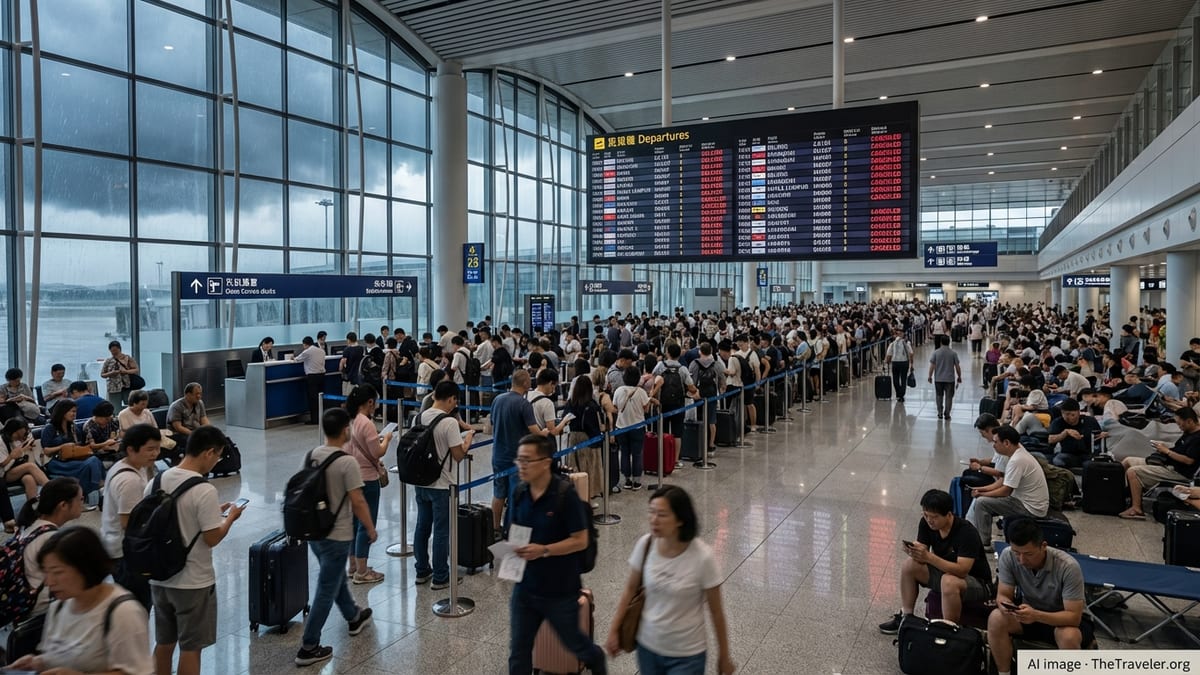
Storm System Tracks From Plains To East Coast
Publicly available forecast information shows a broad frontal system moving east across the country, triggering clusters of thunderstorms from the southern Plains into the Mid-Atlantic and Southeast. Through Thursday night, severe storm watches and warnings covered portions of Oklahoma, Tennessee and neighboring states, with forecasters highlighting the risk of intense rain, hail and damaging winds.
Weather alerts issued in central Oklahoma late Thursday described strong thunderstorms over Oklahoma City and nearby suburbs, with radar estimating 1 to 2 inches of rain in a short period and prompting a flood advisory for low-lying and poor drainage areas. Local reports indicated street flooding and slick conditions on major commuter routes, particularly in and around Yukon, Edmond and western sections of the Oklahoma City metro.
By Friday, the focus had shifted east. Across central and eastern North Carolina, meteorologists tracked a cold front bringing widespread showers and thunderstorms from Charlotte through Raleigh to the coast. Published coverage from regional outlets on Friday morning emphasized the potential for heavy downpours, localized flooding and gusty winds strong enough to down tree limbs and cause scattered power interruptions.
Additional heavy rain bands were projected to move up the Eastern Seaboard into the Northeast through Friday, with national outlooks noting concerns about flash flooding in urban corridors and along smaller rivers and streams. In some locations, the severe thunderstorm watch overlapped with separate flood watches, underscoring the twin threats of wind damage and rapid runoff.
Power Cuts And Transport Disruption Hit Key Corridors
The storm sequence has already produced power cuts in several metropolitan areas this week, including parts of the Southeast and Mid-Atlantic that have faced repeated rounds of heavy rain since early October. Recent coverage from Atlanta and surrounding counties highlighted how earlier severe storms in September brought down trees and power lines, leaving more than 50,000 customers without electricity in that region alone as wind gusts reached an estimated 60 miles per hour.
Although the latest thunderstorm watch is centered farther north and east, utilities and emergency planners are pointing to those recent outages as a reminder of how quickly travel and everyday activity can be disrupted when storms hit populated corridors. When power failures intersect with evening rush hour or early morning commuting periods, traffic signals, rail operations and airport ground systems can all be affected at once, magnifying delays.
In Pennsylvania, state-level situation reports from past severe weather events document how a combination of thunderstorm watches, warnings and localized tornado alerts have previously prompted ground stops at major airports such as Philadelphia International and led to temporary diversion of flights. Those brief but intense disruptions have stranded travelers, delayed connections and forced airlines to reposition aircraft once conditions improved.
Road networks are equally vulnerable. During previous severe thunderstorm outbreaks in the Mid-Atlantic, official incident summaries recorded numerous closures caused by downed trees and power lines, as well as water rescues on flooded roads in suburban counties. With Friday’s storms expected to deliver additional heavy rainfall to some of the same states, forecasters are again urging drivers to avoid water-covered routes and be prepared for rapidly changing conditions.
What A Severe Thunderstorm Watch Means For Travelers
According to public guidance on weather alerts, a severe thunderstorm watch signals that conditions are favorable for storms capable of producing damaging winds, large hail and intense rain. It typically covers a broad region for several hours, often ahead of the main line of storms, and is distinct from a warning, which is issued when hazardous weather is imminent or already occurring in a specific area.
Information from national weather agencies notes that severe thunderstorm watches are often coordinated through specialized forecasting centers and then relayed by local offices, which refine the expected timing and impacts for individual counties and cities. Travelers may see multiple overlapping alerts, including flood advisories or high wind watches, as the same system moves through.
For people in transit, the key implication of an ongoing watch is heightened potential for sudden deterioration in weather. Flights that appear on time in the morning can face delays or ground stops if storms intensify near hub airports later in the day. Road journeys that begin under cloudy skies can quickly encounter blinding rain, ponding water and reduced visibility, especially along interstates and secondary highways.
Rail and bus services are not immune. Heavy downpours can overwhelm drainage along tracks, while strong gusts increase the risk of branches or debris impacting overhead lines. Publicly available planning documents from several states stress the need for transport agencies to monitor live radar and field reports closely whenever a watch is in effect, so that services can be slowed, rerouted or briefly suspended if necessary.
Regional Hotspots Of Concern Through Friday
Forecast discussions and local coverage on Friday morning highlighted a few regional hotspots where travelers face the greatest near-term disruption risk. Central and eastern North Carolina sits near the core of the daytime severe potential, with storms expected to develop from late morning and peak through the afternoon as the cold front passes.
Cities such as Charlotte, Raleigh, Fayetteville and Wilmington were projected to see repeated rounds of showers and thunderstorms, some containing torrential rain and briefly strong wind gusts. Local forecasts noted that the most intense cells could produce rainfall rates high enough to overwhelm storm drains, raising the likelihood of temporary street flooding near low underpasses, coastal causeways and urban creek crossings.
Farther north, broader-scale outlooks indicated that heavy rain would spread into the Mid-Atlantic and Northeast later Friday and into Friday night. Even where storms are not especially organized, forecasters warned that saturated ground from earlier autumn systems, including a recent nor’easter that lashed the New England coast in late September, may increase the chance of tree damage and scattered power interruptions.
To the west, parts of the central Plains and northern Rockies are contending with separate high wind watches around the same time frame. In these regions, alerts caution that travel could be very difficult for high-profile vehicles, particularly on exposed stretches of highway where crosswinds may reach hazardous levels even without thunderstorms present.
Practical Advice For Those On The Move
Travel organizations and safety campaigns consistently emphasize advance planning whenever a severe thunderstorm watch is in effect. For air travelers, the most immediate step is to monitor airline notifications and airport social media channels throughout the day, as schedules can change with little notice once lightning and strong winds approach a terminal.
Motorists are encouraged to factor extra time into journeys, especially during peak commuting periods when any incident can quickly back up traffic. National safety guidance stresses that drivers should never attempt to pass through flooded roadways, since even shallow moving water can dislodge a vehicle. Turning around and finding an alternate route is recommended if water is visible across the pavement.
For those staying in hotels, resorts or short-term rentals, basic preparedness measures can reduce inconvenience during power cuts. Emergency management publications advise keeping mobile devices charged ahead of the storm window, locating stairwells in case elevators are unavailable, and securing an inexpensive flashlight or headlamp where it is easy to find in the dark.
Across all modes of travel, the overarching message tied to the ongoing severe thunderstorm watch is to stay informed and remain flexible. With storms expected to continue affecting different parts of the country through Friday, itineraries that allow for schedule adjustments, brief delays and route changes are likely to be more manageable than tightly packed plans that leave no room for disruption.