


More news on this day
Severe thunderstorm watches in early November are reshaping travel plans across parts of the United States, as fast-moving storm systems trigger flight delays, ground stops and hazardous driving conditions at the start of the busy late-autumn travel period.
Get the latest news straight to your inbox!
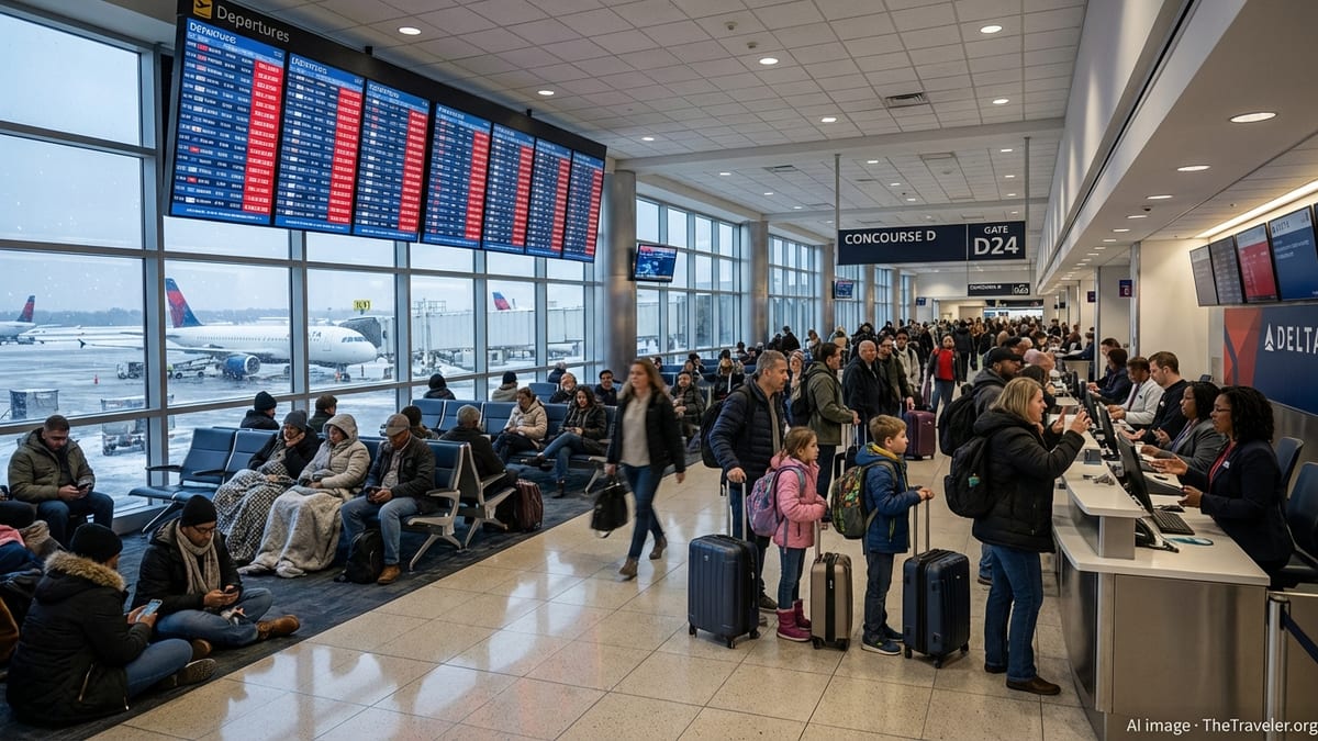
Storm Watches Intensify as November Travel Ramps Up
Publicly available data from the Storm Prediction Center shows a cluster of convective watches issued between November 1 and November 3, 2026, including tornado and severe thunderstorm watches covering stretches of the central Plains and southern High Plains. Several of these watches remained in effect into the overnight hours, underscoring the potential for rapidly changing conditions that can catch travelers between destinations.
One convective watch issued during the evening of November 2 remained active into the early hours of November 3, highlighting the risk window for organized severe storms during a period when many travelers are still in the air or driving long-distance routes. Archived watch information indicates broad polygons stretching from northern Texas and eastern New Mexico into portions of Kansas and Oklahoma, reflecting the scale of the thunderstorm threat across multiple interstate corridors.
These watches are being issued against the backdrop of a wetter, stormier pattern in parts of the South and interior West as November begins. Seasonal outlooks cited by national travel and weather coverage in late October flag the corridor from California through Texas and into the Southeast as particularly vulnerable to heavy rain and thunderstorms that may intersect with early holiday travel.
For travelers, the timing of these watches matters as much as their location. Late-day and evening issuances coincide with peak flight departure banks at major hubs and with the final long-haul departures and arrivals on intercity bus and rail services, increasing the likelihood of knock-on delays when storms form near large population centers.
Florida Flight Disruptions Highlight Weather Sensitivity
The impact of severe thunderstorm risk on air travel was illustrated on November 2, when thunderstorms over Florida led to widespread disruption at several of the state’s busiest airports. Analysis by passenger-rights platform AirHelp reports that 908 flights were delayed or canceled across four airports that day, including Miami International, Fort Lauderdale–Hollywood International, Melbourne Orlando International and Southwest Florida International in Fort Myers.
Ground stops were recorded at both Miami and Fort Lauderdale as storm cells moved across South Florida, temporarily halting inbound departures from other airports and forcing aircraft already en route to slow down or hold. Melbourne Orlando International was listed as closed for several hours in the afternoon, while Fort Myers reported growing departure delays with average waits of about one hour as thunderstorms intensified overhead.
According to the same disruption overview, American Airlines accounted for a substantial share of cancellations at Miami, while JetBlue recorded a high number of delays at Fort Lauderdale. With convection-driven storms classified as a safety issue outside airline control, these delays and cancellations are generally not eligible for European-style financial compensation schemes, an important detail for international travelers who may otherwise expect fixed payouts after long disruptions.
Even so, consumer advocates note that passengers affected by severe-thunderstorm delays can typically request rebooking on the next available flight and, in the case of cancellations, can ask for a refund of the unused portion of their ticket if they choose not to travel. Travelers connecting through storm-prone hubs are being advised by travel coverage to monitor forecast discussions and airport status pages closely, particularly when traveling on tight same-day connections.
Ground Stops and Highway Hazards in the Interior West
The same pattern that has supported severe thunderstorm watches in the central United States has also brought impactful weather to the interior West. On November 1, a ground stop was recorded at Las Vegas Harry Reid International Airport as strong, gusty winds and a nearby severe thunderstorm warning pushed surface gusts at the airfield to around 48 knots, according to data compiled by aviation-focused monitoring services.
The Las Vegas ground stop began in the late afternoon local time and was later extended to cover a wider slice of departures controlled by an additional air traffic center. Departures bound for Las Vegas were held at their origin airports until the restriction was lifted, resulting in rolling delays for travelers arriving from both domestic and international gateways in the western United States and Mexico.
Farther east, detailed alert logs from Weather Alert Watch show that the National Weather Service office in Albuquerque issued a series of severe thunderstorm warnings on November 1 for parts of Bernalillo, Santa Fe, Torrance and surrounding counties in New Mexico. Radar-indicated storms were reported moving northeast at around 55 miles per hour, with hazards including 60 mile-per-hour wind gusts and the potential for damage to roofs, siding and trees in and around Santa Fe and communities along Interstate 40 and Interstate 25.
These warnings highlight how quickly conditions can deteriorate for drivers in the region. Portions of Interstate 40 between about mile markers 182 and 212 and sections of U.S. Highway 285 north and south of Santa Fe were listed among the impacted routes, underscoring the need for motorists to check short-fuse warnings as closely as long-range watches when planning cross-state drives.
Understanding a Severe Thunderstorm Watch and What It Means for Travelers
While localized warnings tend to draw the most immediate attention, the broader severe thunderstorm watch is often the first signal that travelers may face a disruptive day. Guidance published by the National Weather Service and the Federal Aviation Administration describes a severe thunderstorm watch as an alert issued for areas where conditions are favorable for storms capable of producing damaging winds, large hail or isolated tornadoes, generally over a period of several hours.
The Storm Prediction Center in Norman, Oklahoma is responsible for issuing these watches for the contiguous United States. FAA documentation notes that the center produces public severe thunderstorm watches, public tornado watches and aviation-specific watch notification messages, each designed to support different users ranging from the general public to dispatchers and pilots in airline operations centers.
For airline passengers, one of the most direct effects of a severe thunderstorm watch comes through changes to en route and terminal airspace management. When convective activity develops within or near a watch area, traffic managers may implement ground stops, reduce arrival rates or reroute aircraft around active cells, all of which contribute to delays. The Florida disruptions on November 2, along with the Las Vegas ground stop one day earlier, fit squarely within this pattern of precautionary slowdowns when thunderstorm potential intersects with high-traffic hubs.
Travelers on the road also need to interpret watches carefully. A severe thunderstorm watch does not guarantee that every city or highway inside the outlined area will experience damaging weather, but it does indicate that storms with strong winds or hail are possible. Public preparedness guides produced by National Weather Service forecast offices for the 2026 travel season emphasize the value of having multiple ways to receive updates, including smartphone alerts and local radio, particularly for those driving through rural stretches without reliable mobile coverage.
How U.S. Travelers Can Navigate a Volatile November Pattern
The burst of watches and warnings in early November comes as broader outlooks point toward an unsettled pattern for parts of the United States heading into the peak holiday travel window. Seasonal analyses highlighted by national news and travel outlets in late October suggest that an ongoing strong El Niño is likely to favor wetter conditions from California across the southern tier into the Southeast, raising the odds of repeated thunderstorm episodes affecting air and road travel.
In practical terms, that means travelers heading through hubs such as Los Angeles, Phoenix, Dallas–Fort Worth, Houston, Atlanta, Miami and Orlando may encounter weather-driven slowdowns more frequently on certain days this month, even if multi-day forecasts still indicate generally mild temperatures. As the Florida and Nevada disruptions show, a single line of storms passing over a major airport during the afternoon rush can lead to residual delays well into the evening.
Trip-planning advice in current travel coverage emphasizes building additional buffer time into itineraries, especially when making same-day connections involving multiple airlines or transport modes. Rebooking options and same-day change policies vary by carrier, but several major U.S. airlines continue to publish weather waivers during significant convective events, allowing passengers to shift travel dates or routings when their origin or destination falls under an active watch or warning.
For those driving, the combination of severe thunderstorm watches and localized warnings calls for flexible routing. Heavy rain, hail and sudden crosswinds can reduce visibility and vehicle control in a matter of minutes, particularly on exposed stretches of interstate. Publicly available guidance from weather and emergency-management agencies advises that motorists avoid parking under overpasses during hailstorms, reduce speed dramatically in heavy rain, and be prepared to pause travel temporarily when alerts indicate rapidly approaching severe cells along their route.