


More news on this day
Environment and Climate Change Canada has issued a yellow snowfall warning for Calgary and much of southern Alberta for Wednesday, November 18, 2026, with “snow at times heavy,” additional accumulations of 5 to 10 centimetres and total storm amounts near 10 to 25 centimetres in some areas, creating challenging conditions for drivers, air travelers and local commuters.
Get the latest news straight to your inbox!
Official Yellow Snowfall Warning and What It Means
The current Environment and Climate Change Canada alert for the City of Calgary is a Yellow Warning – Snowfall, listed with a moderate impact level and high forecast confidence. Issued in the early morning of Wednesday, November 18, 2026, the warning covers Calgary and a large swath of southern Alberta, where a widespread area of snow at times heavy is underway and expected to continue through the day.
The bulletin calls for additional snowfall of 5 to 10 centimetres during Wednesday, on top of earlier snow, bringing total storm amounts into the 10 to 25 centimetre range across affected areas. Recent Environment Canada weather summaries already list Calgary near 15 centimetres from this system, placing the city solidly within official warning territory for the Prairies.
In Alberta and most Prairie provinces, a federal snowfall warning is typically issued when 10 centimetres or more of snow is forecast within about 12 hours. This event meets that threshold, but the colour coding and language signal that it is a significant winter storm rather than an extreme or historic blizzard. Travelers should treat it as a disruptive system that complicates movement rather than one that shuts the city down entirely.
Roads, Highways and Local Commuting Impact
The snowfall warning text emphasizes that travel will likely be challenging across Calgary and southern Alberta as snow continues through Wednesday before tapering off during the evening. Accumulating snow is expected to make roads and walkways difficult to navigate, with a specific caution that rush hour traffic may see a significant impact while visibility and traction vary from one neighborhood or stretch of highway to another.
Environment Canada urges motorists to slow down, use headlights and maintain a safe following distance in case of sudden stops or changing conditions. Visitors driving from the Rocky Mountain parks, Red Deer corridor or points east toward Medicine Hat should expect stretches of reduced visibility, slushy or snow-covered lanes and periodic slowdowns around interchanges and urban bottlenecks as plows work through priority routes.
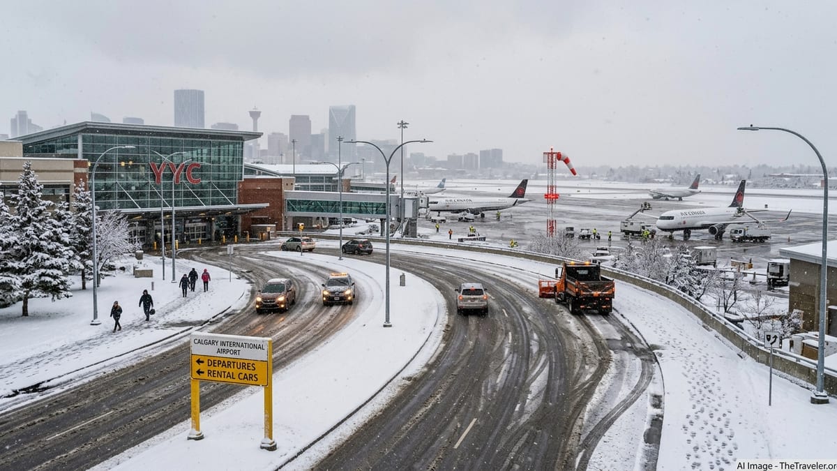
Within Calgary, municipal crews typically focus first on major arterials and high-volume routes, which means residential streets and secondary roads may remain snow-covered and rutted for longer, especially during the first 18 to 24 hours of a storm. Travelers relying on rideshare or taxis should build extra time into transfers between downtown hotels and Calgary International Airport, and pedestrians should be prepared for slick sidewalks and curb cuts while businesses and homeowners work through clearing obligations.
Conditions at Calgary International Airport
At Calgary International Airport, the snow is being managed through standard winter operations rather than emergency measures. Recent aviation reports for CYYC show temperatures around freezing, light winds and active runway surface condition assessments indicating a mix of wet pavement and thin wet snow, along with ongoing notices about runway surface treatment as conditions evolve.
Available flight-tracking and notice-to-air-mission data for November 18 show a normal pattern of winter operations: runway condition reports are being updated, but there is no indication of an airport-wide closure or blanket ground stop tied specifically to the snowfall warning. Winter weather can still cause individual delays or cancellations, especially on smaller regional routes or where aircraft must deice, so travelers should keep their plans flexible.
Passengers flying through YYC should monitor airline apps and airport flight-status tools closely on November 18 and into November 19. Extra time for check-in, security screening and potential deicing is advisable, and those with tight connections through other Canadian hubs may want to watch for knock-on delays if schedules compress during peak travel banks.
Short-Term Forecast and What Travelers Should Watch Next
Environment Canada’s Calgary forecast tied to this warning features periods of snow on Wednesday with daytime highs near plus 1 degree Celsius, which supports continued accumulation while allowing some compaction and slush on main routes. As the snow tapers Wednesday evening, conditions transition to mainly cloudy and colder weather, with daytime highs hovering near the freezing mark and overnight lows dropping to around minus 6 to minus 8 degrees Celsius from Thursday, November 19 onward.
Colder nights following fresh snow can lead to refreezing of slush and meltwater, so even once the warning is lifted, travelers should anticipate lingering icy patches on sidewalks, overpasses and less-traveled roads. Those renting cars or planning early-morning departures on November 19 should be particularly cautious on ramps, bridges and shaded areas that may remain slick.
Because active weather alerts and short-range forecasts are time-sensitive, anyone arriving in or departing from Calgary over the next 24 to 48 hours should recheck Environment Canada’s City of Calgary alert page and seven-day forecast before traveling. It is also important to review real-time road conditions and municipal snow-clearing updates, and to confirm flight status directly with airlines or Calgary International Airport. The current signal from federal forecasters is a moderate but impactful winter event, one that requires extra planning and caution rather than cancellations by default.