


More news on this day
Strong thunderstorms sweeping across the Charlotte region have disrupted air travel at Charlotte Douglas International Airport and cut electricity to thousands of homes and businesses as powerful wind gusts, intense lightning and heavy rain moved through the Carolinas.
Get the latest news straight to your inbox!
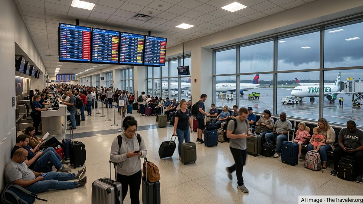
Flights Delayed and Grounded at Charlotte Douglas
Arrivals and departures at Charlotte Douglas International Airport were heavily disrupted as storms moved across the city, with flight-tracking data showing extensive delays and ground stops during the most intense periods of lightning and wind. Publicly available information indicates that ramp operations were repeatedly paused as lightning approached the airfield, a standard safety step that halts refueling and baggage handling and can quickly cascade into wider schedule disruptions.
Incoming flights were forced into holding patterns or diverted as visibility dropped and storm cells passed over the airport. Outbound flights faced rolling delays as aircraft waited for safe windows to depart and for crews and ground staff to be repositioned. The impact was felt most acutely on regional and connecting routes, where missed connections created additional backlogs for passengers already dealing with crowded summer schedules.
Charlotte Douglas has seen similar large-scale weather disruptions in recent seasons, including winter storms and tropical remnants that led to hundreds of cancellations in a single day, according to aviation and weather archives. Those previous events highlight how quickly operations at one of the nation’s busiest hubs can be affected when severe weather settles over the central Carolinas.
Analysts note that summer thunderstorms often arrive in multiple waves, meaning operations can recover briefly only to slow again as additional cells develop, a pattern that appeared to play out as storms repeatedly moved across the Charlotte metro area.
Thousands Lose Power Across the Charlotte Metro
As the storms intensified, utilities across the Charlotte region reported widespread power outages, with public outage maps showing thousands of customers without electricity at the peak of the event. The majority of interruptions clustered in neighborhoods with mature tree canopies and older above-ground distribution lines, areas that are especially vulnerable when saturated soil and high winds combine.
According to outage dashboards maintained by major power providers and aggregated by independent tracking services, scattered outages stretched from in-town neighborhoods to rapidly growing suburbs north and east of the city. Some customers experienced only brief interruptions, while others reported longer waits for restoration as crews navigated heavy rain, blocked streets and continued lightning.
Tree damage appears to have been a primary driver of the blackouts, with local broadcast reports and social media posts showing large limbs on lines and, in some cases, entire trees uprooted into roadways and yards. In similar recent storms, local stations documented incidents where trees crashed onto homes and vehicles in Charlotte’s older neighborhoods, underscoring the ongoing clash between dense urban tree cover and overhead power infrastructure.
Utilities in the region have warned in previous planning documents that more frequent intense storms can stress above-ground systems, prompting stepped-up vegetation management and strategic undergrounding projects in selected corridors. The latest wave of outages will likely draw renewed attention to how quickly power can be restored when storms arrive during peak summer demand.
Roads, Transit and Neighborhoods Feel the Impact
Beyond the airport and the power grid, transportation across the Charlotte area slowed significantly as heavy rain reduced visibility and pooled on major arteries. Reports from local outlets described intersections operating as four-way stops when traffic signals went dark, especially along busy corridors that connect central Charlotte with its suburban retail centers.
Transit riders also contended with delays as bus routes detoured around downed trees or temporarily flooded low-lying underpasses. Light rail and commuter services remained available but operated more slowly through rain and gusty conditions, adding minutes to already crowded peak-period trips. In some areas, debris on tracks required inspection before regular speeds could resume.
Neighborhoods across the city reported flashes of intense lightning and sudden bursts of wind, sometimes arriving after a period of relative calm. Residents posting on community forums and social platforms described loud thunderclaps, close lightning strikes and brief but violent downpours that sent water cascading down streets. Several posts referenced momentary power flickers even in areas that did not experience longer outages.
Emergency planners have repeatedly warned that such short, intense events can be as disruptive as longer-duration storms, especially when they coincide with evening commutes or travel peaks and when soil is already saturated from earlier rainfall.
Storms Add Pressure to an Already Active Weather Season
The latest round of severe weather arrives in the midst of a notably active year for the Carolinas, with repeated episodes of heavy rain, strong winds and severe thunderstorm watches stretching from the coast to the foothills. Recent weather outlooks from federal forecasters have highlighted the risk of strong to severe thunderstorms across North Carolina on multiple days, often citing damaging winds, lightning and localized flash flooding as primary hazards.
In the Charlotte region, recent weeks have already brought rain and wind from tropical remnants as well as strong frontal systems that produced tens of thousands of power outages across parts of the Carolinas. Local television coverage has shown toppled trees, damaged roofs and flooded streets from those earlier events, underscoring how quickly conditions can deteriorate when multiple systems track across the same areas in a short span of time.
Climate and infrastructure assessments prepared for the city point to a long-term increase in the number and intensity of weather events that can disrupt transportation and energy networks. These analyses warn that heavier downpours, stronger winds and warmer temperatures are likely to place additional strain on everything from stormwater drainage to airport operations, especially as population growth continues to concentrate more people and businesses in vulnerable corridors.
For residents, the pattern has translated into more frequent advisories to secure outdoor items, monitor forecasts closely and be prepared for short-notice changes to travel plans, whether by air or on the region’s highways.
Preparedness, Recovery and What Travelers Should Know
The combination of flight disruptions and power outages across Charlotte underscores the importance of basic preparedness steps for residents and visitors alike. Travel industry guidance based on past storms in the region suggests that passengers transiting through Charlotte Douglas during active weather should enroll in airline notifications, monitor flight status frequently and plan for the possibility of extended time at the airport if connecting flights are affected.
Travel planners note that when storms force repeated ground stops, even brief lulls in the weather may not immediately eliminate delays, as airlines work through backlogs of aircraft and crews that have been displaced by earlier interruptions. Passengers with flexible itineraries are frequently advised to consider early-morning departures, which can be less vulnerable to the cumulative effect of storms that build later in the day.
For households, local emergency management resources and consumer advisories consistently recommend keeping flashlights, charged battery packs and nonperishable food on hand during storm season, along with reviewing how garage doors, medical equipment and communication devices will function if power is lost. Residents in tree-lined neighborhoods are often encouraged to report leaning or damaged limbs near power lines well before storms arrive, giving utilities more time to address potential hazards.
As crews continue restoration work and airlines work to normalize schedules following the latest storms, public information from weather services and local media outlets indicates that additional rounds of showers and thunderstorms remain possible. For Charlotte, that means another period of closely watched radar images, shifting travel plans and an ongoing effort to strengthen critical infrastructure against the next sudden burst of severe weather.