
More news on this day
Thunderstorms over the Denver metro area on June 8 led to a ground delay program at Denver International Airport, where tracking data showed more than 750 flights running behind schedule through the afternoon and evening.
Get the latest news straight to your inbox!
Severe Weather Slows One of the Nation’s Busiest Hubs
Publicly available aviation data on June 8 indicated that Denver International Airport experienced a sharp spike in disruptions after strong thunderstorms moved across the metropolitan area, prompting a ground delay program that rippled through arrivals and departures. Flight-monitoring services showed more than 750 flights delayed at various points in the day, along with a smaller number of cancellations as airlines adjusted schedules.
Coverage from Colorado news outlets described a period of intense storms over the city, with heavy rain, lightning and strong winds sweeping across the plains east of downtown during the afternoon. The conditions coincided with a National Weather Service severe thunderstorm warning and a tornado watch over parts of the Front Range, adding further complexity for air traffic managers and airline operations teams.
Aviation status information indicated that arriving flights into Denver faced average delays on the order of three quarters of an hour during the peak of the disruption, with some routes held at their origin airports while the weather system moved through. Departures also slowed as ground crews temporarily cleared the ramp when lightning was detected in the vicinity, a standard safety measure at many large airports.
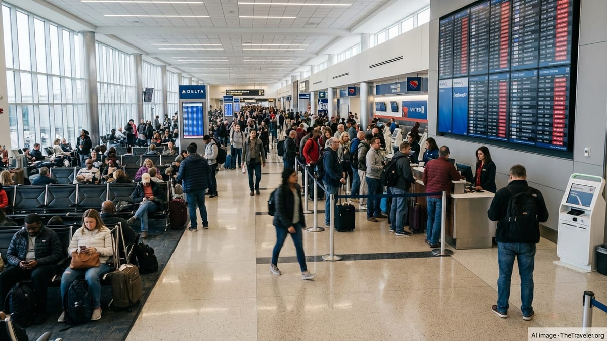
The combination of convective storms, a busy Sunday travel period and Denver’s role as a major connecting hub resulted in crowded terminals and extended waits for many travelers, particularly those with tight connections through the airport’s three concourses.
Ground Delay Program Limits Arrivals To Match Reduced Capacity
According to publicly accessible Federal Aviation Administration tools, a ground delay program is one of the primary traffic management strategies used when weather or other constraints limit an airport’s ability to accept its normal flow of arrivals. Instead of allowing flights to depart and then forcing them to circle in holding patterns, departure times at origin airports are pushed back to align with the reduced landing rate.
On June 8, the measure at Denver appeared to coincide with the most active phase of thunderstorms over the region, when crosswinds, low visibility and lightning reduced the number of operations that could safely be handled per hour. By metering inbound traffic in advance, the system sought to prevent airborne congestion over the Front Range and to keep fuel use and pilot duty-time impacts in check.
Ground delay programs typically generate cascading knock-on effects across the national airspace system, since delayed departures in one city can disrupt crew rotations and aircraft positioning for subsequent legs. With Denver serving as a central connecting hub for multiple large U.S. carriers, the June 8 slowdown was reflected on routes across the Mountain West, Midwest and coastal markets.
Industry analyses note that thunderstorms are among the most challenging weather phenomena for airlines and air traffic controllers, particularly during the warm season on the High Plains, when storm cells can rapidly intensify and drift across approach and departure paths.
Peak Summer Travel Meets Thunderstorm Season
The disruption unfolded as U.S. airports prepared for one of the busiest summer travel seasons in recent years, with passenger volumes near or above pre-pandemic levels on many key routes. Denver International Airport has ranked among the top three airports in the country by passenger traffic, which means even a short-lived weather event can translate into hundreds of delayed flights.
Historical patterns in the region show that late spring and early summer often bring frequent afternoon and evening thunderstorms to Colorado’s Front Range. Aviation-focused weather case studies for the Denver airspace describe recurring episodes in which storm clusters form over the foothills before moving east across the airport corridor, periodically forcing traffic management initiatives similar to those seen on June 8.
Travelers passing through Denver have long been advised to account for this seasonal volatility, especially for tight connections in the late afternoon and evening. Accounts shared on public forums by frequent flyers based in Denver often reference repeated experiences with short-notice ground stops or delay programs when lightning moves near the airfield.
The combination of large passenger volumes, ongoing airfield and terminal construction projects, and recurring convective weather can strain airport resources on peak days, from ramp staffing to baggage handling and concessions, as crowds build up in gate areas during extended hold times.
What Passengers Experienced On The Ground
Reports from local media and traveler postings described busy security checkpoints, long lines at airline service desks and packed gate areas as the delays accumulated on June 8. Many passengers faced rolling schedule changes as airlines updated departure estimates in 15 to 30 minute increments while monitoring radar imagery and traffic flow updates from the air traffic system.
Some travelers with late-afternoon connections through Denver found their inbound aircraft held at departure airports during the strongest storms, effectively pushing their itineraries into the evening and raising the risk of missed final legs. Others encountered extended waits on arriving aircraft parked short of the gate while lightning protocols restricted ground personnel from working on the ramp.
Airport operations information indicated that once the most intense cells moved east of the field, arrival rates gradually increased and departure queues began to shrink. However, with hundreds of flights already behind schedule, the backlog took hours to unwind, and some evening flights remained significantly delayed as airlines worked to reposition crews and aircraft.
As is common during widespread weather disruptions, travelers also reported challenges finding available seats on later flights, with rebooking options limited on heavily booked summer routes.
Broader Context For Weather-Related Disruptions
Data compiled by federal aviation agencies and industry groups consistently show that weather is a leading driver of flight disruptions in the United States, accounting for a substantial share of delays and a notable portion of cancellations each year. Thunderstorms, in particular, can reduce runway capacity, slow ground operations and constrain the use of key arrival and departure corridors.
Recent FAA performance and construction impact reports for Denver International Airport highlight both ongoing airfield rehabilitation work and seasonal weather risks as factors that can reduce the airport’s effective capacity during certain periods. Even modest decreases in throughput can quickly translate into long lines of aircraft on taxiways and extended wait times for passengers when scheduled operations are near peak levels.
The June 8 event fits into a broader pattern of geographically scattered, weather-driven disruptions that have affected major U.S. hubs in early June, including storms prompting ground delay programs at other large airports on separate days. For travelers, aviation analysts often recommend building additional connection time into itineraries during thunderstorm season and monitoring both airline notifications and airspace system status tools on the day of travel.
While Denver’s operations gradually normalized as the storms moved on, the episode underscored how quickly convective weather along the Front Range can ripple across the national network, turning an afternoon of thunder into a nationwide web of late arrivals and missed connections.