


More news on this day
A dense blanket of winter fog rolled across Brisbane early Thursday, severely reducing visibility across the city, diverting flights from Brisbane Airport and slowing the morning commute on key roads and motorways.
Get the latest news straight to your inbox!
Flights Diverted as Visibility Plunges at Brisbane Airport
Low cloud and thick fog over Brisbane Airport in the early hours led to visibility dropping to just a few hundred metres at times, according to publicly available aviation weather briefings. Forecast data indicated that a post-rain fog bank formed over the city and drifted toward the airport precinct, with conditions below typical landing minima for some services.
Flight-tracking data and local media coverage indicate that several inbound domestic services were placed into holding patterns offshore before either delaying their approach or diverting to alternate airports. Passengers reported extended time on the tarmac and in terminal lounges as airlines adjusted schedules and repositioned aircraft.
Airport operation notices published by Brisbane Airport Corporation urged travellers to monitor airline communications and in-terminal information displays for late changes to gate allocations and departure times. While the core terminal infrastructure remained fully open, the heavy reliance on instrument-guided landings during periods of low visibility meant that throughput was temporarily reduced.
Air traffic management documentation for the Brisbane airspace shows that winter fog is a known operational risk, with procedures in place for rerouting, stacking and, if necessary, diverting flights when runway visibility drops below prescribed thresholds.
Commuters Confront Slow Traffic and Hidden Hazards
Beneath the cloud layer, Brisbane’s road network also slowed to a crawl through the morning peak as drivers navigated obscured line markings, reduced sight distances and patches of lingering moisture on major arterials. Reports from state traffic information services described reduced-visibility conditions on approaches to the city and along stretches of the Logan and Gateway motorways.
Motorists shared images and accounts of headlights vanishing into grey haze just a few car lengths ahead, with some describing travel speeds well below posted limits on elevated sections and river crossings. Publicly available traffic dashboards showed congestion building earlier than usual on key commuting corridors, particularly in low-lying suburbs and river-adjacent districts more prone to fog accumulation.
Public transport services continued to operate, but buses and surface rail services experienced minor timetable slippage as drivers exercised extra caution at level crossings and major intersections. Transport advisories encouraged commuters to allow additional travel time and to use low-beam headlights, reinforcing standard winter driving guidance.
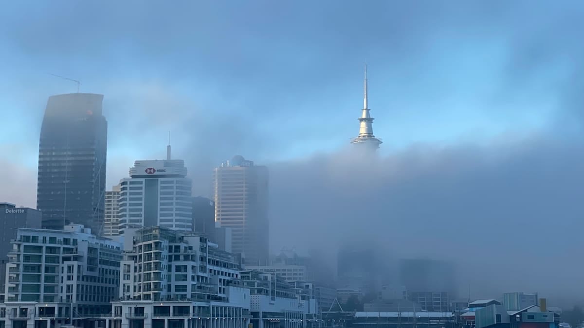
In the city centre, the fog softened the skyline and obscured high-rise rooftops for several hours after sunrise, with visibility improving only gradually as the sun strengthened and light winds began to disperse the low cloud.
Why Brisbane’s Winter Fog Can Turn Severe
Meteorological guidance from the Bureau of Meteorology notes that Brisbane can experience dense advection and radiation fog when moist air lingers after rain and overnight winds fall calm. Under these conditions, the air near the surface cools quickly, condensing moisture into a low, uniform cloud that can sit over the city and its coastal approaches.
Aviation-focused educational material for the region highlights that even relatively short-lived fog episodes can have outsized impacts on airport operations, as modern safety rules require specific runway visual ranges for take-offs and landings. When visibility drops below those limits, aircraft may be forced to delay, hold, or divert, even if conditions appear manageable from the ground.
Climate data for Brisbane Airport show that dense fog events are most common in the cooler months, particularly in July and August, when clear overnight skies and residual humidity coincide. On Thursday, the combination of prior shower activity, high humidity and a stable air mass created just such a scenario, with the fog lingering well into the morning in sheltered suburbs and along waterways.
Weather outlooks issued later in the day pointed to improving conditions as a ridge of high pressure settled over southeast Queensland, with clearer skies expected to reduce the likelihood of repeated fog of the same intensity in the immediate term.
Ripple Effects for Travellers and Local Tourism
The disruption came during the busy mid-winter travel period, when domestic leisure demand to and from Queensland remains strong. Travellers heading for school holiday trips and short breaks reported missed connections and rebooked itineraries as airlines reshuffled aircraft across the domestic network.
Travel industry commentary suggested that most affected passengers were being accommodated on later same-day services, but some itineraries involving tight connections to regional Queensland or onward international flights faced more significant reshaping. For visitors on short stays in Brisbane and the Gold Coast, the lost hours at the start of a trip represented a noticeable dent in already compressed itineraries.
Local tourism operators noted that weather-related disruptions, while relatively common in aviation, still create a perception risk for time-poor travellers choosing weekend city breaks. At the same time, the dramatic scenes of skyscrapers and river bends disappearing into cloud prompted a surge of social media posts, inadvertently showcasing Brisbane’s subtropical winter mood to a global audience.
Travel analysts observed that events like Thursday’s fog episode reinforce the value of flexible booking options and travel insurance for passengers, particularly on itineraries involving multiple sectors or separate tickets across different carriers.
What Travellers Should Do When Fog Strikes
Consumer travel advisories consistently recommend that passengers check their flight status before leaving for the airport during adverse weather, including fog, storms or strong winds. On Thursday morning, many Brisbane travellers relied on airline apps and airport displays to track rolling departure and arrival estimates as conditions evolved.
Experts in air traffic management and passenger rights point out that, in most jurisdictions, weather disruptions fall under force majeure or similar categories, limiting compensation obligations but not removing carriers’ responsibilities for care such as rebooking assistance and basic support in the terminal.
For road users, safety agencies advise maintaining longer following distances, using low-beam headlights rather than high beams in fog, and avoiding sudden braking or lane changes. Thursday’s congestion patterns around Brisbane indicated that many motorists opted to delay or stagger their trips, reducing the risk of serious incidents despite the challenging visibility.
With cooler mornings still ahead in southeast Queensland’s winter, aviation and transport planners are expected to keep a close watch on overnight humidity and wind conditions, aiming to anticipate similar fog events and minimise the scale of disruption for both air travellers and daily commuters.