
More news on this day
Northern Ireland faces a period of heavy downpours, hail and frequent lightning on Tuesday 30 June, with a yellow thunderstorm warning in force and the potential for localised flooding and travel disruption.
Get the latest news straight to your inbox!
When the thunderstorm warning is in force
Publicly available information from the Met Office indicates that a yellow thunderstorm warning covers all six counties of Northern Ireland for much of Tuesday 30 June. The alert follows overnight rain and is expected to coincide with the development of intense showers and thunderstorms through the afternoon and into the evening.
The warning window runs from late morning into tonight, with the most intense activity forecast during the mid to late afternoon when daytime heating peaks. Forecasters expect scattered thunderstorms to form over a broad area rather than a single organised band, meaning some locations may see very little rainfall while nearby communities experience torrential downpours.
The alert is part of a wider spell of unsettled early summer weather across the UK and Ireland, following several days of high temperatures that have left the atmosphere primed for vigorous convective storms. Previous thunderstorm warnings in recent days have already brought disruptive conditions to parts of Ireland and the UK, heightening concern about the potential for further impacts today.
Although the current warning is at the yellow level, which signals the possibility rather than the certainty of severe impacts, the Met Office notes that where storms do occur they could be intense over a short period. As a result, travel operators and local authorities are preparing for rapidly changing conditions on road and rail routes.
Rainfall, flooding and lightning risks
Guidance linked to the warning suggests that rainfall rates could be high enough to produce localised surface water flooding, particularly in urban areas and locations with poor drainage. Slow-moving or repeated storms over the same area could quickly overwhelm drains and culverts, sending water across roads and into low-lying properties.
Even brief bursts of heavy rain may be enough to cause standing water on key commuter routes, increasing the risk of aquaplaning and making braking distances significantly longer. In rural districts, intense downpours on already saturated or sun-baked ground can trigger rapid runoff, filling ditches and minor watercourses and leading to sudden, short-lived flooding of nearby lanes.
The convective nature of today’s storms also brings a heightened lightning risk. The Met Office and other forecasters highlight the potential for frequent cloud-to-ground strikes within stronger cells, raising the chance of isolated power interruptions, damage to exposed infrastructure and hazards for people caught in the open.
Some storms may produce small hail and gusty winds, which can briefly reduce visibility for drivers and create difficult conditions for cyclists and motorcyclists. Short-lived squally gusts may also pose risks near scaffolding, temporary structures and trees that are already in full leaf.
Expected impact on travel and transport
Recent statements from transport and safety agencies across Ireland and the UK emphasise that heavy showers and thunderstorms of the type forecast for Northern Ireland can cause sudden disruption on road and public transport networks. Even where rainfall totals are modest over the course of the day, intense bursts at peak times can be enough to slow or temporarily halt traffic flows.
On main roads and motorways, surface water can quickly accumulate in dips, underpasses and near blocked drains, forcing vehicles to change lanes or reduce speed sharply. On minor roads, particularly in rural areas, runoff from nearby fields can spread mud and debris across the carriageway, catching drivers by surprise and reducing grip.
Rail services may also face delays if torrential rain leads to localised flooding on the line or if lightning affects signalling and power systems. Previous episodes of similar weather in the region have led to speed restrictions and short-notice alterations to timetables, with knock-on effects for commuters during the evening peak.
Airports and ferry ports are not expected to see widespread disruption, but short delays remain possible if thunderstorms pass close to key terminals. Aircraft may need to adjust approach patterns during periods of intense lightning or heavy rain, while ferry services can be affected by reduced visibility and squally winds around storm cells.
Advice for motorists and travellers
Road safety campaigns in Ireland in recent days, issued in connection with comparable thunderstorm warnings, have urged motorists to slow down, increase stopping distances and be prepared for sudden pools of water on the road. Similar guidance is relevant for Northern Ireland today, particularly for those driving on unfamiliar routes or during heavier showers.
Drivers are advised to check traffic updates before setting out, allow extra time for journeys and avoid driving through floodwater where depth is uncertain. Even shallow water can hide potholes or debris, while deeper sections may stall engines or sweep lighter vehicles off course. Motorcyclists and cyclists are especially vulnerable to sudden changes in road conditions and reduced visibility in heavy rain.
Rail and bus passengers are encouraged to monitor operator updates for any weather-related delays or diversions, especially during the afternoon and evening peak. Those with time-sensitive connections may wish to travel earlier where possible or build additional flexibility into their plans in case storms intensify near key hubs.
For people planning outdoor activities, forecasters recommend staying alert to rapidly changing skies, having a clear route to shelter and avoiding exposed hilltops, open water and tall isolated structures during any thunderstorm. Short, sharp storms can develop with relatively little warning once the atmosphere becomes unstable.
What to watch for as conditions evolve
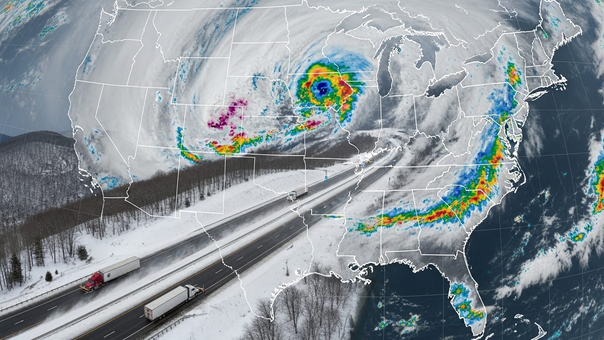
Meteorologists note that the precise distribution of thunderstorms is highly sensitive to small-scale features, meaning that radar and satellite imagery during the day will provide the clearest picture of where the heaviest rain is developing. Travellers and residents are encouraged to pay attention to short-range updates and adjust plans accordingly.
If storm cells repeatedly form over the same area, rainfall totals could climb quickly, increasing the likelihood of localised flooding and more significant travel disruption. In contrast, if storms remain more scattered and move through swiftly, impacts may be limited to brief but intense downpours and minor delays.
Emergency planners and local services will be monitoring river levels and known surface water hotspots through the day, drawing on flood guidance products produced jointly by the Met Office and environmental agencies. Any escalation in risk would likely prompt further public messaging on travel and safety.
For now, the yellow-level alert signals a day in which conditions may vary dramatically over short distances. While some parts of Northern Ireland may see little more than a few showers, others could experience intense thunderstorms, flash flooding and disruption to journeys, particularly during the afternoon and evening period when the warning is in force.