


More news on this day
A widespread yellow fog warning is in force across parts of England and Wales, with meteorological guidance indicating visibility could fall below 50 metres in places and create significant disruption for travellers on one of the busiest Sundays in the autumn calendar.
Get the latest news straight to your inbox!
Yellow warning covers large swathes of England and Wales
Publicly available information from the Met Office on 8 November 2026 shows a yellow weather warning for fog in place across large areas of central, southern and northern England, extending into parts of Wales. The warning window generally runs from 18:00 on Sunday 8 November to late morning on Monday 9 November, though some regions have seen fog lingering from the early hours.
The alert cites dense fog patches with visibility falling to around 50 metres or less, particularly overnight, creating what forecasters describe as difficult travel conditions. Recent coverage of conditions in counties including Lancashire, Yorkshire and parts of the Midlands points to widespread low cloud and fog through the morning, with the potential for further thickening after dark as temperatures drop and winds remain light.
Several regional outlets report that this latest warning has been assigned a high likelihood and moderate impact level, signalling that forecasters consider fog very probable across the warning area, with a realistic chance of noticeable disruption to everyday activities and transport on key intercity corridors.
Meteorological background published in late October explains that autumn’s longer nights and clearer skies in the United Kingdom can create a favourable setup for radiation fog, where heat escapes from the ground overnight, cooling the air close to the surface and allowing moisture to condense into thick banks of fog that can persist well after sunrise.
Road, rail and air passengers advised to expect delays
Travel-focused statements incorporated into the fog warning highlight a range of possible impacts for people on the move, from slower road journeys to delays on rail routes and disruption at airports within the affected region. Reports from national broadcasters and regional newsrooms on the morning of 8 November describe already reduced speeds on motorways and A roads where thick fog has settled in low-lying areas and river valleys.
On major routes such as segments of the M6 and other cross-country corridors in northern and central England, local coverage has described visibility in places dropping to around 50 metres, prompting drivers to reduce speed significantly. Guidance from road safety campaigns notes that when visibility shrinks to just a few dozen metres, motorists have only a second or two to react to hazards at typical highway speeds, making tailgating and sudden braking particularly risky.
Passengers using intercity rail services are also being warned via operator bulletins and news reports to check for short-notice changes. While trains are generally less directly affected by fog than roads or aviation, dense banks of low cloud can slow operations where additional signalling checks are required or where rail infrastructure crosses congested road networks around stations and level crossings.
Air travel is considered especially vulnerable to this type of weather pattern. According to published coverage on 8 November, airports serving the warning area face the possibility of delayed departures and diversions if visibility at runways drops below operational thresholds. Even limited timetable changes early in the day can create knock-on effects for travellers connecting through hub airports later in the evening.
Met Office explains why fog warnings are relatively rare
Background material from the Met Office indicates that formal weather warnings for fog are issued less often than alerts for hazards such as strong wind or heavy rain. One reason given is that dense fog of the severity required for a warning tends to be more localised and can vary sharply over short distances, which makes forecasting precise impacts more challenging.
Guidance published by the agency notes that the most disruptive conditions typically occur when visibility falls below about 50 metres, a threshold at which severe disruption to road transport becomes more likely. In such situations, stretches of motorway or key arterial routes may be affected on and off through the night and early morning, while nearby areas remain relatively clear.
The current yellow warning therefore reflects a balance of likelihood and impact, acknowledging that not every location within the shaded area will see extremely poor visibility at the same time, but that some stretches of road, rail approaches and airport environs could briefly experience conditions well below normal safety margins.
Travel industry observers point out that this kind of marginal but widespread hazard can be especially challenging for planners, who must weigh the risk of significant delays against the cost and complexity of large-scale cancellations when conditions might improve quickly as the sun rises or a light breeze develops.
Practical guidance for travellers facing very low visibility
Transport and weather agencies provide a consistent set of recommendations for travellers when dense fog is forecast. Drivers are urged in public advisories to slow down, increase following distances, and use dipped headlights rather than full beam, which can reflect off water droplets and further reduce visibility. In some cases, variable speed limits and motorway warning signs may be activated to encourage safer driving speeds.
Published safety campaigns also emphasise the importance of avoiding sudden lane changes and heavy braking in foggy conditions, as other drivers may not be able to react in time when visibility is restricted to a few dozen metres. Motorists are encouraged to allow extra journey time, avoid non-essential travel during the worst of the fog, and be prepared for lower speed limits in affected zones.
Rail passengers are advised through operator notices to monitor service updates, particularly for early-morning departures, and to plan connections with additional buffer time. Where fog affects larger hub stations or busy commuter routes, minor signalling delays can accumulate and affect timetables across a wide region well into the late morning.
For air travellers, airlines and airport operators are directing customers via public channels to check flight status before leaving home and to consider carrying hand luggage where possible, in case short-notice rebooking is required. Even when an airport remains open, low-visibility operating procedures can reduce the rate at which aircraft are able to land and depart, increasing the chance of queues on the ground and missed onward connections.
What the warning means for the days ahead
While the current yellow fog warning for England and Wales is set to expire by late morning on Monday 9 November, meteorological blogs and seasonal outlooks indicate that the same pattern of clear nights, light winds and cooler air could repeat in the coming weeks. This raises the possibility of further episodes of dense fog, particularly across inland valleys and transport corridors with a history of autumn and winter visibility issues.
Travel planners and tourism businesses are paying close attention to evolving forecasts, especially with a busy run of late-autumn events and weekend getaways on the horizon. Any repeat of widespread sub-50-metre visibility on peak travel days could have a noticeable impact on hotel check-in times, excursion schedules and the smooth operation of coach tours.
For visitors already in the United Kingdom, the situation underlines the value of flexible itineraries and real-time information. Travellers booking advance tickets on trains or low-cost flights are being encouraged, via consumer advice columns and transport provider notices, to review the small print on change fees and refund policies in case of weather-related disruption.
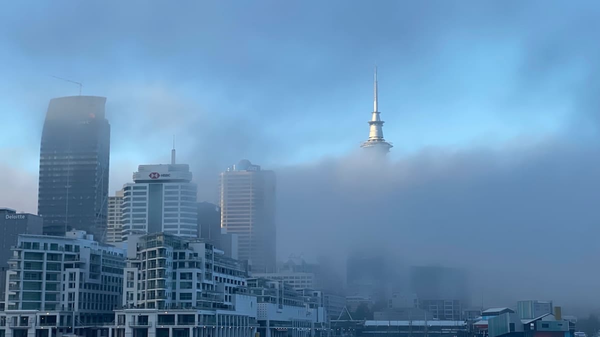
Although fog of this intensity can transform familiar landscapes and city skylines into atmospheric scenes, the latest warnings serve as a reminder that very low visibility is primarily a safety concern. Those planning journeys across the affected parts of England and Wales in the coming hours are being urged by public guidance to stay informed, allow additional time and adjust plans where necessary as conditions evolve.