


More news on this day
A widespread blanket of dense fog across parts of England and Wales has prompted a Met Office yellow warning covering 36 local authority areas this morning, with drivers, rail users and air passengers advised to expect slower journeys and possible disruption.
Get the latest news straight to your inbox!
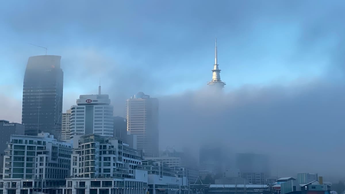
Yellow fog warning in force this morning
The Met Office issued the yellow fog warning at around 04:10 UTC on Saturday 31 October 2026, with the alert active from 04:00 to 10:00. Publicly available forecast information indicates that patches of dense fog are reducing visibility to below 100 metres in places, particularly during the early morning peak.
The warning follows a similar alert for fog on Friday morning and comes after a period of unsettled weather linked to recent autumn storms. Forecasters indicate that, while winds have eased compared with last weekend’s severe conditions, the calmer air is allowing fog to form and persist over a wide area.
According to the Met Office’s online guidance, yellow warnings highlight weather that could bring some disruption to travel in a number of locations even if the overall impact remains moderate. In this case, the main concerns centre on reduced visibility on roads and at transport hubs, especially during the busiest travel window of the morning.
Forecast detail suggests that fog will slowly thin, lift and clear later in the morning, although in some spots it may linger into the early afternoon. Conditions are expected to improve from late morning onward as temperatures rise and light winds begin to disperse low cloud and mist.
36 areas across England and Wales affected
The current warning spans parts of the East Midlands, East of England, London and the South East, the North West, Wales, the West Midlands and Yorkshire and the Humber. Coverage includes both urban centres and key inter‑regional routes used by commuters, holidaymakers and freight traffic.
In the East Midlands, the alert extends across Derby, Derbyshire, Leicester, Leicestershire, Lincolnshire, Northamptonshire, Nottingham, Nottinghamshire and Rutland. These areas include long stretches of the M1 corridor and connecting A‑roads that link the Midlands with northern and southern England.
Further east, Bedford, Cambridgeshire, Central Bedfordshire, Hertfordshire, Norfolk and Peterborough fall within the warning area, taking in parts of the A1, A11 and A14. In London and the South East, Buckinghamshire and Milton Keynes are included, again affecting sections of the motorway and trunk road network radiating from the capital.
To the north and west, Cheshire East and Cheshire West and Chester, Denbighshire, Flintshire, Powys and Wrexham in Wales, as well as Shropshire, Staffordshire, Stoke‑on‑Trent and Telford and Wrekin in the West Midlands, are covered. In Yorkshire and the Humber, the warning takes in East Riding of Yorkshire, Kingston upon Hull, North East Lincolnshire, North Lincolnshire, North Yorkshire, South Yorkshire, West Yorkshire and York, an area that includes several of northern England’s busiest city regions.
Travel disruption risk for road, rail and air passengers
Guidance published alongside the warning notes that slower journey times are likely on many roads, with particularly challenging conditions where visibility suddenly drops on rural routes, across open farmland or near rivers and low‑lying ground. Drivers setting out before fog has lifted are advised to expect changing visibility over short distances.
Publicly available travel advice indicates that bus and rail services may also experience delays where reduced visibility requires slower running or leads to knock‑on congestion at stations and junctions. Morning commuter services in and out of major hubs such as Nottingham, Leeds, York and Birmingham could be affected until conditions improve.
The aviation sector is also highlighted as vulnerable, with the risk of delays or cancellations where fog affects visibility on runways and at airport approach points. Regional airports within the warning zone, as well as larger gateways serving the Midlands and northern England, may need to adjust schedules or temporarily suspend operations while visibility remains below operational thresholds.
Ferry and port operations along the east coast and in North Wales can also be affected by dense fog, which restricts visibility for harbour movements. Operators are expected to monitor the situation closely and adjust sailings if required for safety reasons.
What the Met Office warning system means
The fog alert in place this morning is classified as a yellow warning under the Met Office National Severe Weather Warning Service. Official guidance on the warning system explains that yellow warnings indicate a likelihood of lower‑level impacts, such as some travel disruption and difficult driving conditions, across a broader area.
Under the colour‑coded scheme, fog, rain, wind, snow, ice, thunderstorms and extreme heat are all assessed using a combination of likelihood and impact. While amber and red warnings are reserved for more severe events where the risk to life and infrastructure is higher, yellow warnings such as today’s still merit attention, particularly for those making essential journeys early in the day.
For this particular alert, the Met Office notes that the likelihood of fog forming is rated as high, while the anticipated impact is moderate. The primary hazards relate to sudden reductions in visibility and the potential for minor transport disruption if routes become congested or if delays build across different parts of the network.
Travellers are encouraged to consult the latest forecast and warning updates before setting out, as the extent and intensity of fog can change quickly. The Met Office suggests that warning areas and end times may be adjusted as more observational data becomes available through the morning.
Practical advice for travellers and holidaymakers
Public guidance from meteorological and transport agencies offers several practical steps for those travelling through the affected regions. Motorists are advised to allow extra time for journeys, reduce speed in line with visibility, and ensure that headlights and fog lights are working correctly before departure.
Drivers are also encouraged to keep greater distances from the vehicle in front, avoid sudden braking where possible and watch for pedestrians or cyclists who may be harder to see. On multi‑lane roads, heavy spray and pockets of thicker fog can appear without warning, making lane changes and overtaking maneuvers more hazardous.
Rail passengers are advised to check live departure boards and operator updates, particularly for early‑morning services. Although fog does not always lead to major timetable changes, previous events have shown that short delays can accumulate where trains are required to run at reduced speeds or where signalling systems are affected by low visibility.
Air travellers with morning departures or arrivals at airports inside or near the warning area are urged to verify the status of their flights before leaving home, as schedule changes can occur at short notice when visibility drops. For those with onward international connections, building in additional transfer time can reduce the risk of missed links if operations are temporarily curtailed.