


More news on this day
More than 4,000 flights across the United States faced delays as Tropical Storm Bertha made landfall along the Gulf Coast this week, disrupting major airline operations and stranding travelers nationwide just as the midsummer travel rush peaks.
Get the latest news straight to your inbox!
Storm’s Landfall Triggers Systemwide Disruptions
Tropical Storm Bertha came ashore in southern Louisiana on Wednesday, July 22, bringing heavy rain, coastal flooding and strong winds to parts of the Gulf Coast. Publicly available information from the National Hurricane Center indicates the storm first made landfall in St. Bernard Parish, southeast of New Orleans, before tracking west toward the Texas border.
Bertha’s wide wind field and intense rain bands swept over several major aviation hubs, including New Orleans, Houston and other Gulf Coast airports. As the storm shifted west and then inland, bands of thunderstorms and low ceilings forced ground stops and reroutes, backing up departures and arrivals across multiple regions.
According to airline tracking data referenced in published coverage, the number of delayed flights in the United States climbed past 4,000 within hours of Bertha’s landfall, with hundreds more flights canceled outright. Those totals continued to fluctuate through Thursday as the weakening system moved farther inland yet remained strong enough to disrupt air traffic flows.
The impact extended well beyond the Gulf states. Once crews and aircraft were out of position, delays rippled through the broader network, affecting flights on the East Coast, the Midwest and even transcontinental routes that rely on aircraft cycling through storm-affected hubs.
Key Hubs Along the Gulf Coast Bear the Brunt
Airports closest to Bertha’s path experienced some of the most significant operational challenges. New Orleans Lakefront and Louis Armstrong New Orleans International saw periods of gusty winds and reduced visibility as the center of the storm approached and moved inland. Reports indicate that Houston-area airports later faced similar conditions as Bertha drifter toward the Texas-Louisiana border.
Ground delays at these facilities contributed to a cascading effect across airline networks. When departures are held for lightning, heavy rain or crosswinds, arriving flights may be left circling in the air or diverted, while subsequent rotations for those aircraft are delayed or canceled. This pattern played out repeatedly as Bertha’s outer bands swept through the region in waves.
Airlines also had to adjust operations at smaller Gulf Coast airports where storm surge, localized flooding and strong gusts complicated ramp work. Published reports describe intermittent power interruptions and flooded access roads in low-lying communities, conditions that can slow refueling, baggage handling and boarding even when the runways themselves remain usable.
Because many carriers rely on Gulf Coast routes to feed traffic into larger national and international hubs, the disruption at regional airports had an outsized effect on connections, particularly for travelers heading to or from Latin America and the Caribbean.
Travelers Face Long Lines, Missed Connections and Limited Options
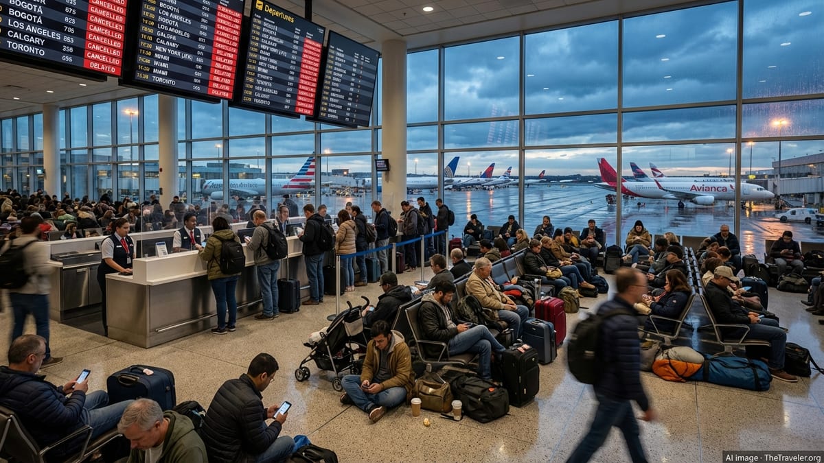
For passengers, the operational strain translated into hours-long lines at customer service counters and gate podiums, as well as crowded concourses filled with stranded travelers. Social media posts and local news segments on Thursday showed full departure boards dominated by yellow and red delay markers in multiple cities.
With flight crews frequently timing out after extended duty periods caused by diversions and holds, rebooking became increasingly complex. In many cases, travelers attempting to reach smaller markets were told the next available confirmed seat could be more than 24 hours away, especially where airlines operate limited daily frequencies.
Publicly available guidance from major carriers urged customers with flexible plans to postpone nonessential trips to and from the Gulf region. Others encouraged travelers to use mobile apps and text alerts rather than airport ticket counters to request refunds, future travel credits or same-day changes, in an effort to reduce congestion at already strained terminals.
Some airports opened additional seating areas and maintained extended concessions hours to accommodate the volume of delayed passengers. Nonetheless, widespread reports described families sleeping in gate areas and scrambling for hotel rooms near major hubs as evening departures were scrubbed from the schedule.
Airlines Activate Weather Waivers and Recovery Plans
As Bertha approached, airlines issued weather waivers that allowed affected customers to change itineraries without standard fees. These waivers typically covered a broad swath of Gulf Coast destinations, along with select inland airports expected to see heavy rain and thunderstorms from the storm’s remnants.
Recovery plans centered on repositioning aircraft and crews once conditions allowed, with carriers aiming to restore a normal schedule by late week if weather cooperated. In practical terms, that meant concentrating resources first on high-demand trunk routes and then gradually rebuilding capacity on thinner regional links.
According to operational updates cited in national media, some carriers dispatched larger aircraft on select routes to accommodate backlogged passengers where gate and runway capacity allowed. Others trimmed late-night and very early morning services, focusing instead on mid-day and afternoon departures when weather windows appeared more favorable.
Airport operators, meanwhile, continued routine inspections of runways and taxiways for standing water, foreign object debris and minor damage. While early assessments suggested limited direct structural impact from Bertha at most major airports, even temporary closures for inspection added minutes and sometimes hours to ground delays.
What Travelers Can Expect in the Coming Days
As of Friday, July 24, Bertha has weakened substantially after making a second landfall near the Texas-Louisiana border and tracking farther inland. Forecast discussions from the National Hurricane Center indicate the system is expected to continue losing strength, reducing the direct weather threat to airports but leaving behind a complex tangle of schedule disruptions.
Travelers with upcoming flights through Gulf Coast hubs are still being advised, in publicly available guidance, to monitor their reservations closely. Even as skies clear, aircraft and crew imbalances can linger for several days, particularly for routes with limited daily frequencies or tight connection windows.
Industry analysts note that the disruption caused by Bertha comes during an already busy summer travel period, when high load factors leave airlines with little spare capacity to absorb sudden schedule shocks. As a result, travelers may see fewer standby opportunities and longer waits for open seats if additional weather systems emerge in the Atlantic or along typical thunderstorm corridors.
For now, the most reliable strategies for affected passengers include checking flight status repeatedly before leaving for the airport, making use of airline mobile apps to adjust itineraries when possible, and preparing for longer-than-normal lines and wait times at security, boarding and baggage claim in regions touched by Bertha’s path.