


More news on this day
As federal interest in the United States Marine Highway Program grows, Alaska is sharpening its focus on two strategically important coastal communities, Ketchikan in the southeast and Unalaska in the Aleutian chain, positioning them as key nodes in a national waterborne transportation network.
Get the latest news straight to your inbox!
Alaska’s Coastal Towns in a National Freight Strategy
Publicly available information from the U.S. Maritime Administration describes the United States Marine Highway Program as a national effort to shift more freight to coastal and inland waterways, easing pressure on congested roads and rail corridors. Within that framework, Alaska’s waters are organized into major routes such as the M-5 Pacific coastal corridor and the M-11 Alaska coastal route, which trace the state’s long, sparsely served shoreline.
Maps and federal route lists show Unalaska, home to Dutch Harbor, as the western anchor of the M-5 Alaska segment, extending the continental Pacific marine corridor deep into the Aleutian Islands. Ketchikan, by contrast, appears as a critical southeastern gateway at the southern end of the Alaska Marine Highway System, where ferries and cargo services connect local residents, regional trade, and travelers coming from the continental United States.
Policy documents indicate that the Marine Highway Program’s competitive grants and project designations are increasingly targeted toward reinforcing such strategic nodes. In Alaska, that has meant federal project recognition for services like the Unalaska Express barge operation on the M-5 route and support for regional freight initiatives that rely on connections through Ketchikan and other southeast ports.
The resulting picture is of a state whose maritime communities are no longer treated simply as remote endpoints. Instead, they are being framed as essential components in a growing national system of marine freight corridors, with the potential to absorb more cargo from land routes while supporting local economies that depend heavily on both maritime logistics and tourism.
Ketchikan’s Dual Role as Ferry Hub and Scenic Gateway
State transportation materials describe Ketchikan as a headquarters and operational center for the Alaska Marine Highway System, which runs a 3,500-mile network of ferry routes connecting dozens of coastal communities. The city’s ferry terminal facilities serve as a junction for vessels that carry passengers, vehicles, and goods north along the Inside Passage and south toward the lower 48 states.
These ferry routes are woven into the federal Marine Highway framework and are recognized as a designated national corridor. The Alaska Marine Highway was named a National Scenic Byway and later an All-American Road, underscoring Ketchikan’s importance not only in freight and basic mobility but also in tourism and scenic travel along the U.S. coastline.
Recent state project lists show ongoing investment in Ketchikan’s ferry terminals and associated infrastructure, reflecting an effort to maintain and upgrade the facilities that underpin its role in the marine highway. These improvements are positioned as key to sustaining reliable service for residents of roadless communities and for shippers moving goods between Alaska and the continental United States.
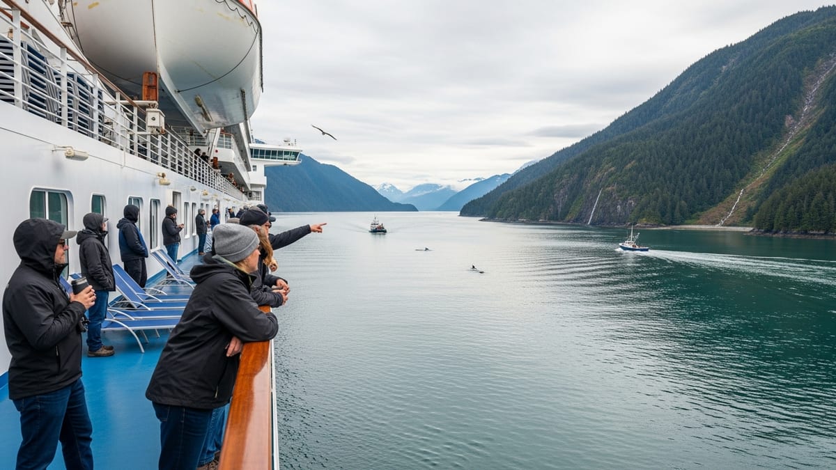
For travelers, Ketchikan continues to function as a primary point of entry into Alaska’s coastal landscape, where ferries, cruise vessels, and cargo operations converge. Within the broader Marine Highway narrative, this makes the city a visible symbol of how federal freight policy intersects with local transportation needs and visitor-focused economies.
Unalaska’s Dutch Harbor Emerges as a Western Anchor
On the opposite end of Alaska’s maritime network, Unalaska and its International Port of Dutch Harbor appear in federal Marine Highway project announcements as a growing freight hub. Published program descriptions highlight the Unalaska Express project, which supports barge services moving containerized cargo along the M-5 Alaska route, linking Dutch Harbor with Kodiak, Seward, and Valdez.
These barge operations form part of a supply chain that brings essential goods to remote communities and moves outbound commodities such as seafood to broader markets. Dutch Harbor is widely recognized as one of the nation’s busiest fishing ports, and its integration into the Marine Highway framework aligns federal freight planning with longstanding commercial activity in the Aleutians.
By designating marine highway projects in and around Unalaska, the Maritime Administration has made this region eligible for federal grants that can support terminal expansion, equipment upgrades, and operational improvements. Reports indicate that such funding is intended to enhance reliability and capacity for both domestic and international cargo flows that converge at Dutch Harbor.
In policy terms, Unalaska’s position at the far western edge of the M-5 route illustrates how the Marine Highway Program is being used to formalize and support maritime corridors that already serve as lifelines for remote communities, while also strengthening their role in national supply chains that extend across the Pacific.
Federal Grants and Alaska’s Strategic Freight Planning
The United States Marine Highway Program is authorized to fund projects that shift freight to waterways, relieve landside congestion, and support rural and tribal communities. Recent funding notices show that port authorities, state agencies, and private operators can apply for grants that cover a significant share of eligible project costs, especially for projects in rural locations such as many Alaska ports.
Alaska’s statewide freight plans reference the Marine Highway routes off Ketchikan and Unalaska as essential corridors for moving goods in and out of isolated communities. These documents outline a multimodal strategy in which ferries, barges, and coastal shipping complement limited highway and aviation infrastructure, reinforcing the argument that marine investments can deliver outsized benefits in sparsely populated regions.
Publicly available grant materials for the current fiscal cycle indicate that marine highway proposals are evaluated on their ability to improve freight efficiency, environmental performance, and economic resilience. For Alaska, projects tied to Ketchikan’s ferry terminals or Unalaska’s barge facilities can demonstrate wide-ranging impacts, from lower logistics costs for local businesses to more reliable delivery of food, fuel, and construction materials.
As federal transportation policy continues to emphasize supply chain resiliency, Alaska’s marine corridors are likely to remain prominent candidates for support. Their combination of strategic geography, existing maritime traffic, and limited overland alternatives aligns closely with the stated goals of the Marine Highway Program, keeping Ketchikan and Unalaska at the center of planning conversations.
Tourism, Community Access, and the Future of the Marine Highway
Beyond freight, the marine corridors linking Ketchikan and Unalaska play a crucial role in passenger travel and community access. The Alaska Marine Highway System provides essential links to towns without road connections, and Ketchikan serves as a major embarkation point for residents and visitors navigating the Inside Passage.
At the same time, tourism industries in and around Ketchikan rely heavily on reliable ferry and cruise schedules that align with broader marine highway operations. Scenic designations and marketing of the coastal routes have helped position ferry travel as a distinctive way to experience Alaska, blending everyday transportation with leisure and exploration.
In Unalaska, marine connections are vital for workers in the fishing industry and associated services, as well as for a smaller but growing segment of adventure travelers drawn to the Aleutians. Strengthened barge and cargo links under the Marine Highway framework can indirectly support these activities by ensuring stable flows of supplies and improving the reliability of maritime schedules.
Looking ahead, Alaska’s planning documents and federal program updates suggest that continued investment in terminals, vessels, and port infrastructure will influence how effectively Ketchikan and Unalaska can function as integrated parts of the United States Marine Highway. Their evolving roles hint at a future in which the state’s coastal communities are more tightly connected to national transportation networks while retaining their distinct maritime character.