


Grand Gulch, tucked into Utah’s Cedar Mesa within Bears Ears country, is one of the Southwest’s most rewarding backpacking destinations, but it is not a casual canyon hike. Permits, fragile archaeological sites, tricky route-finding, variable water, and rough access roads catch many first-time visitors off guard. Understanding how the area works before you go will shape everything from which trailhead you choose to how much water you carry and how you behave around thousand-year-old dwellings.
Get the latest updates straight to your inbox!
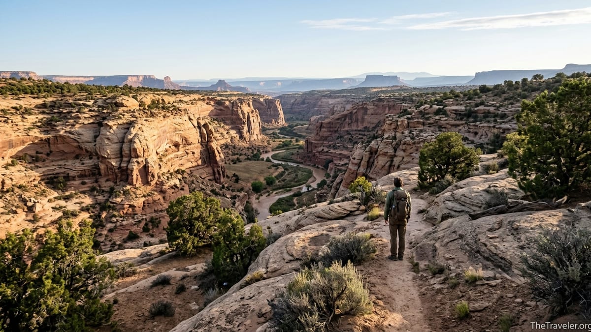
Understand Where Grand Gulch Is and What Makes It Different
Grand Gulch is a complex network of sandstone canyons cut into Cedar Mesa in southeast Utah, within the Bears Ears landscape and largely managed by the Bureau of Land Management as part of the Cedar Mesa / Grand Gulch area. The nearest full-service towns are Blanding and Monticello, each roughly 1.5 to 2 hours’ drive from popular trailheads, with no services once you leave the highways. Travelers used to national parks with visitor centers on every corner are often surprised to find only a small ranger station, long stretches of empty highway, and miles of washboarded dirt roads.
Unlike famous park hikes such as Angels Landing in Zion or Bright Angel in Grand Canyon, Grand Gulch is not a single trail but a primitive backcountry system with multiple access points. Popular entries include Kane Gulch, Bullet Canyon, Government Trail, and Collins Canyon, each connecting to the main gulch at different points. A “Kane to Bullet” loop, for example, can easily become a three to four day trip, while a full traverse from Kane Gulch to Collins Canyon can take five to seven days for strong, experienced parties.
What makes Grand Gulch extraordinary is the combination of remote canyon scenery and a very high concentration of Ancestral Puebloan archaeological sites. Hikers can encounter cliff dwellings, granaries tucked into alcoves, and rock art panels that are more than 700 years old. This cultural richness is exactly why the area is heavily regulated and why many locals and tribal members prefer that visitors come informed, prepared, and respectful rather than treating it as another casual desert slot canyon.
The remoteness has practical implications. The closest big box grocery stores and outdoor shops are in Moab or Cortez, several hours away, so gear failures or forgotten items are not easily fixed once you arrive. Cell service drops off quickly south of Highway 95 and along Utah Highway 261, and satellite messengers become far more useful than smartphones once you approach the rim of Cedar Mesa.
Permits, Seasons, and When to Stop at Kane Gulch Ranger Station
One of the biggest surprises for first-time visitors is that Grand Gulch is not a walk-up, no-paperwork experience. A permit is required year-round for day use and overnight backpacking in Grand Gulch and its major tributaries such as Kane Gulch, Bullet Canyon, Government Trail, and Collins Canyon. Day-use permits are typically available at self-serve trailhead kiosks or at Kane Gulch Ranger Station. Overnight permits are more tightly controlled and, in high season, are often obtained in advance.
Kane Gulch Ranger Station, located along Utah Highway 261 a few miles south of its junction with Highway 95, is the logistical and informational hub for the area. During its main operating seasons, roughly March through mid-June and September through October, rangers are usually on duty in the mornings to issue overnight permits, check itineraries, and show a short mandatory orientation video focused on protecting archaeological sites. For many travelers, that 15-minute film and a quick conversation with staff provide the most useful, current information they will get about water levels, trail conditions, and any temporary closures.
Because permit rules and quotas can shift with management plans and visitation levels, many experienced hikers now reserve overnight permits through the federal reservation system before they drive out, especially for popular spring and fall weekends. As a practical example, a group planning a four-day loop in April might reserve an overnight permit months ahead to avoid being turned away if walk-in quotas are already full when they reach Kane Gulch early on a Friday.
Season also dictates your experience. Spring and fall are generally considered the safest and most comfortable times to explore Grand Gulch, with cool nights and daytime highs that, while warm, are usually manageable for hiking with a pack. Summer heat can be extreme, with temperatures in exposed stretches of canyon and on the mesa rim climbing high enough to make travel hazardous. Winter brings shorter days, potential ice on the slickrock, and occasionally snow on Cedar Mesa roads, which can make even reaching the trailheads the crux of the trip.
Roads, Trailheads, and How Remote “Remote” Really Is
Many travelers arrive in southeast Utah assuming that a standard rental sedan will handle everything. While it is often possible in dry conditions to reach major Grand Gulch trailheads like Kane Gulch and Bullet Canyon in a high-clearance 2WD vehicle, this is not guaranteed. Access involves paved highways plus stretches of rough graded roads and side tracks that can become deeply rutted after storms. When the clay-rich desert soil turns to mud, even four-wheel drive trucks can struggle.
The approach to Kane Gulch Trailhead is relatively straightforward, with parking just north of the ranger station along a paved state highway. Other access points, such as Government Trail or Collins Canyon, involve more miles of unpaved road. Visitors who drove passenger cars down these roads before a storm have found themselves stuck for hours or facing tire damage well beyond what a rental agreement covers. Checking current conditions with the Kane Gulch ranger staff or the local BLM office before committing to a remote road is as important as checking the weather.
Trailheads are minimally developed: expect gravel parking lots, pit toilets at some but not all locations, and a self-registration box rather than a staffed kiosk. There are no snack bars, camp stores, or gear shuttles. A typical routine for experienced backpackers is to top off fuel and groceries in Blanding or Monticello, fill water jugs at a gas station or in town, and then drive directly to the trailhead with everything they need for the next several days, including extra water left in the vehicle for the return.
Shuttle logistics can surprise loop and through-hikers. The road distance between trailheads such as Kane Gulch and Collins Canyon is significant, and there is no formal shuttle service. Hiking partners often use two vehicles to create a point-to-point route. Solo hikers sometimes rely on informal arrangements with friends staying at nearby campgrounds or simply choose an out-and-back or loop that starts and ends at the same trailhead, accepting some backtracking in exchange for simpler logistics.
Water, Navigation, and How Physically Demanding Grand Gulch Can Be
On a map, Grand Gulch looks like a canyon system that should have water under most conditions, and in many years it does. However, the reliability, clarity, and access to water sources change with seasons, recent storms, and long-term drought. Spring travelers may find clear pools at regular intervals, while late-season hikers sometimes report long dry stretches where they must carry enough water for a full day or more between murky potholes that require careful treatment.
Because of that variability, experienced hikers typically call the Kane Gulch Ranger Station in the week before their trip to ask about current water reports. Rangers often have up-to-date notes from recent parties on where pools are holding, whether certain seeps are flowing, and which sections are unusually dry. Even then, parties commonly start with three to five liters per person on day one and carry a robust filtration and treatment system, knowing that a few extra kilograms in the pack are a small price to pay compared with running dry hours from the nearest exit.
Navigation is another aspect that surprises hikers who are familiar with more manicured trail systems. In Grand Gulch, main routes often follow the canyon bottom, but side canyons, social trails to ruins, and braided paths around obstacles can confuse even competent desert hikers. Cairns are present in some places but are not as consistent as in heavily engineered trail networks. A typical tool set for modern visitors includes a large-scale paper map such as a Cedar Mesa / Grand Gulch topographic map, a compass, and a GPS-enabled map app on a smartphone or dedicated device, with saved offline layers because digital maps are useless without service if you fail to download them in advance.
The physical demands should not be underestimated. A three-day loop from Kane Gulch down to its junction with Grand Gulch and back, for example, requires carrying a multi-day pack through soft sand, navigating minor pour-offs, and climbing in and out of side gullies to reach campsites or water. Elevation changes between the mesa and canyon floor are moderate compared with the Grand Canyon, but uneven surfaces, pack weight, and temperature swings can make eight to twelve mile days feel harder than the mileage suggests. Many seasoned backpackers schedule conservative distances, especially on the first and last days when packs are heaviest and when exiting to the rim.
Archaeological Sites, Etiquette, and Legal Consequences
Grand Gulch is often described as an outdoor museum because of its density of archaeological sites. Visitors commonly encounter structures such as small cliff dwellings tucked into alcoves, granaries sealed with ancient mortar, pottery sherds, and rock art panels depicting figures, animals, and geometric designs. For many travelers, seeing a perfectly preserved granary above a quiet bend in the canyon is the most powerful moment of the trip.
What many first-time visitors do not fully appreciate is how vulnerable these sites are to even casual carelessness. Oils from a single handprint on sandstone can darken rock art panels over time, and one heavy step on a wall or roof beam can collapse an entire structure that has survived intact for centuries. That is why regulations require visitors to view structures from a distance, avoid leaning or sitting on any part of a ruin, and never enter rooms or granaries. The same applies to artifacts: potsherds, stone tools, and corn cobs must be left exactly where they are found. Rearranging or stacking them to “improve” a photo is considered damage.
Laws protecting these sites are not symbolic. Removing artifacts, carving initials near rock art, or climbing into dwellings can trigger investigations under federal statutes that carry fines and potential jail time. Visitors have been cited and prosecuted in the broader Bears Ears region for looting and vandalism, and law enforcement takes these cases seriously. Rangers, local residents, tribal monitors, and other hikers all play a role in reporting suspicious behavior.
Equally important, many of these places are not just historical ruins but living cultural sites that remain significant to Native American tribes who trace their ancestry to the region. Approaching them with humility means speaking quietly, avoiding eating or camping directly in front of structures, and not treating them as props for social media. A common best practice is to admire an alcove from a comfortable distance, take a few photographs without touching anything, and then move on so that others, including local community members, can experience the place in a more natural state.
Camping, Fires, and Low-Impact Travel in a Fragile Canyon
Backcountry camping in Grand Gulch is generally allowed in many sections of the canyon, but it is subject to restrictions that change with conditions. Visitors are usually asked to camp well away from archaeological sites, water sources, and fragile vegetation. In practice, that might mean choosing a sandy bench at least 200 feet from a known ruin and far enough from pools that your kitchen and toilet areas do not contaminate scarce water. Rangers often highlight specific “good” camping zones during the permit conversation and may point to commonly used sites that concentrate impact.
Campfires are heavily regulated because of both cultural and ecological concerns. In many seasons and in many parts of Cedar Mesa, open wood fires are prohibited entirely, and visitors are required to use portable stoves for cooking. Even where fires are technically allowed, the lack of downed wood in side canyons and the visual impact of fire rings near sensitive sites make campfires a poor choice. Most experienced travelers now rely on small gas canister stoves and pack extra fuel rather than assuming they will cook over local wood.
Human waste management is another area where standards are stricter than many backpackers expect. In some canyons, regulations increasingly favor or require the use of pack-out toilet systems such as commercial waste bags, particularly in areas with high site density where digging catholes around every popular camp would quickly create sanitation problems. Even when catholes are still permitted, they must be sited far from water sources, trails, and cultural sites, and fecal waste must be buried in a way that discourages animals from digging it up.
Trash and micro-trash are an ongoing problem in popular desert canyons. Lightweight snack wrappers, small pieces of tape, and the corners of energy bar packages collect in alcoves and along sand benches. Many travelers now carry a dedicated zip bag attached to the outside of their pack as a visible reminder to pick up every scrap they create and to grab a few extra pieces left by others. That small effort, multiplied across many visitors, helps keep Grand Gulch feeling like a remote canyon rather than a crowded trail corridor.
Practical Gear, Safety, and What to Plan Before You Go
Gear choices for Grand Gulch look similar to those for other multi-day desert backpacking trips, but a few specifics make a big difference. Sturdy, broken-in footwear is essential, whether that means traditional hiking boots or supportive trail runners. The route involves long stretches of sand and cobbles, as well as slickrock, and visitors in casual sneakers often finish day one with blisters that make the rest of the trip miserable.
Sun exposure is significant, especially on the approach across the mesa and in wide canyon sections. Travelers typically wear wide-brimmed hats, long-sleeve sun shirts, and lightweight pants instead of relying solely on sunscreen. A sun hoody, sunglasses with good UV protection, and lip balm can make a tangible difference in comfort by day three or four. Because flash floods are less of a daily threat here than in narrow slot canyons but still possible after intense storms, it is important to check the regional weather forecast and avoid committing to narrow tributaries if heavy rain is expected.
Communication and emergency planning matter in such a remote area. Mobile phones should be treated as cameras and navigation tools rather than as reliable communication devices. Many parties carry a satellite messaging device capable of sending basic texts and SOS signals in case of injury or illness far from the rim. Before leaving pavement, it is wise to leave a written itinerary with a trusted friend that includes entry and exit trailheads, planned camps, permit details, and the date when you should be considered overdue if you have not checked in.
Finally, think through your exit strategy before you step into the canyon. Exits from Grand Gulch to the rim are mostly via established routes back to named trailheads. Scrambling up unknown side canyons in an emergency can lead to dead ends at cliffs. Having a paper map that clearly shows official trails and known exit routes, and reviewing those options in advance, turns a stressful situation into a manageable change of plans if something unexpected happens, such as a partner developing a knee injury or a water source drying up ahead of schedule.
The Takeaway
Grand Gulch offers a rare combination of solitude, desert beauty, and direct encounters with the deep human history of the Colorado Plateau. For travelers willing to prepare carefully, respect regulations, and move lightly through the landscape, a few days in these canyons can be one of the most memorable experiences in the American Southwest. Those who arrive expecting a front-country trail with plentiful water, clear signage, and casual rules around ancient sites often find themselves overwhelmed or turned back at the ranger station.
The travelers who come away raving about Grand Gulch tend to share a few habits. They read up on permits and rules in advance, schedule their trip in the cooler shoulder seasons, and build flexible itineraries that allow for conservative mileage and time to explore side canyons thoughtfully. They stop at Kane Gulch Ranger Station not just to pick up paperwork but to listen to current advice about water, roads, and site etiquette. They bring robust navigation tools, carry extra water when in doubt, and treat every structure and artifact as if it were in an active museum gallery rather than an abandoned ruin.
By approaching Grand Gulch as a privileged visit to a living cultural landscape rather than a playground, you help ensure that the rock art, dwellings, and granaries that moved you will remain intact for those who follow, including the descendant communities for whom this place is still home in a deep sense. Preparation, humility, and respect are the three things most travelers wish they had brought more of when they first stepped into the shade of a Cedar Mesa alcove.
FAQ
Q1. Do I really need a permit to hike or backpack in Grand Gulch?
Yes. A permit is required year-round for both day use and overnight backpacking in Grand Gulch and many of its major tributaries. Day-use permits are often available at self-serve kiosks at trailheads or at Kane Gulch Ranger Station, while overnight permits are limited and typically obtained in advance or in person during ranger station operating hours.
Q2. When is the best time of year to visit Grand Gulch?
Most visitors aim for spring, roughly March through early June, and fall, roughly September through October. During these shoulder seasons, daytime temperatures are more moderate, nights are cool, and water sources are often more reliable than in the peak of summer. Mid-summer can be dangerously hot, while winter brings shorter days and occasional snow or ice on roads and trails.
Q3. Can I visit Grand Gulch in a regular rental car?
Access to Kane Gulch Trailhead is usually possible in a standard vehicle when roads are dry, but some other trailheads require driving rougher dirt roads where high-clearance vehicles are safer. After heavy rain or snow, even four-wheel drive trucks can struggle with mud and ruts. If you rent a car, choose one with reasonable clearance, drive slowly on unpaved stretches, and always check current road conditions with the ranger station or local land managers before heading out.
Q4. Will I have cell service in Grand Gulch?
Cell coverage is very limited once you leave major highways. You should assume that you will not have a reliable mobile signal at the trailheads or anywhere in the canyons. Plan navigation, emergency contacts, and meeting points accordingly, and consider carrying a satellite communication device if you are traveling in a small group or on a longer itinerary.
Q5. How hard is the hiking compared with other Utah canyon trips?
Hiking in Grand Gulch is moderately to very strenuous, depending on your route and pack weight. While elevation changes are generally less extreme than in the Grand Canyon, long days of walking in soft sand, crossing uneven slickrock, and carrying multi-day gear and water can be demanding. It is more challenging than a short day hike to a roadside arch, but less technical than many narrow slot canyons that require ropes.
Q6. Is water easy to find in the canyon?
Water is present in many seasons, but its availability varies by year, recent weather, and specific location. Some springs and pools are relatively reliable, while others dry up in late season. It is important to ask rangers for current water information before your trip, carry enough capacity to handle long dry stretches, and always treat or filter any water you collect.
Q7. Can I bring my dog into Grand Gulch?
Pets are heavily restricted in parts of the Cedar Mesa and Grand Gulch area because of the density of cultural sites and the sensitivity of soils and vegetation. Regulations can change, and some canyons prohibit dogs entirely. Before planning to bring a pet, check the most current rules with the managing agency. Many visitors ultimately decide to leave dogs at home to avoid conflicts with regulations and fragile sites.
Q8. Is it okay to camp near ruins if I do not touch anything?
Camping right below or in front of ruins is discouraged and often prohibited, even if you do not enter structures or touch artifacts. The goal is to keep foot traffic, cooking, and human waste away from these sensitive places. Choose campsites on durable surfaces such as open sand benches away from sites, water sources, and rock art, and follow any specific camping guidance given with your permit.
Q9. Are campfires allowed in Grand Gulch?
Campfire rules vary by season and exact location, but they are often restricted or banned due to scarce wood, visual impacts, and resource protection. Many travelers use small backpacking stoves for cooking and skip fires entirely. Before your trip, confirm current fire regulations and be prepared to camp without a campfire even if conditions seem cool.
Q10. What maps or navigation tools should I bring?
A large-scale topographic map of Cedar Mesa and Grand Gulch, a compass, and a GPS-capable device with offline maps are strongly recommended. Trails in Grand Gulch are not always clearly marked, and multiple social paths can lead to confusion. Having both paper and digital tools, along with the skills to use them, greatly reduces the risk of getting disoriented in the canyon system.