


The Tongass National Forest wraps around Southeast Alaska’s main towns, putting old growth rainforest, waterfalls and alpine ridges surprisingly close to cruise docks and hotels. The challenge for short stay visitors is not finding trails but choosing realistic day hikes that match fitness, weather and port schedules. This guide focuses on achievable outings from Juneau, Ketchikan, Sitka, Wrangell and Prince of Wales Island, with practical details on distance, difficulty, transport and what to expect in real Tongass conditions.
Get the latest updates straight to your inbox!
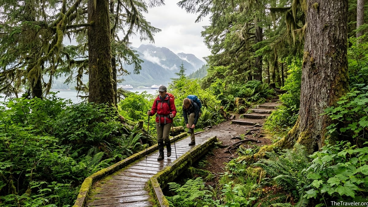
How to Choose the Right Tongass Day Hike
Hiking in the Tongass is very different from walking a dry desert trail or a city park greenway. Even short routes can feel strenuous because of slick roots, mud, wet boardwalks and steep wooden stairways. A three mile rainforest loop like Juneau’s East Glacier Trail typically takes two to three hours, and popular summit hikes such as Deer Mountain above Ketchikan or Gavan Hill above Sitka can easily fill an entire port day for fit hikers.
When you choose a hike, consider both distance and elevation gain. Easy coastal and lake walks in this guide are generally under four miles round trip with less than 300 feet of climbing. Moderate half day trails tend to be four to seven miles with up to 1,000 feet of gain. Strenuous ridge and summit routes climb between 2,000 and 3,000 feet in a relatively short distance, often on rough rock, roots and stairs. On wet days these upper sections can feel closer to scrambling than walking.
Access and timing matter as much as difficulty. Many cruise ships dock for five to eight hours. Allow at least one hour on each end for leaving the ship, transport to the trailhead and a buffer before all aboard. For example, Juneau’s city bus to the Mendenhall Glacier area is inexpensive but can add 30 to 40 minutes each way including the flat one mile walk from the bus stop to the visitor center, while ship shuttles and taxi vans usually take 20 to 25 minutes from downtown.
Rainforest realities should shape your packing list. Expect frequent showers even in July and August, with temperatures often in the 50s Fahrenheit and wind chill near exposed viewpoints. Waterproof hiking shoes or boots with good tread make a big difference on slick planks and mud. Locals commonly wear lightweight synthetic layers under a rain jacket, carry a small backpack with water and snacks, and often bring trekking poles for steeper trails.
Juneau: Glacier Views and Valley Forest Walks
Juneau offers some of the most accessible Tongass hiking because the road system runs directly into the Mendenhall Glacier Recreation Area, which is part of the national forest. From the popular visitor center about 12 miles from downtown, two key trails work well for most visitors: Nugget Falls Trail and the East Glacier Loop. Cruise line shuttles, independent tour buses and taxis typically take around 20 minutes to reach the main parking area, while the city bus drops riders about a mile away along Glacier Spur Road.
Nugget Falls Trail is an easy graveled path of about two miles round trip with very little elevation gain. Most walkers complete it in 45 to 75 minutes, not counting photo stops. The route follows the shore of Mendenhall Lake to a broad beach at the base of Nugget Falls, where on many summer days you can see kayaks on the lake and small icebergs near shore. The trail surface is wide and relatively smooth but not fully wheelchair accessible because of some loose gravel and minor undulations. Visitors with limited mobility who can handle a flat park path often find this a comfortable outing.
The East Glacier Trail forms a three and a half mile loop above the visitor center, usually hiked in two to three hours. It climbs roughly 400 to 500 feet on a combination of dirt path, stone steps and wooden stairs, passing through dense hemlock and spruce forest with mossy boulders and occasional glacier viewpoints. Sections can be slick when wet, especially in early season or after heavy rain. This route suits reasonably fit walkers who are comfortable with many steps and some short steep pitches but do not want extreme exposure. It is not ideal for travelers with knee or balance issues due to the continual stairs.
Beyond the visitor center area, the Kaxdigoowu Heen Dei, also called the Mendenhall River Trail, offers an easier option close to town. This mostly flat path of about two miles one way runs along the Mendenhall River greenbelt with views back to the glacier on clear days. The main access is near Brotherhood Bridge along Glacier Highway, roughly a 15 minute taxi ride from downtown. The compact gravel surface is suitable for sturdy strollers and many mobility aids, though some segments can puddle after heavy rain. For visitors who want a low commitment walk with a strong sense of the Tongass, this greenbelt is an excellent choice.
Ketchikan: Short View Walks and Big Mountain Climbs
Ketchikan sits tightly between steep rainforest slopes and the Tongass Narrows, which means several trailheads lie within a short drive of the cruise docks. Rainbird Trail is a popular close to town option for visitors with just a couple of hours. Reached from pullouts above the Third Avenue Bypass, this roughly 1.3 to 1.5 mile route follows a mostly forested bench parallel to town, with spur viewpoints over the harbor and cruise ships. Expect roots, short ups and downs and occasional mud. Fit walkers can complete an out and back in about an hour from the trailhead, not counting the walk or taxi from the dock.
For a taste of quiet forest and lake scenery, Ward Lake and Perseverance Lake make a good half day progression. Ward Lake, about eight miles north of downtown near the end of the paved North Tongass Highway, has a mostly flat loop of roughly 1.3 miles on packed gravel, which local residents often walk in 30 to 45 minutes. It is one of the easiest places near Ketchikan to experience big trees, muskeg and mirrored water without serious elevation gain. Nearby, the Perseverance Trail climbs from near Ward Lake to Perseverance Lake over about 2.4 miles one way with roughly 450 feet of elevation gain. Most hikers allow three to four hours for the round trip, which includes boardwalks, gravel sections and some short steeper pitches.
Experienced hikers seeking a demanding summit day may gravitate to Deer Mountain, the prominent 3,000 foot peak behind town. The Deer Mountain National Recreation Trail climbs about 2,600 feet in roughly 2.75 miles from the trailhead to the summit, passing through temperate rainforest, muskeg and alpine meadows. Local hikers often suggest allowing five to seven hours for the full outing, especially in wet conditions. The steep switchbacks, slippery roots and wooden steps make this a strenuous option best saved for dry or at least stable weather and for visitors with solid fitness who are comfortable descending steep, uneven terrain.
Reaching Ketchikan trailheads typically involves a brief drive along the Tongass Highway. Taxis are readily available at the cruise dock, and many independent tour operators sell “hiking drop off” services to Ward Lake and trailheads like Deer Mountain. While the town operates a local bus system, schedules can be tight for cruise passengers, so most time pressed visitors rely on taxis for round trips that usually cost in the range that city cab meters would show for 15 to 25 minute rides in a small Alaskan town. Visitors should ask drivers in advance about pickup to ensure a timely return.
Sitka: Totem Walks, River Valleys and Ridge Stairs
Sitka’s trail network connects directly to town, making it possible to step off a cruise shuttle and start walking into Tongass forest within minutes. The easiest and most accessible experience is at Sitka National Historical Park, where about 1.6 miles of connected loop trails follow the shoreline and Indian River. These paths are mostly flat and graveled, with numerous traditional and historic totem poles along the route. Many visitors complete a circuit in 45 to 60 minutes while still having time to linger at viewpoints and interpretive signs. The main entrances are within walking distance of downtown and harbor shuttle stops, and the even surface works for many strollers and wheelchairs.
A step up in commitment is the Indian River Trail, which leaves from a road end just beyond the park boundary but still only a short drive or a longer walk from central Sitka. This forest route follows its namesake river upstream through closed canopy spruce and hemlock for roughly 4.2 miles one way. There is moderate elevation gain, generally under 800 feet over the whole distance, but the challenge comes from roots, mud and occasional blowdown. Day hikers commonly turn around before the informal waterfall viewpoint if time is short, making this a flexible two to six hour outing. The trailhead has limited parking, so taxi drop off or a combination of town walking and a short cab ride is often easiest for cruise visitors.
For strong hikers with a full day, the Gavan Hill and Harbor Mountain system offers one of the most rewarding ridge walks in Southeast Alaska. The Gavan Hill Trail climbs steeply from a neighborhood near central Sitka up long flights of stairs and switchbacks through dense forest to a ridge above treeline, where boardwalks and rock tread lead to expansive views of Sitka Sound and surrounding peaks. The full Harbor Mountain to Gavan Hill traverse covers roughly 4.6 miles one way and includes several hundred meters of total elevation gain and loss. Many visitors opt to hike up and down from the Gavan side only, allowing four to six hours.
Sitka’s weather can shift quickly from mist to wind and sun, especially along the Harbor Mountain ridge. Lightweight but fully waterproof shells, a warm mid layer and gloves are advisable even on seemingly mild mornings. Because the Gavan and Harbor Mountain routes involve sustained stairs, they are not recommended for anyone with significant knee or balance limitations. Those visitors are better served by the totem lined park loops and the relatively gentle lower miles of Indian River, both of which still offer classic Tongass experiences such as salmon runs in late summer and the sound of ravens in the canopy.
Wrangell: Boardwalk Viewpoints and Waterfall Forests
The small community of Wrangell provides surprisingly varied hikes for its size, all within the Tongass National Forest. Mount Dewey, which rises directly behind town, is one of the best short view hikes in Southeast Alaska for cruise passengers. A boardwalk and stair system roughly a quarter mile long climbs steeply through forest to a viewpoint overlooking Wrangell Harbor, nearby islands and the coastal mountains. Most visitors complete the climb in 20 to 40 minutes, depending on photo and rest stops. The wooden steps can be slick in rain and mossy in places, so shoes with good grip are important even for this short outing.
For a longer forest immersion, the Rainbow Falls Trail begins a short drive from town along Zimovia Highway and climbs through hemlock woods to a series of viewpoints near Rainbow Creek and its namesake waterfall. The lower portion is a well built boardwalk with numerous stairs, forming a steep but secure path ideal for half day hikers who are comfortable gaining several hundred feet. Local tourism materials describe Rainbow Falls as a good option for either a short day hike to the falls themselves or a longer outing for those who continue into the high country beyond.
Wrangell also offers gentler walks for visitors with limited mobility or families with small children. Volunteer Park, reached in a few minutes by car or taxi from the harbor, has about 1.5 miles of low elevation trail on mostly flat packed gravel through marshy meadows and forest. It lacks big mountain views but delivers birds, wildflowers in season and a quieter feel than the more popular summit stairways. This is one of the better choices in the region for travelers who cannot manage extended climbs or steep descents but still want an authentic Tongass setting.
Transport in Wrangell is straightforward since distances are short. Independent companies, such as local guiding outfits that advertise hiking drops in town brochures, commonly bundle Mount Dewey or Rainbow Falls visits with trips to other attractions like Petroglyph Beach. Prices change from season to season, so visitors should confirm current taxi or shuttle rates upon arrival at the harbor information kiosk and plan return times with plenty of margin before boarding.
Prince of Wales Island: Remote Feeling Trails from Craig and Klawock
Prince of Wales Island has a sprawling road system for a rural island, but it still feels far more remote than Juneau or Ketchikan. Most visitors base themselves in the west coast communities of Craig and Klawock, both within reach of several representative Tongass hikes. One of the most approachable is Big Lake Fish Pass near Klawock, where a very short boardwalk of roughly a few hundred feet leads to a fish ladder and stream views. This is a genuine easy walk suited to almost any visitor who can manage a short, level stroll, and during salmon season it can provide impressive wildlife watching from a safe, built viewpoint.
More ambitious hikers often target Sunnahae Mountain above Craig, a challenging trail that climbs from near sea level to an alpine summit directly behind town. Regional visitor guides describe Sunnahae as a strenuous route with substantial elevation gain across a few miles, combining steep forest tread, roots and boardwalk. Fit hikers commonly reserve most of a day for this outing, packing food, extra layers and navigation tools because cell coverage can be intermittent once above town.
Between these two extremes lies the One Duck Trail, listed in local guides as roughly 1.25 miles long and rated strenuous despite its modest distance because of steep grades and uneven tread. Located inland along the island road network, it offers a concentrated workout for those wanting a taste of Tongass forest without committing to a full alpine summit. Reaching these trailheads almost always requires a rental vehicle or pre arranged shuttle, as regular public transit is limited on Prince of Wales. Visitors arriving by ferry or floatplane should coordinate with accommodations in Craig or Klawock, many of which can recommend local taxi operators or lodge shuttles.
Because help can be farther away on Prince of Wales than in the bigger ports, hikers here should take particular care with preparation. Carrying rain gear, a map or GPS app with offline data, water and high energy snacks is especially important. Bears and deer are common along these trails, and berry patches near boardwalk edges can attract both wildlife and insects in late summer. Staying alert, making noise in dense brush and giving animals plenty of space are key parts of a safe visit.
Rainforest Safety, Bear Awareness and Accessibility
Across the Tongass, visitors share the trails with black bears, Sitka black tailed deer and countless smaller creatures. Most human bear encounters in these busy front country areas involve an animal moving away from the trail after hearing people approach. To support that natural avoidance, local land managers recommend hiking in small groups when possible, talking or occasionally calling out in dense brush, and avoiding the use of headphones that block awareness. On salmon streams such as Indian River in Sitka or creeks near Ward Lake in Ketchikan, it is especially important to give any bears on or near the trail plenty of space and a clear escape route.
Food storage discipline matters even on short day hikes. Travelers should keep snacks in sealed containers, avoid leaving packs unattended on the ground at viewpoints, and never feed wildlife, including seemingly bold ravens or squirrels at popular lookouts. In most of the day hiking areas described here, carrying commercial bear spray is optional but common among local hikers. Visitors who choose to carry it should learn how to use it before starting the trail and keep it readily accessible rather than buried in a pack.
Accessibility and mobility considerations vary widely between hikes. Short, mostly level routes like Sitka National Historical Park’s main loops, Nugget Falls Trail in Juneau and the Ward Lake loop near Ketchikan offer relatively even gravel paths suitable for many strollers and some wheelchairs, though surface conditions change with weather. Boardwalk and stair heavy trails such as Mount Dewey, Rainbow Falls, Gavan Hill and Deer Mountain can be challenging even for very fit hikers, and are not recommended for anyone who has difficulty with long flights of steps or steep, uneven surfaces.
Weather and daylight also affect accessibility. In May and September the sun sits low on the horizon even at midday, and shaded forest sections can stay damp and slippery all day. Early season snow patches may linger near higher elevations on Deer Mountain, Gavan Hill or Sunnahae Mountain. Visitors using mobility aids should ask local visitor centers or ranger stations for the most recent trail conditions, as downed trees, washed out bridges and maintenance projects can temporarily change what is realistic for a given ability level.
Comparison Guide: Matching Hikes to Your Time and Ability
To help narrow the choices, it can be useful to think of Tongass day hikes by town and rough difficulty bands rather than try to memorize every foot of elevation gain. In Juneau, easy outings include Nugget Falls and the Mendenhall River Trail near Brotherhood Bridge. East Glacier and valley routes such as the lower Dan Moller Trail provide moderate half day options. Strong hikers with a rental car and a full day sometimes add longer routes like West Glacier, but those go beyond the scope of most cruise visits focused on simpler trails.
For Ketchikan, the gentle Ward Lake loop and short segments of Rainbird make good entry level walks that fit a two or three hour window. Perseverance Trail to Perseverance Lake rises into the moderate category, rewarding a half day investment with views of forested peaks and still water. Deer Mountain stands alone as a demanding summit effort suitable for visitors comfortable hiking steep grades for several hours. Many cruise passengers choose to hike only to the first major viewpoint on Deer Mountain for a compromise between effort and time.
Sitka’s easiest category includes Sitka National Historical Park’s totem lined loops. The lower miles of Indian River or a partial out and back make solid moderate choices when you have three to five hours. The Gavan Hill and Harbor Mountain routes occupy the strenuous band and can absorb a full day, especially if you arrange a point to point traverse shuttle through a local guide service or taxi. In Wrangell, Mount Dewey’s short but steep boardwalk fits between easy and moderate, depending on personal fitness, while Rainbow Falls and the upper country beyond provide a more demanding half day. Volunteer Park remains one of the most accessible, gentle forest walks in the region.
On Prince of Wales Island, Big Lake Fish Pass is squarely easy and well suited to family outings or quick stops between other activities. One Duck Trail, though short, feels moderate to strenuous because of its grades, and Sunnahae Mountain sits firmly in the strenuous category. Grouping hikes this way helps time pressed visitors skim local trail maps or brochures and quickly spot what aligns with their available hours, comfort with elevation and interest in either scenery from high viewpoints or close up details like totems and salmon streams.
Conclusion: Building Your Personal Tongass Shortlist
Different traveler types will gravitate to different corners of the Tongass, even when starting from the same ship or hotel. Families with younger children or older grandparents often do best stacking short, accessible walks such as Nugget Falls in Juneau, Ward Lake in Ketchikan and Sitka National Historical Park’s totem trails, possibly combined with a ranger program or visitor center stop. These outings keep everyone close to bathrooms and shelters while still delivering glacier views, rainforest trees and a genuine sense of Southeast Alaska.
Casual walkers with a few hours in port might target one moderate trail per stop. Good examples include Juneau’s East Glacier Loop, Ketchikan’s Perseverance Trail, Sitka’s lower Indian River and Wrangell’s Rainbow Falls as far as the main waterfall viewpoints. Each offers enough distance and elevation to feel like a real hike without requiring technical skills. Combining one of these with time for a harbor stroll or café visit creates a balanced port day that avoids the stress of rushing back to the ship.
Experienced hikers willing to devote an entire port call to the mountains can build an itinerary around the classic strenuous routes: Deer Mountain above Ketchikan, Gavan Hill or the Harbor Mountain traverse above Sitka, Sunnahae Mountain on Prince of Wales, or extended explorations beyond Rainbow Falls in Wrangell. These outings demand early starts, careful weather checks and respect for how quickly fog and rain can change conditions at higher elevations. They also provide the clearest views of the Tongass canopy stretching to the sea and, on lucky days, distant glaciers and icefields.
Whatever your profile, the key is honesty about time, fitness and comfort in wet, slippery terrain. With realistic expectations, proper footwear, a rain shell and awareness of wildlife guidance from local rangers, even a short boardwalk walk can feel rich and memorable. The Tongass National Forest begins almost at the edge of every Southeast Alaskan town. A wisely chosen day hike will let you step into that vast green world, then return to your ship or inn with plenty of time to dry out and plan the next adventure.