


Southern Utah is spoiled with wild country, but two areas regularly rise to the top of serious desert travelers’ wish lists: Cedar Mesa, on the edge of Bears Ears National Monument, and Grand Staircase Escalante National Monument. Both offer sculpted canyons, big-sky camping, and true remoteness, yet they deliver very different kinds of adventures. Choosing between them can shape your entire Southwest trip, from the kind of car you rent to whether you pack a canyoneering harness or an archeology field guide.
Get the latest updates straight to your inbox!
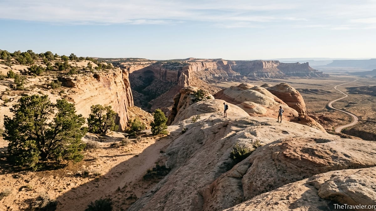
Cedar Mesa vs Grand Staircase Escalante at a Glance
Cedar Mesa sits on a high plateau between Utah Highways 95 and 261, above the San Juan River and just west of Blanding. Much of it falls within Bears Ears National Monument and is managed by the Bureau of Land Management. The landscape is a dissected mesa cut by deep tributaries like Grand Gulch, Mule, Owl, and Slickhorn canyons. Trails drop quickly from open sagebrush and pinyon into narrow, sandstone corridors filled with seeps, cottonwoods, and cliff alcoves.
Grand Staircase Escalante, spread across roughly a million acres of public land in south-central Utah, feels even larger on the ground. Visitors usually base themselves around the town of Escalante, the Burr Trail near Boulder, or the Cottonwood Canyon and Skutumpah roads between Kanab and Bryce Canyon. Here, the focus is on sinuous slot canyons, rolling slickrock domes, badlands, and long washboarded dirt roads like Hole in the Rock Road leading to trailheads for places such as Peekaboo and Spooky Gulch or Coyote Gulch.
For a first, rough comparison: Cedar Mesa is more about multi-day backpacking and cultural sites in quiet canyons. Grand Staircase Escalante offers a wider variety of day hikes, classic slot canyons, and scenic drives suitable for a broader range of vehicles and travelers. Both demand preparation, but the style of adventure each favors is very different.
In practical terms, many travelers pair one of these destinations with a national park such as Arches, Canyonlands, or Capitol Reef. If your trip is 5 to 7 days and you want to avoid too much driving, it is usually better to choose one region as your base instead of trying to fully “do” both in a single visit.
Access, Roads, and Base Towns
Cedar Mesa feels remote even by Utah standards. The main access routes are Utah Highway 95, which cuts east–west across the mesa, and Utah Highway 261, which climbs the dramatic gravel switchbacks of the Moki Dugway from Mexican Hat. From those paved roads, short signed spurs reach trailheads like Kane Gulch Ranger Station, Government Trail, or Slickhorn. Most of these spurs are dirt but generally passable in dry weather with a standard high-clearance car; after spring storms, ruts and mud can briefly require four-wheel drive.
Base towns around Cedar Mesa are small and simple. Blanding and Bluff, each about 45 to 60 minutes’ drive, have basic motels in the 90 to 150 dollars per night range, plus grocery stores and gas. Mexican Hat is closer to the southern canyons, with a handful of roadside motels and cafes. Do not expect extensive restaurant choices or big-box stores. Many hikers pick up last groceries in Moab or Monticello before driving south to the mesa.
Grand Staircase Escalante has more dispersed but slightly better-developed access. The town of Escalante anchors the central Escalante Canyons section, with a couple of midrange motels, small inns and cabins, and a few campgrounds where tent sites typically run around 30 to 45 dollars per night. Escalante is also home to the Escalante Interagency Visitor Center, an important stop for water, maps, and the latest road reports. To the west, Cannonville and Tropic serve the “staircase” country near Cottonwood Canyon Road, while Kanab and Page work for the Paria River and House Rock Valley Road.
The condition of the area’s infamous dirt roads changes constantly and impacts which travelers are comfortable visiting. For example, recent reports show the first section of Hole in the Rock Road graded but heavily washboarded, with the final stretches toward the trailhead for Coyote Gulch still better suited to high-clearance vehicles. Shorter drives to popular spots such as Devil’s Garden or the Dry Fork slots remain realistic for careful drivers in compact SUVs when the road is dry. In wet weather, clay surfaces can quickly become impassable regardless of vehicle type, so keeping an eye on the local road condition bulletins is crucial.
Permits, Regulations, and Crowds
One of the clearest differences between Cedar Mesa and Grand Staircase Escalante is how they are managed. Cedar Mesa has a long-running permit system aimed at protecting both fragile canyon ecosystems and an extremely dense concentration of ancestral Puebloan sites. Day hiking in most canyons requires purchasing a modestly priced day-use pass, while overnight backpacking in places like Grand Gulch and many side canyons requires a backcountry permit, often reserved in advance. Group sizes are limited, and some popular routes have strict quotas, especially in peak spring and fall seasons.
The effect of these permits is noticeable on the ground. On a three-day April backpack in Grand Gulch, for example, you might encounter only a handful of other groups, mostly experienced hikers carrying bear canisters or hang bags and moving carefully around architectural sites and rock art. Rangers and volunteer stewards sometimes walk the canyons to check permits and gently remind visitors to avoid touching walls or entering ancient dwellings.
Grand Staircase Escalante, by contrast, remains mostly permit-free for day hiking. You can show up in Escalante, stop at the visitor center for a map, and head out to Lower Calf Creek Falls, Zebra Slot, or Willis Creek without advance paperwork, unless you are entering certain nearby areas managed by the National Park Service. Overnight trips and certain technical canyons may require free self-registration or overnight permits, but there is generally more spontaneous flexibility.
The trade-off is that some marquee day hikes in Grand Staircase Escalante now feel much busier than comparable experiences on Cedar Mesa. On a pleasant Saturday in October, the parking area for the Dry Fork slots off Hole in the Rock Road might be close to full by midmorning, with families, tour groups, and photographers all funneling into the same narrows. By comparison, trailheads like Fish Canyon or Road Canyon on Cedar Mesa may host only a few vehicles even during the same period.
Landscape, Hiking Style, and Signature Experiences
Cedar Mesa rewards travelers who like long, immersive canyon days. Typical itineraries involve dropping off the mesa rim on a faint trail, descending a rocky slope or short scramble, then walking the sandy, occasionally rocky canyon floor for hours. Along the way you may pass seeps and springs, admirably preserved granaries tucked into alcoves, and panels of petroglyphs and pictographs. A classic example is a three-day loop starting at Kane Gulch, traversing down Grand Gulch to Junction Ruin and Turkey Pen Ruin, then climbing out via Bullet Canyon. Daily mileage can be moderate, but deep sand and boulder-hopping make it feel more serious than the numbers suggest.
Grand Staircase Escalante offers more variety, including many short and moderate day hikes. Families often gravitate to Lower Calf Creek Falls, where a well-maintained 6-mile round-trip trail leads to a tall waterfall pouring into a cold pool, or to Willis Creek, which provides an easy introduction to walking in a shallow stream inside a narrow sandstone corridor. More adventurous hikers explore slot canyons like Peekaboo and Spooky Gulch, which involve amusing but tight squeezes, short climbs, and the occasional hand-over-foot downclimb, all within a half-day outing.
For backpackers, both regions shine in different ways. Backpacking in Cedar Mesa revolves around multi-night canyon trips that require carefully plotting water sources and exit routes. In Grand Staircase Escalante, classic overnight trips include the Escalante River corridor between trailheads such as Highway 12 and Highway 12’s bridge area, or Coyote Gulch with its sweeping red walls and natural bridges. These often involve more straightforward navigation but demand comfort with frequent stream crossings and occasionally wading mid-thigh or higher.
In practical terms, if your dream Utah experience is camping two nights beneath 200-meter-high walls in a canyon where your only neighbors are ravens and the traces of thousand-year-old dwellings, Cedar Mesa is hard to beat. If instead you want a trip where you can alternate between iconic half-day hikes, short scenic drives, and one or two backpacking nights, Grand Staircase Escalante offers more flexibility.
Cultural Sites, Natural History, and Ethics
Cedar Mesa is one of the richest archeological landscapes in the United States. Canyons here hold thousands of sites connected to ancestral Puebloan people, including cliff dwellings, kivas, storage structures, pottery sherd scatters, and rock art panels. Official maps typically mark only a fraction of what exists, and visitors are encouraged to treat even unmarked walls and alcoves as potentially significant. If you explore side canyons off Owl or Slickhorn, for instance, you may round a bend and suddenly notice a small masonry room tucked into a ledge or a faint line of pigment on stone.
Because of this density, the travel ethic on Cedar Mesa places a strong emphasis on restraint. You are expected to view structures from a distance, never enter rooms, and avoid sitting or walking on fragile midden soils. Even apparently small actions, like brushing a hand along a wall to steady yourself, can damage plaster, pigments, or the patina that archeologists rely on for clues. Rangers at trailheads and visitor centers frequently share real examples of footprints into kiva roofs or handprints on ancient mud mortar that have irreversibly altered sites.
Grand Staircase Escalante has cultural sites too, but its visitor identity is more tied to geology and solitude. The monument’s “staircase” of cliffs and the Escalante Canyons provide textbook examples of cross-bedded Navajo sandstone, petrified wood, and fossil-bearing formations. At the visitor centers in Escalante or Big Water you will find displays about dinosaur discoveries, including the region’s reputation for yielding new species and helping scientists understand Late Cretaceous ecosystems. On the ground, hikers are more likely to focus on slot canyon sculpting, natural bridges, and desert ecology than on archeology, though rock art and historic inscriptions appear in some side canyons.
In both regions, a growing number of travelers now choose to build in a stewardship component. In Grand Staircase Escalante, for example, some outfitters offer guided days that mix hiking with trail brushing or invasive-plant removal. On Cedar Mesa, volunteer projects sometimes focus on monitoring visitation at specific sites or cleaning up unauthorized fire rings and social trails. These trips appeal especially to repeat visitors who already know the headline hikes and want a deeper connection to the places they love.
Seasonality, Weather, and Safety
Both Cedar Mesa and Grand Staircase Escalante are best visited in spring and fall. From roughly late March into May and again from late September through October, daytime highs often sit in the comfortable range for hiking, while nights can be brisk but manageable with a three-season sleeping bag. In these shoulder seasons, Cedar Mesa’s higher elevations can still see patches of snow in shaded areas early in the year, and cold air pooling at the bottom of canyons can make mornings surprisingly chilly.
Summer is possible but challenging in both regions. In Grand Staircase Escalante, daytime highs in July often climb well into the 90s Fahrenheit in the lower canyons, and heat radiating off slickrock can make exposed sections of trail feel hotter. Many experienced hikers start before sunrise, nap in shade at midday, and limit their distance. Monsoon thunderstorms typically develop from July into early September; a storm that dumps rain dozens of miles away can send a flash flood down a slot canyon that looked dry at the trailhead. Outfitters in Escalante regularly adjust itineraries at short notice when forecasts call for unstable conditions.
On Cedar Mesa, summer heat is slightly moderated by elevation, but canyon bottoms can still grow hot and airless. Water sources can shrink dramatically; a pool you counted on in April might be reduced to a stagnant puddle by August. For this reason, many backpackers either avoid mid-summer altogether or carry heavy water loads between reliable springs, which changes the character of the trip.
Winter presents a different set of considerations. Highways 95 and 261 are plowed but can be slick, and side roads to trailheads can accumulate snow or mud. In Grand Staircase Escalante, roads like Cottonwood Canyon and Skutumpah may temporarily close or require high-clearance four-wheel drive after storms. On the other hand, fit and well-prepared hikers willing to handle cold conditions may have trails like Lower Calf Creek Falls or parts of Grand Gulch almost entirely to themselves in December and January.
Costs, Logistics, and Who Each Area Fits Best
Costs for visiting either region are similar in broad strokes, but a few details could sway budget-conscious travelers. Expect fuel prices in small Utah towns to be higher than in major cities, and factor in that both Cedar Mesa and Grand Staircase Escalante involve substantial driving between trailheads. In Grand Staircase Escalante, it is common to log 30 to 60 miles on dirt roads in a single day exploring trailheads like Devil’s Garden, Egypt, or Forty Mile Ridge, which adds to fuel and vehicle wear. Rental car agencies sometimes state that travel on unpaved roads is at your own risk, so double-check your contract if you plan to venture far down roads like Hole in the Rock.
Permit fees vary. A backcountry permit for several nights in Cedar Mesa can still be relatively inexpensive compared with the cost of a guided trip, but the requirement to apply in advance can make the area slightly less spontaneous for road-trippers who choose their destinations week by week. In Grand Staircase Escalante, the absence of day-use fees at most trailheads can balance out higher fuel bills, especially for travelers who base in Escalante and day-hike for four or five days in a row.
In terms of traveler profile, Cedar Mesa best suits hikers who already have some backcountry experience, are comfortable with route-finding and carrying all essentials, and value solitude and cultural landscapes over iconic Instagram views. A realistic example would be a small group of friends who have backpacked in Canyonlands or the Grand Canyon before and want a quieter, more self-reliant trip focused on multi-day loops. Grand Staircase Escalante, while still wild, is generally a better match for mixed-ability groups and first-time desert visitors. A family staying at a cabin in Escalante, spending one day at Lower Calf Creek, one at the Dry Fork slots, and one simply exploring scenic overlooks along Highway 12, will find plenty to do without committing to a heavy pack.
If time and energy allow you to choose just one, a useful rule of thumb is this: pick Cedar Mesa if you want a backpacking-centered trip anchored around archeology and quiet canyons, and pick Grand Staircase Escalante if you want a hike-and-drive trip with a mix of slot canyons, waterfalls, and sweeping vistas.
The Takeaway
Cedar Mesa and Grand Staircase Escalante are not competing versions of the same experience so much as complementary chapters in a larger story of the Colorado Plateau. Cedar Mesa leans inward: narrow canyons, subtle ruins, and the feeling of dropping away from the modern world for days at a time. Grand Staircase Escalante leans outward, with big horizons, a menu of slot canyons and day hikes, and a patchwork of roads that let you sample different landscapes in a single trip.
When you choose between them, you are really choosing your preferred style of adventure. If your ideal day involves breaking camp in the cool shade of a canyon, filtering water from a spring, and quietly studying petroglyphs with no one else in sight, Cedar Mesa will likely resonate more deeply. If your ideal day looks like driving a dusty road at sunrise, hiking a narrow slot before lunch, and watching the sunset from a highway overlook before a hot shower in town, Grand Staircase Escalante will probably feel like a better fit.
Both regions require respect for fragile environments, thoughtful planning, and a willingness to adapt when weather or road conditions change. Whichever you choose, build in extra time, stay flexible, and arrive with more water, food, and patience than you think you need. The reward is a style of wilderness travel that is increasingly rare: days shaped more by sandstone and sky than by clocks and crowds.
FAQ
Q1. Which is better for first-time desert travelers, Cedar Mesa or Grand Staircase Escalante?
Grand Staircase Escalante generally suits first-time visitors better because many of its classic hikes are day trips from established base towns like Escalante, with easy access to visitor centers, more lodging options, and a wider range of short or moderate trails. Cedar Mesa is quieter and more remote, with a stronger focus on self-supported backpacking and navigation in less-developed canyons.
Q2. Do I need a four-wheel-drive vehicle to explore these areas?
In dry conditions, you can access many trailheads in both regions with a high-clearance two-wheel-drive vehicle, especially paved or well-graded roads near Lower Calf Creek Falls or the main Cedar Mesa trailheads. However, some Grand Staircase Escalante roads such as the deeper sections of Hole in the Rock Road and portions of Smoky Mountain Road are much safer with high-clearance four-wheel drive, and any clay road in wet weather can become impassable regardless of vehicle.
Q3. How far in advance should I secure permits for Cedar Mesa backpacking?
For peak spring and fall seasons, it is wise to plan Cedar Mesa backpacking permits several months ahead, especially for popular routes like Grand Gulch where overnight use is limited. Shoulder-season trips outside school holidays sometimes have better availability, but you should still check current permit procedures and reserve as early as your itinerary allows.
Q4. Are guided trips available in both Cedar Mesa and Grand Staircase Escalante?
Yes, a number of outfitters based in towns such as Bluff, Blanding, and Escalante offer guided hiking and backpacking trips in both regions. In Grand Staircase Escalante, guides commonly lead slot canyon hikes and overnight Escalante River or Coyote Gulch trips. On Cedar Mesa, guided itineraries often focus on archeology education and backcountry travel skills in canyons like Owl, Fish, or Mule.
Q5. Which area is better for families with children?
Most families find Grand Staircase Escalante a more practical choice. Trails like Lower Calf Creek Falls, Willis Creek, and the Dry Fork slots offer engaging features, manageable distances, and the option to retreat quickly to a car or town lodging. Cedar Mesa’s longer approaches, limited water, and permit logistics can be challenging for younger children or for adults who are new to backpacking.
Q6. What is the best season to visit if I want to avoid crowds?
Early spring and late fall are the sweet spots for both regions, but to avoid crowds you might target late October into early November or late March before school holidays. Cedar Mesa tends to feel quieter overall due to its permit system and the nature of its trips, while Grand Staircase Escalante sees the most concentrated congestion at a few popular trailheads during prime weekends.
Q7. How much water should I carry, and are there reliable sources?
In both regions you should carry more water than you think you need, often at least three to four liters per person for strenuous day hikes and more for backpacking days without known springs. On Cedar Mesa, trip planning usually revolves around a small number of named pools and springs, which can shrink dramatically in dry years. In Grand Staircase Escalante, some routes follow perennial streams such as the Escalante River or Calf Creek, but others cross long, dry stretches of slickrock or sand with no water at all.
Q8. Are dogs allowed in Cedar Mesa and Grand Staircase Escalante?
Leashed dogs are generally allowed on most Bureau of Land Management lands, including many parts of both Cedar Mesa and Grand Staircase Escalante, but there are important exceptions and practical considerations. Steep scrambles, deep sand, hot slickrock, and the presence of cultural sites can make dogs a poor fit for some canyons, and regulations can change near national park boundaries. Always check the latest rules and think carefully about your pet’s safety before bringing a dog.
Q9. Can I combine both areas in a single one-week trip?
It is possible to sample both in a week, for example by spending three nights backpacking on Cedar Mesa and three nights based in Escalante for day hikes. However, the significant driving distances and the immersive nature of Cedar Mesa trips mean many travelers feel rushed when they try to do both. If you prefer a more relaxed pace, dedicating an entire week to just one region often leads to a deeper experience.
Q10. How can I visit responsibly and minimize my impact?
Traveling responsibly here means following Leave No Trace practices, respecting archeological sites, and staying on durable surfaces. On Cedar Mesa, never enter structures, touch rock art, or move artifacts, and camp away from cultural sites and water sources. In Grand Staircase Escalante, avoid carving names into rock or building cairns, pack out all trash including food scraps and toilet paper, and heed road closure signs so that fragile desert soils and vegetation are not damaged.