


More news on this day
Connecticut transportation and emergency planners are now officially planning around a future of fewer but more intense winter storms, after a federal resilience report for non-coastal regions concluded that inland parts of the state are seeing less frequent snow events but higher snowfall intensity per storm, a shift that could reshape Christmas travel expectations across the 2020s.
Get the latest news straight to your inbox!
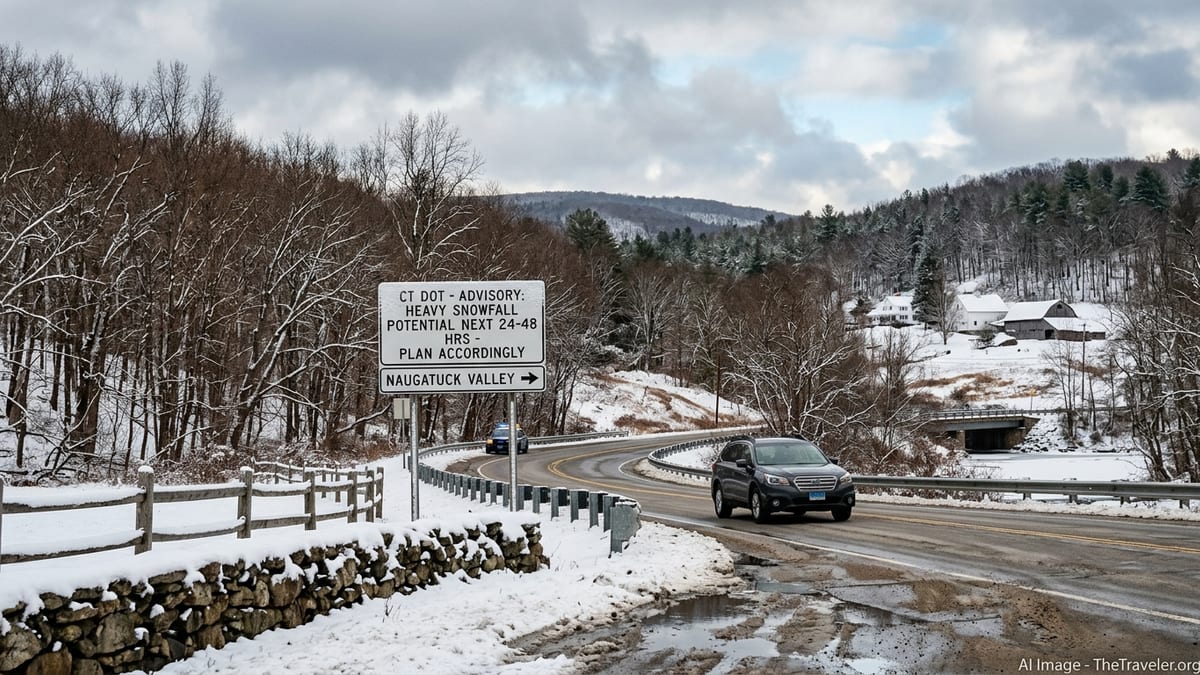
Planning Around “Fewer Snowstorms” In Inland Connecticut
The new PROTECT – Non-Coastal CT resilience planning narrative, prepared by the Naugatuck Valley Council of Governments with support from the U.S. Department of Transportation and finalized in September 2025, explicitly cites a trend toward “fewer snowstorms” but heavier snowfall per event for interior Connecticut. The narrative draws on the 2019 Connecticut Physical Climate Science Assessment Report, which found that overall winter precipitation is projected to rise even as the number of frost and typical snow days declines.
Federal and state climate summaries back up that framing. NOAA’s 2025 State Climate Summary for Connecticut finds that average temperatures have already risen by more than 3.5 degrees Fahrenheit since the early 20th century, while heavy precipitation events have become more common, particularly in the cool season. UConn’s Connecticut Institute for Resilience & Climate Adaptation likewise projects an 8 to 15 percent increase in winter and spring precipitation, with a larger share of that moisture likely to arrive in intense storms rather than frequent light snowfalls.
Crucially for travelers, none of these reports forecast specific conditions for any single Christmas week. Instead, they describe long term risk: on average, fewer days with snow on the ground across the season, but a higher chance that any given storm can rapidly produce disruptive totals and complex wintry mixes that are harder to manage.
Recent Winters Show “Feast or Famine” Snow Patterns
Official snowfall logs from the 2025 to 2026 winter illustrate the pattern planners are now building into their models. Around Hartford and Bradley International Airport, seasonal totals reached roughly the low to mid 50 inches according to National Weather Service based climatology, yet those totals were concentrated in a limited number of true storm days rather than a steady run of small events spread through the winter.
One standout example was the January 23 to 27, 2026 North American winter storm, which delivered more than 15 inches of snow at Bradley and comparable or higher amounts in several inland communities. Local and regional summaries rank that event among the largest single snowfalls in nearly a decade for parts of Connecticut, with blizzard criteria met at some coastal sites. By contrast, long stretches before and after the storm featured bare ground or light, mixed precipitation, underlining the new “on or off” character of many recent winters.
State environmental reporting has also begun to frame winter conditions in terms of volatility rather than simple averages. The Connecticut Council on Environmental Quality’s 2025 annual report notes that the state is both warmer and wetter than in the mid 20th century, which is consistent with winters that can feel relatively mild for weeks but still generate one or two high impact snow or ice events capable of disrupting travel for days.
What Holiday Travelers Should Expect This Decade
For Christmas and New Year travel in the late 2020s, the emerging message from planners is to expect more Decembers with rain, slush and patchy snow cover rather than reliably white landscapes, but to treat any forecasted winter storm as a potentially high impact event. On the roads, fewer minor snowfalls can mean drivers are less acclimated when conditions deteriorate, while more mixed precipitation raises the stakes for ice on untreated surfaces and rapid ponding where drainage is poor.
The PROTECT and NVCOG planning work also highlights increased concern about rain falling on existing snowpack, which can quickly load up storm drains and smaller rivers. Around major corridors such as I 84, I 91 and the inland stretches feeding into I 95, that combination can turn a single 24 to 36 hour event into several days of spotty closures and slowdowns. For rail travelers on lines feeding into Metro North and for those using intercity services through Hartford and New Haven, that same volatility can show up as short bursts of significant delays, even if the preceding weeks have been largely trouble free.
At Bradley International and smaller regional airports, recent seasons provide a similar picture. There have been winters with relatively modest numbers of days with measurable snow, yet one or two storms each year have still caused substantial schedule disruptions and temporary ground stops. Planners now assume that such events will continue to occur, even in a warming climate, and are using the new resilience analysis to prioritize snow removal capacity, deicing logistics and backup power around those peak days rather than a long sequence of minor operations.
How Connecticut Is Adapting, And What Travelers Should Check
In practical terms, the PROTECT funded resilience work for non coastal Connecticut is feeding into decisions on where to harden roads, bridges and drainage that are most exposed to intense winter storms. Regional agencies are modeling more frequent heavy precipitation days in the cool season, including those that combine snow, sleet, freezing rain and rapid runoff. That, in turn, is influencing salt storage locations, plow routing plans and communication protocols with utilities ahead of major holiday travel periods.
Electric grid and emergency managers are paying closer attention to wind and ice combinations during winter holidays, reflecting lessons from recent storms that produced both heavy, wet snow and strong gusts. While inland Connecticut may see fewer small snowfalls overall, a single nor’easter can still bring more than a foot of dense snow, which is particularly damaging to trees and distribution lines. The resilience reports emphasize that such high impact events remain firmly in the planning baseline, not as outliers that can be ignored.
As of late November 2026, National Weather Service and state transportation advisories show no significant winter storm watches or warnings yet in effect for the upcoming Christmas travel period, and snowfall this season has so far been minimal across Connecticut. Travelers, however, are being urged by state agencies to monitor updated NWS forecasts, airline and rail alerts and local DOT communications closely in the days before Christmas and New Year departures, given the region’s demonstrated capacity for rapid storm development. The new planning documents are clear that volatility, rather than any specific long range snowfall prediction, is what should guide holiday travel decisions in inland Connecticut.