
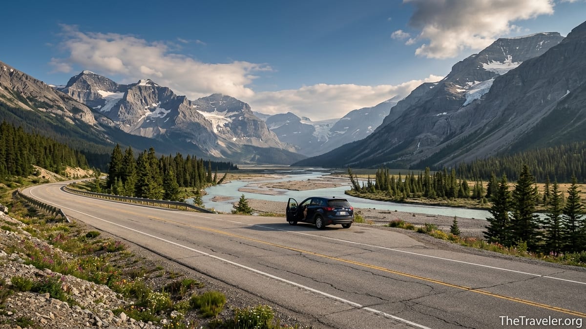
Some drives impress you. The Canadian Rockies have a way of quietly undoing you. Somewhere between Banff and Jasper, with peaks stacked to the horizon and turquoise water flashing through the trees, the road stopped feeling like asphalt and started feeling like a series of moving postcards. It is a landscape so improbably beautiful that more than once I found myself pulling into a turnout, engine ticking, just to confirm that what I was seeing was, in fact, real.
Get the latest updates straight to your inbox!
Setting Out: Banff, Lake Louise and the First Glimpse of the Postcard
The classic gateway to this drive is the town of Banff, a compact resort community wrapped in peaks and elk-trimmed lawns. Many travelers pick up a rental car in Calgary, then make the two-hour run along the Trans-Canada Highway to Banff before continuing deeper into the mountains. By the time you roll down Banff Avenue, Mount Rundle and Cascade Mountain are already filling the windshield, a prelude to what lies ahead.
Practicalities show up quickly. You need a Parks Canada pass for any time spent in Banff, Jasper or Yoho National Parks, and staff at the park gates and visitor centers are accustomed to road trippers rolling in with questions about weather, wildlife and where to stop next. Parking in Banff itself can be tight in summer; many visitors now leave their car in long-term lots on the edge of town and use local transit to explore before setting off toward Lake Louise.
Lake Louise is often the first place where the postcard metaphor starts to feel literal. On busy July mornings, the lakeshore can be shoulder-to-shoulder with people from around the world, all angling for the same photograph of aquamarine water and Victoria Glacier beyond. Even if you have seen it in a hundred brochures, watching the light slide across that milky, glacier-fed lake is arresting. It is also a good place to reset expectations: in high season you will not be alone, but the scenery is generous enough to make room for everyone.
For many drivers, Lake Louise is the decision point. You can push west into British Columbia toward Yoho National Park or turn north onto Highway 93, better known as the Icefields Parkway, toward Jasper. Most eventually do both, but no matter which way you point your hood, the sense is the same: this is where the mountains stop being a backdrop and become the road itself.
The Icefields Parkway: A Ribbon of Asphalt Through Ice and Stone
The Icefields Parkway, a roughly 230-kilometer stretch between Lake Louise and Jasper, is often called one of the most beautiful drives on earth. It earns that reputation slowly and then all at once. Within minutes of leaving Lake Louise, the traffic thins and the road begins to bend and rise, flanked by peaks that feel too tall and too close to belong beside a highway.
Early on, the parkway threads past Bow Lake, a long, calm basin of turquoise that sits directly beneath the Wapta Icefield. On a still morning, the water reflects Crowfoot Mountain so cleanly that the mountains appear to be hanging in space. There is a simple pullout beside the lake where people stand by their vehicles, coffee in hand, as if they have stumbled into a painter’s studio. A short walk leads to the shore, where driftwood lines the edge and, even in July, wind can bite at your fingers.
Farther north, the road crests at Bow Summit, one of the highest highway passes in Canada. From a signed parking area, a modest uphill stroll brings you to the Peyto Lake viewpoint. Photo after photo has made Peyto’s wolf-head outline famous, but glimpsing it for the first time is still a shock. Below the wooden viewing deck, the lake glows an opaque blue that looks almost artificial until you remember the fine rock flour sluicing down from the glaciers above. On crowded summer afternoons, visitors shuffle along the railings, falling abruptly silent when the clouds part and the color intensifies.
Somewhere between these big-name stops is where the drive becomes something quieter. Long sections of the parkway offer no services, no billboards and often no cell coverage. You drive between dense stands of fir and spruce, cross pale, braided rivers, and watch hanging glaciers slung like frozen waves along the valley walls. Bears sometimes graze on roadside dandelions in early summer, and you will occasionally find a knot of cars pulled onto the shoulder while people watch bighorn sheep picking their way across talus slopes above.
Columbia Icefield Country: Where the Road Meets Ancient Ice
The psychological midpoint of the parkway is the Columbia Icefield, a sprawling mass of interconnected glaciers that spills over the Continental Divide. The highway rises toward it in a series of broad curves, and you can feel the temperature drop slightly as you approach. Even before you see specific glaciers, you sense the scale: mountaintops seem thicker, slopes more heavily armored with ice.
Opposite a modern visitor center, the Athabasca Glacier pushes down toward the road, its snout streaked with dust and stones. A large parking area accommodates tour buses, rental SUVs, and campervans, and from here travelers have choices. Some take guided tours that load passengers into oversized, all-terrain buses that rumble directly onto the ice, where guests step out onto a safe, groomed section. Others choose to walk a self-guided trail to a roped boundary near the toe of the glacier, passing signs that mark how far the ice extended in different decades. It is a sobering, visual lesson in how quickly these landscapes are changing.
Small details underscore the remoteness. Fuel is not available between Lake Louise and Jasper except at a few seasonal points, so most rental companies advise filling up before the parkway. Services at the icefield itself are limited, and in the shoulder seasons there are long stretches of road with no open café or gas pump in sight. Drivers share tips at pullouts about where they last saw an open station, and many carry snacks, extra water, and a printed map in case their phones show nothing but a blank signal bar.
Beyond the icefield, heading north, the road begins a series of dramatic curves and descents that have become minor attractions of their own. One of the most striking is the Big Bend, a long, sweeping hairpin where the parkway loops back on itself along a steep valley wall. From the elevated viewpoint, the road appears as a thin gray ribbon hundreds of meters below, tiny cars crawling around the curve like toy models, framed by waterfalls and cliffs. Drivers often leave their engines running while they step out for a photograph, reluctant to leave the scene even though the next corner promises something just as grand.
Waterfalls, Canyons and the Run into Jasper
As the kilometers accumulate, water becomes the drive’s recurring character. Not far beyond the Columbia Icefield, delicate streams that begin as snowmelt high on unnamed peaks gather force, leaping off cliffs and cutting deep gashes through the rock. Roadside stops such as Tangle Creek Falls are almost casual in their convenience: the cascade tumbles right beside the highway, close enough that you can feel mist on your face while standing on the shoulder.
Closer to Jasper, Sunwapta Falls and Athabasca Falls offer a different kind of spectacle. Both have well-marked parking lots and short, family-friendly paths leading to fenced viewpoints. At Sunwapta, the river narrows abruptly, surging around a small island of trees before plummeting into a chasm. Visitors lean over railings, voices raised over the roar, watching entire logs shoot through the channel like twigs. Athabasca Falls, in turn, reminds you how relentless water can be. The river has carved a series of tight canyons and potholes into the bedrock, and even in late summer its power feels out of scale with its width.
Eventually the valley opens and the forest relaxes into more widely spaced stands, signaling that Jasper is near. The town itself is smaller and quieter than Banff, with a working-railway atmosphere and fewer high-end storefronts. Many travelers end or begin their parkway drive here, checking into simple motels, family-run lodges, or campgrounds where trains can be heard at night. After hours on the road, walking Jasper’s main street at dusk, with laundry flapping from balcony railings and the scent of woodsmoke in the air, can feel almost intimate.
From Jasper, side trips unfurl in all directions. Maligne Canyon, with its narrow bridges over a sheer limestone gorge, and Pyramid Lake, with its mirror-like reflections of Pyramid Mountain, are two of the most accessible. Yet even if you go no farther, simply sitting on a bench in town and watching locals cycle past with skis or grocery bags is part of the pleasure. It is the human scale of a place that also happens to sit amid some of the most dramatic mountains on the continent.
Detouring West: Yoho National Park’s Emerald Hues
On the return leg, or as a dedicated side trip, many drivers peel off at Lake Louise and head west into Yoho National Park in British Columbia. In less than half an hour, the mood of the mountains shifts. The highway climbs through Kicking Horse Pass, then drops toward the small railway town of Field, where freight trains coil along the valley floor and simple guesthouses host hikers and climbers.
A short paved side road beyond Field leads toward Emerald Lake, one of the region’s most quietly astonishing scenes. After about fifteen minutes of driving through forest, the trees open and a wide, green-blue lake appears, ringed by peaks of the President Range. On calm days the water is so reflective that the mountains seem to lean in close, as if admiring themselves. A lakeside lodge, café, and rental kiosk support a gentle rhythm of visitors who paddle rental canoes, wander along the level shoreline trail, or settle into Adirondack chairs to watch the light shift.
Elsewhere in Yoho, roadside attractions slot neatly into a driving itinerary. The Natural Bridge, a short drive from Emerald Lake Road, shows where the Kicking Horse River has sculpted a rock span from what was once a more conventional waterfall. Pullouts explain how winter ice and spring floods continue to shape the formation. Even a quick stop here, stepping out from your car to watch water slam through narrow chutes a few meters away, reinforces how dynamic these apparently solid landscapes are.
Yoho tends to feel a little less crowded than Banff and Jasper, in part because access to some of its most delicate spots, like Lake O’Hara, is strictly limited by reservation-only buses and quotas on day hikers. For road trippers, that makes the places you can reach by car feel particularly fortunate. It is possible, in shoulder seasons, to stand on the shore of Emerald Lake in early evening with only a handful of other people for company, listening to the muted clink of paddles and the occasional distant train horn threading through the valley.
Driving Realities: Seasons, Safety and the Pace of Wonder
For all its postcard beauty, the Canadian Rockies is still a high mountain environment, and the drive demands respect. Winter and early spring can bring ice, blowing snow and reduced visibility to both the Icefields Parkway and the passes around Yoho. Provincial road agencies post detailed forecasts and condition updates, and locals treat them as essential reading before they set out. Rental companies often equip vehicles with winter tires in the colder months, and signs at park entrances remind drivers that chains and emergency gear are strongly recommended during storms.
In summer, the challenges change. Long daylight hours and dry pavement can lure drivers into thinking they can cover more distance than is comfortable. The Icefields Parkway in particular is deceptively slow: even though the speed limit is generally 90 kilometers per hour, frequent scenic stops, wildlife sightings, and short hikes can easily stretch a Lake Louise to Jasper run into a full day. Travelers who try to squeeze it into a rushed afternoon often arrive at their destination exhausted, with more memories of tail-lights than glaciers.
Planning ahead softens many of these edges. Booking accommodations early, especially in July and August, is less about chasing luxury and more about guaranteeing any bed at all. Simple motels in Jasper, older lodges at the Columbia Icefield, and small inns in Field can fill months in advance. Likewise, those arriving in rental cars do well to confirm fuel locations, as some gas stations along the corridor operate only from roughly late spring through early fall. Carrying a spare layer, extra snacks and plenty of water is less an exercise in paranoia than in comfort.
Perhaps the most important adjustment, though, is mental. The Rockies reward a slower, more observational approach. Instead of treating the parkway and its feeder roads as conduits between must-see attractions, it is worth embracing the idea that the road itself is the experience. Pull over for a herd of elk, stop to read roadside geology panels, walk ten minutes down an unassuming trail to find a quiet bend in a river. These are the unscripted moments that give the journey its texture.
The Takeaway
Driving through the Canadian Rockies feels, at times, like moving through a carefully curated gallery of landscapes. Yet nothing about it is staged. Clouds slide in and erase entire ridge lines; minutes later, a shaft of light will illuminate a single glacier while the rest of the valley stays in shadow. Rivers change color with the season, roadside slopes burst into brief riots of wildflowers, and even familiar viewpoints like Peyto Lake or Emerald Lake can look entirely different from one visit to the next.
What lingers most after the trip is not just a highlight reel of famous stops, but a mosaic of smaller impressions: the quiet click of a cooling engine in an empty pullout, the smell of wet pine after a passing shower, the way strangers lean over maps together at a picnic table, tracing tomorrow’s route with a fingertip. On paper, this is a drive from Banff to Jasper and back again, maybe with a detour into Yoho. In memory, it becomes a long, slow exhale, a stretch of time when the outside world narrows to a strip of pavement and a horizon sewn with mountains.
If you go, go prepared and unhurried. Respect the weather, the wildlife and the roads. Fill your tank and your daypack, but leave room in your plans for detours. Sooner or later you will round a bend and see something that forces your hand to the indicator, pulling you off the main flow of traffic and into a small moment of stillness. In that pause, as peaks rise around you and a glacial river moves off toward some unseen valley, you will understand what so many travelers mean when they say that in the Canadian Rockies, reality looks like a postcard and feels, just for a while, even better.
FAQ
Q1. Do I need a special permit to drive the Icefields Parkway and other roads in the Canadian Rockies?
You do not need a special driving permit, but you do need a valid national park pass for Banff, Jasper and Yoho if you are stopping anywhere along the way, including viewpoints and trailheads.
Q2. How long should I plan for the drive between Lake Louise and Jasper on the Icefields Parkway?
The distance is roughly 230 kilometers, but most travelers find that allowing a full day, 8 to 10 hours with stops for viewpoints, short walks and meals, makes the experience far more enjoyable.
Q3. Is it safe to drive the Canadian Rockies in winter?
It can be safe with proper preparation, winter tires and careful attention to road condition reports, but storms, icy sections and early darkness mean some visitors prefer to travel in late spring through early fall instead.
Q4. Are gas stations and food readily available along the Icefields Parkway?
Services exist but are limited and often seasonal, so it is wise to start with a full tank from Banff, Lake Louise or Jasper and carry snacks and water in case cafés or fuel stops you expect are closed.
Q5. Can I see the Columbia Icefield and Athabasca Glacier without booking a tour?
Yes, you can drive to the Columbia Icefield area, park near the visitor center and walk a signed trail to a safe viewpoint near the toe of the Athabasca Glacier, even if you do not join a guided excursion onto the ice itself.
Q6. What kind of vehicle is best for this road trip?
Most standard cars and small SUVs are suitable in summer conditions; in winter and shoulder seasons, vehicles with good winter tires and modern stability features provide additional confidence on snow and ice.
Q7. When is the best time of year to drive through the Canadian Rockies?
Late June through September typically offers the best combination of open mountain passes, accessible viewpoints, and milder weather, though this is also when traffic and accommodation demand are highest.
Q8. How common is wildlife on the roadside, and what should I do if I encounter animals?
Seeing elk, deer, bighorn sheep or bears from the car is fairly common; it is important to slow down, stay inside your vehicle, avoid feeding or approaching animals and move on once you have watched briefly.
Q9. Do I need to book accommodation in advance along the route?
In peak season, reserving lodging in Banff, Lake Louise, Jasper or small hubs like Field well ahead of time is strongly recommended, as options can sell out weeks or months in advance.
Q10. Is it possible to drive from Banff to Jasper and back in one day?
It is technically possible but would make for a very long and rushed outing; most travelers find the experience more rewarding if they overnight in Jasper or near the Columbia Icefield and break the journey into at least two days.