


Grand Gulch, tucked into the Cedar Mesa region of Bears Ears National Monument in southeast Utah, is one of the Southwest’s most rewarding but logistically complex backcountry destinations. Between the permit system, limited services, fragile archaeological sites, and primitive trails, a successful trip depends on understanding where to get official maps, how permits work, and what to expect on the ground. This guide pulls together current, real-world information to help you plan responsibly and confidently.
Get the latest updates straight to your inbox!
Understanding Grand Gulch and the Cedar Mesa Permit System
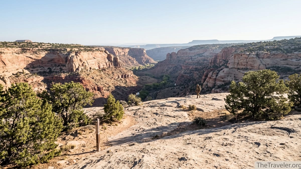
Grand Gulch is a long, serpentine canyon network draining the Cedar Mesa plateau in San Juan County, Utah. Managed by the Bureau of Land Management as part of Bears Ears National Monument, it is famous for its concentration of Ancestral Puebloan cliff dwellings, rock art panels, and granaries tucked into alcoves above the canyon floor. Unlike better-known national parks with signed trails and developed campgrounds, Grand Gulch is a primitive backcountry area where route-finding, self-reliance, and cultural respect are essential.
Because of the density and sensitivity of archaeological sites, the BLM manages Grand Gulch under the Cedar Mesa permit system. Day use and overnight permits are required year-round for Grand Gulch and its tributaries, along with other Cedar Mesa canyons such as Slickhorn, Fish, Owl, Road, and the forks of Mule Canyon. The permit system is not just bureaucratic red tape. It is how land managers limit daily use, monitor impacts, and fund basic services like toilets, trailhead maintenance, and on-the-ground ranger presence.
In practice this means you cannot simply drive to Kane Gulch, shoulder a pack, and head down-canyon without paperwork. For a casual day hike into Grand Gulch from Kane Gulch or Bullet Canyon, you will need a day-use pass. For a classic multi-day backpack like Kane Gulch to Bullet Canyon or a longer traverse toward the San Juan River, you will need an overnight backpacking permit, which is capped at roughly 20 overnight visitors per day across all Cedar Mesa canyon trailheads combined. That cap means popular spring dates can book out well in advance.
The Cedar Mesa permit system is separate from America the Beautiful interagency passes. Your national parks pass does not cover Grand Gulch day-use or overnight permits. Every person entering the canyons must either have an individual day-use pass or be listed on a valid overnight permit, so factor this into group planning and budgeting from the outset.
Where to Get Reliable Grand Gulch Trail Maps
Accurate maps are crucial in Grand Gulch, where trails are often just braided footpaths along sandy wash bottoms and cairns that can be washed out by flash floods. The most authoritative free map is the BLM’s own Grand Gulch map, available as a printable and geo-referenced PDF that shows trailheads, major side canyons, mileage markers, and many named features. Versions of this official map are often posted at trailheads like Kane Gulch and Bullet Canyon and are also provided in trip planners focused on Cedar Mesa and Bears Ears.
For navigation in the field, many experienced visitors pair the BLM map with a commercial topographic map or app. For example, some hikers download a USGS-based map layer for offline use in apps like Gaia GPS or Avenza Maps and then add the BLM Grand Gulch PDF as a georeferenced overlay. This allows you to see your GPS position relative to benchmarks like Todie Canyon, Step Canyon, and the confluence zones. Buying a printed waterproof topo map of Cedar Mesa from an outdoor retailer in Moab or Monticello before you head south is also a good backup in case electronics fail.
Do not rely solely on crowd-sourced GPS tracks from random websites or social media posts. In Grand Gulch, informal use trails can lead straight to sensitive archaeological sites that land managers prefer not to have widely publicized. The official BLM map deliberately omits exact locations of many ruins and rock art panels to help protect them. Treat online trip reports as inspiration and general route confirmation, but let the BLM materials and your own navigation skills guide where you actually walk.
Before your trip, consider printing multiple copies of the Grand Gulch map at home, storing one in a waterproof map case, and keeping a spare in your vehicle. At Kane Gulch Ranger Station you will often find updated paper maps, Cedar Mesa trip planners, and staff who can take a pen and physically mark your planned route, likely camps, and water sources based on current conditions, which is far more reliable than a static image pulled from an old blog.
How the Permit System Works for Day Hikes and Overnight Trips
Permits for Grand Gulch are structured differently for day use and overnight backpacking, and the rules vary a bit by season and by canyon. Day-use permits are required year-round for hiking Grand Gulch and other designated Cedar Mesa canyons. Many visitors purchase these individual day passes through a federal reservation platform ahead of time, but they can also be obtained on-site at self-serve fee stations at major trailheads or directly from Kane Gulch Ranger Station when it is open. Fees are modest by national park standards, but they apply per person, per day, so a family of four doing a full day down to Junction Ruin and back will pay more than a solo hiker.
Overnight backpacking permits are more tightly managed, with daily quotas and a mix of advance reservations and walk-in availability. As a practical example, a group planning a three-night traverse from Kane Gulch to Bullet Canyon in April would usually reserve an overnight permit several weeks or even months in advance for the exact dates and group size. These permits are often booked through the national reservation system, and the group then finalizes the permit and picks up physical paperwork at Kane Gulch Ranger Station, where each member will typically watch a short orientation or video on visiting archaeological sites respectfully.
Walk-in permits are sometimes available for less popular dates, shoulder seasons, or shorter itineraries. A visitor arriving on a Thursday in early October might stop at the ranger station, ask about last-minute availability, and secure a one-night permit to camp in upper Kane Gulch if the overnight quota has not been reached. However, you should not plan a prime-season multi-day trip around the hope of snagging a walk-in slot. Spring and fall, particularly around school breaks, see a spike in demand from backpacking clubs, university outdoor programs, and commercial guiding companies that all draw from the same limited quota.
Fees for overnight permits are charged per person per trip and are in addition to any day-use pass requirements. While specific dollar amounts can shift over time as managers adjust fees, expect an overnight trip in Grand Gulch to cost noticeably more per person than a quick day hike, particularly for longer itineraries. Check the most current Cedar Mesa permit information shortly before you book so that you have accurate figures and understand cancellation or change policies.
Kane Gulch Ranger Station and Other Visitor Information Hubs
Kane Gulch Ranger Station is the primary on-the-ground information center for Grand Gulch and Cedar Mesa. Located on State Route 261, it sits just south of the Kane Gulch trailhead and serves as both a ranger contact point and a modest interpretive facility. The BLM currently opens the station seasonally, generally from March 1 to June 15 and from September 1 to October 31, with limited hours, often Thursday through Sunday from 8 a.m. to noon. Outside these windows, you may find only outdoor information panels and self-serve permit stations, with the building itself closed.
During open hours, Kane Gulch rangers can help you refine your itinerary based on current water availability, trail conditions, and recent weather. For instance, if thunderstorms have recently rolled across Cedar Mesa, rangers may advise you to avoid certain narrow sections or to expect murky, sediment-laden pools instead of clear potholes. They can also clarify rules on camp locations, group size limits, and site visitation etiquette. Many overnight visitors are required to watch an educational video on cultural resources here before they receive their permit, which helps ensure a shared baseline of respect for ancestral sites.
Because Grand Gulch lies in a remote part of Utah, visitor services outside the ranger station are limited. There is no gas station, grocery store, or restaurant at the trailheads. Most travelers base themselves in small towns like Blanding, Bluff, or Monticello, which have motels, campgrounds, gear shops or general stores, and other essentials. The Bears Ears Education Center in Bluff functions as an unofficial visitor hub, offering educational exhibits on the monument, current conditions reports, and guidance on low-impact travel in places like Grand Gulch and Comb Ridge.
Plan to fuel up, top off water containers, and purchase any last-minute supplies before you drive onto Cedar Mesa. Once you turn off the highway toward trailheads such as Bullet Canyon or Government Trail, you will encounter long stretches of graded dirt that can be rough, rutted, or muddy after storms. Cell service is spotty to non-existent. Treat Kane Gulch Ranger Station as your last reliable point for face-to-face information and be prepared to be self-sufficient once you shoulder your pack.
Planning Your Route: Popular Trailheads and Itineraries
Most visitors access Grand Gulch from a handful of established trailheads along the edges of Cedar Mesa. Kane Gulch is the best-known starting point, offering a relatively direct descent into the Gulch itself. A common day hike from here is to follow the canyon about four miles to the vicinity of Junction Ruin and Turkey Pen Ruin, then return the same way, making for a full day that includes significant elevation loss and gain. Fit parties sometimes extend their day further downstream before turning around, but you will want an early start to beat afternoon heat, especially in late spring.
For backpackers, through-routes between Kane Gulch and other access points are a highlight. One classic three to four day itinerary begins at Kane Gulch, joins Grand Gulch proper, then exits via Bullet Canyon, where drivers often stage a shuttle vehicle. This trip offers a mix of open canyon hiking, side trips to significant cultural sites, and varied terrain from slickrock benches to juniper-covered slopes. Longer journeys push downstream toward Collins Canyon, Government Trail, or even closer to the San Juan River, but these require careful attention to water planning and a stronger tolerance for route-finding in less-traveled sections.
Side canyons like Todie, Step, and Sheiks offer additional loop and lollipop options for experienced navigators who are comfortable interpreting topographic maps. For example, a small group might enter via Todie Canyon, drop into Grand Gulch, explore upstream and downstream over several days, then exit via Kane Gulch. These itineraries can reduce overlap with more heavily traveled stretches while still staying within areas that rangers frequently patrol and monitor.
When sketching your route, balance ambition with realism. Distances in Grand Gulch can feel longer than they look on a map due to sandy footing, repeated stream crossings, and stops to explore side alcoves or photograph rock art from appropriate distances. A plan that looks like a modest 10 mile day on paper may feel strenuous under a full pack in warm weather. Build in time to move slowly through cultural sites, respect closures, and adjust your schedule if storms or heat demand earlier finishes.
Seasonal Conditions, Water, and Safety Considerations
Spring and fall are the prime seasons for Grand Gulch. From roughly March through early June, daytime highs often land in a comfortable range for backpacking, though cold nights and occasional late snow on the mesa are still possible. From September into October, cooler temperatures return after the intense heat of midsummer, and changing light brings out rich colors in the canyon walls. These shoulder seasons are also when Kane Gulch Ranger Station typically operates with regular hours, making it easier to secure permits and up-to-date route information.
Summer presents serious challenges. Temperatures on the exposed Cedar Mesa plateau can soar, and even in the shaded canyon bottoms, the air can feel stifling, especially when the sun is high. Flash flood risk increases during the North American monsoon period, typically mid to late summer into early fall. In narrow segments and side slots, a storm miles away can send a wall of water and debris downstream without warning. Backpackers in July or August must be especially conservative about weather forecasts, keeping a close eye on the sky and knowing when to retreat to higher ground.
Water availability is one of the key planning variables in Grand Gulch. Springs, seeps, and potholes exist, but their reliability varies from year to year and season to season. The BLM’s Cedar Mesa trip planners and rangers at Kane Gulch can often provide recent reports on which sources are flowing or holding useable pools. As a rule of thumb, do not assume every marked spring or note in an old guidebook is dependable. In dry years, parties have been forced to adjust itineraries mid-trip to reach known water sooner or to shorten loops when sources dried up earlier than expected.
Safety in Grand Gulch is largely self-managed. There are no developed campsites, and you must choose durable, previously used sites away from archaeological features and out of drainages prone to flooding. Cell coverage is unreliable, so many backcountry travelers carry a satellite communicator for emergencies. Even for a simple day hike to a popular ruin, bring more water than you think you will need, sun protection, a basic first aid kit, and a paper map and compass in case electronics fail. Treat Grand Gulch as true wilderness, not as a front-country park walk.
Cultural Respect and Low-Impact Travel in Grand Gulch
Grand Gulch is both a spectacular hiking destination and a living cultural landscape that remains deeply significant to Native nations with ancestral ties to the region, including Navajo, Hopi, Zuni, and Ute communities. The density of cliff dwellings, kivas, rock art, and artifact scatters means you will almost certainly encounter cultural sites, even if you are not seeking them out. Visitors are expected to approach these places with respect and to follow guidelines that protect them for future generations.
Standard rules in Grand Gulch include staying off walls and roofs of structures, never entering rooms or kivas, and always observing rock art and artifacts from a distance. You should not touch petroglyph panels or pick up pottery sherds, corncobs, or other cultural materials, even briefly. Moving an artifact from where it lies can erase important archaeological context. At some high-profile sites, rangers may have placed signs or barriers indicating where visitors may sit or stand. Where no signs exist, assume that the most conservative option is the correct one.
Camping regulations in the canyons are also shaped by cultural protection. In many stretches, you must camp a specified minimum distance away from archaeological features and from water sources. That might mean walking farther than you planned at the end of the day to find a legal site on durable ground such as sand or slickrock. Fire rules can shift based on season and fuel conditions, but even when campfires are technically allowed, many experienced visitors rely exclusively on backpacking stoves to avoid wood collection impacts and fire scars in narrow canyon bottoms.
Finally, think about your role in sharing information. When you return home, it may be tempting to post exact GPS coordinates and detailed blow-by-blow descriptions of every ruin you visited. Consider focusing instead on broad route descriptions, general impressions, and Leave No Trace messaging, leaving specific site locations out of public trip reports. This approach supports tribal and conservation perspectives that call for limiting the spread of sensitive site data while still celebrating the experience of walking through Grand Gulch.
The Takeaway
Planning a trip into Grand Gulch involves more research and preparation than many other desert hikes, but the payoff is a deep immersion in one of the Southwest’s most remarkable cultural and natural landscapes. Understanding how the Cedar Mesa permit system works, where to obtain reliable trail maps, and what to expect seasonally will help you design an itinerary that matches your experience level and respects the limits set by land managers.
On the ground, Kane Gulch Ranger Station and regional hubs like Blanding, Bluff, and Monticello provide critical support in an otherwise undeveloped part of Utah. Treat these places as key planning stops, not afterthoughts. Build your route around realistic distances, variable water, and the time you need to absorb the canyon’s quiet and its history at a respectful pace.
Most importantly, remember that Grand Gulch is not just a backdrop for adventure. It is a living cultural landscape whose significance extends far beyond any one visitor’s trip. If you approach it with humility, preparation, and care, you can help ensure that its trails, sites, and stories remain intact for the tribal communities who are connected to it and for travelers who will follow in your footsteps.
FAQ
Q1. Do I need a permit to day hike in Grand Gulch?
Yes. Day-use permits are required year-round for Grand Gulch and other designated Cedar Mesa canyons. You can generally obtain them in advance through the federal reservation system or at self-serve trailhead fee stations and Kane Gulch Ranger Station when it is open.
Q2. How do I get an overnight backpacking permit for Grand Gulch?
Overnight permits are managed through the Cedar Mesa system, with a limited number of people allowed into the canyons each day. Most visitors reserve permits ahead of time for specific dates and group sizes, then finalize and pick them up at Kane Gulch Ranger Station, where they also receive a briefing on safety and cultural site etiquette.
Q3. Where can I find an official Grand Gulch trail map?
The Bureau of Land Management publishes an official Grand Gulch map that is available as a PDF and often posted at major trailheads. Many hikers print this map at home or download it as a georeferenced file to use with navigation apps, pairing it with standard topographic maps of Cedar Mesa for added detail.
Q4. When is Kane Gulch Ranger Station open?
Kane Gulch Ranger Station typically operates seasonally, with hours concentrated in spring and fall, often March through mid-June and September through October, and usually in the mornings on select days of the week. Exact hours can change, so check current BLM information shortly before your trip.
Q5. What towns are best for staging a Grand Gulch trip?
Most visitors use Blanding, Bluff, or Monticello as staging points. These towns offer fuel, lodging, food, and basic gear, and Bluff hosts the Bears Ears Education Center, which provides additional information on regional conditions and low-impact travel practices.
Q6. Is water reliable in Grand Gulch?
Water sources such as springs, seeps, and potholes exist but are not uniformly reliable. Their flow can vary widely by season and by year. Always consult recent information from BLM trip planners and Kane Gulch rangers and be prepared to adjust your itinerary or carry extra water if conditions are dry.
Q7. Can I bring my dog into Grand Gulch?
Pets are generally prohibited in Grand Gulch and many Cedar Mesa canyons because of the sensitivity of archaeological sites and wildlife. If you are traveling with a dog, seek alternative hikes in areas where pets are allowed and confirm current rules before you go.
Q8. Are campfires allowed in the canyon?
Fire regulations change based on season and conditions. Even when small fires are technically permitted, many visitors choose to use only backpacking stoves to avoid damaging limited wood resources and leaving fire scars. Check current fire restrictions with the BLM before your trip and be prepared to go without a campfire.
Q9. How difficult are Grand Gulch hikes?
Grand Gulch hiking ranges from strenuous day trips with significant elevation change to multi-day backpacks that require route-finding, water management, and comfort in remote terrain. Trails can be sandy, rocky, and occasionally brushy, with limited signage. Parties should be experienced in desert backcountry travel and equipped for self-rescue.
Q10. Is Grand Gulch suitable for first-time backpackers?
Because of its remoteness, permit system, cultural sensitivity, and variable water, Grand Gulch is usually better for backpackers who already have some experience in desert environments. Newer backpackers who are set on visiting may want to start with a guided trip, a shorter overnight in a well-traveled section, or extensive practice in less committing areas first.