


High above the canyons of southeast Utah, Cedar Mesa is a broad sandstone table cut by a maze of sinuous gorges hiding ancient cliff dwellings, rock art, and perennial springs. Tucked inside Bears Ears National Monument, it offers a rare mix of serious backcountry adventure and some of the most culturally significant landscapes in the American Southwest. Visiting here is not like dropping into a national park viewpoint. It requires permits, planning, good navigation skills, and a commitment to traveling with respect. Done right, a few days on Cedar Mesa can be one of the most powerful trips you take in canyon country.
Get the latest updates straight to your inbox!
Understanding Cedar Mesa and Bears Ears
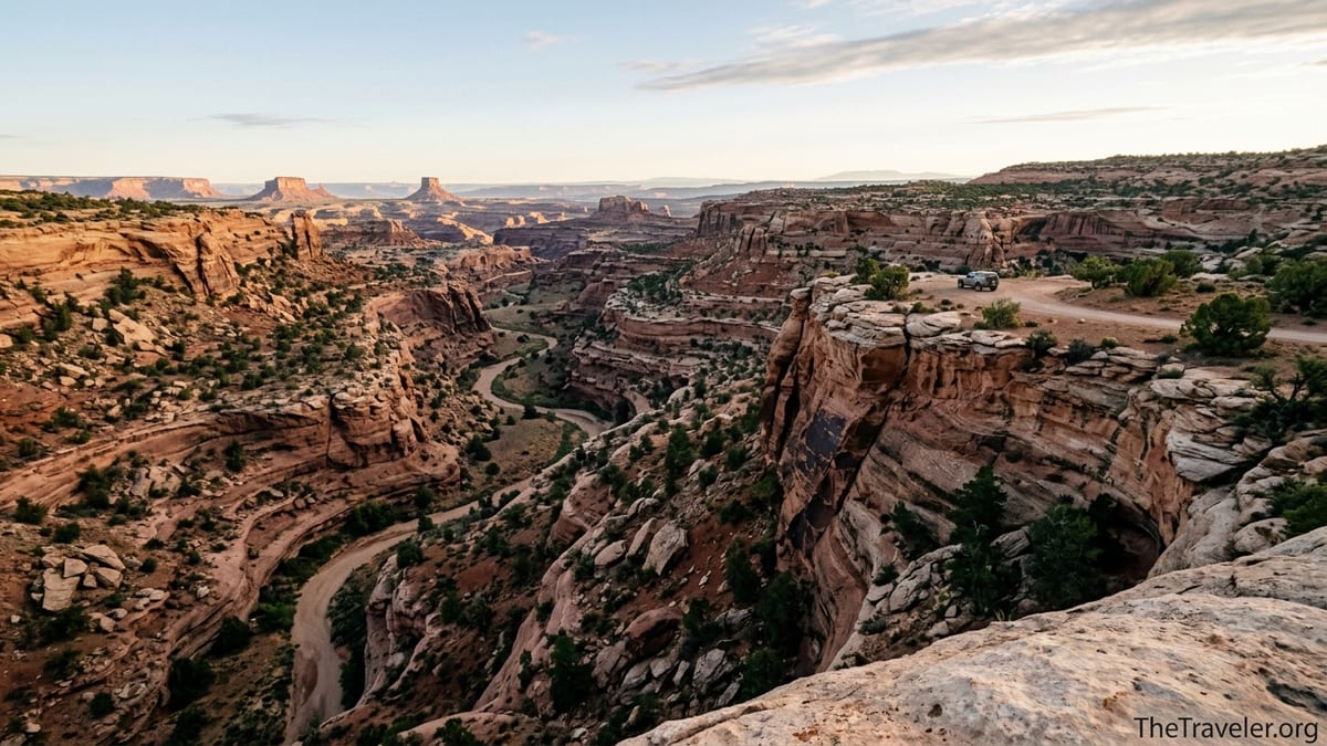
Cedar Mesa rises to roughly 6,000 feet in southeast Utah, between the San Juan River to the south and Utah Highway 95 to the north. From above it looks like a flat, forested plateau, but it is deeply incised by canyons such as Grand Gulch, Mule, Slickhorn, Owl, and Fish, which ultimately drain toward the San Juan. Most of the mesa sits inside Bears Ears National Monument and is managed by the Bureau of Land Management’s Monticello Field Office as a Special Recreation Management Area, with a focus on protecting archaeological sites and fragile desert ecosystems.
The human history here stretches back thousands of years. The canyons hold dense concentrations of Ancestral Puebloan sites, from small granaries tucked into alcoves to elaborate cliff dwellings and rock art panels. A single day in Grand Gulch can take you past petroglyphs, painted figures, and masonry dwellings perched on ledges high above the canyon floor. For modern visitors, this density is part of the draw, but it is also why regulations are stricter than in many other BLM landscapes.
Administratively, you will see Cedar Mesa referenced across several official resources. The BLM’s Cedar Mesa Trip Planner and Cedar Mesa permit information detail access rules, day use passes, and backpacking limits, while Bears Ears National Monument guidance stresses "Visit with Respect" principles and notes that some areas are not appropriate for heavy visitation. For planning, it is helpful to think of Cedar Mesa as a semi-remote, permit-controlled backcountry zone attached to a much larger monument.
Nearby towns are small and services limited. Bluff and Blanding, each roughly 45 to 60 minutes from the main canyon trailheads in good conditions, are your primary bases for lodging, fuel, and groceries. Many visitors overnight in Bluff, then drive up Highway 261 or 95 to reach the mesa early, stopping at the Kane Gulch Ranger Station when it is open.
Getting There, Seasons, and Road Logistics
Cedar Mesa sits in a remote corner of San Juan County. Most travelers from Denver or Salt Lake City drive in via U.S. Highway 191, then branch off on Highway 95 or 261. The closest commercial gateway is Cortez, Colorado, about 2.5 hours to the east by car, though some visitors fly into Salt Lake City or Albuquerque and allow a full day to reach the area. There is no public transit; you need your own vehicle and enough fuel for backtracking if conditions deteriorate.
The two key approaches to the top of the mesa are Utah Highway 95 from Blanding or Hanksville, and Utah Highway 261 from Mexican Hat. The latter includes the Moki Dugway, a roughly 2.7 mile stretch of steep, unpaved switchbacks that climb the sheer south face of Cedar Mesa with grades around 10 percent and sharp hairpin turns. Although it is an official state highway segment, it can be intimidating for drivers not used to gravel roads, and is not recommended for large RVs, trailers, or in icy conditions. Passenger cars can usually manage it in dry weather if driven slowly and carefully, but many visitors prefer to approach via the gentler, fully paved Highway 95.
Inside the mesa interior, most canyon trailheads are reached by short graded dirt roads that leave 95 or 261. For example, the Kane Gulch Ranger Station and Grand Gulch trailhead sit just off Highway 261, while the Government Trail and Bullet Canyon trailheads are reached by dirt spurs. In dry late spring or fall, these access roads are usually passable for standard clearance vehicles, although rocks and ruts are common. After heavy rain or snowmelt they can become muddy and rutted enough to warrant high clearance or four-wheel drive. Because road conditions can change quickly, it is wise to ask at the ranger station or at local outfitters in Bluff and Blanding for current updates.
Spring and fall are the prime seasons. From March through early June, daytime highs are generally pleasant in the 60s and 70s Fahrenheit on the mesa top, but nights can be below freezing. September and October bring cooler nights and clear, crisp days that are ideal for multi-day backpacks. Summer heat on the canyon floors can be intense, with temperatures often climbing well above 90 degrees and long stretches without reliable shade or water. Winter can bring snow to the mesa top and ice to the Moki Dugway and canyon access roads, which may temporarily close or become unsafe for non-specialized vehicles.
Permits, Passes, and Regulations You Must Know
Unlike many BLM areas where you can simply park and walk in, Cedar Mesa operates under a system of mandatory passes and limited-use permits. Day hiking in the canyons of Cedar Mesa and nearby Comb Ridge now requires a day hiking pass year round, which can often be purchased at self-serve fee stations at trailheads or at the Kane Gulch Ranger Station when it is open. As of mid 2026, the day-use fee for many Cedar Mesa canyons is modest per person, typically in the range of a few dollars, but travelers should check current prices on official BLM information before they go because fees have increased in recent years to fund monitoring and maintenance.
Overnight backpacking requires a separate permit with capped numbers. The main backpacking canyons, including Grand Gulch and its tributaries such as Kane, Bullet, Collins, and Sheiks, have strict daily quotas on group sizes and total numbers of overnight visitors. Permits are issued through a mix of advance reservations, which are typically handled through Recreation.gov, and same-day or day-before permits available in person at the Kane Gulch Ranger Station during its seasonal open hours. For popular spring holidays, weekend permits for routes like Kane Gulch to Bullet Canyon often book out weeks in advance.
Some individual archaeological sites, such as Moon House in McLoyd Canyon, have their own additional permit requirements and smaller daily limits, reflecting how fragile and crowded they can become. Moon House permits, for example, are limited to a small number of visitors per day and are only available by reservation during specific seasons. It is not possible to spontaneously drop in without prior planning. For many travelers, this means choosing between a general backpacking itinerary in Grand Gulch or a focused day trip to a single marquee site, rather than trying to do everything in one short visit.
The Kane Gulch Ranger Station is the primary in-person contact point for Cedar Mesa. According to current BLM information, it typically operates on a limited seasonal schedule, for example March 1 to June 15 and September 1 to October 31, with morning hours several days a week. During a shoulder season visit, you might arrive at 8 a.m., speak with a ranger about water levels and conditions on your chosen route, pay for your backpacking permit, and watch a short "Visit with Respect" orientation before hiking out. Outside these operating windows, you will need to rely on self-issue stations, online reservations, and posted guidance at the trailheads.
Where to Base Yourself, Camp, and Resupply
Most visitors pair time on Cedar Mesa with nights in Bluff or Blanding. Bluff, a historic town on the San Juan River about 40 minutes south of the Moki Dugway, has several small motels, locally run inns, and a few newer hotels catering to Bears Ears travelers. It also hosts the Bears Ears Education Center, run by a nonprofit, which offers cultural context, current conditions, and guidance on visiting tribal homelands respectfully. Blanding, north of the mesa on Highway 191, offers more conventional services such as chain motels, supermarkets, and gas stations, making it a practical choice if you are arriving late or need to restock between backpacks.
On the mesa itself, camping is predominantly dispersed and primitive, though there are ongoing efforts to move toward designated sites in the busiest areas. The BLM has identified and signed several hardened dispersed campsites along key access roads where camping is encouraged. These are basic gravel clearings or existing flat spots without amenities: no picnic tables, no toilets, no water. Visitors are expected to bring their own water, pack out all trash, and use portable toilets or follow human-waste disposal practices that meet current BLM guidance, which increasingly favors packing out waste in high-use cultural landscapes.
Because Cedar Mesa sits within a patchwork of federal and tribal jurisdictions, it is critical to camp only on appropriate public lands and to avoid parking or camping on Navajo Nation or private inholdings without explicit permission. Before you drive down a promising dirt spur to find a campsite, double-check a current BLM or high-quality topo map to confirm you are still on BLM-managed land. In practice, many visitors keep things simple by using established dispersed sites along Highway 261 or 95 near major trailheads, or by returning to formal campgrounds at places such as Natural Bridges National Monument after canyon day hikes.
There are no services once you leave the highway. Plan to be self-sufficient: fill your fuel tank in Bluff or Blanding, carry at least several gallons of water in your vehicle, and have enough food for an extra day in case weather or vehicle trouble delays your exit. A common pattern for a three-day backpack is to check in at Kane Gulch, hike for two or three days in Grand Gulch, then return to the trailhead and drive back to a motel room in Bluff for a shower and a hot meal before heading on to Monument Valley or Moab.
Classic Canyons and Ancient Sites to Experience
Cedar Mesa is less about ticking off named overlooks and more about immersing yourself in a landscape of canyons and cultural sites. That said, several routes have become classics for good reason. Kane Gulch into Grand Gulch, for example, is a popular overnight or multi-day trip. Starting from the trailhead just north of the ranger station, you descend a shallow drainage that gradually deepens into a sandstone canyon. Around half a day down-canyon you reach Junction Ruin, a photogenic cluster of dwellings and granaries tucked into an alcove above the confluence with Grand Gulch. Continue downstream and you pass additional ruins and rock art panels, each requiring careful observation to notice and approach respectfully.
Bullet Canyon to Grand Gulch is slightly more rugged and offers another multi-day loop or through-hike option. A typical three-day itinerary might involve starting down Bullet, camping near a spring-fed section of the canyon, then looping out via Kane or Collins Canyon. Along the way, hikers often encounter large alcove ruins and rock art tucked far above the main canyon floor. Because routes like these spend long stretches away from easy exit points, they reward strong navigation skills, careful water planning, and comfort with scrambling around dryfalls and pour-offs.
Day hikers and those with limited time can still experience Cedar Mesa’s character through shorter out-and-back walks. House on Fire, a well-known ruin in Mule Canyon off Highway 95, requires a relatively short hike along a sandy wash and offers a striking visual effect when photographed under mid-morning light that reflects off the canyon floor and "lights" the streaked alcove ceiling. Similarly, the Government Trail across Cedar Mesa’s interior accesses the rim of Grand Gulch and views toward the Quail Panel rock art site on longer day or overnight trips, showcasing the way the mesa top opens abruptly into a labyrinth of canyons.
Other nearby landscapes, such as Comb Ridge and Valley of the Gods, provide a change of scenery. While technically distinct from the core Cedar Mesa canyons, they are often folded into the same trip. A traveler might spend two nights backpacking in Grand Gulch, then drive north to explore roadside rock art and short hikes along Comb Ridge, or south to camp among the towering buttes of Valley of the Gods with long views back toward the Bears Ears buttes rising above Cedar Mesa’s northern rim.
Backcountry Skills, Water, and Safety Considerations
Travel in Cedar Mesa is mostly off-pavement and often off-trail, so solid backcountry skills make the difference between a rewarding adventure and a stressful, risky trip. Navigation in the canyons relies less on constructed paths and more on reading washes, benches, and cairned routes around obstacles. Many guidebooks and trip planners recommend carrying a detailed topographic map of Grand Gulch and the Cedar Mesa plateau, often from commercial publishers that highlight springs and ruins. Combining this with a GPS device or smartphone mapping app loaded with offline maps lets you confirm your position when the canyon walls block wider views.
Water is the central planning factor for multi-day trips. Springs and pools exist in most major canyons, but their reliability varies by season and recent precipitation. In some years, long stretches of Upper Grand Gulch may have only a few seeps or pothole pools, while lower sections retain more continuous flows. Before committing to a route, call or visit the Kane Gulch Ranger Station for recent reports on specific springs. On the ground, never assume an unverified blue line on a map is flowing; plan conservative daily distances that allow for backtracking if a source is dry, and carry a filter or purifier as well as enough capacity to haul several liters per person between sources.
Cedar Mesa’s remoteness also means that self-reliance is critical in emergencies. Cell service is spotty to nonexistent in most canyons and on stretches of Highway 261 and 95. Many experienced visitors carry a satellite messenger or personal locator beacon to contact help in the event of a serious injury or vehicle breakdown, particularly in shoulder seasons when fewer people are around. Simple precautions such as telling a friend your detailed itinerary, signing trailhead registers clearly, and building in an extra day of food can make rescues more straightforward if something goes wrong.
Environmental hazards are typical of the high desert. In spring and early fall, afternoon thunderstorms can bring sudden downpours, raising the risk of flash floods in narrow slots and side canyons, even if the sky overhead looks benign. In summer, heat exhaustion and dehydration are common risks for unprepared hikers. In winter and early spring, icy pour-offs and snow on the mesa rim can turn normally simple scrambles into serious obstacles. Check detailed weather forecasts for Bluff or Mexican Hat and adjust your plans if strong storms or heat waves are expected during your visit.
Visiting Ancient Sites with Deep Respect
Perhaps the most important part of planning a Cedar Mesa trip is understanding that you are entering living cultural landscapes, not abandoned ruins. The canyons and mesas of Bears Ears remain deeply significant to many Native nations, including Navajo, Hopi, Ute, and Zuni communities, whose ancestors built and used the structures you see today. Local tribes continue to advocate for visiting with humility, treating dwellings and rock art as active places of ceremony and memory rather than backcountry playgrounds.
In practical terms, this means adopting strict low-impact behavior at cultural sites. Do not enter structures, climb on walls, or lean against rock art panels, even if you see footprints or social media images suggesting others have done so. The masonry and plaster are often fragile and can be damaged by a single incautious touch. Avoid sitting or placing backpacks on midden areas, which are the darker, trash-like deposits below many alcoves that contain ancient artifacts and organic material important for scientific study. If you encounter pottery sherds, corncobs, or tools, enjoy them in place and leave them exactly as you found them.
Photography is welcome at most sites, but a respectful approach avoids disclosing precise locations of lesser-known ruins and panels, especially online. In recent years, the popularity of geotagged posts has contributed to overuse at specific locations. Trip planners and rangers increasingly ask visitors not to share exact coordinates or detailed directions for more vulnerable sites, encouraging others instead to plan visits through official channels or knowledgeable guides who can offer cultural context and emphasize appropriate behavior.
Noise and group size also shape the experience. Many people visit Cedar Mesa precisely for its sense of quiet and sacredness. Speaking softly near sites, keeping groups small when entering alcoves, and choosing dispersed campsites away from prominent ruins all help maintain that atmosphere. In some canyons, camping directly beneath or across from archaeological sites is prohibited; rangers can point out common no-camping zones and suggest better alternatives during your permit briefing.
Planning a Sample Three-Day Cedar Mesa Itinerary
A realistic first visit for fit, experienced hikers might center on a three-day backpack in Grand Gulch combined with a day or two of frontcountry exploring. One example itinerary starts with a night in Bluff to recover from travel and gather supplies. The next morning, after an early breakfast, you drive an hour to Kane Gulch Ranger Station, pick up your reserved permit for a Kane Gulch to Bullet Canyon through-hike, review water reports with the ranger, and then hit the trail by late morning.
On day one, you descend Kane Gulch, acclimating to the canyon terrain and stopping at a few ruins visible from the main wash. That evening you camp on a sandy bench well away from ancient sites, using a portable toilet system if required by current regulations and treating water from pools or seeps below camp. On day two, you follow Grand Gulch downstream, visiting Junction Ruin and other panels as time and energy allow, always watching your footing and keeping a respectful distance from fragile structures. That night you camp near a reliable water source flagged by the ranger, aiming for an early bedtime to beat the next day’s climb out.
Day three begins with a cool start up Bullet Canyon, where you may encounter a few short scrambles and dryfalls requiring route-finding around boulders and pour-offs. By early afternoon you top out on the mesa, hike back to your vehicle, and drive to Blanding for a hot shower and meal. If you have an extra day before heading home, you might then drive along Highway 95 to hike to House on Fire in Mule Canyon or stop at Natural Bridges National Monument for a loop trail that links several large rock spans and offers views back toward the Cedar Mesa rim.
This kind of itinerary keeps daily mileage moderate, focuses on one main canyon system rather than trying to sample everything, and builds in margins for weather or slower-than-expected travel. It also highlights how essential advance permits and flexible logistics are in an area where ranger station hours are limited and trailhead access can change with a single storm.
FAQ
Q1. Do I really need a permit just to day hike in Cedar Mesa canyons?
Yes, most main Cedar Mesa and nearby Comb Ridge canyons require a day hiking pass year round, which you typically purchase at trailhead self-pay stations or at the Kane Gulch Ranger Station when it is open.
Q2. Is the Moki Dugway safe to drive to reach Cedar Mesa?
The Moki Dugway on Highway 261 is a steep, unpaved series of switchbacks. It is usually safe for careful drivers in dry conditions with standard vehicles, but it is not recommended for large RVs, trailers, or in snow and ice. You can avoid it entirely by approaching Cedar Mesa via the paved Highway 95 instead.
Q3. What is the best season to visit Cedar Mesa for hiking and backpacking?
Spring, from roughly March to early June, and fall, from September through October, offer the most comfortable temperatures and more reliable water sources in the canyons. Summer can be extremely hot, while winter brings snow and ice that can complicate driving and hiking.
Q4. How many days should I plan for a first-time visit?
A long weekend of three to four days gives you time for one overnight or multi-day backpack and at least one additional day of shorter hikes or scenic drives. With a full week you can combine several canyons, explore Comb Ridge, and visit places like Natural Bridges National Monument or Valley of the Gods.
Q5. Are there guided trips available if I am not comfortable going on my own?
Yes, several permitted outfitters based in Bluff, Blanding, and Moab run guided day hikes and multi-day backpacking trips in Bears Ears and Cedar Mesa. A guided trip can be a good option if you want cultural interpretation, logistics support, and experienced leadership for navigation and safety.
Q6. Can I rely on finding water in the canyons, or should I carry everything?
Most classic canyons such as Grand Gulch and its major tributaries have springs or pools, but their reliability changes with season and rainfall. It is important to check current water reports with the Kane Gulch Ranger Station, carry a filter or purifier, and have enough capacity to haul several liters between known sources.
Q7. Is dispersed camping allowed anywhere on Cedar Mesa?
Dispersed camping is generally allowed on BLM-managed lands on Cedar Mesa, but visitors are encouraged or required in some areas to use existing hardened sites along main access roads. Always verify that you are on public land, follow posted no-camping zones near cultural sites, and be prepared for completely primitive conditions with no services.
Q8. What maps or navigation tools should I bring?
A detailed topographic map that covers Grand Gulch and the Cedar Mesa plateau, combined with a GPS device or smartphone loaded with offline maps, works well for most visitors. Many hikers also carry a compass and printed route descriptions so they are not fully dependent on electronics.
Q9. How can I visit ancient sites without causing damage?
Stay on established paths, avoid entering or touching structures, keep off middens, never disturb or remove artifacts, and give rock art panels plenty of space. Traveling in small, quiet groups and camping away from prominent ruins further reduces your impact and respects the ongoing cultural significance of these places.
Q10. Is Cedar Mesa suitable for families with children?
Yes, but only with careful trip selection and preparation. Shorter day hikes such as the approach to House on Fire can work well for older children who are comfortable with uneven terrain and can follow strict rules about not touching ruins or artifacts. Overnight backpacks in remote canyons are best reserved for families with prior backcountry experience and strong skills in navigation and self-rescue.