


More news on this day
Travelers in and out of Atlanta saw conditions stabilize on Monday afternoon as a flash flood warning for metro Atlanta expired and flight operations at Hartsfield Jackson Atlanta International Airport returned to largely normal levels after weather related disruptions earlier in the day.
Get the latest news straight to your inbox!
Warning Expires After Intense Morning Downpours
The National Weather Service issued a flash flood warning late Monday morning for parts of the Atlanta metropolitan area after bands of heavy rain moved across north and central Georgia, quickly overwhelming drainage in low lying and urban areas. Meteorological bulletins described rainfall rates capable of producing rapid ponding on roads, especially along interstates and secondary routes that funnel commuters toward the city and its airport.
By mid to late afternoon, updated forecasts indicated that the most intense cells had shifted away from the core of the metro area, allowing the flash flood warning to expire on schedule. While localized flooding was still possible in poorly drained locations, publicly available information showed that the broader, short fused flood threat for the region had eased as rainfall intensity dropped and water levels began to recede.
Hydrologic outlooks for the remainder of Monday suggested that any lingering showers would be scattered and less organized, reducing the likelihood of additional, rapid onset flooding. Forecasters continued to monitor creeks and tributaries that respond more slowly to heavy rain, but the focus gradually moved from emergency alerts toward short term clean up and recovery in affected neighborhoods.
Ground Stop Lifted and Operations Normalize at ATL
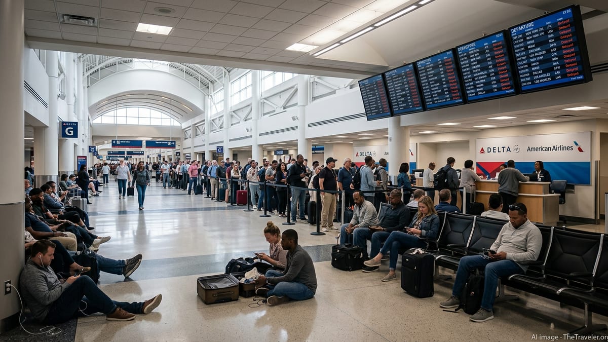
The heavy rain coincided with a period of restrictions at Hartsfield Jackson Atlanta International Airport, one of the world’s busiest aviation hubs and a critical connection point for domestic and international travelers. According to published coverage, a temporary ground stop earlier in the day slowed departures as thunderstorms and low visibility passed over the field, leading to a buildup of delayed flights on the tarmac and at gates.
By early afternoon, traffic management programs began to ease as storm cells weakened or shifted away from key approach and departure corridors. The Federal Aviation Administration’s daily air traffic report indicated that while thunderstorms in the broader region could still produce some delays, operations at Atlanta were expected to follow typical patterns for a summer day that features scattered convection rather than a prolonged disruption.
Flight tracking data through major aviation platforms reflected the shift. Departure banks that had been held during the most intense rainfall showed signs of recovery as aircraft pushed back in closer succession, connection windows widened and inbound flights resumed more regular arrival streams. For many passengers, the impact was felt as moderate delays rather than widespread cancellations, with airlines working through afternoon and evening schedules to re accommodate travelers.
Travelers Urged to Expect Typical Summer Weather Delays
While the expiration of the flash flood warning and the return to routine airport operations marked a clear improvement, travel conditions in and around Atlanta remain subject to the familiar volatility of late July weather. Forecast discussions for north and central Georgia continue to highlight the potential for scattered thunderstorms driven by daytime heating and abundant moisture, a pattern that can trigger brief, localized downpours even after a broader warning period has ended.
Publicly available guidance suggests that travelers should continue to allow extra time when moving between the city and the airport, particularly during the evening rush when residual moisture and lingering boundaries can spark new storms. Short lived but intense rain can still reduce visibility and slow traffic on major corridors such as Interstates 75, 85 and 285, even in the absence of an active flash flood warning.
Within the terminals, the current outlook points to manageable conditions rather than systemic disruption. Airlines are operating with typical summer buffer times to absorb passing storms, and airport information boards show a mix of on time departures with pockets of minor delay. Passengers connecting through Atlanta are being advised through carrier communications and mobile apps to monitor gate assignments and departure times closely as the weather pattern evolves through the evening.
Broader Context for Metro Atlanta’s Flood Risk
The latest episode arrives against a backdrop of heightened attention to flash flooding in metro Atlanta, a region where rapid urban development, complex topography and high traffic volumes intersect. Recent National Weather Service briefings for the Atlanta and Peachtree City forecast area have repeatedly cited an elevated risk of short duration flooding when slow moving storm systems align over the city’s dense network of highways, neighborhoods and commercial corridors.
Historical records show that extreme rainfall events can significantly affect both surface transportation and air travel in the region. Past storms have produced unusually high three day rainfall totals, prompting flash flood emergencies in parts of the city and leading to notable clusters of flight delays and cancellations at Hartsfield Jackson. These experiences have sharpened public awareness of how quickly conditions can deteriorate when intense rain falls over already saturated ground.
In response, local agencies and transportation partners have emphasized real time monitoring, more targeted warnings and improved drainage assessments in vulnerable corridors. For travelers, the practical takeaway from Monday’s events is that a single day can see conditions shift from severe weather alerts and ground stops back to largely normal operations within a matter of hours, underscoring the value of checking both forecast updates and flight status frequently when summer storms threaten.
What Today’s Improvements Mean for Upcoming Trips
For those planning to arrive in or depart from Atlanta later Monday and into Tuesday, the expiration of the flash flood warning signals a return to more predictable, if still occasionally stormy, travel conditions. Booking systems show that airlines are working through residual delays by adjusting aircraft rotations and crew assignments, with many afternoon and evening flights departing within windows considered typical for summer weather operations.
Travel industry reports indicate that hotels near the airport and in the downtown core are accommodating a limited number of passengers whose earlier flights missed connections during the morning disruption, but large scale stranding of travelers has not been widely reported. Ground transportation providers serving the airport, including taxis, rideshare services and regional shuttles, are operating normally, with only routine congestion around terminal curbs during peak periods.
Looking ahead, forecasters note that while more showers and storms are possible in the coming days, current outlooks do not point to an immediate repeat of Monday’s focused flash flood concern. Visitors using Atlanta as a gateway to other parts of the United States are likely to encounter the usual mix of brief, weather related holds rather than extended interruptions, provided that storm clusters remain scattered and fast moving rather than slow and training over the same locations.
For now, the combination of a lifted flash flood warning, stable hydrologic trends and recovering air traffic patterns offers a measure of reassurance to travelers, airlines and local residents who watched the morning’s heavy rain unfold. As always in midsummer, however, those passing through Atlanta’s skies and streets are encouraged to keep one eye on the radar and another on their travel notifications as the season’s next round of storms develops.