
More news on this day
Long overshadowed by its reputation for fashion and finance, Milan is quietly ascending the rankings of Europe’s most walkable cities, reshaping central districts for people on foot and revealing a network of pedestrian friendly quarters that reward visitors who slow down and explore.
Get the latest news straight to your inbox!
A New European Contender in the Walkability Rankings
Recent walkability research cited by European travel and business media places Milan among the continent’s top pedestrian friendly cities, often just behind Munich and ahead of larger capitals. Studies highlighting low car dependence, dense public transport coverage and compact historic districts describe the Lombard capital as a city where visitors can experience major landmarks within a comfortable walking radius. Reports indicate that central Milan scores particularly well on safety, visual interest and the number of attractions reachable without relying on private vehicles.
Publicly available information shows that Milan’s transformation has accelerated over the past decade, with successive city plans prioritizing walking, cycling and public transport. Policies to restrict private car access in the historic core, combined with parking limits and congestion charges in designated inner areas, have been credited by urban mobility analysts with reducing through traffic and encouraging more residents and visitors to travel on foot.
These efforts position Milan within a broader European movement that sees walkability as both a quality of life measure and a tourism asset. Advisory firms tracking real estate and liveability trends in Europe suggest that improved public space, slower streets and reduced traffic volumes are increasingly viewed as competitive advantages for cities looking to attract visitors and investment.
From Cathedral Square to Castle: A Continuous Pedestrian Spine
At the heart of Milan’s pedestrian appeal is a central spine that links some of its best known landmarks almost entirely on foot. The area around Piazza del Duomo, long closed to regular traffic, functions as a broad pedestrian stage framed by the cathedral, Galleria Vittorio Emanuele II and surrounding arcades. Urban design studies note that this square anchors a walkable loop that can be extended toward the city’s main shopping and cultural streets.
Municipal project documentation describes how the axis from Duomo through Corso Vittorio Emanuele and Piazza San Babila has been progressively reorganized to favor pedestrians, greenery and cycling, with traffic reduced or diverted to create a nearly continuous car light route. Plans tied to metro expansion works also envisage more generous sidewalks and simplified crossings in nearby Largo Augusto and around the State University, reinforcing an east west corridor that can be covered easily on foot.
To the northwest, regeneration schemes for Piazza Cordusio and the first section of Via Dante aim to prioritize walking between Duomo and Castello Sforzesco. Design briefs prepared for the square’s redevelopment highlight moves to cut vehicular flows, realign tram tracks and widen pavements so that the main movement through the area is pedestrian. When complete, this will extend Milan’s central promenade into a linked sequence of plazas and streets where visitors can walk from cathedral to castle with minimal interaction with car traffic.
Car Free Icons and Everyday Walkable Districts
Beyond the historic core, Milan has invested in large car free or low traffic districts that demonstrate what a pedestrian oriented contemporary neighborhood can look like. CityLife, a mixed use redevelopment on the former trade fairgrounds northwest of the center, is often cited by planners as one of Europe’s larger urban areas free of surface car traffic. Official descriptions emphasize an underground road system that keeps vehicles out of public spaces, while a continuous east west path for walking and cycling links residential towers, offices, a shopping gallery and extensive parkland.
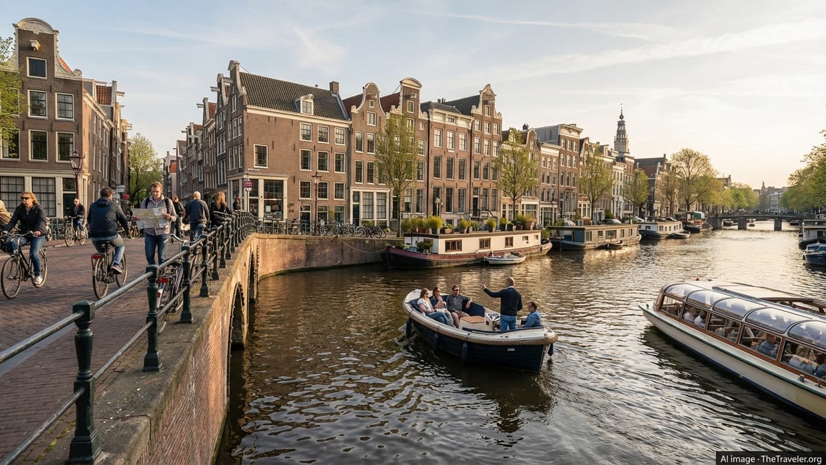
Other areas illustrate how historic fabric and modern pedestrian priorities can coexist. The Navigli canal quarter, once working infrastructure and later partially covered, has been progressively adapted into an active walking district where narrow streets and canal banks host a dense mix of bars, studios and small shops. Academic assessments of the canal restoration plans underline that most projected benefits come from walking paths, public space upgrades and slow tourism along the water, rather than intensive commercial development.
Smaller squares and streets across the center have also been reclaimed for people on foot. Piazza del Liberty, just off Corso Vittorio Emanuele, has been reshaped as a primarily pedestrian plaza above an underground retail complex, while several historic squares near cultural institutions and churches have seen traffic volumes trimmed and surfaces redesigned. Architecture and design publications have documented how these interventions, though modest in scale, knit together to form an increasingly coherent pedestrian network that extends well beyond the postcard views of Duomo.
Policies Behind the Pedestrian League Leader
Milan’s visible changes on the ground are closely tied to a series of policy tools that favor walking and discourage unnecessary car trips. Public information on the city’s adaptation and mobility strategies highlights initiatives such as low emission and restricted traffic zones in the inner ring, time based access fees for cars entering the most central area and parking reforms that curb long term on street storage of private vehicles. Analysts of European urban mobility note that these measures, while sometimes controversial, are associated with lower car use in central districts and a higher share of trips made on foot, by bike or by public transport.
Another pillar is the ongoing push to become a “30 kilometre per hour city” across large parts of the urban area. Policy briefs and local media reporting describe plans to expand 30 kilometre per hour zones to a majority of the street network, combined with physical traffic calming such as narrowed carriageways, raised crossings and chicanes. Advocates argue that lower speeds improve safety for pedestrians and make walking more attractive on everyday routes that fall outside the tourist core.
Emergency street experiments launched in 2020 under the Strade Aperte banner have since evolved into longer term projects. Reports on these initiatives indicate that pop up bike lanes and temporary widenings of sidewalks led to hundreds of kilometers of cycling routes and dozens of intersections where space was reallocated from cars to people. Follow up documentation from the city suggests that many of these measures were either made permanent or incorporated into broader programs like Piazze Aperte, which focuses on turning underused junctions into neighborhood squares.
Next Wave: Green Entrances and Hidden Local Gems
Attention is now turning to the arrival points and thresholds of central Milan, where new projects seek to create greener, more walkable gateways. One of the most closely watched is the planned redesign of Piazzale Loreto, historically a car dominated intersection and major transport hub northeast of the center. Competition materials and project summaries outline an “urban living room” concept that would remove traffic from the surface in favor of a large public square with trees, seating and direct connections to the metro, with an explicit aim of encouraging walking and cycling between surrounding neighborhoods and the core.
Urban research conducted on “entrances” to walkable central Milan points to a series of streets and spaces that already function as informal pedestrian corridors, leading visitors from outer districts into the historic ring. These include axes lined with neighborhood shops and local markets that are less prominent in tourist marketing but valued by residents for everyday errands on foot. As traffic calming and public realm upgrades extend outward, these corridors are likely to gain profile as alternative ways to approach the center without relying on major arterial roads.
For travelers, the result is a city where headline pedestrian zones sit alongside quieter, often overlooked areas that reward exploration. Side streets branching off the main shopping routes reveal small artisan workshops, courtyards and community gardens that benefit from calmer traffic and better sidewalks. Emerging projects along parts of the rediscovered canal network and in former industrial areas show how Milan’s walkable identity is expanding beyond the monumental core into a patchwork of local gems, reinforcing its status as a leading member of Europe’s informal “pedestrian league.”