


More news on this day
Severe weather linked to Storm Austen in the United Kingdom and a powerful moisture-laden system across the western United States is triggering flood alerts, power outages and travel disruption, with forecasters warning of hazardous conditions on roads, rail lines and along exposed coasts into the weekend.
Get the latest news straight to your inbox!
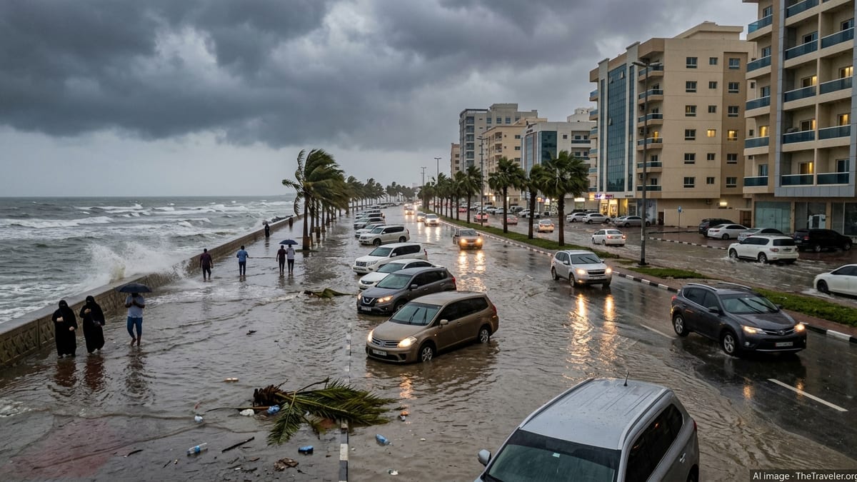
Storm Austen batters UK transport networks
Across parts of England, Wales and Ireland, Storm Austen is bringing strong winds and heavy rain on Friday 23 October, with forecasters warning of disruption to travel and a risk of localised flooding. The Met Office has issued yellow weather warnings for wind across much of England and Wales, while regional authorities in southwest England highlight the potential for difficult driving conditions, fallen trees and debris on routes popular with visitors.
In Devon, local government information notes that an amber wind warning has been issued for parts of the county during the Friday morning peak, with gusts of 60 to 70 miles per hour inland and up to 80 miles per hour on exposed headlands. The advisory urges residents and visitors to review their travel plans, particularly if using coastal or elevated roads, and to expect possible bridge closures and delays on bus and rail services as conditions worsen.
Cardiff and surrounding areas are also experiencing blustery conditions as a yellow wind warning remains in place until early evening. Published coverage indicates gusts of 50 to 60 miles per hour, combined with heavy rain and surface water on major routes into the city. Travelers heading for weekend breaks or onward rail connections are being warned to allow additional time and to monitor updates from transport operators for short-notice cancellations.
In Ireland, Met Éireann has issued status orange rain warnings for the Dublin region alongside yellow wind alerts, highlighting the likelihood of difficult driving conditions, localised flooding and delays to public transport. Official guidance reproduced in public advisories recommends allowing extra time for essential travel, avoiding flooded routes, and staying away from coastal promenades while the storm passes.
Flood risk rises in US Southwest and Mountain West
On the other side of the Atlantic, a separate storm system is funnelling deep tropical moisture into the US Southwest and the Four Corners region, bringing rounds of heavy rain, large hail and a heightened risk of flash flooding. Forecast analysis from major weather outlets indicates that nearly three million people from California across Arizona, Utah, New Mexico and into Colorado are under various flood-related watches and warnings as of Thursday night, with conditions expected to remain unsettled into Friday.
Southern Utah has been particularly hard hit. Publicly available information shows that in the city of Hurricane, evacuation orders were issued on Thursday after reddish-brown floodwater entered residential neighborhoods and an RV park, affecting dozens of homes and vehicles. Media reports describe roads inundated with fast-moving runoff, prompting closures and diversions around the popular gateway corridor to Zion National Park, a key destination for domestic and international visitors.
In northern and central Arizona, strong thunderstorms have produced hail up to golf-ball size, damaging winds and intense rainfall rates. The National Weather Service has issued tornado watches and severe thunderstorm warnings, with flash flood warnings in effect for some canyons and burn scar areas. Travelers heading to outdoor attractions or driving long desert stretches are being advised, through forecast discussions and local news coverage, to avoid low-water crossings, check for closures in national parks and wilderness areas, and to expect rapidly changing conditions.
Further east, public alert aggregators show active flood warnings in parts of New Mexico into Friday morning, where the National Weather Service has highlighted saturated soils and the potential for smaller rivers and streams to rise quickly. Road travel in low-lying locations and across normally dry washes may become hazardous with little advance notice if thunderstorms redevelop over the same areas.
Coastal flooding and marine hazards threaten popular beach destinations
Along sections of the United States Atlantic seaboard, persistent onshore flow linked to the broader storm pattern is contributing to coastal flood advisories and elevated surf, affecting several well-known beach communities. National Weather Service bulletins collated by regional forecast services indicate coastal flood advisories in effect for parts of northeast Florida, including the Jacksonville area, through early Saturday, with forecasters warning of minor to locally moderate inundation in vulnerable spots around high tide.
Advisories note that some normally dry coastal roads and parking areas may experience standing water, particularly where drainage is already compromised by accumulated rainfall. Travelers planning beach visits or using coastal highways are encouraged in public statements to allow extra time, avoid driving through saltwater flooding and watch for detours around low causeways and access roads.
Farther north, separate coastal flood advisories remain posted for portions of the Mid-Atlantic region, where high astronomical tides are combining with onshore winds. Forecast texts point to the potential for storm drains to overflow in bayside neighborhoods and low-lying waterfront districts, leading to shallow but disruptive flooding of side streets and promenades. For visitors, this may translate into temporary closures of waterfront car parks, ferry terminals and boardwalk areas during peak tides.
On the US West Coast, local alerts from Southern California highlight the impact of successive Pacific disturbances on coastal infrastructure. Recent advisories from municipal authorities in Orange County report temporary evening closures of piers and nearby parking lots at Newport Beach and Balboa due to storm-driven flooding, along with traffic restrictions on sections of Balboa Boulevard. Travelers using these areas for sunset visits or dining access are being asked through public notices to avoid unnecessary journeys until water levels recede and clean-up operations are completed.
Impact on air, rail and road travel plans
The combination of high winds, heavy rain and coastal flooding is already disrupting travel plans in several regions and has the potential to escalate if conditions deteriorate. In the United Kingdom, regional transport updates referenced in local government briefings warn of possible speed restrictions on railway lines, temporary line closures, and delays to regional and long-distance services as Storm Austen peaks. Exposed bridges and viaducts in southwest England and south Wales are considered particularly susceptible to high winds, which may force rail operators and highway authorities to limit traffic at short notice.
Road networks across affected areas of the UK and Ireland are facing additional pressure from surface water, fallen branches and poor visibility. Motorway and trunk road operators are advising travelers, via public-facing channels, to reduce speeds, maintain greater following distances and be prepared for standing water in dips and underpasses. Scenic coastal and moorland routes popular with visitors may be especially hazardous where crosswinds can be severe and drainage limited.
In the United States, the risk of flash flooding on rural highways and in national park gateways is a primary concern. Information from recent flood events shows that fast-moving water can undermine road surfaces and wash out shoulders, leaving hidden damage even after the water has receded. Travelers driving rental vehicles through canyon country or desert regions are being urged by park bulletins and tourism boards to check park websites and state transportation maps before setting out, and to avoid entering signed flood-prone segments during active warnings.
Airports in both regions are monitoring the evolving situation, with the potential for strong crosswinds and low visibility to cause approach changes, go-arounds and occasional delays. While most major hubs are designed to operate in poor weather, published guidance from airlines and airports consistently recommends that passengers check the status of their flights and allow additional time to reach terminals when storms and flood alerts are in force.
Practical advice for travelers during the storm
For travelers already in affected regions, the recurring message across meteorological agencies, local councils and transport operators is to stay informed and remain flexible. Official weather services in the UK, Ireland and the United States provide continually updated warnings for wind, rain and flooding, with color-coded or tiered systems that indicate the likelihood and potential severity of impacts. Understanding these warning levels can help visitors decide whether to postpone journeys, reroute around hotspots or adjust check-in times.
Safety guidance from national weather campaigns emphasizes that even shallow floodwater can pose a serious risk to vehicles and pedestrians. Educational materials from US agencies note that just a few inches of fast-moving water can sweep vehicles off the road, and that floodwater often conceals debris, open manholes or damaged surfaces. Travelers are urged to avoid walking or driving through flooded streets, and to seek higher ground if they encounter rapidly rising water near rivers, arroyos or coastal inlets.
Those staying in coastal accommodations or riverside properties are advised in public communications to familiarize themselves with local evacuation routes and to move vehicles to higher ground ahead of forecast high tides or heavy rain. In some locations, authorities have opened temporary shelters and community centers for residents and visitors displaced by inundation; information on these facilities is generally available through municipal channels and local news outlets.
Looking ahead to the weekend, forecast models suggest that conditions will gradually improve in some areas as Storm Austen tracks away from the British Isles and the current Pacific system weakens over the American West. However, residual flooding, damaged infrastructure and lingering transport backlogs may continue to affect travel plans even after rain and wind ease. Travelers with imminent departures or arrivals through the affected regions may benefit from maintaining flexible bookings, monitoring reputable weather outlets and transport operators, and allowing additional contingency time across the next 24 to 72 hours.