


More news on this day
Ahead of the busy Thanksgiving travel period, a powerful Pacific storm interacting with wildfire burn scars and higher than usual tides has shut a major stretch of Highway 1 on the Big Sur coast and prompted warnings of possible Golden Gate Ferry disruptions, raising the risk of last minute detours for drivers and Bay Area ferry riders.
Get the latest news straight to your inbox!
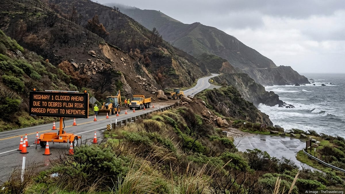
Highway 1 closure on Big Sur coast enters multi day period
Caltrans District 5 closed Highway 1 on the Big Sur coast at 1 p.m. on Wednesday, November 18, 2026, between Nepenthe in Monterey County, near postmile 44, and Ragged Point in San Luis Obispo County, creating a roughly 46 mile gap in the coastal route. The agency cited the risk of fast moving debris flows from this summer’s Plaskett and Timber fire burn scars during the current Pacific storm as the primary reason for the emergency closure.
By Thursday, November 19, Caltrans had shortened the official closure limits, but the highway remained fully closed overnight and crews were still working to clear rockslides, downed trees and other debris at multiple locations. As of November 21, there is still no announced time for a full reopening, and officials are emphasizing that any decision will depend on ongoing weather, slope stability and additional inspections once rainfall rates ease.
Travelers should not assume that Highway 1 will reopen before Thanksgiving. Caltrans has only confirmed that the closure is in effect for now and that updates will be posted through its QuickMap road conditions tool and District 5 social media channels as assessments continue.
Why this storm is uniquely risky for Big Sur travelers
The current storms are arriving just months after the Plaskett and Timber fires burned steep terrain above Highway 1, leaving loose ash, rocks and fallen vegetation on slopes that drain directly toward the road. In its latest advisories, the National Weather Service has highlighted a flood watch and coastal flood advisory for the Southern Monterey Bay and Big Sur coast through the Thanksgiving period, warning that intense rainfall over burn scars can send mud, boulders and charred debris across the highway with little or no warning.
Unlike routine wet weather, debris flows triggered on burned hillsides can move quickly, burying sections of pavement or undercutting road foundations. That risk, combined with high surf and saturated cliffs, is why Caltrans has opted for a full closure rather than trying to keep a lane open under one way traffic control. The agency has stated that closures may be adjusted in length as crews gain access to problem spots, but that they will keep barriers in place as long as debris flow thresholds could still be exceeded.
For visitors, the practical implication is that iconic stops such as Pfeiffer Big Sur State Park and coastal viewpoints south of the shortened closure points may be unreachable by road at times, and that Big Sur communities could experience periods of limited access if slides occur on both sides of town. Lodging and tourism bodies are urging guests to stay in close contact with accommodations and to build flexibility into their plans.
Golden Gate Ferry faces high tide and storm related disruptions
Farther north on San Francisco Bay, Golden Gate Ferry has issued a separate Thanksgiving week advisory noting that forecast strong winds and higher than usual tides could require temporary suspensions of some ferry trips on Tuesday, November 24, 2026. The operator is not currently canceling specific sailings in advance but has flagged that short notice service gaps are possible if dock clearances or safety margins are reduced during peak tide events.
Golden Gate Ferry has also confirmed that there will be no ferry service on Thanksgiving Day itself, Thursday, November 26, in line with its standard holiday calendar. On Friday, November 27, the system is scheduled to run on a reduced, weekend style timetable rather than its full weekday commuter schedule, which will limit early morning and late evening options compared with a normal workday.
These changes do not mean that Bay ferries are broadly shut down for the week. At this stage, only targeted Tuesday suspensions are being contemplated, and those would be driven by actual tide and wind conditions as they occur. Travelers using Sausalito, Larkspur or Tiburon routes into San Francisco should monitor Golden Gate Ferry’s service alerts on the morning of travel and allow extra time to switch to bridge or transit alternatives if a sailing is paused.
What coastal travelers should check before departure
Because conditions on both the Big Sur coast and San Francisco Bay are evolving day by day, agencies are urging travelers not to rely on static maps or older trip plans. Drivers headed toward Big Sur or planning a coastal route between the Bay Area and Southern California should recheck Highway 1 conditions on Caltrans QuickMap shortly before departure and again en route, paying close attention to the specific closure endpoints and any one way traffic controls or additional spot closures elsewhere along the coast.
For those with reservations in Big Sur, it is worth confirming with hotels or campgrounds whether they are accessible from the north, the south, or at all on a given day, as detours via inland highways can add several hours. Alternates such as U.S. 101 remain open, but they do not replace local access to all coastal trailheads, vista points or small communities within the closed Highway 1 segment.
Bay Area passengers planning to use Golden Gate Ferry around Thanksgiving should verify holiday schedules in advance, confirm there is no service on Thursday, November 26, and track any Tuesday, November 24 tide related alerts on the operator’s official channels. In parallel, the National Weather Service forecasts for coastal flooding, high surf and strong winds along the central and northern California coast will be key indicators of whether additional road or ferry restrictions might be introduced as the holiday week unfolds.