


More news on this day
Strong thunderstorms sweeping across the Houston region have disrupted operations at both of the city’s major airports, triggering ground stops, widespread delays and cancellations at the height of the summer travel season.
Get the latest news straight to your inbox!
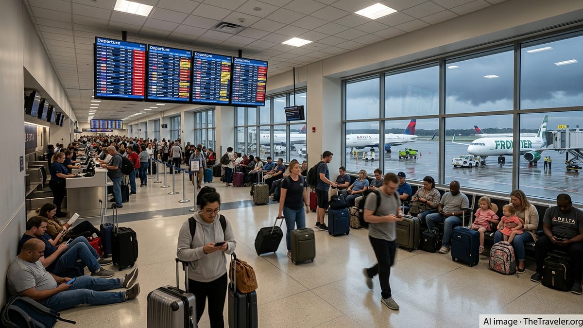
Ground stops hit Bush Intercontinental and Hobby
Recent storm systems moving through Southeast Texas led to ground stops affecting both George Bush Intercontinental Airport and William P. Hobby Airport, according to publicly available Federal Aviation Administration advisories and local media coverage. Intense bands of thunderstorms built over the Houston metro area, temporarily making it difficult to safely manage arriving and departing traffic.
At Bush Intercontinental, where United Airlines operates a major hub, reports indicate that departures and arrivals were periodically paused as cells with heavy rain and lightning moved across key approach and departure corridors. Average departure delays grew to around three quarters of an hour during the worst of the disruption, with some flights waiting significantly longer for a break in the weather.
Houston’s smaller but busy Hobby Airport, a key base for Southwest Airlines and a critical gateway for domestic point to point traffic, also experienced rolling delays as storms tracked across the Gulf Coast. Published coverage from regional outlets described a pattern of brief ground stops followed by tightly controlled release of flights, as controllers balanced safety margins with growing backlogs on the ground.
The timing of the storms, clustering around peak morning and late afternoon departure banks, intensified the impact. Even short pauses on the runway and in the terminal area quickly translated into long lines at security, crowded gate areas and aircraft stacking up on taxiways waiting for clearance.
Ripple effects across Texas and beyond
Once ground stops are imposed at a major hub, disruptions radiate far beyond the immediate storm zone. Public flight tracking data and airline advisories show that knock on delays stretched across Texas and the wider national network as Houston bound aircraft were held at origin airports or slowed en route to ease congestion.
Reports from statewide media indicate that Dallas Fort Worth International and Dallas Love Field, which were also contending with strong storms during the same period, saw elevated levels of delays and cancellations as traffic managers juggled multiple weather impacted hubs. Passengers connecting through Houston found themselves missing onward flights, with some itineraries requiring extensive rebooking as already crowded summer services filled up.
In South and Central Texas, airports in San Antonio and Austin reported scattered delays and diversions tied to the same unstable weather pattern. Some aircraft diverted to Houston earlier in the week when storm cells parked over those cities, compounding gate and ramp pressure at Bush Intercontinental and Hobby once the Houston area itself began to see heavier storms.
According to published analysis of recent seasons, this type of cascading disruption has become a recurring feature of peak travel months, when schedules are tightly optimized and there is limited slack to absorb multiple weather events along key corridors.
What travelers experienced on the ground
For passengers, the storms translated into long waits, shifting departure times and a familiar mix of uncertainty and frustration. Social media posts and local reporting from the terminals described full departure boards illuminated with yellow and red delay indicators as ground crews halted work during lightning and heavy downpours.
Travelers arriving early for morning departures in Houston encountered unusually long security queues as wave after wave of flights pushed into similar time windows once pauses were lifted. With aircraft and crews out of position, some services were first delayed and then canceled outright, leaving travelers to queue again at customer service desks or attempt to rebook through airline mobile apps.
In the gate areas, many passengers spent hours seated on the floor or clustered around scarce power outlets while watching radar loops and updated forecasts, waiting for the all clear that would allow boarding to resume. For some, the disruption meant missed cruises or tour departures along the Gulf Coast, as tight same day connections from Houston slipped beyond recovery.
Hotel bookings near the airports reportedly spiked as evening storms combined with earlier delays to push some travelers into overnight stays. Ride share pickup zones saw surges in demand each time a new wave of cancellations appeared on departure boards, adding stress to local ground transport at the end of already difficult days of travel.
Why Houston’s storms hit air travel so hard
Houston’s location near the Gulf of Mexico, combined with hot, humid summer air and frequent colliding boundaries of sea breeze and inland heat, makes the region prone to fast developing thunderstorms. Aviation planners note that even relatively short lived storm cells can significantly disrupt flows at major hubs when they line up with key arrival and departure paths.
Publicly available FAA guidance explains that ground stops are one of several tools used to keep air traffic operating within safe limits when visibility drops, crosswinds spike or lightning and heavy rain move across critical portions of the airfield. In practice, that can mean that flights bound for Houston are temporarily held at their origin airports or slowed in flight until storms weaken or shift away from approach corridors.
Houston’s dual airport system handles tens of millions of passengers a year, and Bush Intercontinental alone manages a dense schedule of domestic and long haul international flights. When weather forces the air traffic system to cut capacity even modestly, those tightly packed schedules leave little room to absorb disruption, which is why a few hours of storms can translate into a full day of rolling delays.
Historical research into past severe weather events in Texas, including hurricanes and winter storms, highlights how quickly airport operations can unravel when runways, taxiways and ramp areas are repeatedly hit by adverse conditions. The latest storms were far less extreme than those landmark events, but they followed the same basic pattern of constrained capacity, accumulating queues and extended recovery times.
Guidance for travelers heading through Houston
With forecasters signaling an active pattern of thunderstorms across the Gulf Coast in the coming weeks, airlines are encouraging travelers bound for or connecting through Houston to build extra flexibility into their plans. Publicly posted travel waivers already cover some dates for South Texas, allowing passengers to change itineraries without additional fees when severe weather is in the forecast.
For upcoming trips, travelers can reduce stress by allowing longer connection times through Bush Intercontinental or Hobby, especially for late afternoon and evening flights that can be more vulnerable to storms that build through the day. Checking flight status and real time delay information before leaving for the airport helps avoid unnecessary early arrivals when ground stops are already in place.
During active weather, carrying essential items in a cabin bag, including medications, chargers and a change of clothes, can make extended waits more manageable if checked baggage becomes temporarily inaccessible. Many recent travelers have also relied on airline mobile apps or websites to rebook themselves onto new flights while still in the air or while sitting at the gate, often securing alternative options faster than traditional customer service queues.
For visitors to Houston, these storms are a reminder that summer travel across the region can be highly dynamic. Keeping itineraries slightly flexible, monitoring forecasts and understanding how ground stops and delays ripple through the system can help travelers navigate disruptions more smoothly as the season continues.