
More news on this day
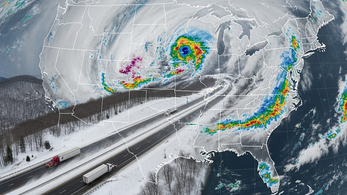
Rounds of heavy rain and thunderstorms moving across the Chicago area this week have led to a flood warning for parts of Cook County and Northwest Indiana, while air travelers at O’Hare and Midway airports face significant delays and cancellations.
Get the latest news straight to your inbox!
Flood Warning Targets Southern Cook County and Northwest Indiana
Publicly available information from the National Weather Service indicates that a flood warning remains in effect for southern Cook County and portions of Northwest Indiana after repeated waves of rain saturated the region. Storms on Wednesday and Thursday dropped enough rainfall to push already-elevated streams and urban drainage systems close to capacity, increasing the risk of flash flooding in low-lying and poorly drained locations.
The warning highlights familiar trouble spots across the South Side and south suburbs, where aging sewer infrastructure and impervious surfaces allow water to pool quickly during downpours. Residential neighborhoods, underpasses, viaducts and intersections that historically flood during summer storms are once again being flagged as especially vulnerable.
Forecasters describe the pattern as a classic warm-season setup, with humid air feeding repeated bands of showers and thunderstorms across the same corridor. Even when individual storms weaken, the cumulative effect of steady rain over many hours can produce flooding issues well after the heaviest cells have moved on.
Residents in the warning area are being advised, through public forecasts and media reports, to remain alert for rapidly changing water levels, particularly after dark when flooded roads can be harder to spot. Travel through flood-prone corridors may remain challenging until runoff recedes and drainage systems catch up.
O’Hare Ground Delay Ripples Across Airline Networks
Chicago O’Hare International Airport, one of the busiest aviation hubs in the world, has again become a focal point of disruption as thunderstorms sweep through northeastern Illinois. Federal aviation data and airline status boards show that a formal ground delay program was issued for O’Hare, limiting the rate of arriving flights and forcing airlines to hold or re-time departures across the country.
According to local coverage of the storm system, the ground delay extended into the early morning hours, with arrivals and departures experiencing holds measured in hours. By Wednesday evening, hundreds of flights at O’Hare had either been delayed or canceled, with additional cancellations accumulating as airlines attempted to reset schedules and reposition aircraft.
Chicago Midway International Airport, while experiencing less severe impacts, has also reported delays and cancellations tied to the line of storms and airspace congestion. Shorter, regional hops in and out of Midway can be especially susceptible to rolling delays when convective weather is active, since many of those flights operate within the same turbulent air mass.
The latest round of disruptions arrives after several weeks of weather-related slowdowns at O’Hare tied to repeated storm systems over the Midwest. Travelers have increasingly turned to airline apps, social media updates and airport displays to track changing departure times, while some carriers have offered limited rebooking flexibility to passengers willing to shift their travel dates.
Travelers Navigate Cancellations, Long Waits and Packed Terminals
Passenger accounts shared through social platforms and aviation forums describe crowded concourses, long customer-service lines and uncertainty about rebooking options as storms rolled over the region. Some travelers reported being held on aircraft waiting for a break in lightning or for traffic-management programs to ease, while others ultimately saw flights canceled after multiple schedule changes.
These experiences mirror broader patterns seen this month whenever intense thunderstorms target the metro area. When ground delays are in place at a major hub like O’Hare, the impact extends far beyond Chicago, affecting flights from distant origin cities that are unable to depart on time, and in some cases forcing inbound aircraft to divert to alternate airports to refuel.
Industry observers note that severe-weather days often lead to a cascading effect: aircraft and crews end up out of position, leaving airlines with few options by late evening. Travelers on later departures can see their flights canceled even after storms have weakened, simply because the operational day has run out of slack.
For those with upcoming trips, aviation analysts consistently recommend proactive planning on days with active thunderstorm forecasts near Chicago. Flexibility in departure time, non-stop itineraries when possible and monitoring of connecting flights can help reduce the risk of extended misconnection delays.
Beach Hazards and Urban Impacts Around the Lakefront
Beyond aviation and roadway flooding, the storm system has also affected conditions along the Lake Michigan shoreline. Forecast discussions and local reporting point to a beach hazard statement in effect through Thursday morning, warning that waves could build to between four and six feet, with strong currents and hazardous swimming conditions along Chicago’s lakefront and nearby Indiana beaches.
Such statements, common during periods of strong onshore winds or passing low-pressure systems, serve as a reminder that even non-severe thunderstorms can drastically alter nearshore conditions. Elevated waves and rip currents are of particular concern as the region heads into the peak of beach season, with more residents and visitors expected to visit lakefront parks and swimming areas.
Within the city, the combination of heavy rain, gusty winds and saturated ground has slowed traffic and temporarily overwhelmed some drainage grates. Commuters have faced ponding on expressways and arterial streets, while transit riders have contended with slower trains and buses as operators navigate reduced visibility and localized flooding.
City work crews and utility teams have been monitoring underpasses, viaducts and key intersections where standing water can quickly strand vehicles. With further scattered storms possible behind the main line, localized issues may continue to emerge even after the most intense rainfall has shifted east of the metro area.
More Storms Possible as Summer Pattern Sets In
Regional outlooks suggest that the Chicago area may not be done with active weather. Early-summer storm tracks have already delivered several severe-weather episodes, including tornado warnings and damaging winds in parts of northern Illinois and northwest Indiana on previous days. The current flood warning and airport delays fit into a broader pattern of volatile conditions across the Midwest.
Forecasters note that a combination of warm, humid air from the Gulf of Mexico and passing upper-level disturbances can produce repeated rounds of thunderstorms over the same region, a setup known as training. When those storms form over a major urban corridor like Chicago, the risk of flash flooding and infrastructure stress increases.
Climate assessments for the Midwest have documented a trend toward more frequent heavy rainfall events in recent decades, with larger downpours delivering a greater share of annual precipitation. While individual storms cannot be solely attributed to long-term climate shifts, the string of intense rain episodes in and around Chicago in recent summers is fueling renewed discussion about resilience, drainage upgrades and the need for improved emergency communication.
For now, public forecasts stress close monitoring of updated radar imagery, flood statements and aviation advisories, particularly for those planning to travel into, out of or through Chicago in the coming days. The combination of saturated ground, high lake levels in some areas and an unsettled atmosphere means that even routine summer storms can have outsized effects on transportation and daily life across the region.