


On paper, the Cedar Run Trail in Shenandoah National Park sounds like a perfect Blue Ridge day out: cold swimming holes, natural rock slides, and a link-up with the famous Whiteoak Canyon waterfalls. In reality, this steep mountain gorge hides a much tougher challenge than many first-time visitors expect, especially those lured in by social media photos of people splashing below cascades. What looks like a quick dip-and-go stroll can, if you are unprepared, turn into a grueling, slippery climb that tests your fitness, your footing, and your judgment.
Get the latest updates straight to your inbox!
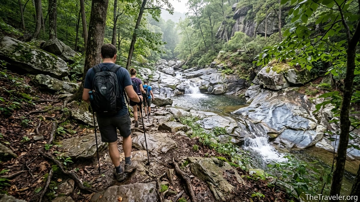
A Steep Gorge Disguised as a Waterfall Walk
Cedar Run sits on the central section of Virginia’s Shenandoah National Park, with its official trailhead at Hawksbill Gap around mile 45.6 of Skyline Drive. The name itself sounds gentle, evoking the clear mountain stream that tumbles toward the valley. Hikers who pull off the road on a humid July afternoon often imagine a relaxed walk to a cool pool before dinner at Skyland or a drive down to Luray. The reality begins as soon as you leave the parking lot and the trail drops sharply toward the gorge.
From the outset, Cedar Run wastes no time losing elevation. National Park Service materials classify the Cedar Run–Whiteoak circuit as “very strenuous,” with nearly 2,800 feet of elevation gain when you hike it as a full loop. That number does not always register with casual visitors who are used to easier Shenandoah favorites like Dark Hollow Falls or Stony Man, which lose far less height and have smoother paths. On Cedar Run, long, rocky grades and uneven stone steps dominate. Even experienced hikers comment on how relentlessly the trail descends or climbs, depending on your direction.
Hiking down from Skyline Drive toward the water, you feel that drop in your knees. Rock outcrops, roots, and short, steep pitches require focused foot placement. Turning around to climb back up later in the day quickly exposes any gap in your conditioning. Hikers who planned “just a quick dip” often find themselves grinding uphill for more than an hour, sweating through cotton T‑shirts and draining the last of their water bottles before they can even see their car.
Compared with Shenandoah’s more famous Old Rag scramble, Cedar Run can seem low-key at first glance, with no ladders or exposed boulder moves. The hidden challenge is the grade itself. Locals and trail runners routinely describe Cedar Run as one of the steepest ascents from park boundary to Skyline Drive. It is not a place to underestimate if you are bringing children, recovering from injury, or arriving late in the day when storms and darkness are real possibilities.
Rocks, Roots, and Slick Stone: Technical Terrain Underfoot
Beyond pure steepness, Cedar Run’s surface catches many people off guard. Guide descriptions and recent trip reports consistently describe the trail as narrow, rough, and often rocky, with long stretches of uneven stone steps built into the mountainside. In dry autumn weather, those rocks demand concentration. Add spring snowmelt, a summer thunderstorm, or leaf litter in October and they transform into a slick, ankle-twisting obstacle course.
Near the stream, the trail frequently skirts slabs of bedrock polished by years of water and feet. In popular spots like the natural water slide and the deeper pools just downstream, the rock can feel as smooth as glass. Simple tasks such as stepping from one boulder to another or walking down to a ledge for a photo become riskier when algae coats the stone. Rangers in Shenandoah regularly respond to lower-leg injuries and slips on these kinds of surfaces, and Cedar Run’s combination of grade and wet rock amplifies that risk.
In practice, this means that what looks like an easy half-mile exploration along the creek can turn technical quickly. Imagine a July afternoon where you park on Skyline Drive, wearing light sneakers you bought for walking around Washington, DC. You follow a well-defined path down past the first cascade, then hop down to a pool for a photo. On the way back up, a short scramble over wet stone forces you to use your hands. One misplaced step and you are sliding toward the water, smartphone and day’s plans at risk. Trail runners in the region often carry trekking poles here, not for the distance but for the braking power they provide on slick, uneven descents.
Even the more forested sections away from the creek demand attention. After heavy rain, water funnels across the path, lifting small stones and creating mud pockets between roots. Leaves can hide ankle-deep holes. If you are used to manicured gravel trails in suburban parks, Cedar Run’s surface feels far more like a backcountry route, and treating it that way is key to staying upright.
Waterfalls, Swimming Holes, and the Lure of the Slide
The reward that pulls so many people down Cedar Run is water. The trail passes a series of cascades and small waterfalls, including a well-known natural rock slide that locals talk about in the same breath as Whiteoak Canyon’s bigger drops. In high summer, photos of people sliding down the smooth chute into a plunge pool circulate on social media and hiking forums, inviting others to make the trip for a swim.
The catch is accessibility. From Skyline Drive, reaching the best-known slide and swimming hole typically involves hiking roughly 1.5 to 2 steep miles down into the gorge. Elevation charts along the Cedar Run – Whiteoak Canyon loop show hundreds of feet of loss over that distance. The trip down may feel like a straightforward adventure, but every step must be reclimbed later, often in muggy heat with thunderheads building above the Blue Ridge.
A realistic scenario: a group of college students from Charlottesville drives up on a Saturday in August, pays the park entrance fee at Thornton Gap, and aims for “just a quick swim” before sunset. They wear sandals, carry one shared daypack with a single 1-liter bottle, and no one brings a map because a friend told them “you just follow the trail down.” They reach the slide, spend an hour jumping into the pool, then start back up around 5:30 p.m. Halfway to Skyline Drive they are exhausted, rationing sips of water, and one hiker is limping after a minor slip. The final 40 minutes turn into a survival slog rather than a pleasant end to a day out.
None of this means you should avoid Cedar Run’s water features. On the contrary, they can be some of the most refreshing and beautiful spots in Shenandoah, especially if you visit on a weekday morning outside peak leaf season. The key is to treat the approach and exit as serious hiking, not just a side stroll. Pack as you would for an all-day outing: sturdy footwear, at least 2 liters of water per person in summer, basic first-aid supplies, and a dry bag if you intend to swim or slide. Respect posted safety guidance about diving, water levels, and sudden storms. The more intentionally you plan the “fun” part, the more enjoyable it will be.
Route Choices: Out-and-Back or the Full Cedar Run – Whiteoak Loop
Another hidden challenge on Cedar Run is not just physical but strategic: deciding how far to go. Many online sources describe the full Cedar Run – Whiteoak Canyon – fire road circuit as an 8-mile or so loop with nearly 3,000 feet of elevation gain, commonly taking strong hikers 6 to 7 hours. That makes it one of the more demanding day hikes in the park for its length, on par in effort with Old Rag or Robertson Mountain despite lacking the famous summit views.
From the Skyline Drive side, one popular way to experience Cedar Run is to descend all the way to the junction with Whiteoak Canyon, then climb back out via that trail and the horse trail and fire road. Others approach from the Whiteoak Canyon lower boundary trailhead near Syria, Virginia, climbing past the series of six main waterfalls before connecting with Cedar Run for the return. Still others simply hike down to a particular pool on Cedar Run and then retrace their steps. Each choice carries different time and energy requirements.
In practical terms, a fit day hiker staying at Big Meadows or Skyland might plan the full loop as a dedicated objective, starting no later than mid-morning with a proper topo map, a packed lunch, and emergency layers. A family from Richmond visiting Shenandoah for the first time with elementary-age children might be better served by a partial out-and-back: perhaps hiking down Cedar Run just far enough to see one or two cascades, then turning around before the grade becomes punishing. For many visitors, choosing a shorter trip that everyone can finish smiling is wiser than pushing for “the whole thing.”
Navigationally, Cedar Run is generally well defined, but side paths near attractive pools and slides can create confusion, especially for those not used to reading blazes or contour lines. During late afternoon, shadows in the gorge lengthen, making it easier to miss a turn or follow a social track to the water that peters out. Carrying a printed map from the park visitor center or a dedicated hiking app with downloaded offline maps helps avoid missteps. For visitors who are used to following a single paved path to viewpoints, the web of options along Cedar Run can feel unexpectedly complex.
Weather, Seasons, and the Risk of Being Caught Out
As with all mountain hikes in Virginia, Cedar Run’s personality shifts dramatically with the seasons. In late spring and early summer, snowmelt and rain feed the creek, making waterfalls more impressive but crossings trickier. Rocks near the water stay damp throughout the day. Afternoon thunderstorms frequently roll across the Blue Ridge, producing sudden downpours that send hikers scurrying for cover. If you are halfway up the steepest grade when a storm hits, rocks that were simply awkward five minutes ago can become treacherously slick.
In high summer, the gorge traps humidity. While Skyline Drive might feel breezy and comfortable at midday, temperatures on the climb out of Cedar Run can feel several degrees hotter, especially when the sun breaks through the canopy. Hikers starting late in the day underestimate how long the final climb will take in that sticky heat. Dehydration, leg cramps, and heat-related fatigue become real risks. A simple guideline is to pack more water than you think you will need and to begin your hike early, especially if the weather forecast hints at both heat and storms.
Autumn brings its own challenges. Crowds increase as leaf-peepers flock to Shenandoah, and parking at trailheads like Hawksbill Gap and Whiteoak Canyon boundary lots can fill early. On the trail, fallen leaves can disguise rocks, holes, and roots, making Cedar Run’s already uneven surface harder to read. In late fall, especially in shaded portions of the gorge, overnight temperatures can drop below freezing even when valley towns like Luray or Sperryville remain mild. Thin sheets of ice on shaded stones near the creek catch early-season visitors by surprise.
Winter transforms Cedar Run into a destination for experienced hikers only. Ice forms not just on the waterfalls but also on the trail itself, particularly on steep runs where seepage crosses the path. Locals who venture out for cold-weather training on steep trails like this often carry microspikes and trekking poles, and they pick clear, sunny days to reduce the risk of slipping. For most travelers planning a once-a-year Shenandoah trip, winter is not the time to experiment with Cedar Run unless you have prior cold-weather hiking experience and gear to match.
Planning, Gear, and Mindset for a Safe Cedar Run Day
Given all these factors, the hidden challenge on Cedar Run is less a single obstacle and more a mindset shift. Many visitors treat it as a short, casual detour en route to the park’s bigger names. Approaching it instead as a genuine mountain gorge hike changes how you prepare and, in turn, how much you enjoy the experience.
Footwear is a good example. Light trainers or fashion sneakers that feel fine on flat city sidewalks quickly show their limitations on Cedar Run’s rocky, rooty grades. A low-cut trail shoe with a grippy sole, or a lightweight hiking boot, provides noticeably better traction on damp stone and loose gravel. Trekking poles may feel unnecessary in the parking lot, but many hikers who bring them end up using them aggressively on the descent and for balance when stepping between boulders near the stream.
Hydration and nutrition matter more than the trail’s moderate mileage might suggest. A common recommendation from local hiking groups is at least 2 liters of water per person on warm days for anyone venturing past the first cascade, along with salty snacks or a simple lunch. If you plan to spend time swimming at the slide or pools, packing a small towel, a dry shirt, and a waterproof bag for your phone and keys can mean the difference between a refreshing dip and a shivering trudge back to the car.
Finally, set realistic time expectations. Checking recent reports or ranger advice at a visitor center in Luray, Big Meadows, or Loft Mountain can help you gauge current conditions: whether recent storms have made the trail muddy, if temporary maintenance closures are in effect for portions of Cedar Run, or if water levels are higher than usual. Building in a time buffer for breaks, photos, and unexpected delays reduces the pressure to rush. On a trail where rushing is exactly what triggers slips and wrong turns, that buffer is its own kind of safety gear.
The Takeaway
At first glance, Cedar Run invites you in with the promise of cold mountain water and tumbling cascades. The real test waiting for hikers lies in the steep, rocky corridor you must navigate to reach them. This is not a manicured waterfall walk, but a rugged Shenandoah gorge that demands fitness, attention, and respect for changing conditions. Those who underestimate it often remember the trail for sore knees, scraped palms, or a stressful climb out at dusk.
Handled with the seriousness it deserves, however, Cedar Run can be one of the most rewarding days in the park. Strong hikers who start early, carry proper gear, and allow enough time discover a wild side of Shenandoah: narrow walls, cliff faces across the creek, deep green pools, and the constant sound of water competing with wind in the trees. Families who limit themselves to a shorter out-and-back, turning around before fatigue sets in, come away with just enough challenge to feel earned without tipping into misery.
The hidden challenge, then, is not just in the grade under your feet. It is in resisting the temptation to treat Cedar Run as an afterthought to better-known hikes. A little humility at the trailhead, an honest assessment of your group’s ability, and a willingness to adjust plans based on weather and time of day can turn what might have been a punishing slog into exactly what many visitors are truly seeking: a vivid, memorable day in the Blue Ridge that feels a bit wild but entirely within your grasp.
FAQ
Q1. Is Cedar Run Trail suitable for beginners or families with kids?
For many first-time hikers, Cedar Run feels too steep and rocky for a relaxed family outing, especially if you try to reach the main slide or do the full loop. Families with younger children often do best by hiking only a short distance from Skyline Drive to an early viewpoint, then turning around before the grade and footing become more demanding.
Q2. How long does it take to hike the Cedar Run – Whiteoak Canyon loop?
Most reasonably fit hikers should plan on 6 to 7 hours for the full loop, including breaks for photos, snacks, and time near the waterfalls or swimming holes. Trail runners and very strong hikers may move faster, but treating it as a full-day outing leaves room for weather, crowds, and surprises.
Q3. Can I just hike to the natural water slide and back?
Yes, many visitors hike down from Skyline Drive to the slide and adjacent pool, then retrace their steps. Expect a steep descent of roughly 1.5 to 2 miles and an equally steep climb back. Plan at least 3 to 4 hours round trip if you plan to swim or spend time at the water, and carry more water and snacks than you think you will need.
Q4. What kind of shoes should I wear on Cedar Run?
A grippy trail running shoe or lightweight hiking boot is strongly recommended. The trail includes long stretches of uneven rock, roots, and damp stone near the creek. Smooth-soled sneakers, flip-flops, or water shoes that work fine at a lake beach are poor choices for the steep, rocky grades on Cedar Run.
Q5. Is Cedar Run more difficult than Old Rag?
Cedar Run and Old Rag are difficult in different ways. Old Rag is famous for its exposed rock scramble and summit views, while Cedar Run’s main challenge is its sustained steepness and slick, rocky footing. Many experienced locals consider the Cedar Run – Whiteoak loop comparable in overall effort to an Old Rag circuit, even without the same panoramic vistas.
Q6. When is the best time of year to hike Cedar Run?
Late spring through early fall offers the most comfortable conditions, with ample water in the creek and long daylight hours. Summer is ideal for swimming but can be hot and humid on the climb out, while autumn brings colorful foliage but also crowds and leaf-covered rocks. Winter hiking is best left to experienced, well-equipped hikers due to ice and cold.
Q7. Are there any facilities or services near the trailhead?
From the Skyline Drive side, Cedar Run shares access with popular hikes near Hawksbill, but services are limited to parking and occasional informational signage. Full services such as food, lodging, fuel, and visitor centers are located at developed areas like Skyland or Big Meadows, which are a short drive away along Skyline Drive rather than at the trailhead itself.
Q8. Do I need special permits or to pay extra fees to hike Cedar Run?
You do not need a separate hiking permit for Cedar Run, but you do need a valid entrance pass for Shenandoah National Park, which is checked at entrance stations such as Thornton Gap and Swift Run Gap. The same pass covers most front-country hikes, including Cedar Run, for the duration of its validity.
Q9. How can I reduce my risk of injury on Cedar Run?
Wear proper footwear, start early, carry sufficient water, and move slowly on wet or leaf-covered rocks, especially near the creek and slides. Using trekking poles, staying on the main trail rather than side paths, and turning around if weather worsens or anyone in your group is clearly tiring are simple steps that dramatically reduce the chance of slips and missteps.
Q10. Is Cedar Run a good choice if I only have one day in Shenandoah?
If you are a fit, experienced hiker looking for a strenuous, waterfall-filled day, Cedar Run paired with Whiteoak Canyon can be an excellent primary objective. If your group includes mixed abilities or you prefer gentler trails with big viewpoints, you might instead choose a shorter hike like Stony Man or Hawksbill and save Cedar Run for a future visit when you can give it the time and respect it deserves.