
More news on this day
Thunderstorms moving across the Houston area on Sunday morning prompted a ground stop at George Bush Intercontinental Airport, disrupting early Father’s Day flights and forcing airlines and passengers to navigate mounting delays.
Get the latest news straight to your inbox!
Ground stop halts morning departures at IAH
Publicly available aviation alerts indicate that the Federal Aviation Administration ordered a ground stop for flights bound for George Bush Intercontinental Airport from 6 a.m. to roughly 8:15 a.m. Central time on June 21. The restriction was put in place as thunderstorms developed over the Houston area, limiting the ability of planes to land and depart safely.
According to local broadcast coverage, the stop applied to flights heading into Houston from other airports, meaning departures to Bush Airport were temporarily held at their origin. The advisory described a medium likelihood that the halt could be extended, reflecting uncertainty about how quickly storms would clear the immediate airspace.
Even after the formal ground stop window ended, tracking data showed knock-on effects in the form of delayed departures and arrivals, as airlines worked through aircraft and crew that had been left out of position by the pause in operations.
The ground stop coincided with a busy summer and holiday weekend travel period, increasing the number of travelers affected during the early morning hours.
Stormy weather pattern keeps pressure on operations
Forecast products for Houston on Sunday pointed to a day marked by scattered thunderstorms, with storm chances strongest in the morning and again during the late afternoon and early evening. Temperatures in the upper 70s and 80s Fahrenheit and high humidity helped fuel the unsettled conditions.
Weather outlooks for the broader southern United States in recent days have highlighted an active frontal system producing rounds of heavy rain and thunderstorms from Texas through portions of the Gulf Coast. Houston has been singled out several times this month in national coverage for repeated thunderstorm activity and associated flooding and wind concerns.
Earlier in the week, airline-focused discussion forums noted that Bush Airport had been “nailed” by multiple days of training thunderstorms, making it more difficult for carriers to recover from disruptions. This broader pattern has put additional strain on schedules at a hub that already sees significant summer traffic.
Historical National Weather Service summaries also underscore how quickly convective storms can hamper operations in the Houston region, with past June events at Bush Airport producing very strong wind gusts and localized flooding that complicate ground handling and airfield movements.
Delays ripple across airlines and connecting itineraries
Data from flight-status and fare-monitoring services on Sunday showed a mix of on-time departures and rolling delays for flights leaving Houston, with some services departing later than scheduled after the morning storms. At least one widely tracked long-haul United Airlines flight out of Bush Airport experienced a delay of more than 30 minutes, according to real-time status boards, illustrating how even short ground stops can cascade through the day’s operations.
Trip-planning and flight-tracking platforms indicated that departures to major domestic and Caribbean destinations remained operational but were subject to revised departure times and extended taxi and sequencing periods. Some flights appeared to push back close to their original time but then faced additional waiting as they joined departure queues shaped by air-traffic control flow programs.
Recent federal reporting has noted that weather remains a leading cause of tarmac holds and extended delay times nationally, particularly at large hubs such as Houston, where tight banked schedules mean a disruption in one wave of flights can affect connections for hours. Consumer-focused investigations earlier this month pointed to a broader trend of increasing tarmac waits across the country as airlines and airports contend with congestion and frequent convective weather.
Travel-waiver policies linked to earlier June thunderstorms in Houston, publicized by major carriers in recent days, illustrate how airlines have been trying to encourage flexible rebooking around forecast storms to ease day-of bottlenecks at counters and gates.
What passengers can do if flying through Bush Airport today
Given the unsettled conditions, publicly available guidance from aviation and consumer advocates continues to stress that travelers flying into or out of Houston on Sunday should check their flight status repeatedly, rather than relying on information from the time of booking. Many airlines update departure and arrival times throughout the day as they receive revised air-traffic control slot allocations.
Experts frequently recommend using multiple tools, including airline apps and independent flight-tracking platforms, to verify whether a flight is delayed, diverted, or operating on time. For those already at Bush Airport, departure boards inside the terminals remain the definitive source for gate and timing changes.
Passengers facing significant delays are often encouraged to explore same-day changes when permitted by their fare rules, especially when thunderstorms are expected to redevelop later in the day. Some carriers serving Houston have recently issued weather waivers around severe-storm forecasts, allowing customers to shift travel dates without change fees on select itineraries.
Travelers with tight connections through Bush Airport may find it helpful to proactively build in extra buffer time or inquire about rebooking to later connecting flights, since morning disruptions can echo through mid-day and evening banks, particularly on heavily used domestic and transatlantic routes.
Monitoring conditions as storms evolve
With the potential for additional thunderstorms in the Houston area later Sunday, the operational picture at Bush Airport is likely to remain fluid. Meteorological outlooks show that the same warm, moist air mass responsible for the morning storms could support renewed development along outflow boundaries and nearby frontal features.
Aviation-planning dashboards and weather briefings used by airlines and pilots typically factor in storm intensity, movement, and lightning frequency when determining whether to hold, divert, or proceed with flights. As a result, passengers may see rapid shifts in flight status as new storms flare or weaken along approach and departure corridors.
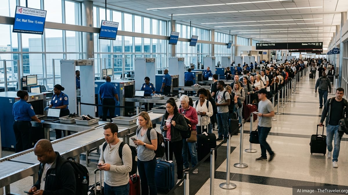
Travelers are advised to build in extra time for security and check-in, as weather-related disruptions often translate into longer lines at ticket counters and customer service desks. Crowd levels can spike quickly when multiple flights are delayed at once, especially at large hubs where connecting passengers converge from across the country and overseas.
With summer thunderstorm season gathering pace across the Gulf Coast, Bush Airport and the airlines that use it as a major hub are likely to see more days where convective weather challenges even the most carefully built schedules, making real-time monitoring and flexibility essential for anyone flying through Houston.