


Naguabo does not unfold like a resort town. It feels more like a lived-in corner of Puerto Rico where rainforest and river, concrete malecón and working piers, all overlap in ways that are sometimes beautiful and sometimes a little rough around the edges. I have visited the area multiple times between 2023 and 2025, focusing on river swimming, the south side access to El Yunque, the Malecón waterfront, and short detours into town. What follows is not a wish list or a brochure, but the specific experiences I actually completed, what they cost me, how I reached them, and which ones I would genuinely repeat.
Get the latest updates straight to your inbox!
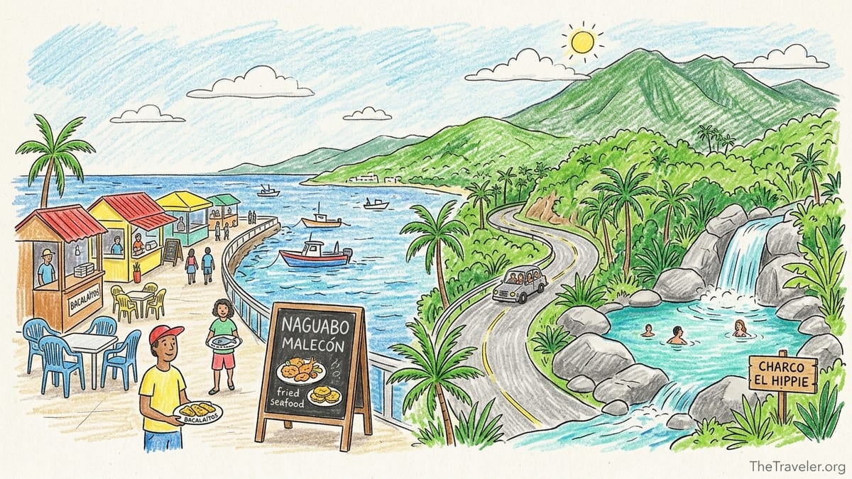
Waterfront Strolls and Fried Seafood on the Malecón
My first real impression of coastal Naguabo was not a postcard view but the smell of frying garlic and shrimp oil along the Malecón de Naguabo. This is the compact waterfront strip on the east side of town, lined with kiosks and small restaurants looking out toward Vieques Pass. I visited three times, twice on weekend afternoons in 2024 and once on a quiet Monday in early 2025. Rather than a polished boardwalk, it felt like a local hangout where music spills from open doors and families squeeze into plastic chairs. I parked on the street just behind the main row of kiosks, in informal spaces where attendants were guiding cars; each time I tipped 3 to 4 dollars to the person watching the car, and that felt both expected and appreciated.
Reaching the Malecón was straightforward: I came in on PR 3 along the east coast, then turned toward the water on the signed access for Naguabo’s waterfront district. Traffic slowed sharply the last half mile on weekend visits, and I needed patience while drivers paused to check for spaces or drop off relatives. From Palmas del Mar in Humacao, the drive took me about 30 minutes without stops. Physically, the visit was easy: flat pavement, short walks between kiosks, and benches where I could sit and watch the chop on the water. On both weekend visits the sun was strong, with passing clouds and sticky humidity, but the sea breeze kept it bearable if I stayed in the shade.
Food-wise, the Malecón delivered variety more than refinement. Over the three visits I tried bacalaítos, pastelillos de chapín, garlic shrimp with tostones, and a whole fried chillo split between two people. Prices in 2024 and 2025 ranged from about 3 to 4 dollars for individual fritters to around 18 to 26 dollars for full fish plates with sides, plus drinks. Portions were generous, seasoning unapologetically salty, and everything arrived on simple plastic or styrofoam. Crowd levels changed the tone considerably. On a Saturday visit around 1 p.m. the promenade felt jammed: speakers competing, kids weaving between cars, and a steady line at the busiest kiosks. On the Monday visit at about the same time, half the businesses were closed and I could hear the ocean more than the music. The sea view itself was pleasant rather than spectacular, especially at high tide when there was more movement and whitecaps offshore.
Would I repeat the Malecón? Yes, with a caveat. I would not plan a long special trip from San Juan solely for it, but if I were already staying anywhere on the east coast between Fajardo and Humacao, I would absolutely return for an unhurried lunch and people-watching. I would aim again for a late morning arrival on a weekday or early Friday to get parking close to the water and to enjoy the promenade before the afternoon rush and louder nightlife atmosphere set in.
River Swimming at Charco El Hippie: Beauty and Real Risks
Charco El Hippie was the most memorable and complicated experience I had in Naguabo. I visited twice, once in March 2024 and again in February 2025, both on dry, mostly sunny weekdays. The pool sits on Río Blanco in the interior hills and is reached off PR 191 south of Naguabo. From the town center I followed PR 3 briefly, then turned inland on PR 191 and continued until small signs and a cluster of parked cars appeared near a concrete house. There, I paid 5 dollars cash to park in a gated yard right beside the access path during each visit. The drive itself was part of the experience: narrow two-lane mountain asphalt with sharp curves, glimpses of cascades below, and occasional potholes that forced me to slow to under 10 miles per hour.
From the parking area, my actual approach differed slightly between the two visits as small details changed, but the essentials stayed the same. I walked down a short concrete ramp toward the river, then used a combination of poured concrete steps and rock slabs to descend to the main pool. It took under five minutes from car to water. The first steep section felt more like a rough driveway, then the path narrowed and I had to use my hands at one point to steady myself on damp rock. The iconic giant boulder and tiered rock wall formed the immediate backdrop of the pool, and off to one side shallow carved shapes in the stone were visible above the waterline, pointed out to me by a local as petroglyphs. On the March 2024 visit, I was there by 9:30 a.m. and had the place almost to myself for half an hour; by 11 a.m. there were several small groups, maybe twenty people total.
Footwear made a big difference. The first time I wore closed-toe water shoes with good grip and felt comfortable crossing wet rock shelves and moving around the edge of the pool. The second time, in sandals with slick soles, I slipped twice on algae-coated rock, catching myself both times but deciding immediately to be more conservative. The rocks around the pool change character: some sections are broad flat slabs where people lay towels, others are irregular and require big steps up or down. Entering the water from the lower rock ledge closest to the house, the bottom dropped from knee-deep to mid-chest in a short distance. I did not jump from any of the higher rocks and personally would not, especially after reading and hearing about sudden surges on Río Blanco and accidents in recent years. My swims both stayed within the calmer middle and near-shore areas.
On both days, water conditions were clear, cool, and deceptively gentle at first glance, with a mild current pulling away from the fall. The weather had been dry for at least 24 hours prior; I confirmed rain radar the night before and asked the parking attendant each time whether there had been recent heavy rain. Even with those precautions, I never stopped thinking about the possibility of a quick rise. I limited my time fully in the water to about 20 to 30 minutes, then spent the rest of each roughly two-hour visit sitting on the warm rocks, occasionally dipping my feet and taking photos. Physically, for someone with average fitness, I would describe the effort as light to moderate: the short but somewhat steep descent and ascent, plus moving cautiously over uneven wet rock, was enough to get my heart rate up but not exhausting. On crowded afternoons the climb up could feel trickier when people were coming both ways.
Did swimming feel safe on the days I visited? Within the specific conditions I chose, yes, I felt reasonably safe staying in the main pool away from the base of the fall and avoiding any jumping. Visibility was good enough to see submerged rocks near shore, and the current was manageable for a moderate swimmer like me. I would not have entered the water if clouds had built up over the ridgeline, if I had heard distant thunder, or if the river had looked brown or high. Crowd levels even on weekdays were medium by late morning, with a mix of local families and small groups of visitors, some bringing small coolers and speakers. I would personally repeat Charco El Hippie again, but only under similar dry-weather weekday conditions, with proper footwear and a clear plan to leave immediately if the sky darkened or the water level began to change.
Rainforest Access from the South: PR 191 and Río Sabana
One of the most underrated aspects of Naguabo is its role as a southern gateway to El Yunque. While many visitors drive to the busy north entrance near Rio Grande, I chose to approach the forest from Naguabo via PR 191 south on two separate days in 2023 and 2024. Both days started in the coastal plain, with the road gently climbing past farms before tightening into switchbacks and forested slopes. My goal was not a specific long-distance trail but to explore the Sabana Recreation Area at the upper end of the road and to get a sense of the southern watershed that feeds Río Sabana and Río Blanco.
The access route began similarly to the drive toward Charco El Hippie but continued farther up PR 191 until the pavement effectively ended near a marked gate and a cluster of picnic shelters. Parking was in a simple lot just off the road, free on both of my visits. From there, a short walk on a slightly cracked but serviceable paved lane led down to the river. Gazebos with concrete tables and basic barbecue stands framed wide, shallow pools where families were wading and children played with inflatable rings. The weather both days was classic rainforest edge: a mix of bright sun and fast-moving clouds, with light showers sweeping through in ten-minute bursts and then clearing.
In terms of effort, these visits were gentle. I spent most of the time walking short stretches of road and path, stepping carefully over slick leaves, and occasionally climbing down small embankments to check out different bends in the river. I did not attempt any of the informal upstream routes that locals described, which can turn into more serious hikes. My time on-site each day was roughly three hours, including a simple picnic at one of the shelters. Crowding varied: on a weekday afternoon there were perhaps five or six groups spread across the area; on a Sunday, the parking lot was nearly full and grills were smoking by midday.
I would definitely repeat this southern El Yunque access. It provided rainforest atmosphere without the reservation system and heavier traffic of the main north entrance. The trade-offs were fewer formal hiking trails and more limited infrastructure. I brought my own food, water, and trash bags, and I was glad I did. For travelers with mobility limitations or those who want to feel surrounded by trees and river without committing to a strenuous hike, this corner of Naguabo is a worthwhile and realistic destination.
Waterfall Adventure Above Río Blanco: Short Explorations, Not Technical Canyon
Beyond the main pool of Charco El Hippie, the Río Blanco corridor offers several smaller cascades and chutes that I explored in a low-key way during my February 2025 visit. After spending time at the main pool, I followed a faint path along the riverbank upstream for about fifteen minutes. The route was informal, with segments of foot-worn dirt alternating with stretches where I walked directly on hot, dry rock. In several places the trail forced me to choose between a scramble over boulders and a sidestep on narrow, sloping rock shelves just above the waterline. This was not a marked trail and definitely not suitable for anyone uncomfortable with heights or slick surfaces.
The reward was a series of small waterfalls and deep, clear pockets that felt more secluded than the main pool. Here the river constricted, pouring into rounded basins polished by years of wet-season flow. I did not jump into any of these bowls, but I did sit and slide carefully into one that was roughly shoulder-deep. The current hugged the rock wall and required constant awareness, especially when moving back toward the shallows. My water shoes were essential, and I kept one hand in contact with the rock whenever possible. I spotted at least one spot where people had obviously been climbing higher to jump, but I chose to avoid that area entirely, staying instead in the lower, calm corner of the bowl.
In total, my upstream exploration added about an hour of active movement to the day. I treated it like a casual canyon ramble rather than a fixed objective. There was no fee beyond the 5 dollars I had already paid for parking near Charco El Hippie, and I saw only two other people in this upstream section. The weather held with filtered sun and light breeze, but even there I watched the sky, conscious that sudden upstream rainfall could send a surge down through these narrow pockets faster than in the broader main pool. With that in mind, I would repeat this kind of waterfall adventure only if traveling with at least one other experienced person and only after a stretch of dry weather, and I would avoid it entirely on weekends when more people may be pushing higher and taking risks.
This kind of exploration is best for travelers who already enjoy uneven terrain, do not mind using their hands, and are willing to turn around at the first sign of discomfort. It is not a guided canyoning trip with ropes or helmets, and there is no signage to warn about hazards. My personal rule in this area was simple: no jumps, no climbing toward ledges above my standing height, and no entering any pool where I could not see the exit or where the current appeared to pinch into a constriction.
Scenic Driving Through Naguabo’s Hills and Coast
Driving itself became one of my favorite Naguabo activities, especially on days when I did not feel like getting fully wet. On two separate afternoons in 2024 I combined the curvy inland roads with relaxed coastline cruising. Starting near the town center, I took PR 3 east along the water, where the road alternated between glimpses of mangroves, small residential clusters, and patches of open shoreline. Then I looped back toward the interior on PR 191, climbing until the air cooled and the views down toward the Caribbean widened. This circuit, with pauses, took about three hours each time.
There was no direct fee for this scenic driving, just the cost of fuel and a few dollars for snacks and coffee at small colmados. The physical effort on my part was limited to staying alert at the wheel, but that in itself was taxing in certain stretches. On PR 191, blind corners and oncoming pickup trucks forced me to hug the inside of curves; in several spots I slowed to under 15 miles per hour simply to feel in control. Weather played a big role in how pleasant the drive felt. On one day, puffy clouds and good visibility made every mirador stop inviting. On the other, low clouds dipped into the hills, light rain slicked the pavement, and I cut the drive short rather than push higher into thicker fog.
Traffic was modest on weekdays, with most vehicles appearing to be local. I rarely felt stuck in a line for more than a minute, except near the Malecón just before sunset when visitors from nearby towns arrived for dinner. I would absolutely repeat these scenic drives, especially paired with a short stop at a panadería in town and a sunset pass along the waterfront. The key would be to start with a full tank, accept that travel times in the hills are slower than the map suggests, and avoid driving the steepest segments after dark.
Historic Remains and Everyday Town Life
While Naguabo is known more for rivers and seafood than for grand monuments, I did spend a few hours on two different trips wandering the compact town center around the plaza. I parked on a side street near the square, using a regular metered space and paying a couple of dollars for an hour via the machine. From there it was an easy, flat walk under the midday sun to the plaza with its shade trees, benches, and view of the church façade. Architecturally, this area showed the mix common to many Puerto Rican towns: a formal central church, some preserved older facades, and several closed or modernized storefronts.
I did not book any historic tours, nor did I enter every building of interest. Instead, my historic experience here came from sitting on a bench under a tree, watching older residents cluster to talk, teenagers drift by in school uniforms, and municipal workers tending to small maintenance tasks around the square. Fragments of older stonework and decorative iron grilles hinted at earlier phases of town life, but this was very much a lived-in civic center rather than a curated museum district. I visited twice, both on weekday late mornings in 2024 and 2025, and crowd levels stayed low, with perhaps a few dozen people scattered around the plaza at any given time.
Physical effort was minimal on these visits: short, level walks on concrete and a lot of sitting. I spent roughly 90 minutes each time, including a stop at a nearby bakery for coffee and a pastry, which cost around 5 to 6 dollars. If you are already in Naguabo for rivers or the Malecón, I would repeat this quick detour into town to balance the nature experiences with a sense of everyday local rhythm. I would not, however, travel from another part of the island solely to see historic remains here, as there are other towns where architecture and museums are more central to the experience.
Research-Only Attractions I Have Not Yet Done
Several Naguabo activities are widely mentioned in tourism materials and online trip reports that I have not yet personally completed. I want to be explicit about that separation. For example, guided canyoning or rappelling trips in the Río Blanco watershed exist, as do more ambitious hikes deeper into the southern El Yunque backcountry from access points near Naguabo. I have read detailed accounts of those outings, including required gear, guiding companies, and more technical routes, but I have not strapped into a harness or descended those waterfalls myself in this region.
Similarly, there are mentions of offshore fishing charters operating out of nearby marinas and of birding-focused visits to mangrove and coastal habitats in the broader municipality. I have only experienced Naguabo’s marine side from the Malecón promenade and roadside viewpoints along PR 3; I have not boarded a boat or spent a full morning with a bird guide in these specific wetlands. Because I cannot speak from my own direct experience, I will not rate these activities or describe their logistics in detail here.
If you are interested in any of these research-only attractions, I recommend contacting local operators directly, checking recent traveler reports from the past season, and confirming both access rules and safety practices before committing. Conditions in rivers, forest roads, and coastal facilities can shift from year to year with storms and maintenance budgets, and I prefer to limit my strong recommendations to places where I have personally seen what those conditions look like on the ground.
The Takeaway
Across several visits, Naguabo impressed me less as a single headline attraction and more as a cluster of experiences that work best in combination. A day that blends a cautious morning at Charco El Hippie under clear skies, a slow drive back down PR 191 with a few photo stops, and a late lunch on the Malecón captures much of what this corner of Puerto Rico does well. Rivers and rainforest feel close, but so do fried fish, loud salsa spilling from open doors, and the everyday routines of a small town plaza.
From a practical standpoint, the best experiences I would repeat share a few traits. They were approachable in terms of physical effort, affordable in cash costs, and flexible enough that I could cut them short if weather shifted. Charco El Hippie, while beautiful and worth the trip for me, demanded the most respect: careful attention to rainfall, a refusal to jump, and shoes that could handle slick rock. The Malecón rewarded timing, feeling much more enjoyable when I arrived early or on a quieter day rather than in the peak of the weekend crush.
If you are planning your own time in Naguabo, I would encourage you to think of it less as a checklist of isolated stops and more as a small territory to move through slowly. Allow room in your schedule for a second visit to the same river spot under different light, for another walk along the waterfront at a different tide, or for a second coffee in the plaza when the crowd mix changes. The experiences I would actually repeat here are the ones that left space for that kind of unhurried return.
FAQ
Q1. Is Charco El Hippie safe to visit for swimming?
On the two dry, sunny weekdays when I visited, swimming felt reasonably safe in the calmer parts of the main pool, but I stayed out of strong current, did not jump from any rocks, and kept a constant eye on the weather. Rivers in this area are known for sudden rises after upstream rain, so I would only go again after checking recent conditions and I would leave immediately if the sky darkened or the water level began changing.
Q2. How do you get to Charco El Hippie and where do you park?
I drove inland from Naguabo on PR 191 until I reached a small cluster of parked cars and a house that offered paid parking. Both times I visited, I paid 5 dollars cash to park inside a gated yard just a short walk from the access ramp and steps down to the river.
Q3. What kind of footwear is best for Charco El Hippie?
Closed-toe water shoes with good grip worked best for me. On my first visit with that footwear I felt secure walking over wet rock; on the second visit, wearing slick-soled sandals, I slipped twice and immediately became more cautious. I would not go again without shoes designed for traction on slippery, uneven surfaces.
Q4. Is the Malecón de Naguabo worth a special trip?
For me, the Malecón is worth a dedicated lunch or evening if I am already staying on Puerto Rico’s east coast, but I would not drive across the island just for it. I enjoyed the mix of fried seafood, sea views, and people-watching, especially on a quieter weekday or early in the day before the weekend crowd and loud music peak.
Q5. How crowded did the Malecón feel and when was it most enjoyable?
On a Saturday around midday the Malecón felt packed, with heavy traffic, loud competing music, and long lines at popular kiosks. On a Monday at the same hour it was half as busy, with more open tables and a calmer atmosphere. I would repeat weekday or early Friday visits and avoid peak weekend afternoons if I wanted a more relaxed experience.
Q6. What did you actually pay for meals on the Malecón?
During my visits between 2024 and 2025, individual fritters like bacalaítos or pastelillos cost me about 3 to 4 dollars each, while full fish or shrimp plates with tostones and salad ranged roughly from 18 to 26 dollars, plus drinks. I also tipped parking attendants along the back street 3 to 4 dollars when they helped find and watch a space.
Q7. Is Naguabo a good base for visiting El Yunque from the south?
For my style of travel, yes. I used Naguabo as a jumping-off point to drive PR 191 south to the Sabana Recreation Area, where I found river access, picnic shelters, and a quieter rainforest edge than the busier north entrance. It worked well if I was content with short walks and river time rather than long, marked hiking trails.
Q8. How physically demanding are the activities you repeated in Naguabo?
Most of the experiences I would repeat fall in the light to moderate category: short but sometimes steep walks on uneven rock at Charco El Hippie, flat strolls and standing time along the Malecón, and gentle riverbank walks near the southern El Yunque access. None required technical skills, but balance and comfort on wet surfaces were important by the river.
Q9. What kind of weather did you encounter and how did it affect plans?
On the coast at the Malecón I had hot sun, humidity, and a steady sea breeze, which was manageable with shade and water. In the hills along PR 191 and by the rivers, I saw classic rainforest patterns: bright sun broken by brief showers. I avoided river swimming entirely on days with unstable forecasts or recent heavy rain, and I cut one scenic drive short when low clouds reduced visibility.
Q10. Which Naguabo experiences would you definitely repeat on a future trip?
I would return to Charco El Hippie on a dry weekday morning with proper footwear and a conservative approach to swimming, spend more time at the southern El Yunque access near Río Sabana, and plan at least one relaxed Malecón lunch with sea views. I would also repeat slow scenic drives along PR 3 and PR 191 and a short wander through the town plaza to balance the outdoor focus with a bit of everyday local life.