


Cascada Las Delicias appears in almost every central Puerto Rico road-trip guide, usually described as an effortless roadside gem near Jayuya. On a recent circuit through the Cordillera Central, I added it as a detour, expecting a quick leg-stretch stop before continuing toward the higher viewpoints. What I actually found was a beautiful but constrained waterfall in Ciales, inside Bosque Estatal Tres Picachos, that felt far less predictable than a managed attraction and demanded much more attention to weather, footing and roadside safety than most guidebook blurbs admit.
Get the latest updates straight to your inbox!
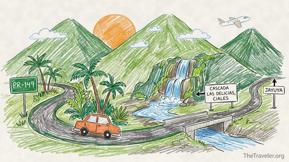
Where Cascada Las Delicias Really Is (And Why That Matters)
Cascada Las Delicias is often labeled “near Jayuya” in English-language guidebooks, and some brochures even list it as if it were inside the Jayuya municipality. In reality, the falls are in Ciales, along the Cialitos River, within the boundaries of Bosque Estatal Tres Picachos. The access is from mountain road PR‑533, which branches off PR‑149 that runs between Ciales and Jayuya. This might feel like a technicality when you are planning from home, but on the ground it matters for navigation, emergency services, and understanding that you are entering a rural state-forest setting, not a staffed municipal recreation area.
Official state-forest materials and conservation documents place Las Delicias inside the Tres Picachos management unit in the municipality of Ciales, with the Cialitos River identified as one of the important waterways flowing off the Tres Picachos massif. Tourism sites sometimes simplify this into “near Jayuya” because the access road continues climbing toward that town, but the waterfall itself sits squarely on the Ciales side of the forested ridge. That means any assumptions that you are visiting a town-run site with lifeguards or rangers on duty will be wrong; you are in a remote, unstaffed segment of a state forest.
Before visiting, I checked both recent trail information and weather. Current hiking and trail databases describe Vereda Cascada Las Delicias as a very short, unmaintained access route from PR‑533 down to the river, with no designated parking and only an informal use path down boulders and wet rock. They also emphasize checking river levels and avoiding the site after heavy rain because the Cialitos can rise quickly. In the rainy shoulder seasons especially, this extra layer of preparation is essential; the waterfall may look close to the road on a map, but it behaves like what it is: a natural mountain river feature in a narrow, steep-sided valley.
I also monitored local forecasts for central Puerto Rico on the day of my visit and the 48 hours before it. There had been only light scattered showers in the cordillera, with no alerts for flooding or major accumulations near Ciales. That gave me a reasonable margin of safety for river conditions, but it did not remove the inherent risks of wet rock, slippery algae and tight roadside space. If the forecast had shown significant rainfall anywhere up-river in the Tres Picachos watershed, I would have skipped Las Delicias entirely, regardless of how enticing the photos looked.
The Mountain Drive: PR‑149 To PR‑533
Reaching Cascada Las Delicias is part of the experience, and not always in a relaxing way. From the north coast, the standard approach is to take the toll expressway toward Arecibo, then exit inland toward Ciales, where PR‑149 begins to climb into the Cordillera Central. From there, you follow PR‑149 south through tight curves, steep grades and a sequence of small barrios, with frequent patches of patched asphalt and narrow bridges. This is not a highway cruise; it is a classic Puerto Rican mountain road that requires concentration, especially if you are more accustomed to mainland interstate driving.
At the junction with PR‑533, a small signed secondary road branches uphill toward the forest. The pavement here narrows to a lane-and-a-half in many stretches, with soft shoulders and vegetation close to the edge. There are no center guardrails once you are fully in the mountain section, and only sporadic concrete barriers on sharper outside bends. In dry daylight conditions, a compact rental car handled the grade and curves without difficulty, but I was happy not to be doing this at night or in heavy rain. Low visibility or slick pavement would amplify the risk of rockfall, potholes and oncoming traffic around blind bends.
From the PR‑149 / PR‑533 junction to the waterfall bridge was roughly a fifteen-minute drive in light traffic. The final approach is easy to overshoot because there is no large official sign for Bosque Estatal Tres Picachos at the falls. Instead, the landmark is a concrete bridge over the river with a short, mossy rock wall and a glimpse of white water upstream through the trees. If you are heading uphill, the main cascade is tucked left of the bridge. I pulled past it once before realizing I had already arrived, which meant a careful three-point turn on the narrow road to return to the wider shoulder near the bridge.
Door to door, from the coffee town center of Ciales to Las Delicias took about forty minutes of unhurried driving, not counting a quick stop to let a local delivery truck squeeze past on a tight bend. Compared with better-signed mountain viewpoints or managed attractions like the roadside miradores on PR‑10, this drive feels more improvisational, with fewer pullouts, inconsistent edge protection and no formal parking lot at the final destination.
Parking On The Shoulder: Roadside Reality
The biggest surprise at Cascada Las Delicias was how constrained the roadside space felt compared with the broad scenes in online photos. There is no marked parking lot, no striped spaces and no dedicated turnout. Drivers simply pull off onto the wider segments of shoulder near the bridge on PR‑533 and angle their cars toward the rock wall or the drop-off, depending on which side they find free. On my midday weekday visit, there were four vehicles already stopped: two compact cars, a small SUV and a pickup. Even with only that small crowd, the road narrowed enough that passing required slowing to a crawl and negotiating eye contact with oncoming drivers.
When tour van groups or weekend crowds arrive, photos and recent trip reports describe vehicles lined along both sides of the road for some distance, effectively turning PR‑533 into a single shared lane around the bridge. This is not just an inconvenience; it is an objective safety issue. Emergency vehicles would have trouble getting through if cars hugged the inside corners, and pedestrians have to step into the travel lane to move between their cars and the informal trail entrance. I chose a spot slightly uphill from the bridge where the shoulder was relatively firm and level, leaving enough clearance for larger vehicles to pass without clipping side mirrors.
There are no attendants, cones or rangers organizing this roadside parking, and no painted “no parking” curbs. That does not mean every spot is a good idea. Sections of shoulder are undermined by erosion, and the drop to the river can be steep where the guardwall is missing. I walked the shoulder before fully committing, checking that my rental would not be hanging partly over soft ground. In wet weather, this evaluation would be even more important, as the clay soil can turn slick and unstable. Anyone arriving in a low-clearance vehicle or a large van should be aware that a safe, legal spot may simply not be available at busy times.
From the shoulder where I left the car, it took less than a minute to reach the bridge on foot. However, even this tiny approach requires alertness. There is no sidewalk, and trucks occasionally roar past at speed, taking the center line to avoid potholes at the edge of the pavement. Anyone visiting with children needs to treat the hundred or so meters along PR‑533 as a live roadway, not as a pedestrian promenade attached to a park.
The Short “Trail”: From Bridge To Mossy Rock
The approach from the bridge to the main cascade is short in distance but uneven in character. On the upstream side of the bridge, an informal dirt path drops from the road edge down toward the river, quickly turning to exposed roots, loose soil and then a jumble of wet boulders. Trail databases estimate the total distance at around a tenth of a kilometer, with a moderate difficulty rating largely because of footing rather than sustained elevation gain. In practice, it felt like a short scramble that would be trivial for agile hikers in grippy footwear, but challenging and potentially dangerous for anyone in flip-flops or for visitors with balance issues.
Immediately below the bridge, the sound of the water intensifies and a faint social trail forks toward small lower cascades and shallow pools. The main upper cascade that appears in most promotional photos is a few minutes upstream, reached by stepping carefully from rock to rock in the riverbed and along the moss-coated walls. The rocks here are worn smooth, shaded by forest and perpetually damp, which means even dry-weather days still involve slick surfaces. Several locals I met were wearing closed-toe water shoes, and one cautioned against bare feet after he watched a visitor slip and bruise a shin on the algae-covered stone.
My total time from leaving the car to standing at a stable viewing spot beside the primary cascade was about five minutes, but it could easily take longer if you move cautiously or if more people are negotiating the same narrow passages between boulders. There are no installed handrails, ropes or waymark signs. You simply follow the sound of water and the most obvious boot-worn route, taking care not to block those coming the opposite direction. In higher flow, some of the stepping stones that were exposed for me would be submerged, forcing visitors either into deeper water or onto steeper, more precarious banks.
Importantly, there is no clear separation between the “trail” and the play area. As soon as you reach the river’s edge, people are swimming, posing for photos and clambering on the same rocks you need to use as your path. For solo travelers and careful hikers this is manageable, but for families with small children or anyone uneasy on slippery ground, the lack of defined boundaries can feel stressful. You have to create your own margin of safety with every step.
What The Waterfall Actually Looked And Felt Like
In person, Cascada Las Delicias is intimate and attractive rather than grand. The main drop is a segmented cascade, around ten to twelve meters high based on forestry documents, spilling and veiling down a rock face that is almost entirely coated in moss and small ferns. Instead of plunging cleanly into a single deep pool, the water fans over ledges, creating several tiers of small basins and rivulets. In mid-flow conditions on my visit, the water volume was enough to produce a steady white curtain and a fine mist near the base without the roar or spray one associates with high-volume waterfalls.
The surrounding forest is dense and close. Tall trees frame the cascade on both sides, with vines draped from the upper canopy and epiphytes clinging to every damp surface. The effect is more like a private grotto than a roadside attraction, especially if you arrive between tour-group pulses. The light can be dim, with filtered sunbeams reaching the mossy wall only when the sun is directly overhead. That means the lush greens that dominate online photos are real but not constant; under cloud cover the scene shifts toward deep shadow, and the water takes on a darker, tea-colored tone reflecting tannins in the river.
The pools at the base of each tier were shallow during my visit, rarely reaching above waist-deep even in the largest basin. Water clarity was generally good. Looking down from a stable rock, I could easily see my toes and the pale stones below, though leaf litter and occasional foam from upstream organic matter floated in the eddies. There was no obvious trash or plastic, which aligns with reports that, despite light infrastructure, the site remains relatively clean when compared with more heavily trafficked roadside rivers elsewhere in Puerto Rico.
Compared with the carefully composed images common on social media, the real scene felt smaller but more three-dimensional. Wide-angle lenses and low camera angles make the main cascade appear almost towering in some promotional shots. Standing on the river rocks, the waterfall occupied a pleasant slice of the gorge wall rather than dominating the skyline. For travelers whose expectations are calibrated by those images, this size reality check is important. If you are seeking a massive, amphitheater-style waterfall experience, Las Delicias may feel modest. If you appreciate detail, texture and close-up water patterns, the site is rewarding.
Stable Viewing vs Entering The Water: Safety Trade-offs
One of the most critical distinctions at Cascada Las Delicias is between observing the waterfall from relatively stable ground and entering the water itself. It is possible to enjoy the setting, take photographs and absorb the atmosphere without wading or swimming. A series of flat, waist-high boulders along the right-hand side (facing upstream) provided solid perches where I could sit, watch and photograph the cascades without getting more than my shoes wet. From these rocks, it was also easy to move back toward the bridge if a sudden change in weather or crowd behavior made the scene feel less comfortable.
Stepping beyond those stable zones into the water introduces a different risk profile. The combination of polished bedrock, algae, moss and constantly moving water means footing can change from reasonable to treacherous within a single step. There are no lifeguards, warning flags or depth markers. Neither forestry authorities nor tourism boards guarantee any “safe swimming” area here. Depth is hard to judge accurately because of refraction and tannins; a rock shelf may lie just below the surface of an apparently clear pool. During my visit, one visitor tried to slide down a small rock ledge near the lower cascade and emerged with a scraped elbow after hitting an unseen ridge.
Local guidance and trail descriptions strongly warn against jumping from any height, climbing the main cascade wall or diving into the pools. Hearing this echoed on-site by residents reinforced the written advice. One man who said he lived in Ciales mentioned that after heavy rain, the same shallow pools can change dramatically, with churning brown water that hides debris washed down from upstream farms and forest. In those conditions, even experienced swimmers could be pushed against rocks or trapped under turbulent flows close to the base of the cascade.
Flash-flood risk is real in the Cialitos watershed. Because the catchment above Las Delicias consists of steep slopes and dense forest within Tres Picachos, intense rainfall higher up does not take long to concentrate in the narrow gorge. Even if skies are blue at the bridge, earlier showers in the mountains can send a pulse of higher, faster water downstream. There are no sirens or automated alert systems on-site. The only practical mitigation is to check forecast information before visiting, observe the color and speed of the water on arrival, and leave promptly if the river begins to rise, darken or carry increasing amounts of debris.
Crowds, Atmosphere And Time On Site
I spent just under an hour at Cascada Las Delicias from the moment I locked the car until I was back on PR‑533 heading uphill. That window included five minutes of slow scrambling in, ten minutes sitting on a stable boulder observing, fifteen minutes experimenting with camera angles and shutter speeds, another ten minutes watching families take turns under the main cascade, and a few minutes of conversation with locals before climbing back to the road. It would be easy to stretch a visit to two hours if you were picnicking, swimming or waiting for changing light conditions, but the physical footprint of the site is small enough that most travelers will feel they have “seen it” within about an hour.
Crowding is highly variable and quickly noticeable because of the confined layout. On my weekday visit, the scene shifted between pleasantly social and slightly congested as cars came and went in waves. At one point there were around a dozen people in the main cascade area: a family with young children, two pairs of friends and a solo photographer. That number already felt close to the comfortable capacity for the rocks and pools, given the need for everyone to share the same slippery access points.
Reports from weekends and holidays describe a very different atmosphere, with portable speakers, coolers and clusters of people lining the shallower pools near the bridge. Once the rocks fill with towels and bags, it becomes more difficult for newly arrived visitors to pick a safe path in and out of the water. Noise levels rise, and the contemplative, grotto-like ambiance gives way to a social river party. Travelers seeking quiet nature time may feel disappointed, while those simply looking for a place to cool off might enjoy the energy. Because there are no rules posted beyond the general norms of a state forest, behavior depends largely on the particular mix of visitors on any given day.
Importantly, there are no facilities at or near the falls. No restrooms, changing rooms, kiosks or trash cans are present at the bridge or along the short trail. This means all water, snacks and gear must be carried in and, critically, carried out. The absence of infrastructure keeps the site visually wild, but it also amplifies the consequences of crowding if even a few groups leave behind bottles or food waste. The section of river I saw was clean, but small traces of past picnics were visible in eddies and in a forgotten plastic bag tucked under a rock.
Was It Worth The Detour Compared With Managed Attractions?
Evaluating whether Cascada Las Delicias was worth the detour depends heavily on what you are comparing it to and what you value in a road trip. On my central Puerto Rico loop, the alternative use of that same window of time and distance would have been to continue on PR‑149 toward higher elevation viewpoints near Cerro de Punta or to linger longer at established miradores with parking and guardrails. Those managed attractions offer broader vistas of the Cordillera Central, easier parking, and fewer unknowns about footing or river behavior, though they lack the intimate, sensory richness of standing next to a moss-covered cascade.
In terms of sheer scenic payoff per minute of extra driving, Las Delicias sits in the middle. The waterfall is genuinely beautiful and photographically interesting, but it is not so unique that skipping it would ruin a central Puerto Rico itinerary, especially if you are already visiting other rivers or forests. The mountain road from Ciales to the PR‑533 bridge is more taxing than the access roads to many official viewpoints, and the absence of a proper parking area or ranger presence adds a background layer of anxiety that may deter more cautious travelers or those responsible for small children.
On my particular journey, which involved a rental car, no guide and a flexible schedule, the detour felt worthwhile but conditional. I appreciated the chance to step briefly into the cool shade of Tres Picachos and experience a waterfall that still feels embedded in a living rural landscape rather than packaged for mass tourism. At the same time, I found myself wishing for a single signed pullout with enough space for a handful of vehicles and a short, stabilized path down to a designated viewing rock. Even minimal infrastructure of that kind would significantly reduce the roadside and footing risks without fundamentally changing the character of the site.
From a budget perspective, the visit added only fuel costs to my day, as there were no entrance fees, guides or parking charges. Organized small-group excursions advertised by local hiking outfits do visit Las Delicias as part of full-day central mountain itineraries, typically bundling it with other natural stops and charging a per-person rate that reflects both transport and guiding expertise. For independent travelers comfortable with rural mountain driving and self-managed risk, those extra costs may not be necessary. For anyone uneasy about navigation, flash-flood awareness or Spanish-language signage, a local guide could be a sensible investment.
The Takeaway: Motivation, Reality And What I Would Change
My motivation for visiting Cascada Las Delicias was shaped heavily by guidebook praise and eye-catching photography. I wanted a quick, atmospheric waterfall stop that would break up the mountain drive between the coffee country around Ciales and the high ridges near Jayuya. The promise of a roadside cascade within a state forest sounded like an ideal low-effort add-on. I imagined something like a pocket version of better-known attractions, with at least a gravel parking area and a short, obvious path to a dramatic drop. Those expectations turned out to be only partly aligned with reality.
The drive and parking experience were more stressful than the promotional descriptions suggested. PR‑149 and PR‑533 demanded focused, patient driving, and the lack of structured parking at the bridge meant I spent as much mental energy on ensuring my car was safely off the travel lane as I did on anticipating the waterfall. While I never felt in immediate danger, the combination of narrow shoulders, passing trucks and pedestrians sharing the asphalt left me more alert than relaxed. This was a detour that required constant micro-decisions rather than a carefree side jaunt.
The waterfall itself largely delivered on its reputation for beauty. The moss-coated wall, segmented cascades and cool, clear pools tucked into dense forest felt genuinely special, especially during a brief lull in visitors when the only sounds were water and birds. Where the experience diverged most sharply from glossy images was scale and crowding. The falls are smaller than they often appear online, and the usable space around them is tight. This magnifies every safety consideration: slippery rocks, proximity to faster channels, and the lack of clear boundaries between viewing spots and play areas. I chose not to wade beyond ankle depth, and even that felt like an active risk calculation.
Looking back, several specific things felt unsafe or at least uncomfortably marginal. The informal roadside parking creates potential conflicts with passing vehicles, the unmarked scramble path funnels all visitors over the same slick, uneven rocks, and there is no on-site information about flash-flood risk, recent rainfall or recommended behavior. None of these are disastrous on a calm, dry weekday with few people around; collectively, though, they suggest that the site can tip quickly into hazardous territory during busy or wet conditions. From a risk-management perspective, this is not a set-and-forget attraction where you can simply follow railings and signs.
Did Cascada Las Delicias deserve the detour on my trip? For me, yes, but with reservations. As someone comfortable with unstructured natural sites and attentive to my own limits, I valued the chance to experience a central Puerto Rico waterfall that still feels largely unmanaged. However, I would not recommend this stop to every traveler in the same unconditional tone that many guidebooks use. For visitors who prioritize maintained infrastructure, predictable access and low-stress logistics, the same time might be better spent at established viewpoints or on a guided excursion that includes Las Delicias within a supervised framework.
If I could change a few things, they would be modest but targeted. A small, signed parking bay set back from PR‑533 near the bridge, a short stabilized path with basic steps or handholds down to a defined viewing platform, and a bilingual information board explaining river safety, flash-flood risk and leave-no-trace expectations would go a long way. Until that happens, the burden will remain on individual travelers to verify current access and weather, assess their comfort with the mountain drive, and make conservative choices at the water’s edge.
FAQ
Q1. Is Cascada Las Delicias actually in Jayuya or Ciales?
Cascada Las Delicias is in the municipality of Ciales, within Bosque Estatal Tres Picachos, accessed via PR‑533 off PR‑149. It is often described as “near Jayuya” because the same road continues toward that town, but the waterfall itself is on the Ciales side of the mountains.
Q2. How difficult is the drive and what vehicle do I need?
The drive along PR‑149 and PR‑533 involves steep grades, tight curves and narrow, sometimes patchy pavement. A regular compact or midsize car in good condition is generally sufficient in dry weather, but nervous drivers, large vans or very low-clearance vehicles may find the route stressful, especially in rain or low visibility.
Q3. Is there official parking at Cascada Las Delicias?
No. There is no marked lot or designated spaces. Visitors park along the shoulder of PR‑533 near the bridge over the river, which can create congestion and safety concerns. At busy times there may simply not be a safe place to leave a vehicle.
Q4. How long is the walk to the waterfall and how hard is it?
The walk from the road to the main cascade is very short, roughly a few minutes, but it involves a steep, informal path and scrambling over wet, uneven rocks. The distance is minimal, yet the footing can be tricky and slippery, so it is not suitable for everyone.
Q5. Is it safe to swim at Cascada Las Delicias?
There is no lifeguard, no designated safe-swim zone and no guarantees about depth or underwater obstacles. While people do wade and swim in the pools, entering the water is at your own risk. Conditions can change quickly with rainfall upstream.
Q6. Can I jump from the rocks or climb the waterfall?
Jumping, diving and climbing the main cascade are strongly discouraged. Depth is hard to judge and submerged rocks or ledges may be just below the surface. Local advice and trail information consistently warn against these activities because of the risk of serious injury.
Q7. What about flash-flood risk and weather?
The Cialitos River can rise rapidly when it rains in the Tres Picachos watershed, even if skies are clear at the bridge. Before visiting, check current weather for central Puerto Rico, avoid the area after heavy rain, and leave immediately if water levels rise, darken or begin carrying more debris.
Q8. Are there facilities such as restrooms, trash cans or kiosks?
No facilities are present at the waterfall or along the short access path. There are no restrooms, changing rooms, kiosks or bins, so you must bring what you need and pack out all trash. Plan restroom stops in nearby towns like Ciales before or after your visit.
Q9. Is Cascada Las Delicias a good stop for families?
It can be enjoyable for families who are used to natural, unmanaged sites and are willing to closely supervise children around a live roadway and slippery rocks. However, the lack of barriers, lifeguards and clear boundaries means it is not an ideal choice for very young children or anyone needing firm, even paths.
Q10. Would you recommend Cascada Las Delicias to photographers and road-trippers?
Yes, with caveats. Photographers who appreciate intimate, mossy cascades and are comfortable working in low light and tight spaces will find plenty of compositions. Road-trippers who enjoy rural mountain driving and spontaneous, lightly developed stops may also value the detour. Travelers who prefer fully maintained attractions with easy parking and formal viewpoints may be happier investing their time in more structured sites elsewhere in the central highlands.